Lake Havasu City, Arizona, was our destination on November 5, 2021. We hadn’t seen my sister, Merri, since November 2019, four months before the world shut down to ward off a nasty virus. On the way, we stopped for a break at a spot large enough for our rig somewhere in the desert north of Desert Center on Rice Road, State Route 177. We lingered a while to take in the view of the red hills across the road.
Red hills somewhere on State Route 177
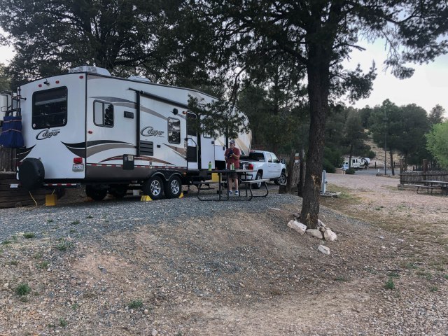
Our usual RV Park of choice is Prospectors RV Resort, when we visit Lake Havasu. This time we tried Campbell Cove. At our site across from the office, trees shaded the driver’s side of our fifth wheel. And no one pulled in beside us. Although the sites were smaller than the ones at Prospectors, being closer to town was more convenient.
Breakfast at the Red Onion is a must, so we met Merri there the next day. After our meal, I noticed the London Bridge Mural on the building across the parking lot. “Hey,” I said. “Let’s take a selfie?” The series of photos below will give you an idea of how many boomers it takes to create a selfie.
“No, not like that.”
“Hold the phone like this.”
“Okay, let me try.”
“Hey, I’ve got it.”
We featured our visit to The Bunker Bar in our November 11, 2021, blog post, so here, I’ll just compare what the place looked like while under construction in November 2019 and what it looked like two years later. If interested in reading more about the bar and watching a 360 degree video, go here.
The Bunker Bar Before
The Bunker Bar After
What could be better than sitting with family on The Blue Chair—now just called The Chair—patio overlooking the London Bridge, eating lunch, and listening to live music? The afternoon could not have been more perfect with a great view, great food, great music, and great family fun.
Check out The Chair for good eats and view
I wish I had photographic evidence of Jon, Merri, and me paddle boarding for our first time. None of us wanted to risk dropping our phones in the water, and I sure didn’t want to drop my Sony A6500 camera. Nautical Watersports hooked us up with boards, paddles, and life vests and set us loose in the little cove a few steps from the store. The no-wake location was the perfect place for our maiden attempt at balancing on a board and paddling about.
Merri, the youngest of us, popped up on her board first. I started out on my knees and graduated to a squatting position before my shaky legs straightened enough to stand. Then presto, magic. My legs stopped shaking. It took Jon a while to stand, and he said his legs never stopped shaking. Next time, we’ll do better. Can’t wait for warm weather to return so I can try paddle boarding again.
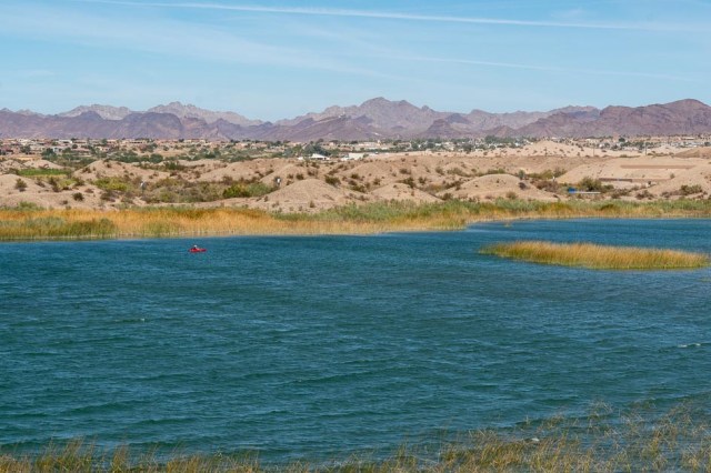
On our final day, we fit in a short hike at Mesquite Bay to enjoy the views of the Havasu National Wildlife Refuge, to get a bit of exercise, and take in the views. Mesquite Bay 1 and 2 both have parking, fishing piers, and informational panels, and shelters. Non-motorized watercraft only are allowed in Mesquite Bay.
Mesquite Bay Havasu National Wildlife Refuge
President Franklin D. Roosevelt established Havasu Lake National Wildlife Refuge (current name Havasu National Wildlife Refuge) in 1941, to establish a migratory bird habitat. The refuge encompasses 37,515 acres along the Colorado River and protects 40 river miles and 300 miles of shoreline from Needles, California, to Lake Havasu City, Arizona.
Fishing pier with sun shade
Hundreds of birds find the refuge a place to stop, rest, and refuel during their migratory journey each year. And like the human “snowbirds” that roll into town in their RVs, many of the fowl spend the winter and some even breed in the area.
Mohave Mountains in the background
Sadly, our visit to Lake Havasu came to a close, and it was time to move on. But I’m positive this won’t be our last trip to Lake Havasu City.
Next up: Barstow, California, where we check out Calico Ghost Town Regional Park, Peggy Sue’s Restaurant, Barstow Railroad Museum, the historic Harvey House, and Route 66 Mother Road Museum.
We left the cool San Diego breezes for the furnace of Tucson, where temps reached 115 degrees or more. Tucson/Lazydays KOA Resort was our stop to split up the 12-hour drive to Ruidoso. It was 6:30 pm when we arrived. About an hour later, Jon walked in the door and sat down. Seconds later someone knocked on the door. It was the security guard who had showed us to our site. He said management wanted us to move.
What? No!
A regular guest wanted our site because it had a tree, and they were staying until October. Really? The tree was a scrawny little thing, and the site was one of several that had a cover for shade. Jon talked the manager out of his crazy idea and averted a heatstroke.
The next day we washed clothes, cleaned house, and stayed cool in the air conditioned trailer. We ended the day with an early dinner at Obon Sushi + Bar + Ramen, a place we had eaten before and highly recommend.
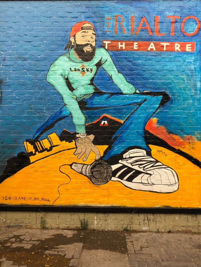
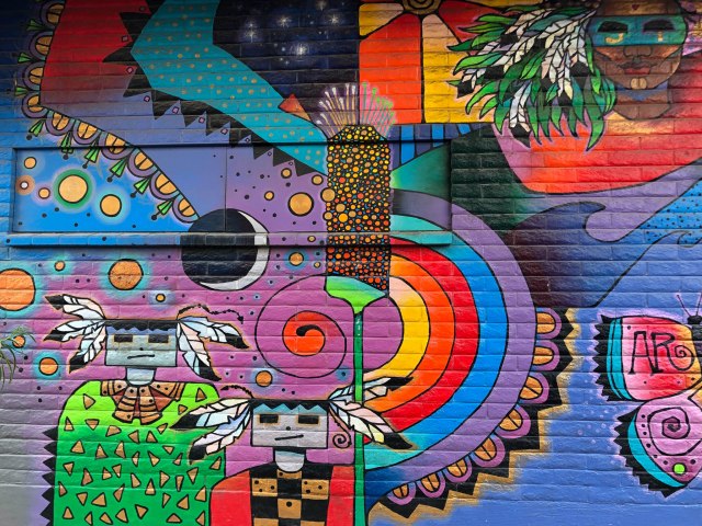
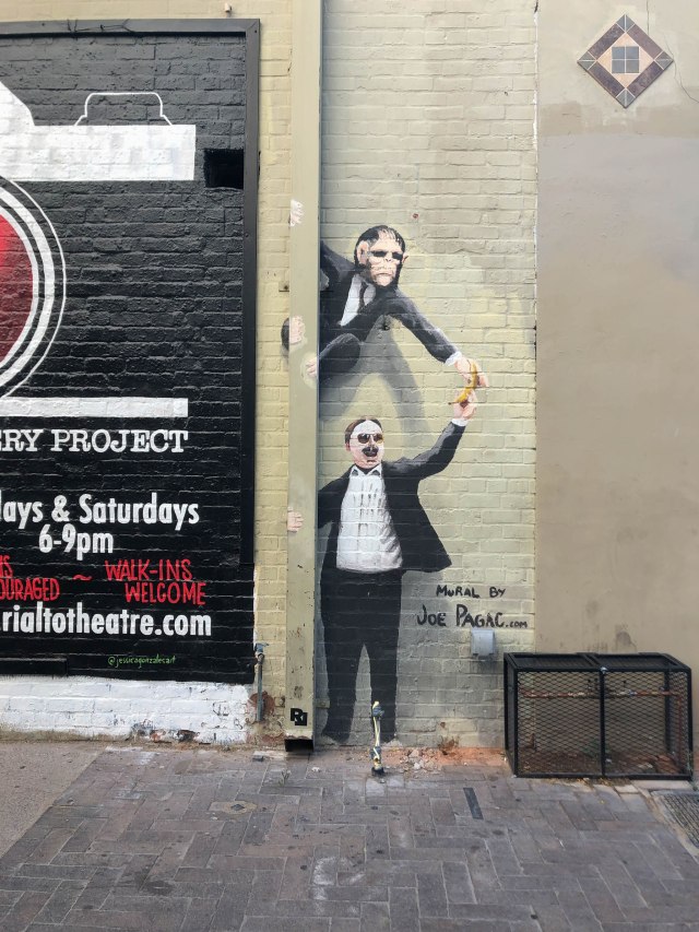
While walking back to the truck, I captured a few murals we saw in an alley and a couple of buildings. It’s never too hot to snap a few photos.
Rialto, California, is where I grew up, so whenever I see the name, I have to take a photo. Wikipedia lists 22 theaters named Rialto across the United States.
Mural found in the alley next to the theater
Love the images and colors in this one
3D Effect
On Thursday, June 17, 2021, we drove the final 6 hours to RV Resort of Ruidoso, New Mexico. The location of our site could not have been better. The park is terraced, and our site was below one site and above another so that we did not feel crammed together. The bonus was that we only had neighbors on the weekend. Compared to all the other sites in the park, I think ours was the best.
RV Resort of Ruidoso campsite.
View from our picnic table
We jumped at the chance to have Bailey’s mother and step-father show us around town. This helped us get our bearings and see where everything was located. The gracious company and our lunch at Oso Grill in Capitan was the highlight. Thanks Dale and Dorothy.
Good eats at Oso Grill in Capitan
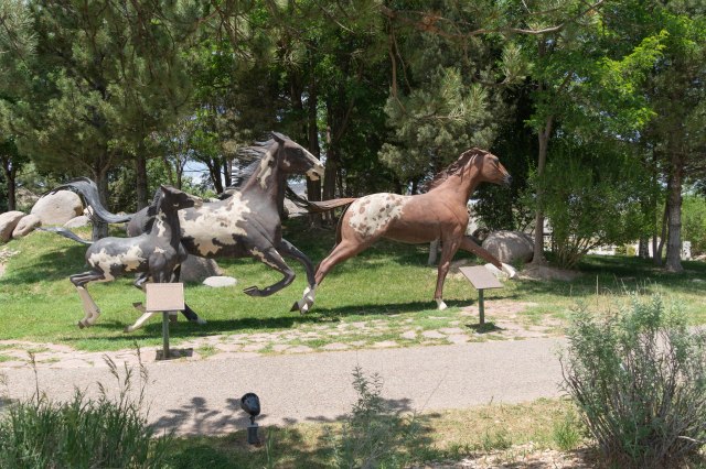
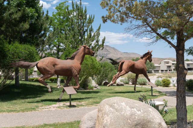
On Saturday, we headed to the Hubbard Museum of the American West. Sadly, it had not reopened after its pandemic closure, so we admired the statuary outside.
The empty parking was a sign the museum was closed.
I had seen the galloping horses from the street when we were driving around the day before and wanted to see them up close.
The breeds represented are Standard, Thoroughbred, Quarter horse, Appaloosa, Paint, Arabian, and Morgan.
The Free Spirits at Noisy Water are a collection of eight bronze horse sculptures created by Dave McGary who is known for his realistic and colorful portrayals of Native Americans.
It’s hard to believe the tail and mane are made of bronze too.
The horses appear to jump and gallop, their muscles taut, manes and tails flowing. I was amazed to learn that the eight horses weigh 3,000-5,000 pounds each and are supported and balanced by only nine hooves.
It’s unbelievable the foal galloping next to its mother has all four hooves off the ground.
Plaques detail information on each of the seven breeds represented. The distance from the leaping horse at the top of the hill to these two out front spans 255 feet.
McGary was a master working with bronze
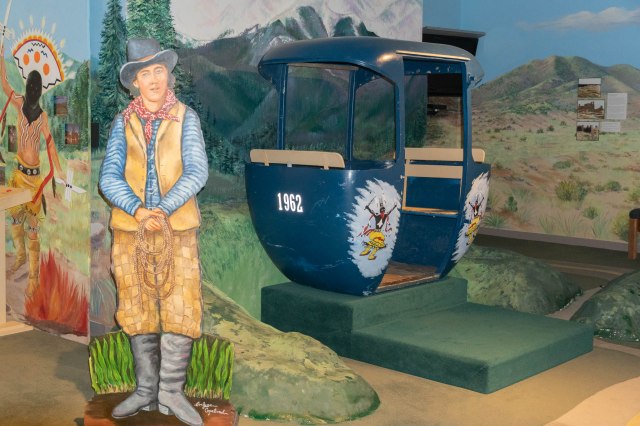
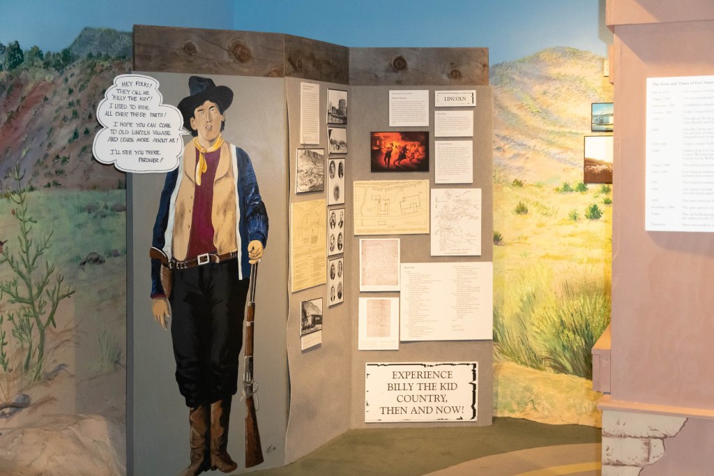
After capturing the photos of the horses, we walked across the street to see if Billy the Kid Scenic Byway Visitor Center was open.
Billy the Kid National Scenic Byway Visitor Center
We picked up maps and pamphlets and wandered around the museum. Billy the Kid (born Henry McCarty and also known as William H. Bonney, Henry Antrim, and Kid Antrim) was a busy guy in Lincoln County. He left a trail of so many historical spots where he committed crimes, where he was jailed, or where he hid out from the lawmen, that he rates a National Scenic Byway. The roads connect the dots between Ruidoso, Capitan, Fort Stanton, Lincoln, and Ruidoso Downs along Highways 48, 380, 230, and 70.
Billy the innocent?
With all the attention Billy gets in this area, you’d think he was a national hero, not an outlaw and murderer. I guess notoriety, no matter what kind, is something to commemorate.
Visitors can learn about many of Billy’s escapades, including his role in the Lincoln County Wars, from the displays.
Billy says, “Learn more about me in Lincoln. I’ll see you there.”
We’ll share a few more tidbits about Billy the Kid in future episodes.
Interested in extraterrestrials? They’re featured here to give a shout out to Roswell.
Extraterrestrials are also featured. Roswell is only 75 miles away.
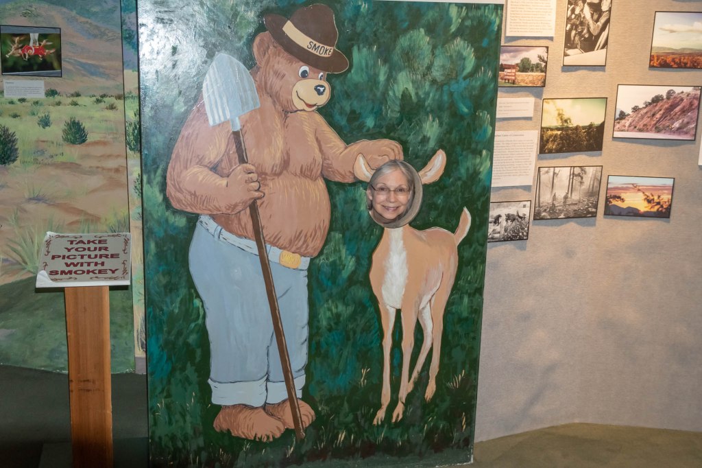
Smokey the Bear is another popular guy in Lincoln County with a museum dedicated to his life and memory in the Village of Capitan.
Don’t forget the photo op with Smokey.
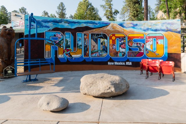
The Village of Ruidoso is in Lincoln County and next to the Lincoln National Forest. It had a population of approximately 8,000 in 2019 and sits at an elevation of 6,920 feet (2,051 meters). Ruidoso is a popular destination for the ski resorts in the winter. The rest of the year, the village and surrounding area offers lake and river fishing, hiking, exploring local history, and horse racing at Ruidoso Downs.
Artist: Michael Fish
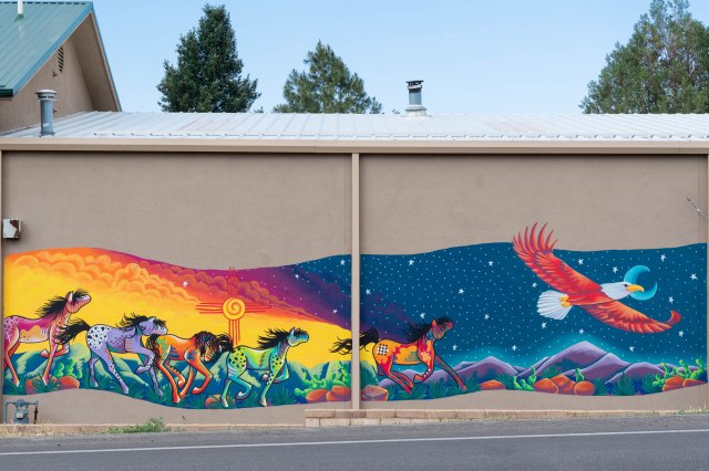
Next we drove to Midtown Ruidoso to check out the independent stores and eateries. We didn’t stay long. With so many out-of-town visitors, it was difficult to find parking and hard to walk on the sidewalk with the families and friends taking up the entire width.
Avoid the crowds on Saturday
We found a much calmer atmosphere when we came back early in the morning one day during the week. With no crowds and few people, I had fun photographing the murals that graced many of the buildings. The Midtown Association funded the public art project, creating a fun outing for photographers and for people who share on social media.
Artist: Jeff HayesArtist: Trish WadeArtisits: Logan Flerity, James Flores, and JB HeardArtisit: Michael FishArtist: M. RabournArtist: Trish Wade
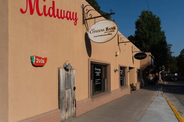
While taking the mural photos, I came across this Citizens Bank building. I sure would like to know why that little wooden door is there.
Little Wooden Door
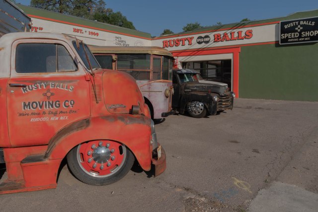
Another curiosity were the antique vehicles out front of Rusty Balls Speed Shop.
That moving van is going nowhere.
And the final spot in this post goes to the Ruidoso Fire Department’s community-built Wall of Courage mosaic monument. The monument measures twenty by seventy-five feet.
Wall of Courage, Brian Sarinova, designer and lead artist
Stay tuned for more episodes covering our week in Ruidoso.
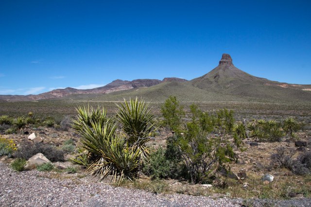
We selected the KOA in Kingman, Arizona, for our next stop on our roundabout way home from Big Bend National Park. Now, all we needed was to find something to do.
Wish I knew more about that pointy peak
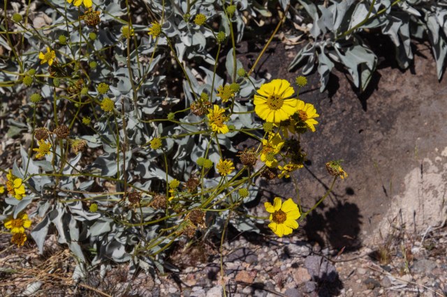
Along Route 66, travelers find plenty of strange and wondrous places to explore. One of those stops is Oatman, Arizona, a living ghost town turned tourist attraction and day-trip destination for Colorado River visitors. My sister told us about the town, so we headed out.
Daisy in the desert
There are two ways to access Oatman along Interstate 40 between Kingman, Arizona, and Needles, California. From the south, pick up Oatman Highway,—a National Back Country Byway and also known as Route 66—off I40 on the east side of the Colorado River. We took the Shinarump Drive and Oatman exit south of Kingman. The route is forty-two paved miles, and vehicles longer than forty feet are not recommended.
A naturally formed mesa?
Be sure to refuel because there is no gas station in Oatman and drive safely navigating the hills and curves. Burros, bighorn sheep, and other vehicles in the road could spoil a driver’s or bike rider’s day.
Layers of geological formations abound along Route 66 in the Black Mountains
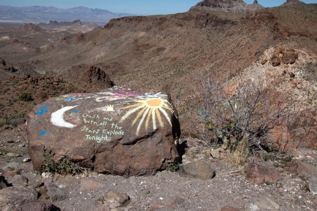
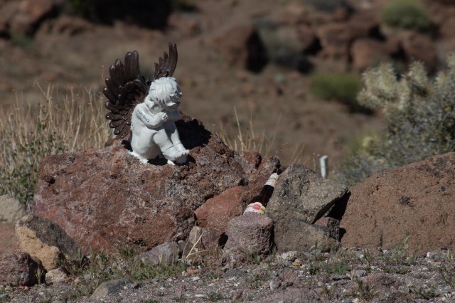
Oatman Highway traverses Mohave County’s Black Mountains. Geological formations, mine remnants, and a mesa used for memorials in memory of family or friends are sights along the way.
Oh, dear. That’s all we need in the middle of a pandemic.The family plotAngel watching over a memorial
The Town of Oatman began as a small mining camp in 1915 when prospectors struck it rich with a $10 million gold find. One year later, the population had swelled to 3,500. From its start and until the government shut down the mines in 1941, the district produced $40 million in gold and some mines were among the largest producers of gold in the western states.
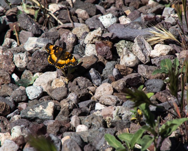
Butterfly in the desert
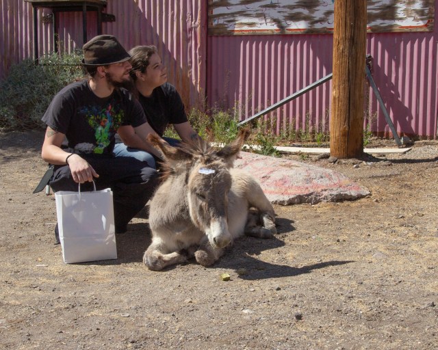
The current population is about 130 people compared to possibly thousands of burros that call the surrounding hills home. Miners brought the burros to town during the heyday of pulling all that gold out of the hills. The animals carried essential supplies, rock, and metals.
Random couple petting a burro. She’s a youngin’. The tag says, “Don’t feed me.”
When the mining ended, the burros were left behind to fend for themselves. The life of a burro in these parts is fairly simple. Wake up each morning and walk to town for food and attention from the tourists.
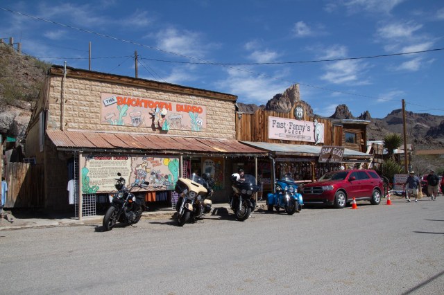
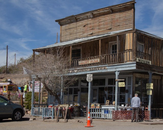
Fast Fanny’s Place was a brothelThe 1902 Oatman Hotel escaped the 1921 fire that destroyed other buildings
The burros stick around during the day, posing for photos with children and the young at heart and munching on handouts the tourists offer. Many of the stores sell carrots and pellets for feeding the burros. Do not feed them any other food. It could make them sick, and that would not be a pretty sight. Come sunset, they migrate back home.
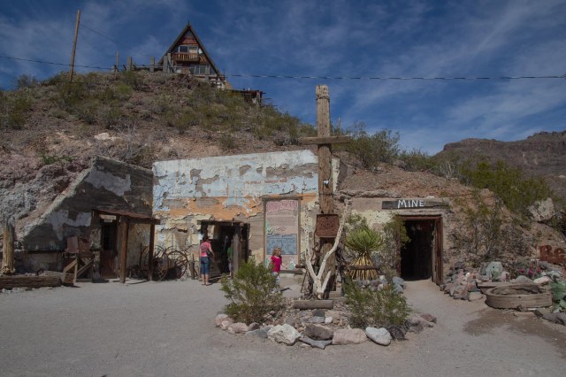
Oatman Drug Company building built in 1915 is listed in the NRHPTake a quick spin through the mine to get a feel for what it was like
Times were tough for the residents when the mining stopped. They survived by catering to travelers driving between Kingman and Needles. The construction and opening of a new route that bypassed Oatman in 1953, left the town mostly abandoned by the 1960s. Over the years it morphed into the tourist attraction it is today with burros and all.
Let’s see. Gold pan’in or books? I’ll take books, please.
One might think Oatman got its name from the mining activity. It was actually the story of Olive Oatman’s kidnapping in 1851 by a local tribe that inspired the town’s name.
Get twisted with Crazy Ray’s T-shirts
Olive had traveled through the area from Illinois with her family when Indians attacked, killing most of her family. Five years later, with a tattooed chin, a Mohave tribe released her at Fort Yuma some 200 miles away.
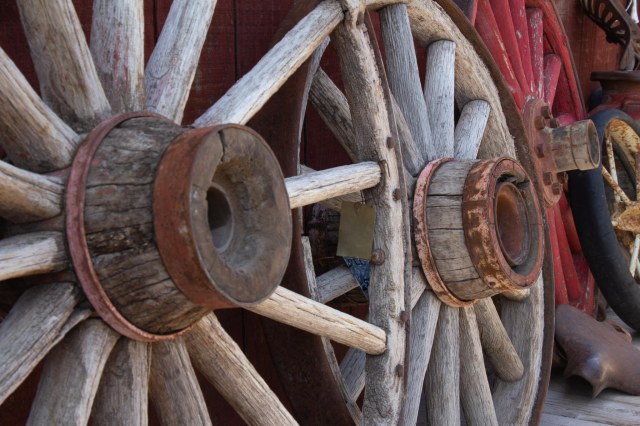
Wagon wheels a plenty
We continued south on the Oatman Highway and came across a group of people riding ATVs, so we stopped awhile and watched as they kicked up the sand.
Looks like fun, but is it?
It looked like fun at first. Then I remembered the time we went with family and friends to Glamis over a Thanksgiving weekend. One day a sandstorm kicked up, and it took us a month to clean the grit from our little 20-foot trailer.
Look, Mom, I’m driving
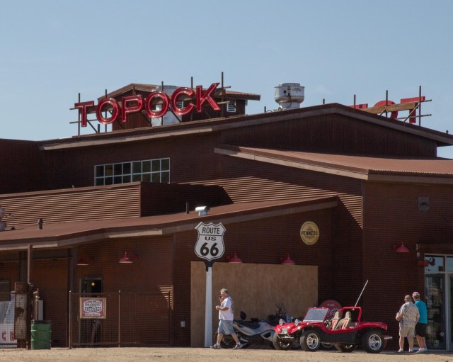
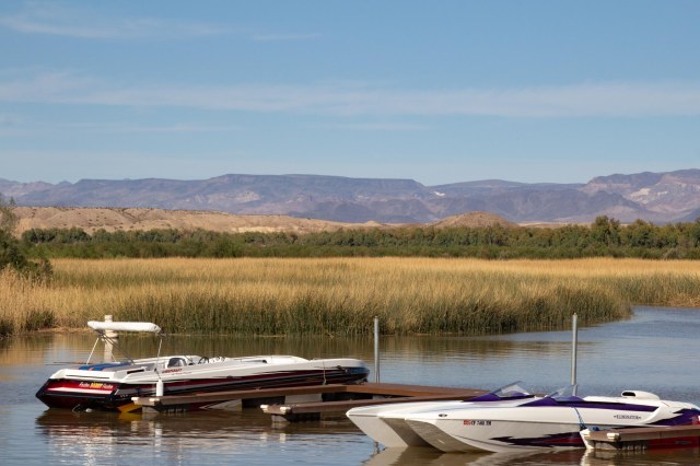
We continued on to Topock Marina where we stopped for a drink and snacks and enjoyed the view of the river, the train, and the marina.
Topock 66 Restaurant, Bar and RiverstoneBoat below and train aboveToprock Marina on the Colorado River
While in Kingman, we also drove into Lake Havasu to eat breakfast with our niece and grandniece at the Red Onion.
Aunt Linda with Niece Bobbi
Exploring the contents of my purse was of more interest to Bobbi than her food. It was nice having a small child on my lap again. This was four years ago, so I’m sure she’s too big to sit on laps today.
Whew! That’s done. We began our trip on February 15, 2016, and arrived home on March 15. I can’t believe it took twelve weeks to document a four-week trip. I thoroughly enjoyed revisiting the places we explored through the research and writing of this series of posts. It is the trip that inspired me to start the blog in September 2016. My family and a few friends had asked me to keep them updated during our travels. When I realized what a chore it was to write up emails and send out photos via email, the blog was born. It seemed the perfect solution to document our trips, and the bonus was finding a simple way to share my photos. WordPress came to my rescue.
Jon and I thank everyone who has followed along on our adventures these past few years, and we look forward to the day when we can wander around the country again. We have several destinations in mind and are itching to get started.
I’m taking the month of August off to concentrate on another project and hope to have new material at some point.
And with that, let me close this post and the entire Big Bend series with another desert shot as we drift off into the sunset.
Albuquerque, New Mexico, to Holbrook, Arizona, was a perfect distance to travel west on March 7, 2016. It also cut another 235 miles from our trip home along Interstate 40 (also known as Route 66). Advertised as the closest full-service campground to the Petrified Forest National Park and the Painted Desert, we selected the Holbrook/Petrified Forest KOA to stay and explore.
Holbrook, Arizona
Holbrook is a small town with a population of 5,000 incorporated in 1917. Its modern history began in 1881 and 1882 when men arrived to build the railroad, raise cattle, engage in criminal activity, and keep the peace. Thus the town sprouted in the middle of the desert. Of course, the Ancestral Puebloans, Native Americans, Hispanics, and pioneers called the area home for many years before the mid-1800s.
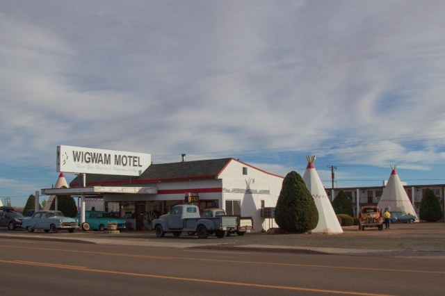
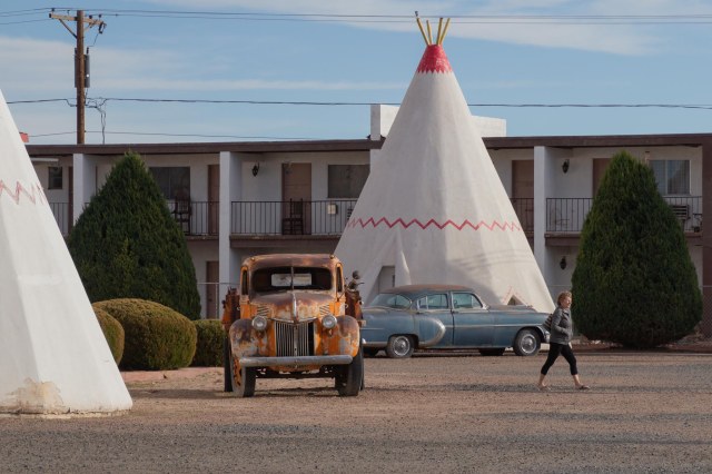
Wigwam Motel Village #6
A notable story for the town is the Holbrook Shootout in 1887, during the Pleasant Valley War, or Tonto Range War. The shootout occurred on September 4, when Apache County Sheriff, Commodore Perry Owens, paid a visit to Andy Blevins (a.k.a., Andy Cooper) to arrest the man for horse theft. At Blevin’s home, Owens found him, two of his brothers, a friend, and other family members. Four men to one didn’t bode well for Owens that day. Like a climax in a western movie, Owens walked away without a scratch, while Blevins, one brother, and his friend perished. Considered a western legend like The Earp Brothers and other lawmen of the Old West, I want to believe Owens chose good over evil most of this life. Unfortunately, many of our heroes don’t always live up to the white-hat variety, and Owens is no exception. I’ll let readers who want to learn more perform their own research on Commodore Perry Owens.
The Wigwam Village #6
We didn’t have much time to spend wandering around the town because our goal was to see the Petrified Forest. One sight that caught my eye was the Wigwam Village #6 on Route 66. I grew up in Rialto, California, where a Wigwam Motel still operates on Foothill Blvd., (Route 66), so I had to stop and click a few pics.
Look. Mater from the Cars movie is here.
Chester E. Lewis of Holbrook built the property and opened in May 1950. Members of the Lewis family have owned the motel since then, modernizing and updating as needed throughout the years. I liked the way the Lewis’s incorporated the antique vehicles for authentic flavor, especially “Mater.”
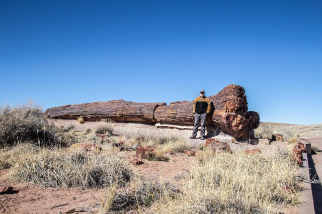
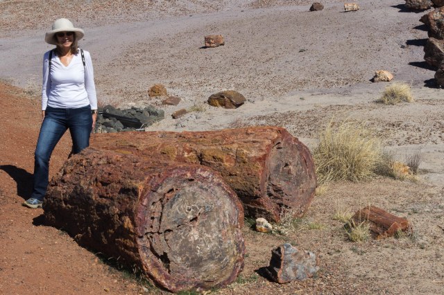
Petrified Forest
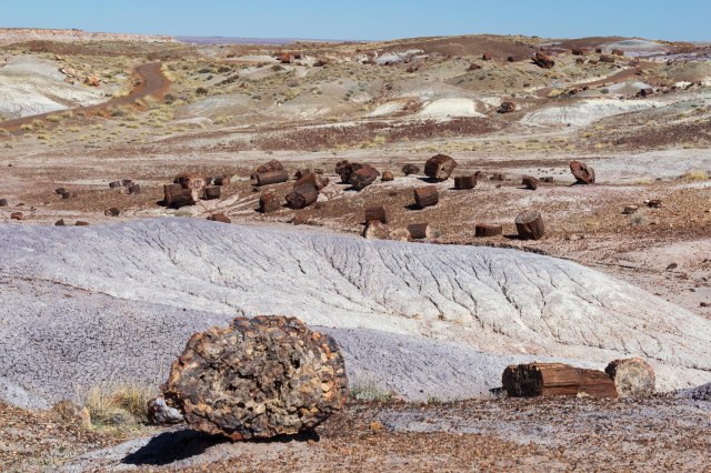
President Roosevelt named the Petrified Forest as a National Monument in 1906. Driving along the road through the park, I had to ask, “Where did these trees come from and why did someone cut them up and scatter them around the landscape?”
Rainbow Forest Museum and Visitor Center from Trail
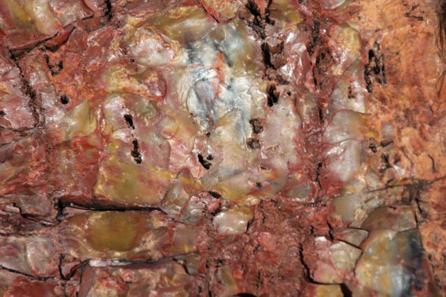
Two hundred million years ago, an ancient river system washed away the tall trees. Water, sediment, and debris buried them so deep that oxygen could not get through. Without oxygen, there was no decay. Instead, the wood absorbed minerals and silica dissolved from volcanic ash and crystalized the organic material over hundreds and thousands of years. Each piece of giant crystal contains iron, carbon, and manganese, which creates a rainbow of colors.
The scientific name of the petrified trees is Araucarioxylon arizonicu
It almost looks like someone came around and used a chainsaw to cut up the petrified logs. The splitting and breaking apart began 60 million years ago when the Colorado Plateau uplifted. So it was Mother Nature at her best that broke the logs with clean, smooth cuts.
The logs look like wood and feel like rock.
The park’s archeological record dates back to the Paleoindian era of 13,500 to 6,000 BCE. From the time of Paleoindian—when hunter-gatherers used the petrified wood to create stone tools—to the year 1540 CE, people who inhabited the area adapted to the changing climate as the ice age waned and warmer, dryer climates became the norm.
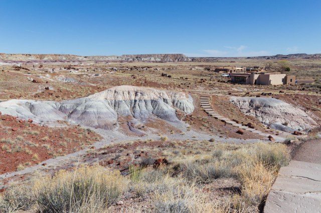
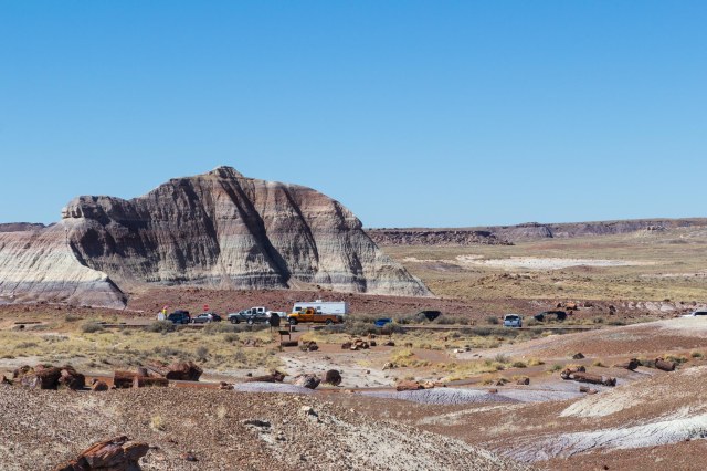
Martha’s Butte from Crystal Forest Trail
Evidence of pit houses; farming of corn, squash and beans; and small game defined the Basketmaker period of 500 BCE to 650 CE. A village of forty-seven pit houses and storage pits was also located in the park, including examples of ceramics used for cooking and storage.
Scattered crystalsLandscape view Close up of rainbow-colored crystalStay off the 110-foot Agate Bridge
During the Pueblo periods, people moved out of the pit houses and built stone structures above ground in clusters. The years 1300 to 1540 CE brought trade to the area resulting in larger villages, an exchange of ideas, and a mix of artifacts from varying cultures.
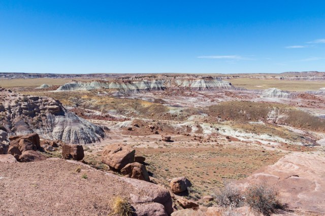
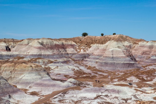
Blue Mesa Trail
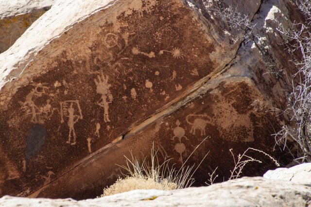
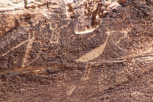
Newspaper Rock includes 650 petroglyphs over a collection of rocks in a small area. The petroglyphs date back to 650 and 2,000 years ago.
Petroglyphs of stars, animals, aliens?And the bird ran away with the frog
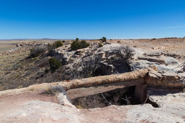
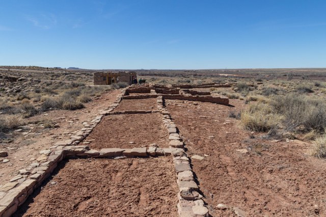
Puerco Plaza dates to the pueblo IV period. Next to Rio Puerco sits the ruins of an adobe compound of a hundred or more rooms. The pueblo contained living quarters that housed up to 200 people around 1300. Underground rooms called kivas for ceremonial purposes were also found. Imagine the single-story structure built in a square with plaster-coated exterior walls and no doors or windows. The roofs consisted of logs, brush, and mud. The people used ladders over the walls and roofs for access outside of the plaza.
Puerco Plaza adobe ruins
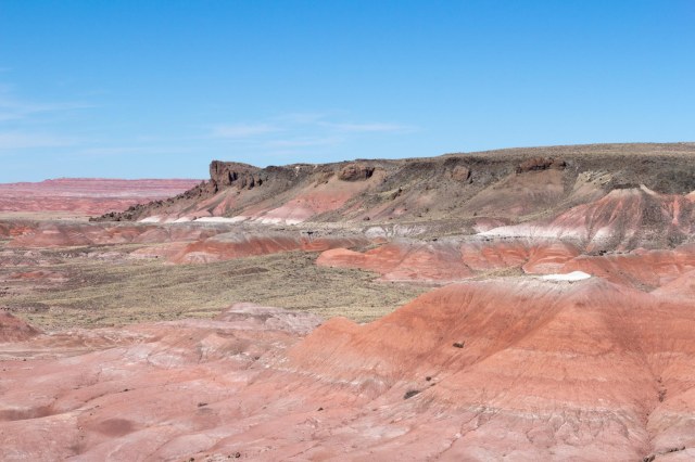
Painted Desert
In 1540, the Spanish explorer Francisco Vazquez de Coronado passed through the area on his way to see the Grand Canyon and Colorado River. He named the colorful land El Desierto Pintada, the Painted Desert. The Painted Desert runs from near the east end of Grand Canyon National Park and southeast into the Petrified Forest National Park. The stratified layers consist of siltstone, mudstone, and shale of the Triassic Chinle Formation. Iron and manganese contribute to the varied colors, including the red rock and shades of lavender.
Painted Desert viewPainted Desert view
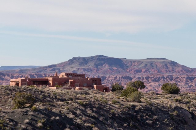
Painted Desert Inn overlooks the Painted Desert and would have been an interesting place to stay as a guest after World War II when the Fred Harvey Company operated the inn and restaurant. The National Historic Landmark functions only as a museum today.
Painted Desert Inn
An original building made of petrified wood was constructed in the early 1920s. The adobe façade dates to a 1930s renovation by the Civilian Conservation Corps. Subsequent modernization projects in 2004 and 2006 helped to preserve the inn.
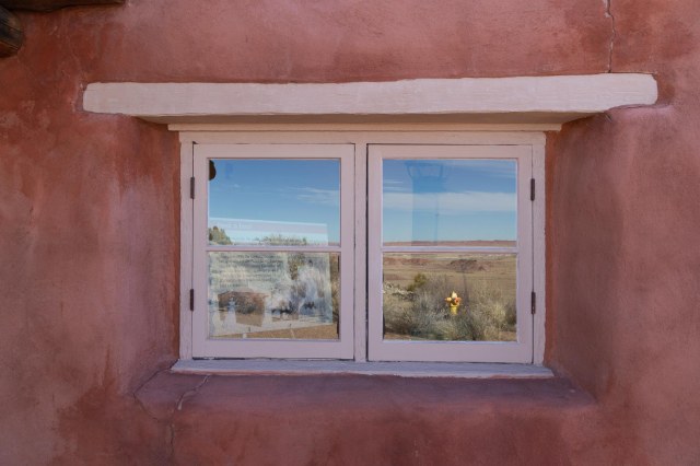
Window reflections
A few days before publication of this post, the north and south visitor centers were open, but the Painted Desert Inn was temporarily closed and wilderness camping permits were not available. As with many of the national and state parks, it’s best to check the website for current conditions before arriving.
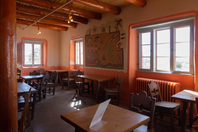
Inside Painted Desert Inn
We highly recommend setting aside an hour, two, or more to explore this unique park and learn not only about the crystal trees but the people who inhabited the area for thousands of years before us.
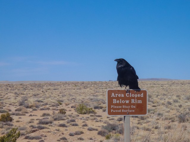
An omen to obey all warning signs
While deep in research for this article, I ran across the AZ Memory Project at azmemory.aslibrary.gov. They have collections of photographs taken in Arizona dating back years. It is one of those websites where I could get lost for hours viewing the various photos, so I thought I would share.
Next up we continue on Route 66, make a quick stop in Kingman, and drive to Oatman, Arizona, a living ghost town and tourist attraction.