Located on land of the Wiyot people, a federally recognized tribe in California, the Sequoia Park Zoo was established in 1907. The oldest California zoo is also the smallest accredited zoo in the country. Many zoos we visit spread out over acres of vast open spaces. Not so Sequoia. It sits along the edge of the City of Eureka’s 67-acre Sequoia Park, which is home to old-growth redwood trees. Finding shade was not a problem among the giants.
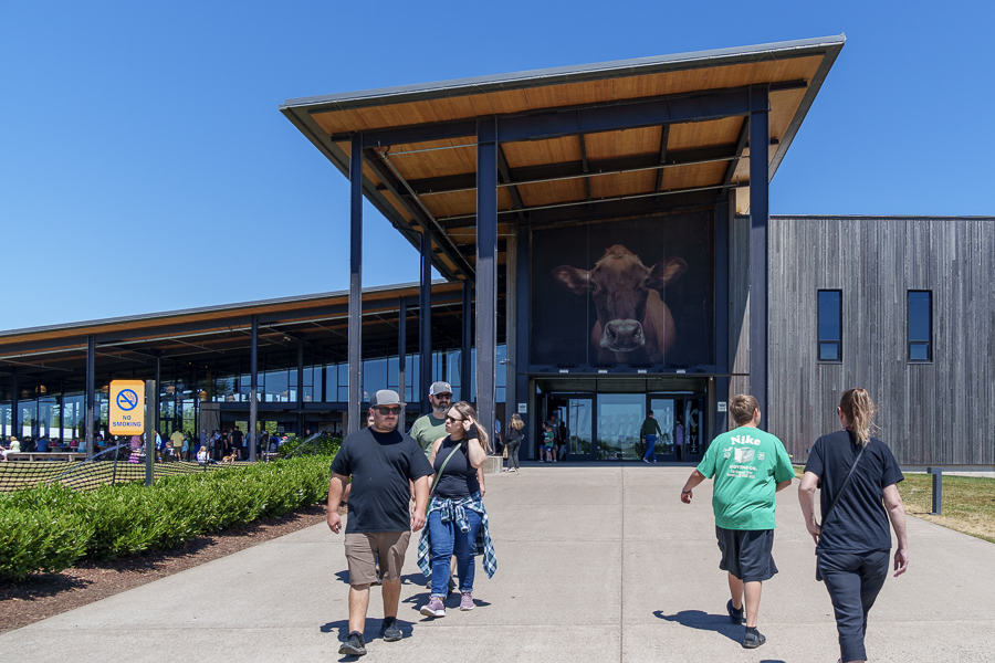
Sequoia Park Zoo entrance
The park is open daily from 10:00 am to 6:00 pm (or 10 am to 5 pm Tuesday – Sunday during winter) and attracts folks of all ages and abilities. Be sure to check their website in case of adverse conditions that may require them to close.
Flamingos are a popular draw at many zoos.
Their mission is to “inspire conservation of the natural world by instilling wonder, respect, and passion for wildlife.”
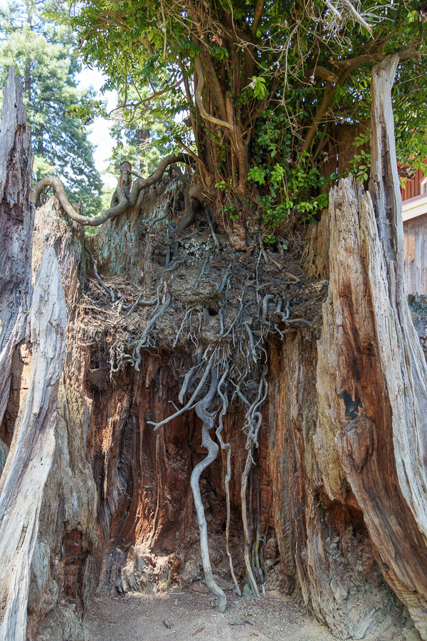
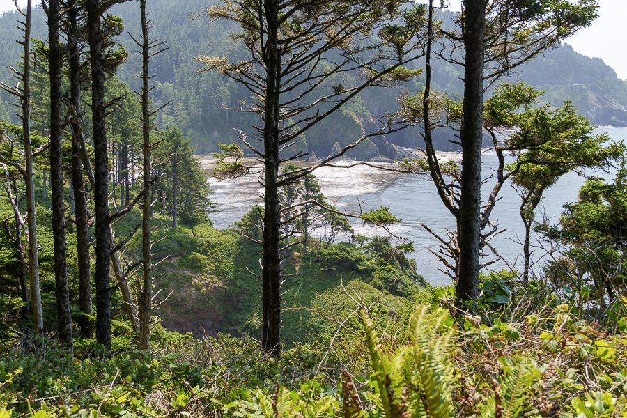
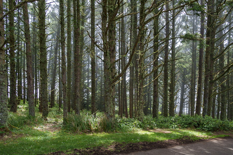
A redwood survives
The zoo offers student field trips; age-appropriate zoo camps from ages five to fifteen; and conservation-related programs, projects, and initiatives.
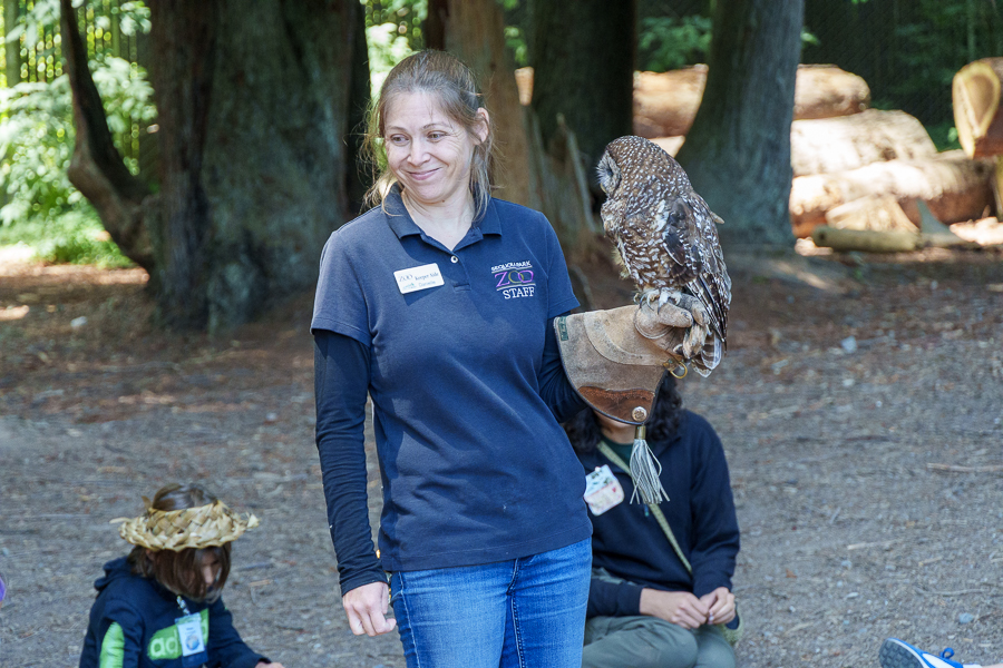
Curious kids learn all about owls.
Circle time led by one of the Keeper Aides.
Kids can experience life in an eagle’s nest.
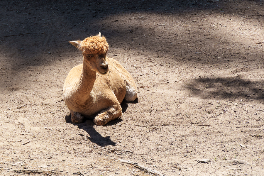
The zoo cares for over 150 animals, representing over 50 species. Among these are animals that cannot return to their natural habitat because of injuries they’ve sustained or from too much human contact. The zoo’s website includes stories of survival for some of these animals that I found interesting to read about.
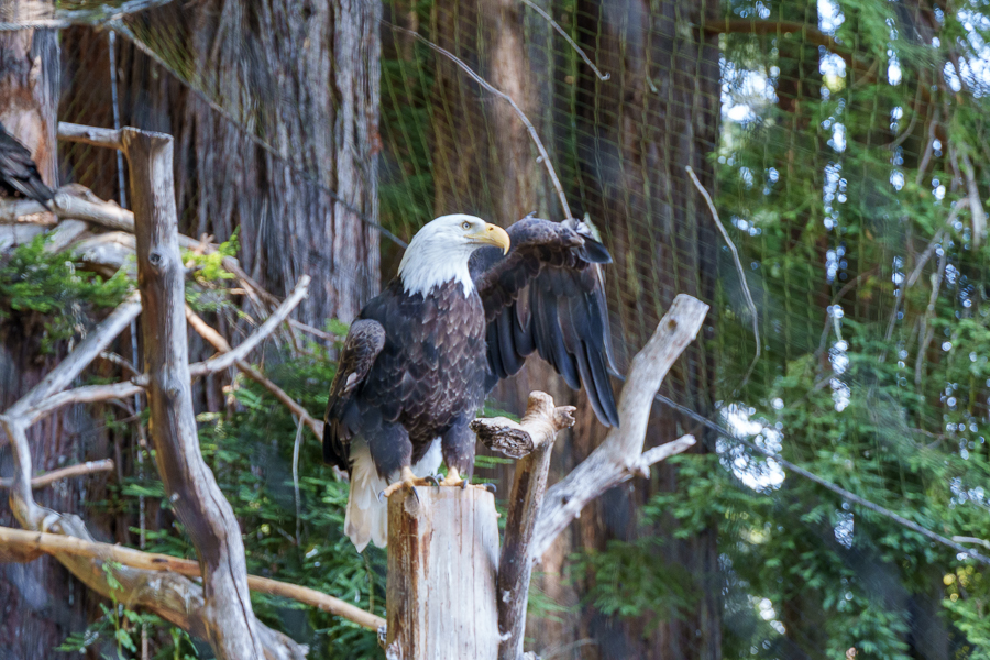
A broken wing prevents this eagle from enjoying freedom in the wild.
The California Department of Fish and Wildlife (CDFW) places abandoned or injured animals assessed as unfit for release in the wild in zoos. Sequoia Park Zoo is one zoo that cares for such animals. On their website are stories about Tule, Ishǔng, and Nabu, the bears that cannot return to the wild, as well as others, like the eagle above.
Black bear, not likely to regain his fur, calls the zoo its home
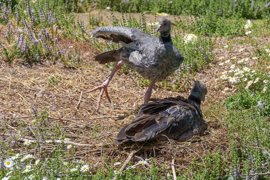
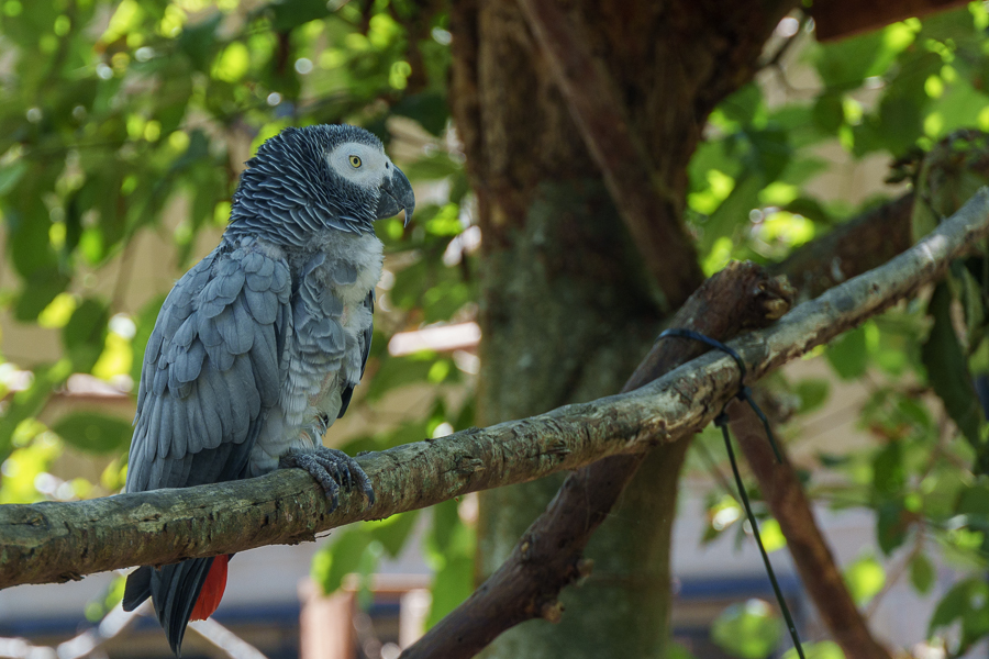
Other Animals Seen at the Zoo
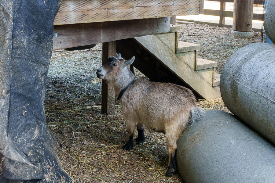
The Barnyard
Besides the animals, two other exhibits are a draw for visitors. Guests can connect hands-on with domestic animals such as miniature horses, guinea pigs, chickens, and donkeys at the Barnyard. Learning about the animals, practicing farm skills, and brushing goats and sheep are activities to enjoy. There’s also a dedicated butterfly research lab at the Barnyard.
Ahh! That feels good.
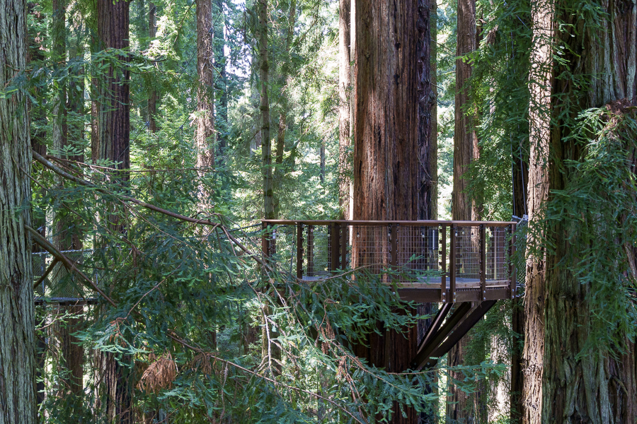
Redwood Sky Walk
The other big draw is the Redwood Sky Walk, opened in 2021. We loved our leisurely walk up the ramp along with the views of the zoo below from a height of 100 feet. One resource listed the Sky Walk as the longest in the Western United States. I wonder whether that claim still stands.
The sturdy wood structure with non-slip walkable treads felt safe and secure, especially with thick posts and 3.5- to 4-foot guardrails on each side of the ramp. It took me a few seconds to get used to the “adventure leg” though because it swayed and bounced when other people navigated across in front or behind me.
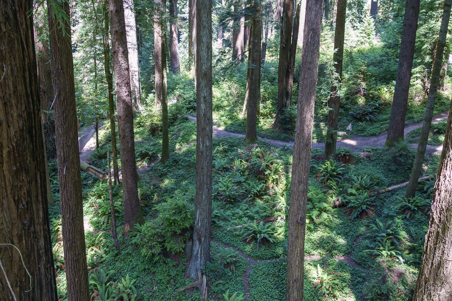
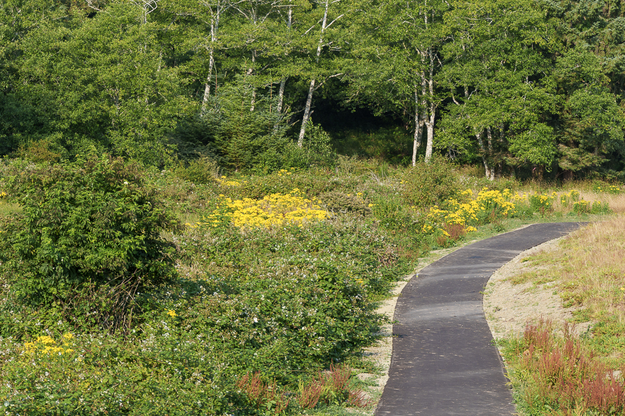
Backlot paths among the ferns
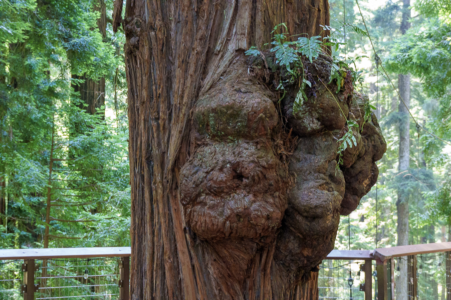
It’s amazing how these trees can survive.
Whimsical rest area
We found the zoo’s compact size easy to navigate and a respite among the giant sequoias and would definitely visit there again.
Once we left Eureka, we made one more overnight stop at the Cloverdale/Healdsburg KOA in Alexander Valley, California. The RV park was about six miles south of Cloverdale in an oak-covered, hilly canyon. One of its inviting features was the fishing lake. Families came out in the late afternoon with fishing rods and reels to try their luck catching fish for the night’s dinner.
Here, fishy, fish, fish
A place to reflect.
We ended our adventure after thirty-six days when we pulled in front of our house on July 26, 2024. To say we enjoyed every bit of the trip is an understatement. While unpacking and washing piles of laundry, I reminisced about where we had been and what we had seen, and was grateful we had returned home safe and sound.
Next Up: We leave the RV at home while we fly and drive to Egg Harbor in Door County, Wisconsin.
We left Florence, Oregon, on July 22, 2024. While driving through Oregon, we noticed quite a few glassblowing studios. Perhaps influenced by Dale Chihuly’s artwork? The Gilded & Ethereal Blue Chandelier is located at Global Aviation in Hillsboro Airport, Hillsboro, Oregon. Other creations have been or are displayed at Willamette University, the Portland Art Museum, and in various galleries.
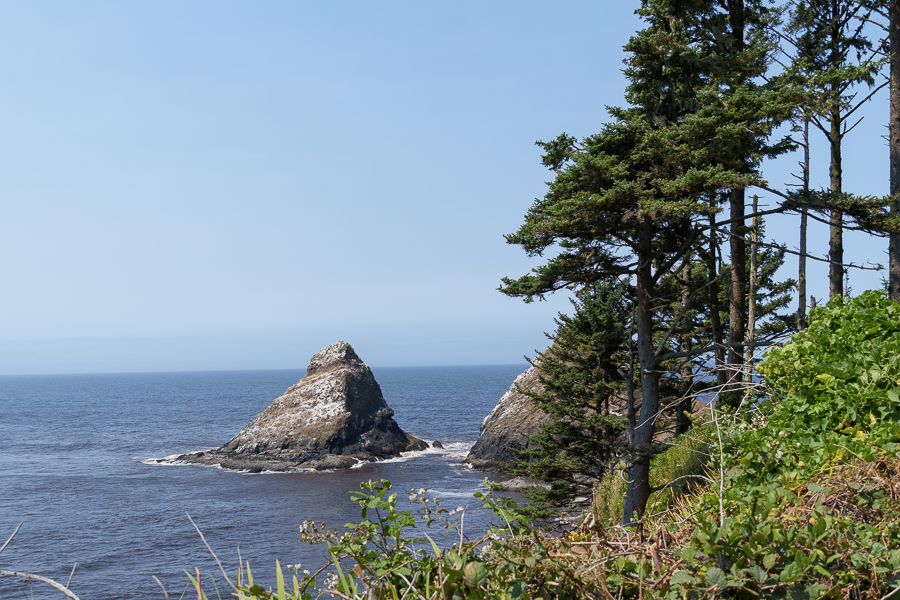
Pacific Ocean views from US 101
For the first time this trip, we had no reservations. I noted two casinos and a KOA where we might find accommodations for a night or maybe two. The first casino we pulled into was too sketchy for our taste. The first thumbs down was its location in the middle of a residential area. The second was the junky motorhome a few spaces down the row that was running its outdoor open-frame generator. We certainly didn’t want to listen to it all afternoon and night.
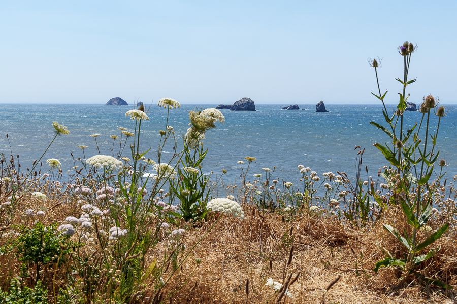
Wished we had time to walk on the beach
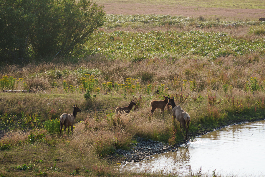
We next drove through the KOA, but of course they had no space. Our third try was the charm at Elk Valley Casino, owned and operated by the Elk Valley Rancheria. It sat up on a hill overlooking the valley, where a herd of elk grazed. The casino had plenty of parking designated for RVs, a restaurant, and other amenities inside. All we had to do was sign in with security and dine on a pair of awesome hamburgers at the Warriors Bar & Grill.
Elk Valley Casino has RV Parking
Plenty of vegetation and water nearby for the elk
Sentry watching for danger?
Trail to the Elk Valley Fuel Mart
Redwood Coast Cabins and RV Park in Eureka, California, was our next destination, where we planned to stay for four nights. We arrived early enough to get our laundry cleaned. When I saw the one washer with a coat of dark sandy dirt all over it, I walked out and hoped we’d find a decent laundromat somewhere in town. I sure didn’t want my clothes coming out dirtier than when they went in. Fortunately, we found a laundromat in Arcata. I gladly paid the extra cost for clean machines and an attendant on duty.
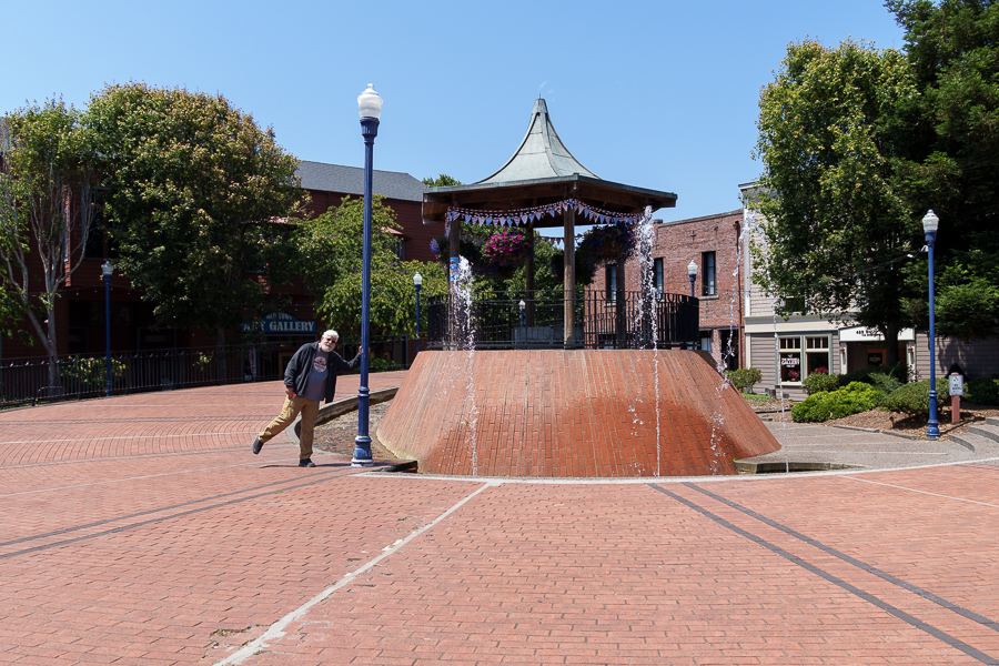
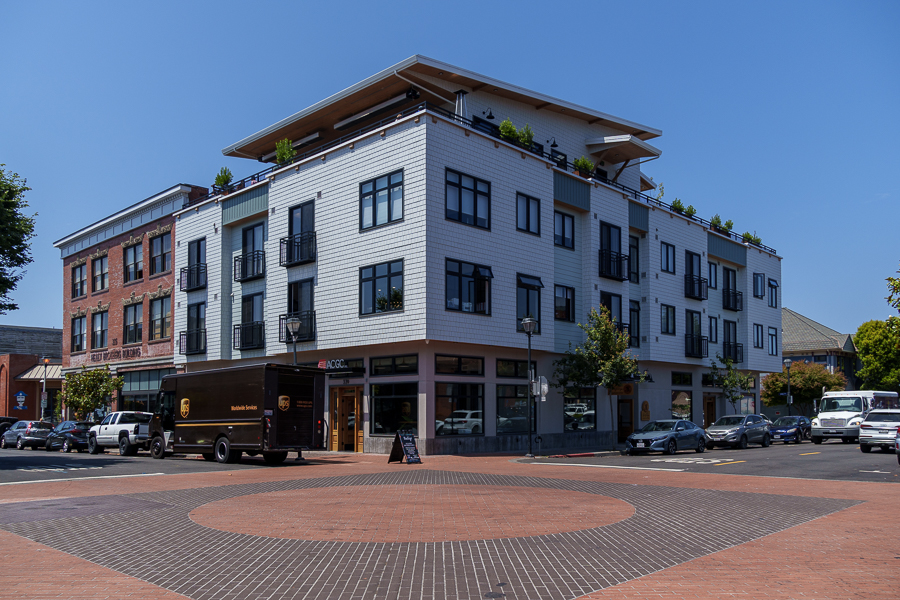
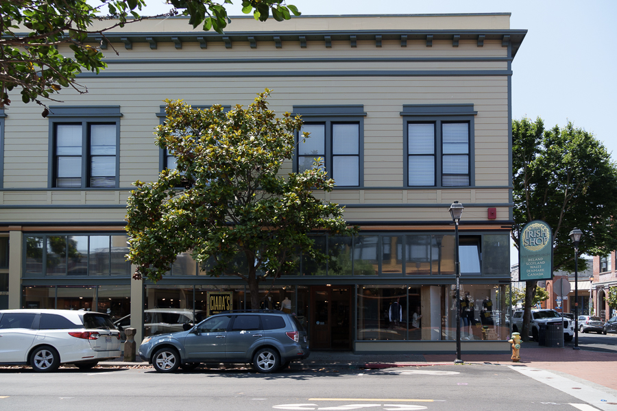
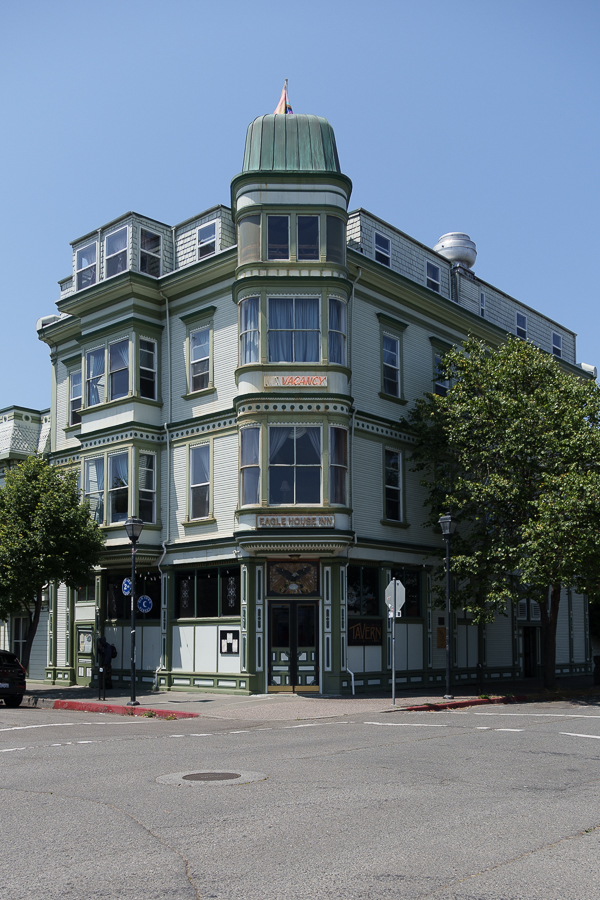
City of Eureka Street Scenes
I never tire of the Victorian styled buildings in these historic towns, so they often end up in these posts. No need to peruse them if they’re not your jam. If they are, you’re welcome.
Historic Mansions
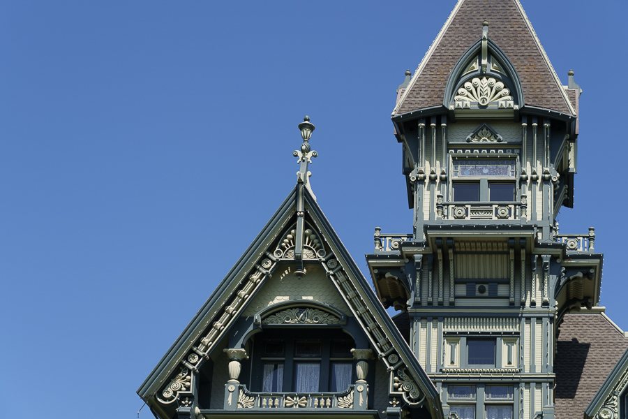
One of the most iconic buildings in Eureka is the Carson Mansion, completed in 1885 by William Carson, who made his fortune in lumber. Its tower is visible in many places throughout town. In the late 1940s, after the last of his heirs abandoned the property and could not find a buyer, the mansion faced destruction.
Isn’t she a beauty?
Local business owners J.H. Crothers and Carl Gustafson, along with other residents, formed the Ingomar Club. The group took over the property and began maintenance and improvements. In 1988, the club initiated an extensive renovation that included replacing replicas of 1889 architectural details where needed.
A closer look at the ornate detail
And even closer detailed view
The Queen Anne style Pinc Lady Mansion (formerly known as the Pink Lady) was built in 1889. New owners still offer the B&B experience and can accommodate wedding and special event rentals. William Carson built this home as a wedding gift for his son and his wife.
Pinc Lady Mansion
At the end of M Street, across Second Street from the Pinc Lady Mansion, stands a newer styled building. Its style is reminiscent of architecture used in the 1940s or 1950s with its sleek, clean lines and lack of ornamentation. This building houses the Mathews, Kluck, Walsh, & Wykle law firm.
Mathews, Kluck, Walsh & Wykle
Other Buildings and Sites Around Town
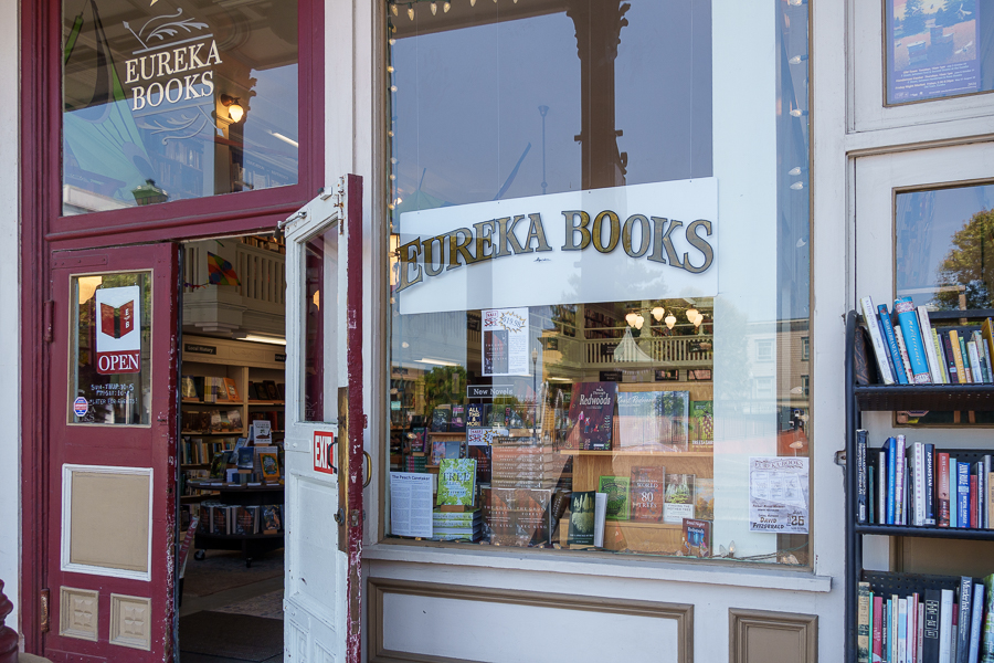
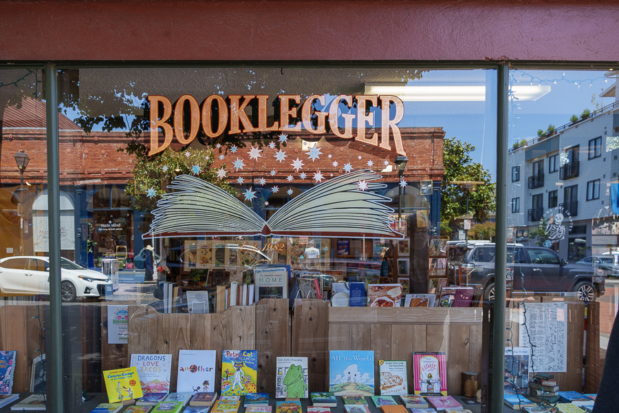
A search revealed two independent bookstores in Eureka: Eureka Books Historic Bookstore (selling new, used, and antiquarian books) and Booklegger (selling used books).
Eureka Books Historic Bookstore
In addition, on the second floor of the city’s library is Serendipity Bookstore. Operated by Friends of the Redwood Libraries, the bookstore sells used books, magazines, and videos. That’s a lot of options for a city with a population of 25,000.
Try Booklegger for used books
Humming Bird Public Art
Cafe Waterfront Oyster Bar & Grill
Singin’ at the water feature
My allergy to wool limited my time in the Irish Shop.
The Historic Eagle House Inn and Phatsy Kline’s Restaurant and Bar
Chapala Restaurant
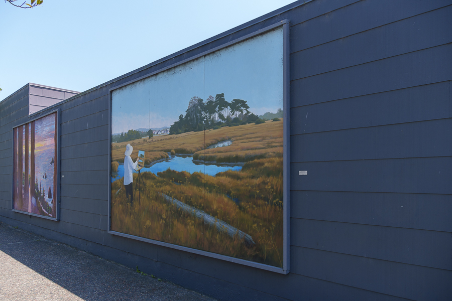
A sample of the many murals around town.
Dedicated to seafaring men of Humboldt past, present, and future, this dolos weighs 42 tons. Structures made of these concrete blocks are used to dissipate waves. They usually weigh around 8 tons.
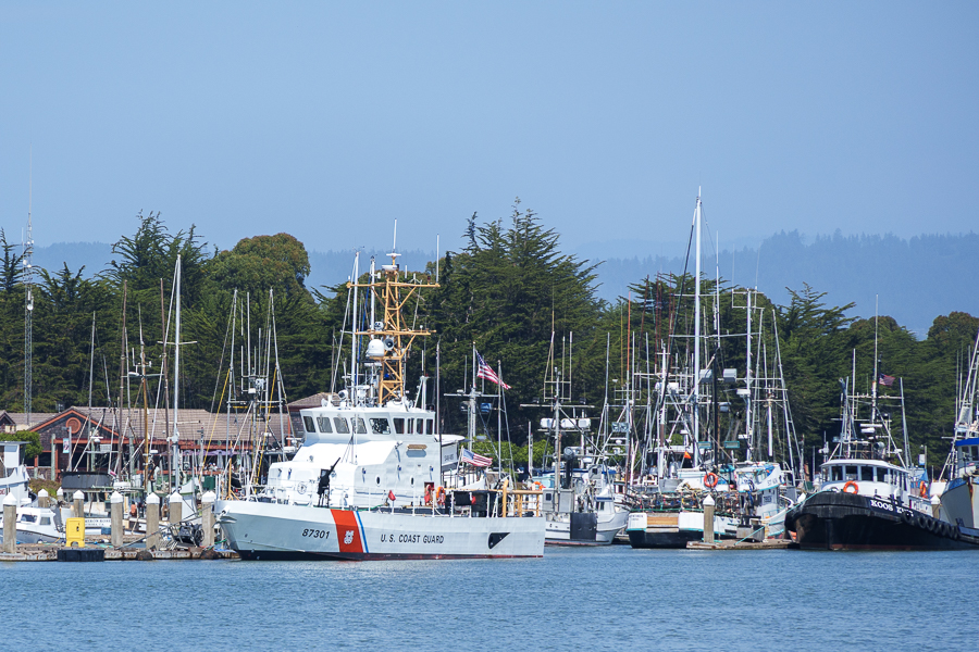
Cal Poly Humboldt research vessel
Coast Guard vessel
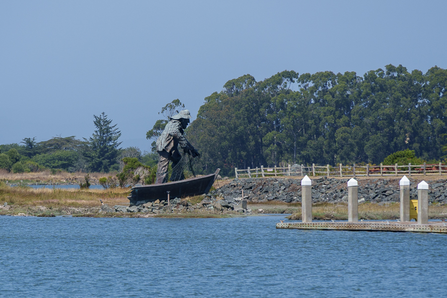
The Fisherman
A bit of whimsy
Dick Taylor Craft Chocolate Factory and Store had yummy-tasting chocolate bars. No tours on the day we visited.
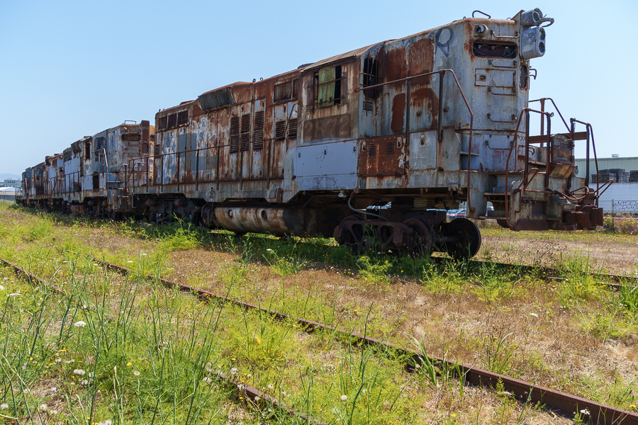
The Zombie Trains
I took photos of these locomotives in the spring of 2014. In December of that year, the City of Eureka declared them a public nuisance. Legal actions, changes in responsibility, and the decline in scrap metal prices prevented their removal until September 2024.
Photo taken on May 9, 2014
The owner tried to appease the city by painting them gray in 2015. As the photo below shows, the paint didn’t last. Although not everyone will agree, I prefer the look of the graffiti to the blotches of rust and paint.
Photo taken on July 24, 2024
A September 11, 2024, article by the Lost Coast Outpost reported on the status of the Zombie Trains removal piece by piece on site, using heavy machinery. Thus ending the debate between paint, rust, and graffiti. I’m sure the City of Eureka cheered at the removal of the locomotives. Our next trip through Eureka won’t be quite the same without seeing the rusty, graffiti-sprayed hunks of metal. I’ll be watching to see what will take their place.
Next up: More in Eureka, California, including the Sequoia Park Zoo and Redwood Sky Walk
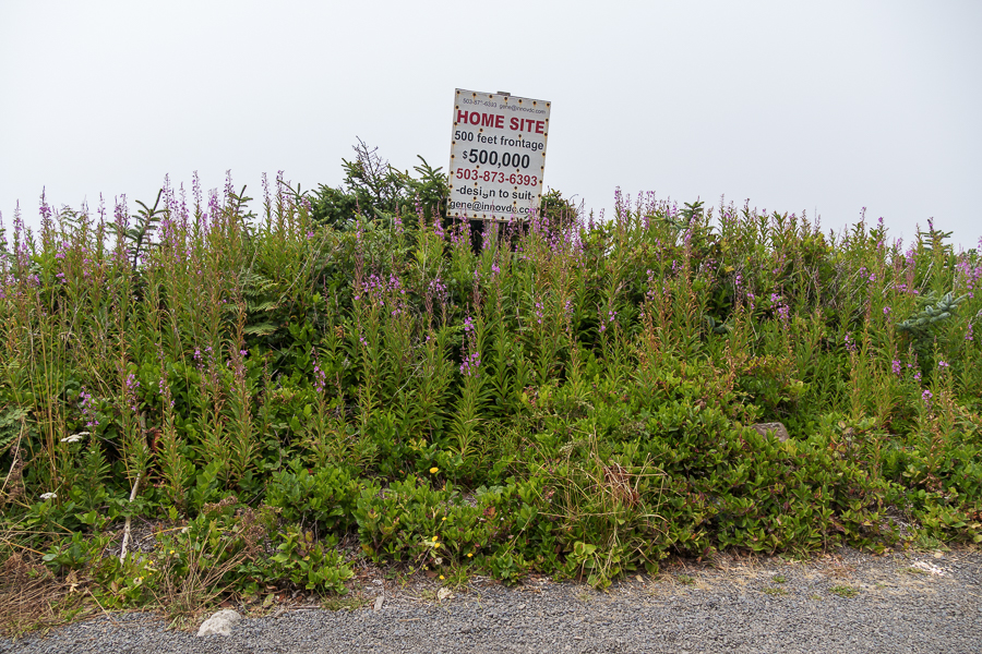
We left Tillamook on July 20, 2024, for Pacific Pines RV Park in Florence, Oregon, where the wind blew harder than we’d seen since we began our adventure at the end of June. Along the way, we stopped to stretch our legs at a turnout that overlooked the ocean.
I was taking photos, concentrating on flowers, when Jon came out of the fifth wheel and said, “Hey look. We could build a house on this lot?” Uh, no thank you. Having a home hanging over a cliff that drops into the ocean was not my ideal place to live.
We selected the Waterfront Depot in Old Town Florence, Oregon, to sample the local food offerings and couldn’t resist having the crab cakes for a starter. Luckily, they were the best crab cakes we had ever tasted. My salmon piccata served in a tasty sauce with capers and mashed potatoes and green salad on the side was equally delicious. So satisfied with our meal, we opted for a slice of the carrot cake. We always try different carrot cakes to compare them to the cakes I make. Disappointment usually sets in after one bite. Not this time. My only recommendation was to add a few more raisins.
A Bit of Public Art and the Siuslaw River Bridge
After dinner we walked outside onto the boardwalk, where we spotted the painted creature in the photo below. It is one of several sculptures painted by artists as part of the Dancing With Sea Lions public art project that began in 2016. The sculptures were displayed and then sold to businesses and individuals as a fundraiser for the Florence Events Center.
Umi No Nami by Ellen Huntingdon on the West Old Town Boardwalk next to the bridge
The Siuslaw River Bridge, listed on the National Register of Historic Places since August 5, 2005, opened to traffic in 1936. The Public Works Administration provided the funding.
View of Siuslaw Bridge from the Boardwalk
Several years later, a steel grid deck replaced the original deteriorating wood-plank deck. The mid portion of the bridge is a double-leaf bascule (drawbridge) that opens to 100 feet (34 m). Its latest rehabilitation occurred in 2018. I’m so glad the Art déco design has survived the bridge’s renovations throughout the years. It allowed me to imagine the vehicles and people that might have crossed the bridge ninety years ago.
Oregon Dunes National Recreation Area (ODNRA)
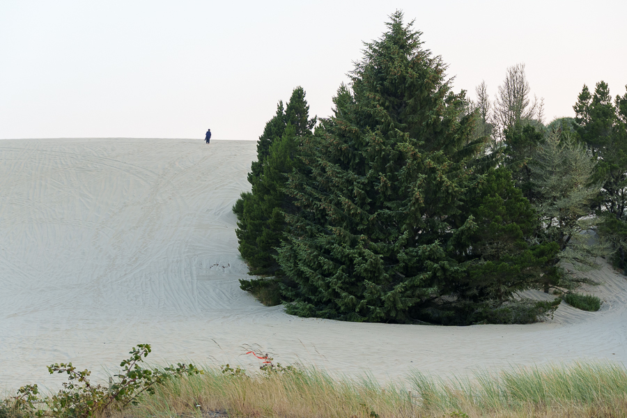
A walk around Old Town would have been nice, had the wind not been blowing so hard. Instead, we drove out on the South Jetty portion of the Oregon Dunes National Recreation Area – North. One might think after a long drive and a filling dinner we’d be ready for a bit of exercise. We had walked on hills much shorter than this one when we were younger and remembered how our legs and ankles ached afterward, so we left the fun to the younger folks.
Looks easy but oh so hard.
ODNRA spans the Oregon Coast from Florence to Coos Bay. We saw only a sliver of the 31,500 acres of recreational nirvana. Whether families and/or friends opt to visit the northern region or the southern region, they can count on plenty of opportunities to have fun. ODNRA offers OHV riding, hiking, water sports, camping and so much more to choose from.
Looking south across the Siuslaw River from the South Jetty
Sunset peeking through trees and clouds
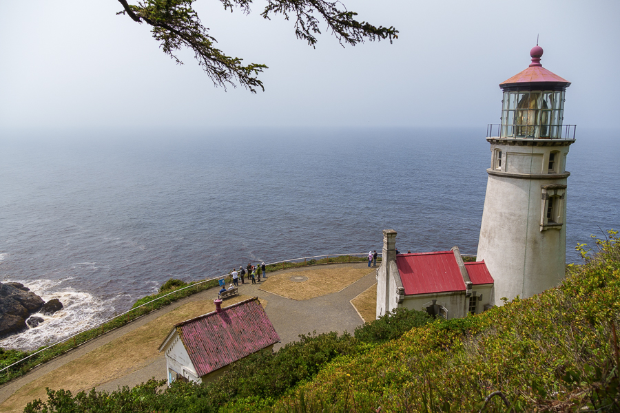
Heceta Head Lighthouse
The next day we were off to another lighthouse. The Heceta Head Lighthouse cast its first beams of light across the waters on March 30, 1894, two years after its Fresnel lens was ordered from France.
View of the Heceta Lighthouse B&B
On the walking trail to the lighthouse
The lighthouse is named after Don Bruno de Heceta. On an expedition of the West Coast ordered by the Queen of Spain in 1775, Heceta noted the shallow waters and rocky headland. A hundred years later, mariners requested a lighthouse to help them navigate along the coast.
View from the trail
View from the trail
The three lightkeepers and their families lived a harsh and isolated existence for the first 40 years of the lighthouse. They must have rejoiced when US Route 101 opened to traffic. It’s no wonder many of them left because of the severe weather and isolation.
Two of the keepers stand out for their long stays. Olaf Hansen stayed on for 16 years. He brought a post office, a schoolhouse, and gardens to the complex. Cap and Ma Herman witnessed many changes at the lighthouse during their stay between 1925 and 1950.
Jon checking the weather
Soon after the Herman’s arrival, the construction of US 101 began, and along with the highway came electricity. In the late 1930s, the US Lighthouse Services, which was disbanded, transferred the lighthouse to the US Coast Guard.
Close-up of the lantern room
Lens broken during routine cleaning
Under the Coast Guard Beach Patrol during World War II, seventy-five men with attack dogs patrolled the Heceta Head. The men lived in wooden bunkers during their deployment. After the war, two men and their families remained at Heceta.
Up the stairs to the lens
In 1963, the Coast Guard turned over the keeper’s house to the US Forest Service, and head keeper Oswald Allick was the last keeper on the site.
Heceta Lighthouse B&B
Fancy a stay at a B&B near the lighthouse? Reserve a room at the Heceta Lighthouse B&B. The inn has three rooms with private baths and two rooms with a shared bath. The non-smoking rooms include a social hour with local wine and cheese and a seven-course breakfast in the morning.
Heceta Lighthouse B&B
Placed on the National Registry of Historic Places in 1973, the USFS turned the house into a bed-and-breakfast. Proceeds from the inn and gift shop fund the maintenance and restoration.
Mike and Carol Korgan became the first innkeepers for the Heceta Lighthouse Bed & Breakfast in 1995 as volunteers. They began an interior restoration of the inn, and when they retired, their daughter Michelle took over.
Docents use the bottom floor of the house as an interpretive center to give free tours. Our timing wasn’t quite right to take advantage of the tour, so we walked around the property and I snapped photos.
Rear of Heceta Lighthouse B&B. Guests can park in the lot.
I could see myself sitting on the porch, watching the sunset, and sipping a cup of cocoa, topped with marshmallows, of course. “Hey, Jon. Wouldn’t it be fun to stay for a night or two?”
On our way back to the RV park, we paused for a couple of photos of the scenery.
Cape Creek Bridge, carrying US Route 101 traffic since 1932
US Highway 101 and the river on the left, ODNRA, and the Pacific Ocean on the right.
Next up: Coastal views, a herd of elk, and Eureka, California.
Our next stop on our way home was Tillamook Bay City RV Park on July 18, 2024. On WA-105 and US-101, we drove through a canyon of trees so thick I caught only a glimpse here and there of what looked like homes or commercial buildings amid the dense forest. Near the ocean, sloughs snaked their way through the wetlands. And folks tried their luck clamming in the muddy low-tide beach areas.
We pulled off the highway and found a long stretch to parallel park the rig in Seaside, Oregon. After a mile and a half walk, Dooger’s Seafood and Grill satisfied our hunger for lunch. It was too bad we had reservations farther south because I wanted to explore the town and area more.
We don’t know whether Apple Maps rerouted us inland onto Miami Foley Road for a reason, or if we made a wrong turn. It didn’t matter. Instead of sitting in traffic on US-101, we enjoyed driving through the narrow valley. Purple, yellow, white, and red wildflowers decorated the side of the road, and the green expanse of farmland acres created an idyllic landscape. The view sure beat looking at car bumpers on the highway.
We reserved the next day for exploring. On our list were the Tillamook Creamery and the Meares Cove Lighthouse.
Tillamook Creamery
In 2014, during a previous trip to the Pacific Northwest, if it hadn’t been pouring rain, we would have stopped to visit the creamery. Then, it seemed the visitor center sat farther back from US-101. We weren’t wrong. The new visitor center opened in June 2018.
For the convenience of visitors, the center is open daily from 10 am to 7 pm. Inside, visitors can take a self-guided tour or opt for a premium experience (reservations recommended). We took the self-guided tour, which took us on a journey through the cheese-making process.
Tillamook Creamery Visitor Center
Upstairs in the Farm exhibit, we learned about the care and feeding of the cows throughout their lives. A factory viewing deck allowed us to watch the cheese production in process from a catwalk level. Diagrams and descriptions on posters gave explanations of what we saw. On the other side of the deck, we watched cheese move on conveyor belts and racks from one step to another. Human factory workers performed a quality check to verify the loaves were the correct size and weight. The workers even shaved off bits of cheese, if needed, before the cheese moved to the wrapping machine.
We would have bought lunch at one of the food counters and an ice cream for dessert had it not been so crowded and taken so long to get through the lines. Instead, we wandered through the gift shop and ended up waiting a few minutes for photos with the Yum Bus, where the crowds had thinned.
Delivering the goods
Meares Cove Lighthouse
A beautiful drive along a cove and through a forest led us to the Meares Cove Lighthouse parking lot. The forest of trees wept droplets of water on us as we walked toward the lighthouse. The trees were still drying out from the heavy morning fog that hugs the coast most days. It reminded me of walking through the Hoh Rainforest in Olympic National Park.
Path to the lighthouse
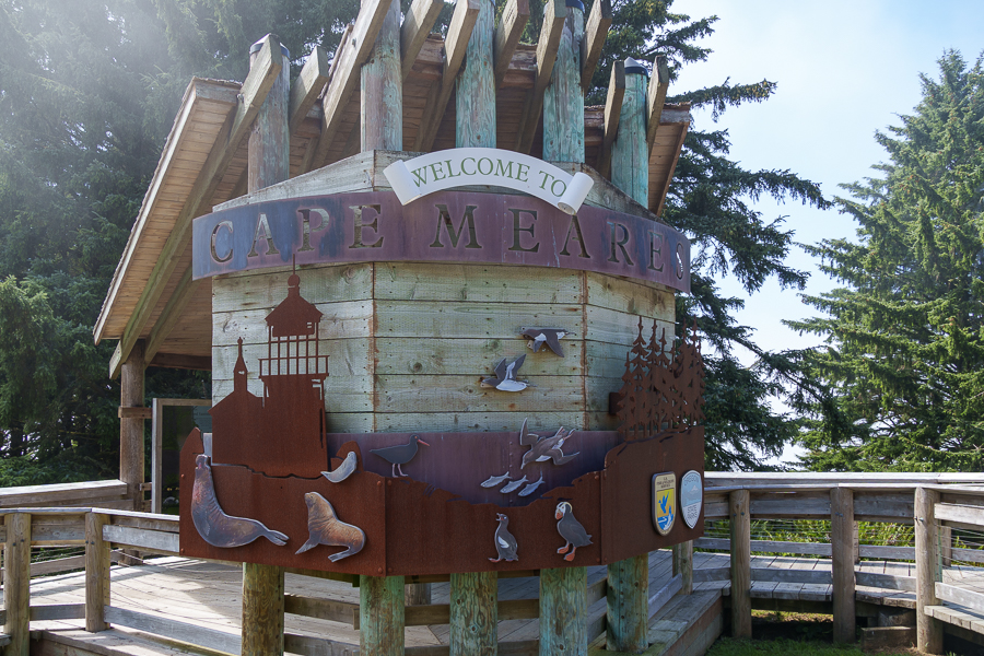
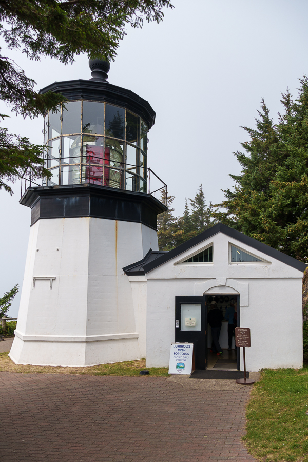
Meares Cove Lighthouse is the shortest lighthouse along the Oregon coast. It stands only 38 feet tall atop a basalt outcropping 200 feet above the Pacific Ocean. Captain John Meares, a northwest explorer who commanded the sloop North West America in the 1780s, named the area Cape Lookout. A mistake made on maritime maps in 1857 identified another location as Cape Lookout. This caused the name change to Cape Meares, since it was easier to change the name than reprint the maps.
During the 1840s and 1850s, prospectors from the goldfields and pioneers who crossed the Coast Range settled in the area for its rich soil. In 1886, the need for a lighthouse became clear, so the Lighthouse Board requested $60,000 for construction. By the end of 1889, the lighthouse, other supporting structures, and living quarters were complete, and on January 1, 1890, the light was lit for the first time.
Two Kohler generators supplied electricity in 1934. On April 1, 1963, a DCB aero beacon, mounted atop a concrete structure, replaced the lighthouse. Concerned citizens pleaded with the Coast Guard not to dismantle the lighthouse a few months later. On April 6, 1964, the Coast Guard agreed to lease the property to Tillamook County.
As often happens with historical buildings, the lighthouse fell victim to neglect and deterioration at the hands of weather and vandalism. Hippies lived in the dwellings and made a mess, and someone, or a group of someones, stole four bull’s-eye lenses from the first-order Fresnel.
Years later, a drug raid recovered one lens. Then, a magazine published an article in 1986 that pleaded for the recovery of the other three. It took 20 years for all four lenses to be reunited.
In 1968, Oregon State Parks Department took over the lease from the county. In 1978, the state built a replacement workroom and had the tower scraped and repainted, and on Memorial Day 1980 the lighthouse opened to visitors.
Inside the lighthouse, a docent took us up the steps to see where the light fixture sits. He told a story of a pair of men in their early twenties who tore up the grassy area around the lighthouse with their vehicle in 2010. They also shot several rounds of ammo into the structure. Their bullets destroyed numerous prisms that made up the antique first-order Fresnel lens. Overall, the damage amounted to $500,000. The Fresnel lenses contain over one thousand prisms and round bull’s-eye lenses that bend the light to produce a powerful beam. They can weigh over two tons.
The judge could have sentenced the young men to seven years in prison for the offence. Instead, he sentenced them to three 16-day stints in jail to be served each year at Christmastime, plus $100,000 restitution. I hope they learned from their mistakes and became more productive citizens as they grew older.
Fifteen years later, their names and details of their crimes still pop up in a Google search. In case guilt and shame fill them with dread, I’ll not repeat their names here. Of course, it’s possible they may still laugh about what they did over a cold glass of beer.
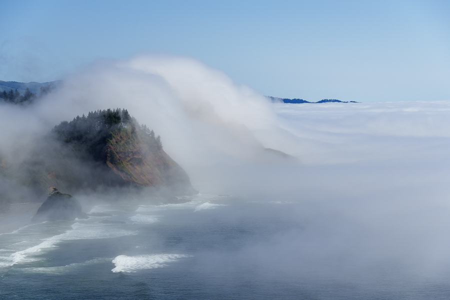
Out on the overlook, I had fun with fog. The formation of the white cottony water droplets suspended in air pushed its way ashore and up the face of hills seemed to mimic the wave action below.
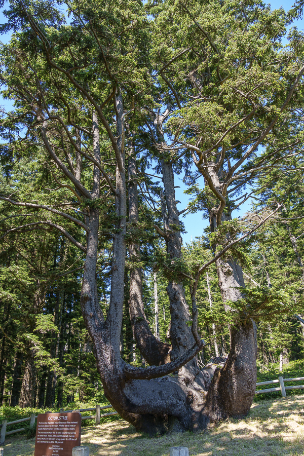
The docents recommended we take the short walk from the lighthouse to the 250- to 300-year-old Octopus Tree. Curious, we headed that way to see the attraction.
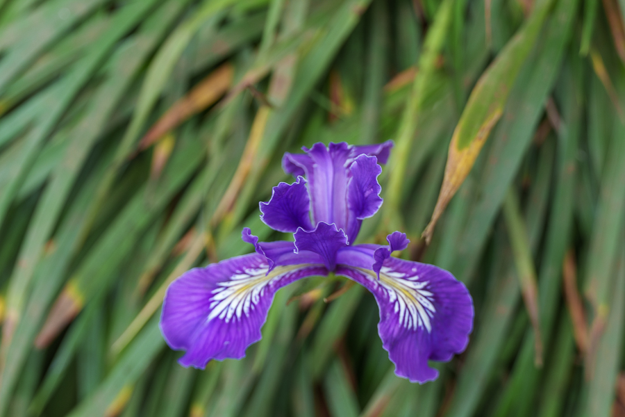
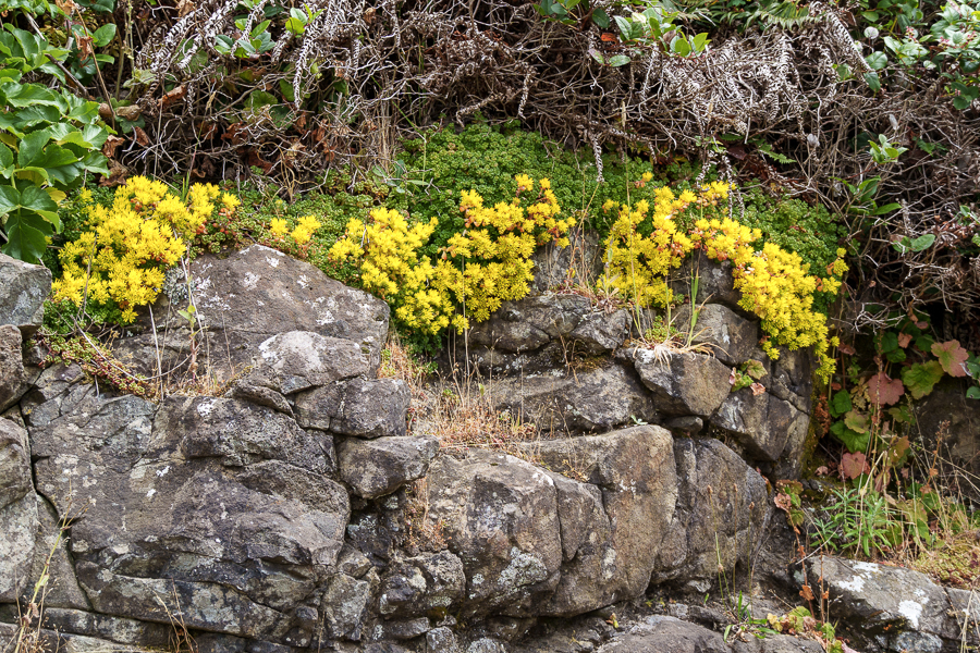
Colorful blossoms seen along the trail to Octopus Tree
The Sitka spruce tree developed a solid base that has grown to 14-15 feet across. The lack of a central trunk and the cluster of trunks around the perimeter create a curiosity to ponder.
Was the tree’s growth natural? Or, was it trained like a bonsai into its formation by Native Americans? Did they bury their dead in canoes built in the tree? No one seems to know for sure, so for now it remains a mystery.