
Albuquerque, New Mexico, to Holbrook, Arizona, was a perfect distance to travel west on March 7, 2016. It also cut another 235 miles from our trip home along Interstate 40 (also known as Route 66). Advertised as the closest full-service campground to the Petrified Forest National Park and the Painted Desert, we selected the Holbrook/Petrified Forest KOA to stay and explore.
Holbrook, Arizona
Holbrook is a small town with a population of 5,000 incorporated in 1917. Its modern history began in 1881 and 1882 when men arrived to build the railroad, raise cattle, engage in criminal activity, and keep the peace. Thus the town sprouted in the middle of the desert. Of course, the Ancestral Puebloans, Native Americans, Hispanics, and pioneers called the area home for many years before the mid-1800s.
A notable story for the town is the Holbrook Shootout in 1887, during the Pleasant Valley War, or Tonto Range War. The shootout occurred on September 4, when Apache County Sheriff, Commodore Perry Owens, paid a visit to Andy Blevins (a.k.a., Andy Cooper) to arrest the man for horse theft. At Blevin’s home, Owens found him, two of his brothers, a friend, and other family members. Four men to one didn’t bode well for Owens that day. Like a climax in a western movie, Owens walked away without a scratch, while Blevins, one brother, and his friend perished. Considered a western legend like The Earp Brothers and other lawmen of the Old West, I want to believe Owens chose good over evil most of this life. Unfortunately, many of our heroes don’t always live up to the white-hat variety, and Owens is no exception. I’ll let readers who want to learn more perform their own research on Commodore Perry Owens.
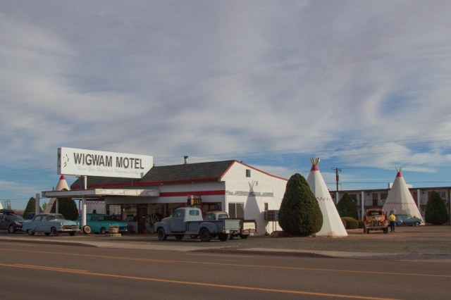
The Wigwam Village #6
We didn’t have much time to spend wandering around the town because our goal was to see the Petrified Forest. One sight that caught my eye was the Wigwam Village #6 on Route 66. I grew up in Rialto, California, where a Wigwam Motel still operates on Foothill Blvd., (Route 66), so I had to stop and click a few pics.
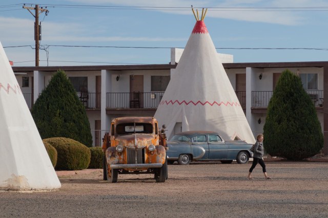
Chester E. Lewis of Holbrook built the property and opened in May 1950. Members of the Lewis family have owned the motel since then, modernizing and updating as needed throughout the years. I liked the way the Lewis’s incorporated the antique vehicles for authentic flavor, especially “Mater.”
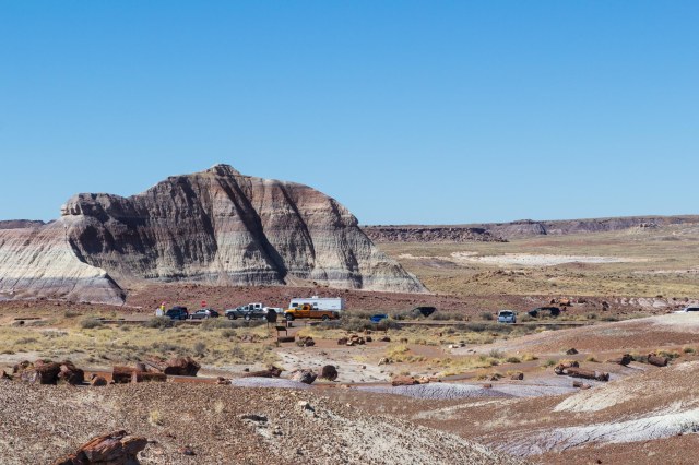
Petrified Forest
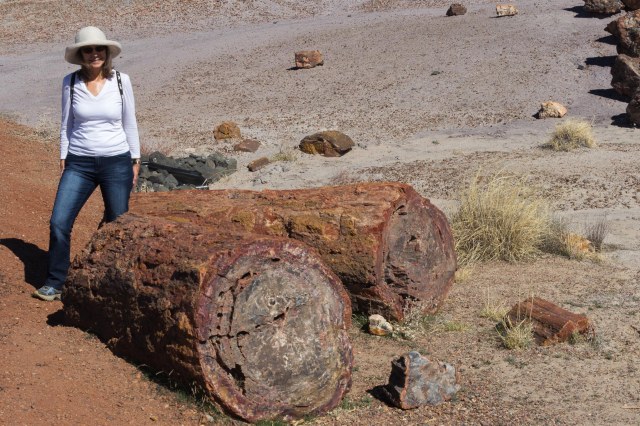
President Roosevelt named the Petrified Forest as a National Monument in 1906. Driving along the road through the park, I had to ask, “Where did these trees come from and why did someone cut them up and scatter them around the landscape?”
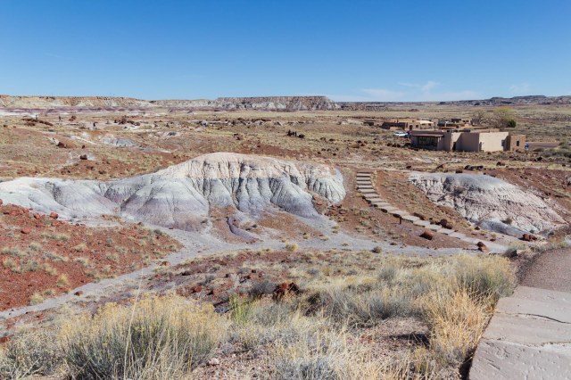
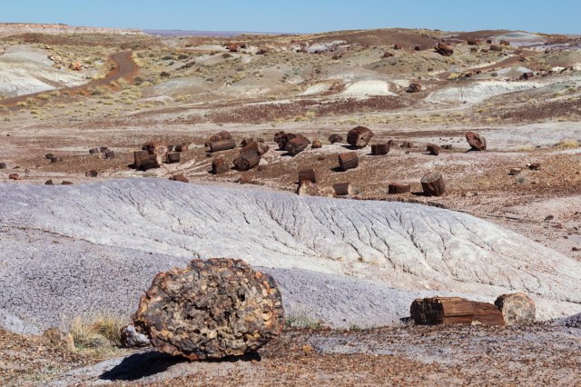
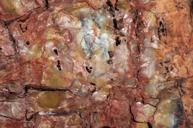
Two hundred million years ago, an ancient river system washed away the tall trees. Water, sediment, and debris buried them so deep that oxygen could not get through. Without oxygen, there was no decay. Instead, the wood absorbed minerals and silica dissolved from volcanic ash and crystalized the organic material over hundreds and thousands of years. Each piece of giant crystal contains iron, carbon, and manganese, which creates a rainbow of colors.
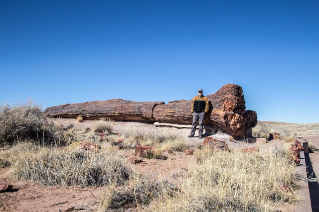
It almost looks like someone came around and used a chainsaw to cut up the petrified logs. The splitting and breaking apart began 60 million years ago when the Colorado Plateau uplifted. So it was Mother Nature at her best that broke the logs with clean, smooth cuts.
The park’s archeological record dates back to the Paleoindian era of 13,500 to 6,000 BCE. From the time of Paleoindian—when hunter-gatherers used the petrified wood to create stone tools—to the year 1540 CE, people who inhabited the area adapted to the changing climate as the ice age waned and warmer, dryer climates became the norm.
Evidence of pit houses; farming of corn, squash and beans; and small game defined the Basketmaker period of 500 BCE to 650 CE. A village of forty-seven pit houses and storage pits was also located in the park, including examples of ceramics used for cooking and storage.
During the Pueblo periods, people moved out of the pit houses and built stone structures above ground in clusters. The years 1300 to 1540 CE brought trade to the area resulting in larger villages, an exchange of ideas, and a mix of artifacts from varying cultures.
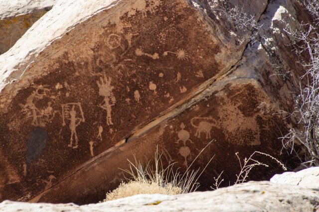
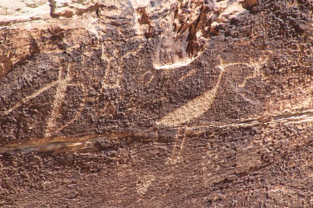
Newspaper Rock includes 650 petroglyphs over a collection of rocks in a small area. The petroglyphs date back to 650 and 2,000 years ago.
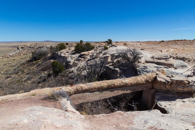
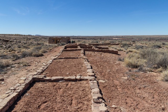
Puerco Plaza dates to the pueblo IV period. Next to Rio Puerco sits the ruins of an adobe compound of a hundred or more rooms. The pueblo contained living quarters that housed up to 200 people around 1300. Underground rooms called kivas for ceremonial purposes were also found. Imagine the single-story structure built in a square with plaster-coated exterior walls and no doors or windows. The roofs consisted of logs, brush, and mud. The people used ladders over the walls and roofs for access outside of the plaza.
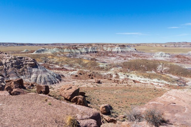
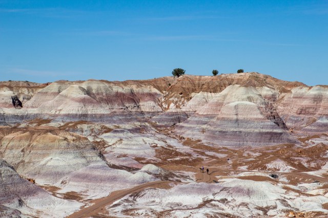
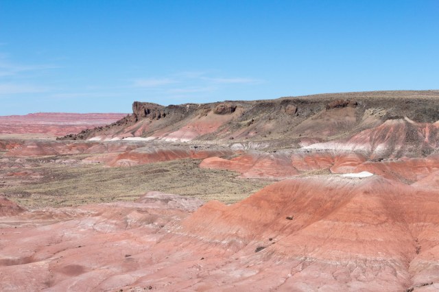
Painted Desert
In 1540, the Spanish explorer Francisco Vazquez de Coronado passed through the area on his way to see the Grand Canyon and Colorado River. He named the colorful land El Desierto Pintada, the Painted Desert. The Painted Desert runs from near the east end of Grand Canyon National Park and southeast into the Petrified Forest National Park. The stratified layers consist of siltstone, mudstone, and shale of the Triassic Chinle Formation. Iron and manganese contribute to the varied colors, including the red rock and shades of lavender.

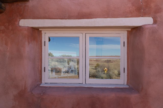
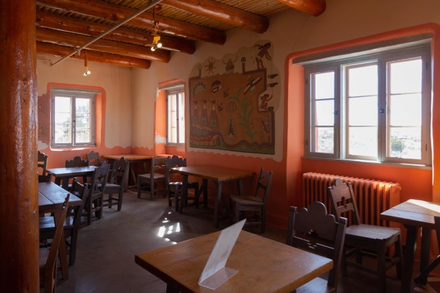
Painted Desert Inn overlooks the Painted Desert and would have been an interesting place to stay as a guest after World War II when the Fred Harvey Company operated the inn and restaurant. The National Historic Landmark functions only as a museum today.
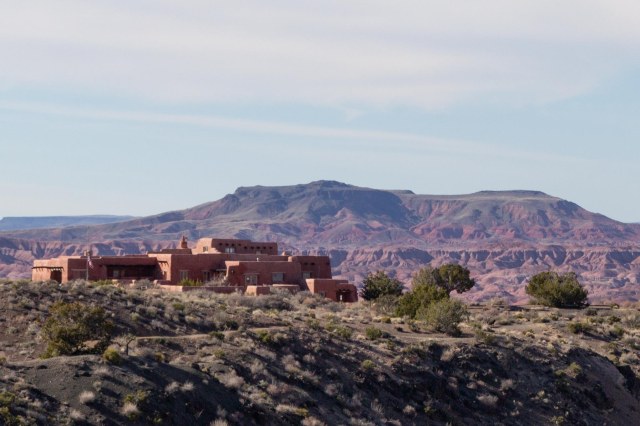
An original building made of petrified wood was constructed in the early 1920s. The adobe façade dates to a 1930s renovation by the Civilian Conservation Corps. Subsequent modernization projects in 2004 and 2006 helped to preserve the inn.
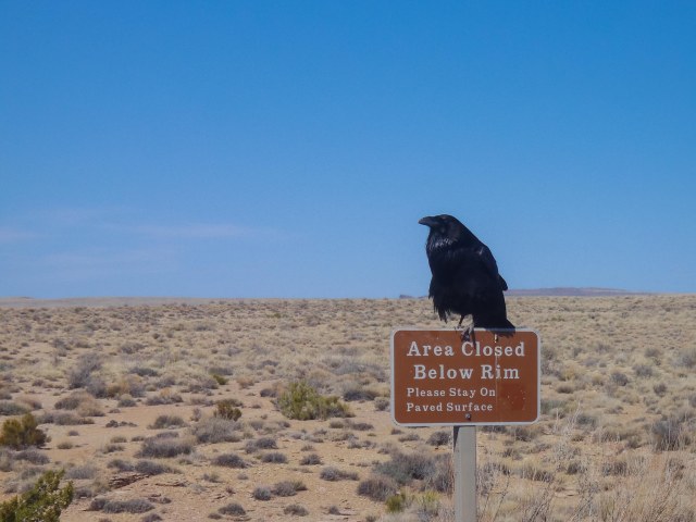
A few days before publication of this post, the north and south visitor centers were open, but the Painted Desert Inn was temporarily closed and wilderness camping permits were not available. As with many of the national and state parks, it’s best to check the website for current conditions before arriving.
We highly recommend setting aside an hour, two, or more to explore this unique park and learn not only about the crystal trees but the people who inhabited the area for thousands of years before us.
While deep in research for this article, I ran across the AZ Memory Project at azmemory.aslibrary.gov. They have collections of photographs taken in Arizona dating back years. It is one of those websites where I could get lost for hours viewing the various photos, so I thought I would share.
Next up we continue on Route 66, make a quick stop in Kingman, and drive to Oatman, Arizona, a living ghost town and tourist attraction.
Stay safe.

I was enthralled by the beauty and fascinating history of the Petrified Forest and Painted Desert. It’s definitely worth the stop.
LikeLiked by 1 person
We enjoyed it and it’s a good place to take a detour during a long drive on Route 66.
LikeLiked by 1 person
Very interesting – both the history of the area and the colors throughout. Thanks for your post.
LikeLike
Thanks for your comment, Betty. History gives me a lens to understand and appreciate what I see when visiting a place. Without that perspective, it’s just another building, hole in the ground, or rock.
LikeLiked by 1 person
Thanks for reminding me how fascinating these sites are. It’s been years since I was there, but I remember how much I enjoyed it.
LikeLiked by 1 person
So glad I sparked a memory for you. It was fun exploring the places we visited four years ago.
LikeLike