For more information about this section of the park, see the Big Bend National Park overview in Part Five.
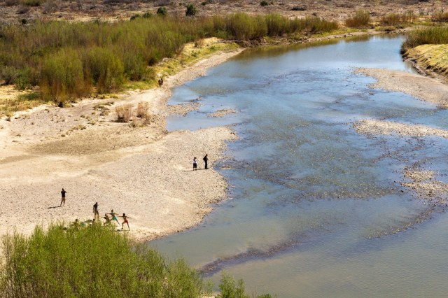
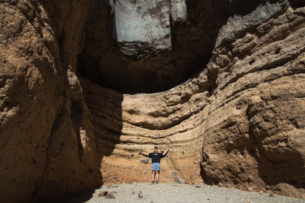
As we enter the Santa Elena Canyon where the Rio Grande meanders through high cliffs, I wonder how such a calm flow of water had carved out the space between the blocks of rock that rise 1,500 feet overhead.
Yoga anyone?
It is the sand and salt in the water that has filed away the limestone, cutting deeper and deeper over millions of years, leaving the ancient limestone formations exposed.
Steep rock cliffs along Santa Elena Canyon trail
Of course, I’m sure thunderstorms and flash floods, which can occur any time beginning in May and running through September, sped up the carving process. Visitors should monitor weather forecasts during those months so they can avoid any danger. The water may look calm now, but I understand the weather can turn in a matter of minutes in Texas.
Floatin’ down the lazy river
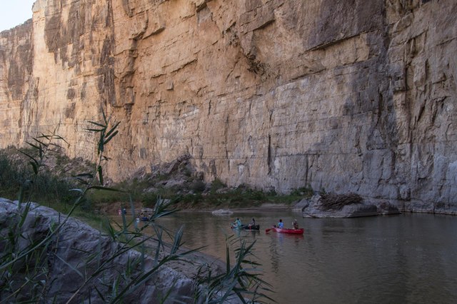
Sign up for a half day or multi-day rafting tour on the river with one of the several tour groups. I knew there was another reason we need to travel back to Big Bend.
Rio Grande River reflection
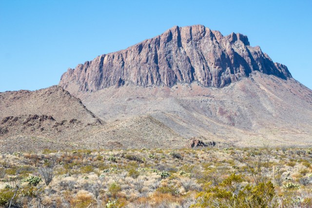
Cerro Castellan contains several layers of lava flows and volcanic tuff, or ash deposits, with layers of gravel and clay. The same lava flow that created Cerro Castellan also created the south rim of the Chisos Mountains.
Cerro Castellan
We had seen plenty of places throughout the park where white rock was piled up and couldn’t tell whether it was something natural or something built up from the mining operations.
Mounds of tuff along the road
We found our answer at Tuff Canyon when we read the information signs. The white stuff is tuff, which formed when a volcanic eruption forced ash through a vent and eventually consolidated into solid rock. The soft rock has been used since ancient times for construction. Some of the Moai statues on Easter Island are constructed from tuff. Visitors will find a couple trails that lead to overlooks of the canyon.
Tuff Canyon
Mule Ears Peaks top out at 3,881 feet above sea level in the Chisos Mountains.
Mule Ears Peak. Are we having fun yet?Ha, ha, Jon.
Goat Mountain is one of many volcanic domes formed during Big Ben’s ancient geological history. The top portion is composed of silica-rich lava, the band of yellow is pyroclastic flow deposits, and the bottom portion is older volcanic rock.
Goat Mountain
We stretched our legs on the Burro Mesa Pour-off Trail, which follows a dry wash full of flood debris, sand, and cobbles.
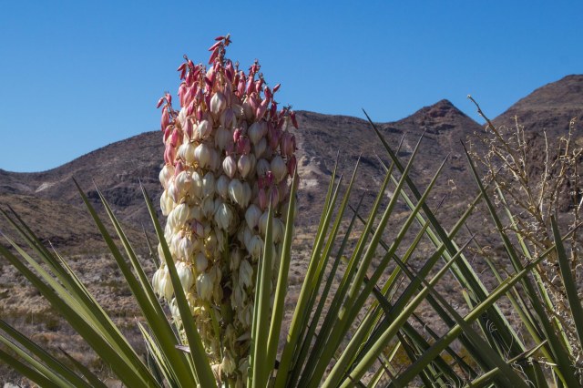
Yucca in bloom
The hard lava that caps the mesa top prevented the torrents of water from carving out a stream here. Instead, the floodwaters from Javelina Wash rushed over the side, carving out the cliff.
Pour Off
The dark-rock Fins of Fire are called dikes and are found throughout the park for miles. They provide evidence of the molten rock that lies quiet under the desert surface. When they are all lined up in a row, they remind of spikes on a dinosaur back.
Fins of Fire
The Chisos Mountains were also formed through a series of volcanic activity that shaped the peaks.
Chisos Mountain Range
Next week’s post will feature the Chisos Mountains and Basin. Until then, stay safe.
Welcome back to Big Bend National Park, where we visited in February 2016. Of the 62 national parks in the nation, Big Bend clocks in at over 801,000 acres, making it the 14th largest in the system.
For more information about this section of the park, see the Big Bend National Park overview in Part Five.
The Rio Grande Village in the eastside of the park is 41 miles from the Maverick Junction entrance where we entered. Be sure to heed the posted speed limit of 45 mph. A park ranger had to warn Jon to slow down a tad.
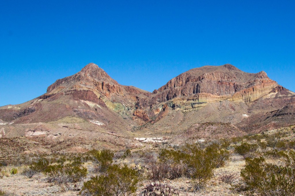
Volcanic peak rising from the desert floor
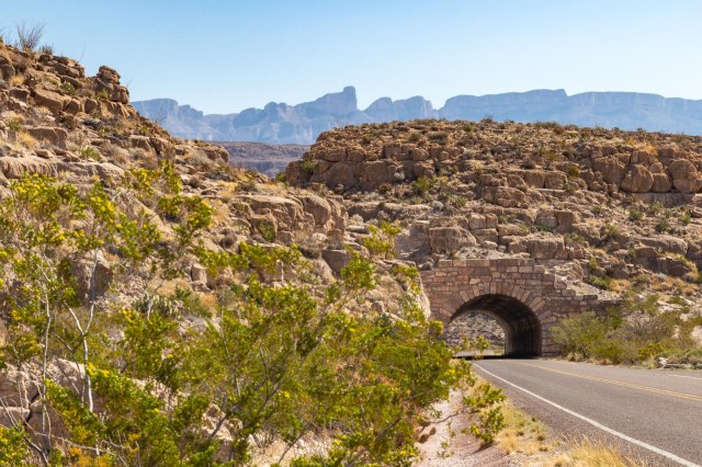
From Terlingua, Highway 118 is the route to take to the eastside of the park. Although this tunnel is short compared to the Zion-Mount Carmel tunnel in Zion or the Wawona in Yosemite, when we see a tunnel and there’s a place to park, we have to take a picture.
Rio Grande Tunnel built in 1959
From the Rio Grande Visitor Center, the Rio Grande Village Nature Trail leads to a viewing platform on a pond and continues up a hillside for river and mountain views.
Viewing platform at pondGreat Blue HeronReeds against blue skyRio Grande River was low
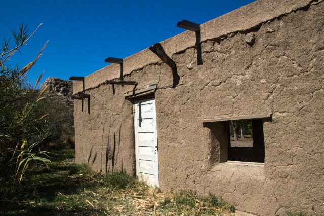
We took a lunch break at the Daniels Farm House, which is a 1920 adobe farmhouse representing Texas pioneer farming. John O. Wedlen, a Swedish immigrant who came to Texas for greener pastures, built the building as a shed for farm equipment.
Picnic setting at Daniels Farm House
Daniels purchased the farm in 1937 and moved into the former storage shed as his residence. Later he added a room to use as a small store, serving the local residents in the Boquillas community.
Daniels adobe-style farm house
Daniels converted 100 acres of land to cotton and moved away in 1944 when the park was established. The home, or shed, is 44 feet by 15 feet, or 660 square feet.
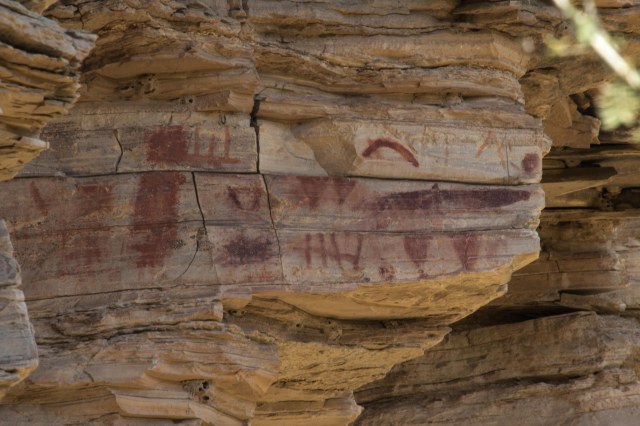
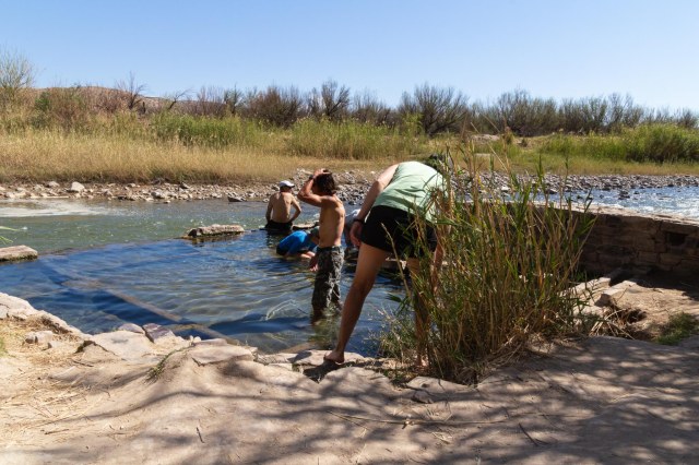
At the Hot Springs Historic District, visitors will find preserved buildings, pictographs, and the foundation from the old bathhouse. The 105-degree water entices guests to come on in, soak a while, the water’s fine.
I think this building was used as a storeRooms for guests
When J. O. Langford heard about the healing powers of hot springs in Texas, he filed a claim under the Homestead Act sight unseen.
Pictographs and petroglyphs are visible on the cliffsTrail leads to the bathhouse
After following a 21-day treatment of bathing and drinking the spring water and experiencing relief from his recurring bouts of malaria, he opened the spring to other bathers at 10 cents a day or $2.00 for the full 21-day treatment.
Visitors try out the warm waters of the spring
Besides starting tourism in the area, he also became a schoolteacher, a self-taught doctor, and a postman.
There is plenty more to see in the eastside of the park, and I’d love to come back and spend a week or maybe two.
Next up we check out the westside of the park. Until then, stay safe.
Hooray, we finally made it to our ultimate destination. On February 28, 2016, we rolled into Terlingua, Texas, for four nights and chose the Big Bend Motor Inn RV Park for our base camp while exploring Big Bend National Park.
Terlingua, listed on the National Register of Historic Places, is a living ghost town with a population estimated at 80 people. As a company town developed in the early 1900s to support mining activities of the Chisos Mining Company, the population grew to 1,000 Mexican and Anglo people. The Mexicans occupied one side of the town, the Anglos on the other, and up on a hill, a mansion overlooked the company-owned general store, water service, a school, gasoline station, a theater, and other amenities.
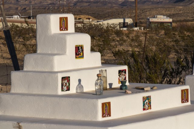
History of Terlingua cemetery
Terlingua, Texas: The Town
Cinnabar, from which metal mercury was extracted, was what drew Howard E. Perry, a Chicago industrialist, to the area. He incorporated the Chisos Mining Company in May 1903. Although he controlled the activities in Texas and built the mansion on the hill, he rarely came to visit his business venture. The Chisos Mining Company became the largest producing mine and largest mercury producer in the United States at that time.
Many of the gravesite memorials are elaborate
On Monday night, the Starlight Theater Restaurant and Bar offered a two for one hamburger deal for dinner. We wandered into the gift shop next door and checked out the sunset at the cemetery while we waited for the restaurant to open. A very nice couple invited us to sit with them for dinner, thinking we’d get a table easier that way. It worked, and we enjoyed our conversation and learned a bit about Texas.
Some memorials are simpler, and others are crumbling
Our plan to return another day to take photos of the Starlight and other buildings around the town fell through, so the photos of the cemetery sprinkled throughout this post are all I have. Hmm, that sounds like a good excuse to go back to Terlinqua someday. It’s a long drive, but definitely worth it.
Trinkets left behind on the headstone
Tourism is the primary economic driver in and around Terlingua and the Big Bend National Park. Businesses such as RV parks, motels, vacation rentals, restaurants and bars, and tour groups are establishments that support the residents and tourists.
Big Bend National Park: An Overview
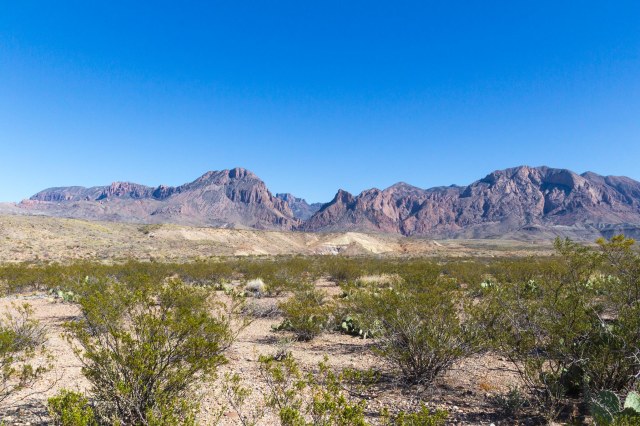
At Big Bend National Park, visitors can enjoy three parks for the price of one. On the Westside visitors will find the Ross Maxwell Scenic Drive, Santa Elena Canyon, plenty of trails to hike, and the Castalon Visitor Center.
David Tinsley was a popular resident in the area
The Panther Junction and the Rio Grande Village Visitors Centers are located on the Eastside. From the Rio Grande center, visitors can hike along the Rio Grande river to see Daniels Ranch and the Hot springs. Access to 4-wheel drive roads leads to various camping sites. The Rio Grande Village is the place for travelers who desire full hookups for their RV. Reservations are needed for 20 of the sites. Or try your luck for the five first-come-first-served sites.
The third area of the park is the Chisos Basin, where the road climbs from 1,800 feet at the Rio Grande to 8,000 feet in the Chisos Mountains. To drive from the flatlands of the desert to the pine-filled mountains made me feel like I was entering another world. A visitor center, hiking trails, the Chisos Mountains Lodge and restaurant, and camping for small trailers (20’ or less) and RVs (24’ or less) are available. The sharp curves and steep grades prevent larger units from making the drive.
Two crosses at sunset
Over the next three weeks, we’ll dedicate a post to each of the park’s sections. Until then, stay safe.
We continue our Winter 2016 Tour with a stop in Las Cruces, New Mexico. Fans of old western towns, we selected Old Mesilla, New Mexico, for a bit of sightseeing.
Mesilla, New Mexico
Mesilla was established in 1848 by the Mexican government after the Treaty of Guadalupe Hidalgo ceded to the United States the northern portions of what is now New Mexico. The town became a haven for Mexican citizens who did not want to be part of the United States.
Just five years later the US purchased the southern portions of New Mexico and Arizona under the Gadsden Purchase Agreement. On November 18, 1854, the US held an official flag-raising ceremony claiming Mesilla and the surrounding area as part of the United States.
Basilica of San Albino stands watch over the Mesilla Plaza. Established in 1851 as an adobe church by the Mexican government, the current building was dedicated on April 12, 1908, atop the adobe’s foundation. The church bells date back to the early 1870s. In 2008, San Albino was granted minor basilica status.
Basilica of San Albino
At the crossroads of Butterfield Stagecoach and Camino Real de Tierra Adentro, Mesilla became the center of the area until 1881 when the Santa Fe Railway chose Las Cruces as the train route.
Colorful displays outside stores invite shoppers in to browse
To demonstrate how valuable the routes and train stops were to the early western towns, compare the population between Mesilla and Las Cruces today. Las Cruces has an estimated population of 100,000 while the city of Mesilla is around 2,200. The Mesilla townsfolk may like their city just the way it is since tourists come from all over to enjoy the festivals and soak up the history.
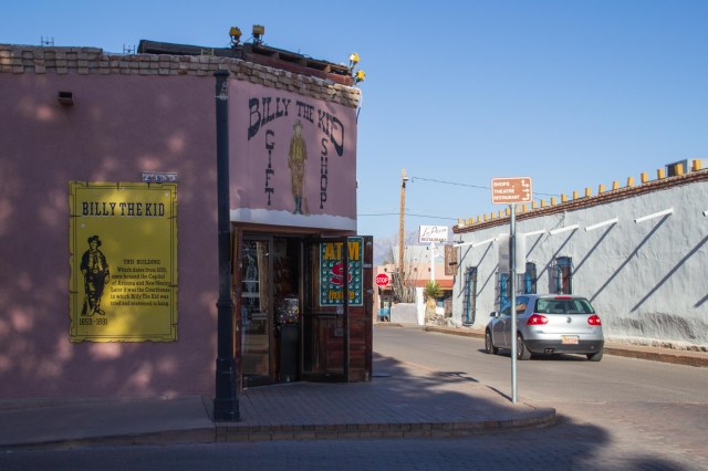
At the location of this gift shop, a judge sentenced Billy the Kid to hang. Although he escaped, he was later captured and killed.
From 1861 to 1862, Mesilla served as the capital of the Confederated Territory of Arizona until 1865 when the Volunteers of the California Column recaptured the town, and it became the headquarters for the military district of Arizona.
The town’s cantinas and festivals during the Wild West era attracted lawmen and lawless alike including Pat Garrett, who killed William H. Bonney, also known as Billy the Kid, and Francisco “Pancho” Villa, the Mexican general who commanded the northern division of the Constitutionalist Army.
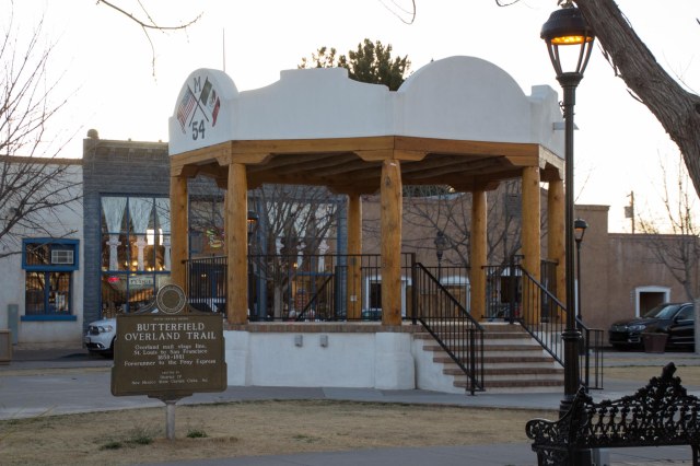
The Mesilla Plaza was named as a National Historic Landmark in 1961, and the original bandstand was built in the 1970s.
Mesilla bandstand
Structural issues required the demolition of the bandstand in October 2013, and it was ready for use at the Cinco de Mayo celebration in May 2014. The plaque honors the Butterfield Overland Trail—a precursor to the Pony Express—and the stage line that connected St. Louis to San Francisco from 1858 to 1861.
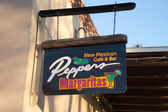
When in New Mexico, one must sample New Mexican cuisine. What better place for hungry travelers to stumble into but Peppers Café & Bar for entrees and margaritas.
Great food and margaritas at Peppers
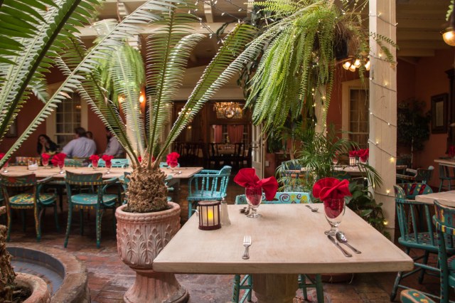
This historic building that houses Peppers has a reputation for being haunted. We arrived in between dinner and lunch, so they allowed us to wander around the place and peek into the various private rooms on the chance a ghost or two may appear. They must come out only at night.
This bright and cheery room belies what lurks in dark corners and beyond the doorways Kaleidoscope of color in a stain glass panel
Does this room remind anyone of the Haunted Mansion at Disneyland or Magic Kingdom? I could almost see the gossamer ghosts floating around the room, the statue head speaking spooky words, and the men in the paintings watching our every move.
Are those eyes spying on me?
Mesilla Book Center has been in business since 1966. Besides books about New Mexico and the Southwest, they sell jewelry, gifts, souvenirs, and Native American kachinas.
Support your local independent book store
The Thunderbird de la Mesilla building is the oldest brick structure in New Mexico. Some might say the building harbored bad luck in its early years. Augustin Maurin started construction in 1860, using burned bricks from his own kiln. Augustin met an untimely death when robbers murdered him in 1866. Cesar Maurin, Augustin’s heir, arrived from France to claim the property and died two years later of natural causes. Pedro Duhalde, a former Mesilla saloon keeper, took over the building, and robbers murdered him too.
Thunderbird de la Mesilla
Tiburcio Frietze is listed as the current owner on the building’s plaque. Sadly, he passed away on January 1, 2020. The building was used as a general store, residence, saloon, and town hall. Today it is a gift shop selling jewelry, carvings, textiles, pottery, religious symbols, and various sundry items.
Entering Texas
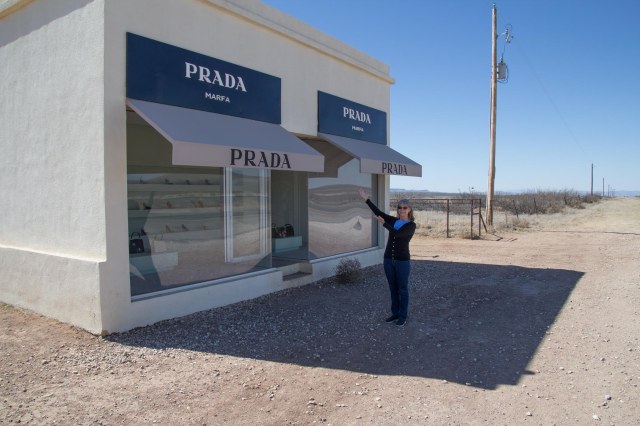
The next day we continued on Interstate 10 through El Paso and transitioned onto US Route 90. Our son-in-law told us about the Prada store out in the middle of nowhere, so we stayed alert as we neared Valentine.
Prada Marfa by artists Elmgreen and Dragset
There it was on the right side of the road filled with shoes and purses from the 2005 fall collection, the same year the structure was established. Keep your credit card in your pocket because shopping is not possible.
Love locks on a fence behind the Prada Marfa store
The building is a permanent land-art project commissioned by nonprofit organizations Art Production Fund and Ballroom Marfa. There are no clerks in the store, and the door never opens.
We had picked out the Lost Alaskan in Alpine, Texas, to stay for the night until we saw the banner advertising the Cowboy Poetry Gathering. With no luck getting a spot in Alpine, we drove on to MacMillen RV Park in Fort Davis, Texas. It didn’t look like much when we drove in, but it was only for one night, and they had a high rating for the best bathrooms ever.
MacMillen RV Park, Fort Davis, Texas
Hooray, we finally made it to Texas and only 380 miles before we arrive at Big Bend National Park.
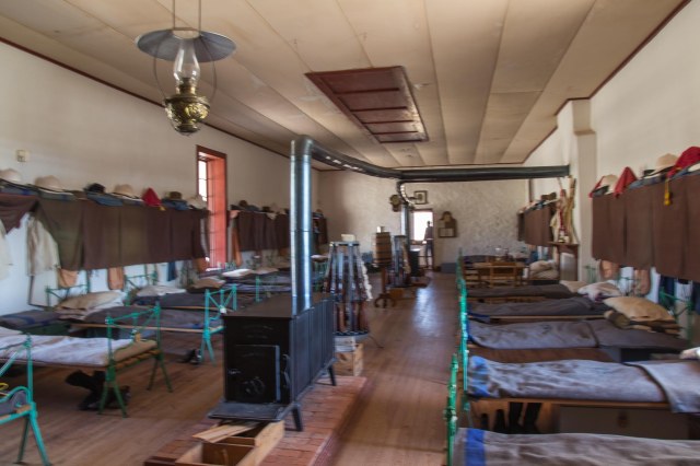
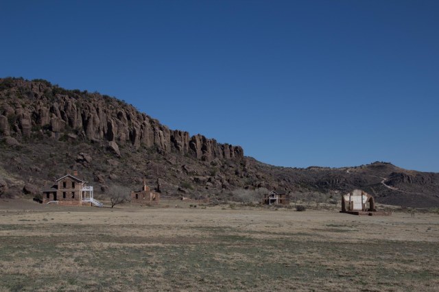
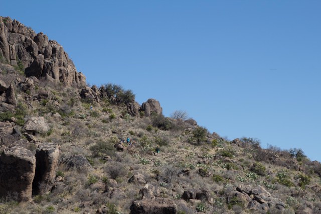
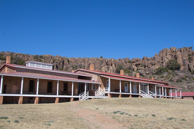
Fort Davis National Historic Site
While we were in the neighborhood, we had to check out Fort Davis National Historic Site, an Indian Wars’ and frontier military post from 1854 to 1891.
Fort Davis National Historic Site
The fort protected emigrants, mail coaches, and freight wagons on the Trans-Pecos portion of the San Antonio-El Paso Road and the Chihuahua Trail.
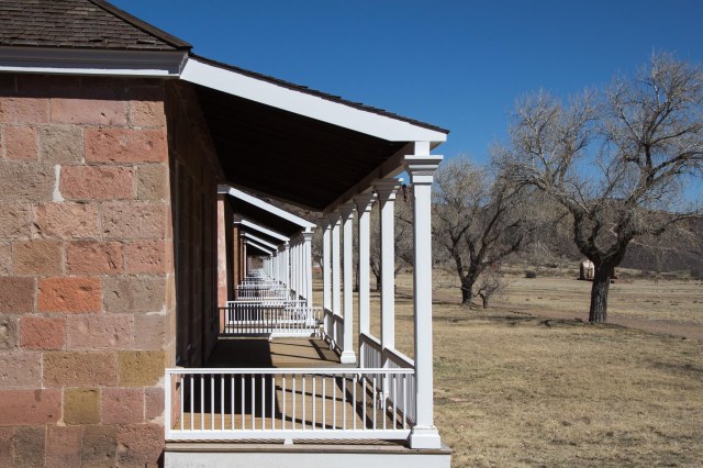
First stop on the docent tour was the barracks
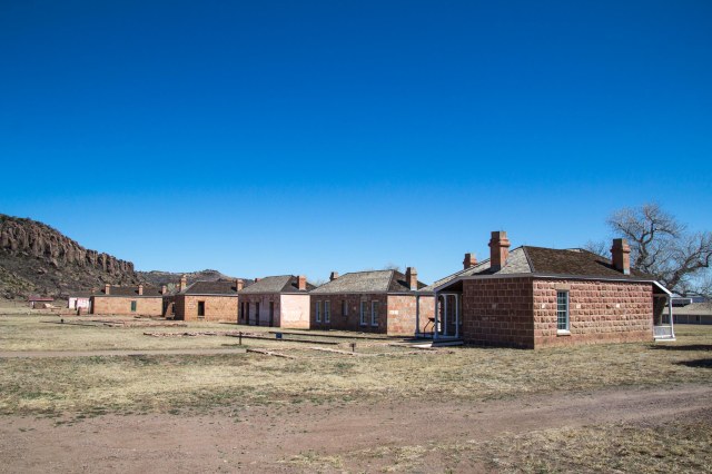
Between the summers of 1866 and 1867, 885 enlisted African-American men of the Ninth Cavalry, commanded by Lieutenant Colonel Wesley Merritt, arrived at the abandoned Fort Davis post.
Docent on site at the Commander’s house
The Ninth was responsible for constructing the new post and protecting travelers and the mail on the San Antonio-El Paso Road from Comanche and Apache Indians. In September 1975, the Ninth transferred to New Mexico, and various other cavalry and infantry companies occupied the fort over the years.
Another view of the housing
I love it when we’re poking around and something pops up that we learned at another location. This time it was camels.
Building waiting for renovations
Ten days earlier while we were in Quartzsite, we came across a monument to Hi Jolly, an Army camel driver from Syrian and Greek parentage who was hired to test out camels in the southwest desert. Apparently, the camels traveled through Fort Davis on their way to Arizona in 1857. Hi Jolly most likely had arrived at the fort with his brigade of drivers and camels.
The house on the left was the commander’s homeHiking trails are available in the parkNot too recent graffitiThe hospitalOfficer housingBack of officer housingAll I need is a rocking chair and a glass of iced tea
That wraps up the fourth installment of our Winter 2016 Adventure. We finally arrive in Terlingua, Texas, and Big Bend National Park in the next post. Thanks for sticking with us these past weeks.