Winter 2016 Adventure – Big Bend National Park or Bust Part Eight

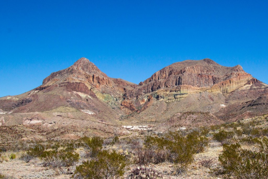
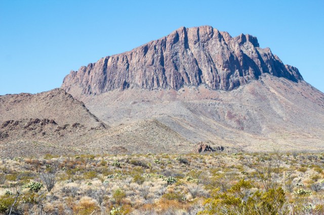
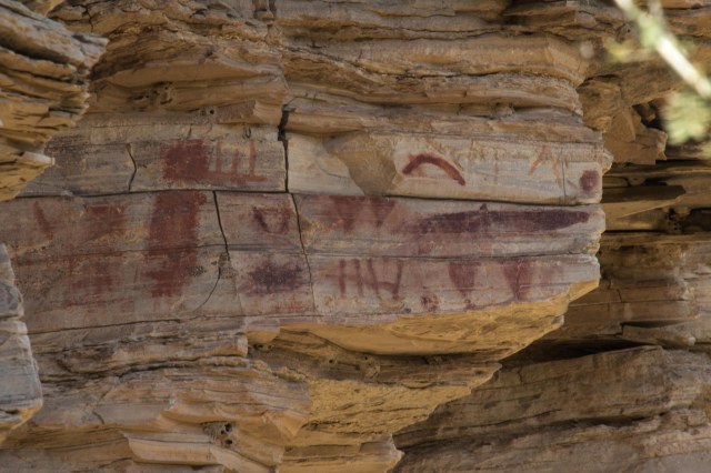
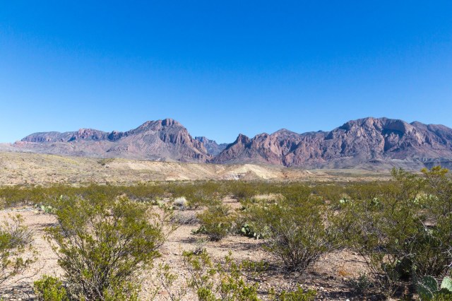
In part eight of our Winter 2016 adventure, we drove up to the Chisos Mountain Range, the only mountain range contained entirely within a national park. It covers 40 square miles and the highest peak is Emory at 7,825 feet above sea level. For more information about this section of the park, see the Big Bend National Park overview in Part Five.

Desert landscape with Chisos Mountain Range
Chisos Mountain Range

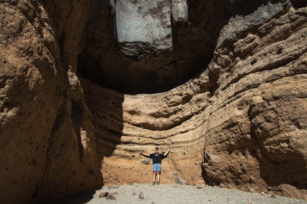
Our truck made it up the steep, twisty road to the Chisos Basin Trailhead without a problem. There are five hikes of varying lengths to choose from.

Sign of Chisos Basin Trailheads

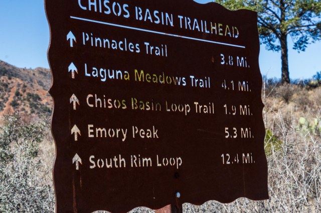
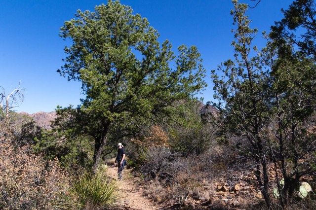
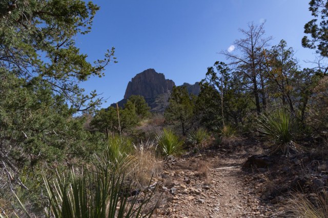
We selected the shortest since we had not prepared for a half-day or longer trek and added on the Window View Trail.

Chisos Montain trail view
Are you coming?
Chisos Mountain trail view
Where did the trail go?
Juniper with half moon
Half moon over junipers
Fin-like protrusions on side of mountain
A fortress of fins
Window view of Chihuahuan desert
Chisos Basin Campround and Window View
Chisos Basin campground

After the whirlwind of travel and sightseeing, we took a day off to catch up on washing chores and left the following day for Carlsbad Caverns in New Mexico. We drove north on Texas Hwy 285 and found a roadside stop with picnic tables along the way, so we stopped to eat our lunch.

Woman sitting at oversized picnic table
Eating lunch at a Texas-size picnic table

I felt like a little kid again, dangling my feet off the bench seat. I guess it’s true what Texans say about their state: Everything is bigger in Texas.

We have oil wells in California, with lazy pumps and arms that rock up and down, so I had never seen flaring before. It kind of scared me when I saw these oil wells dotted across the desert with plumes of flames. Did we drive into a dystopian movie set by mistake?

Oil well with flaring
Flaring oil well

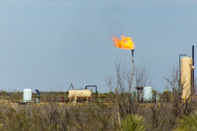
Apparently, production flaring is used to get rid of unwanted petroleum gas with the idea that it is better to burn it off than to release it into the environment. The lesser of two evils, I guess. Oil production rigs with flare stacks spread out across the desert for as far as we could see and all the way into Carlsbad, New Mexico. I don’t think I took a deep breath from the time we entered the oil field until we saw Carlsbad disappear in our rearview mirror.

At Carlsbad KOA we enjoyed the birds flitting around, especially the doves. The smell of the gas burn offs was not to our liking though.

Two doves sitting on wood structure
Doves on duty

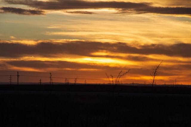
All that gas burning off sure made for a colorful sunset.

Orange and yellow sunset with clouds
Sky fire
Sunset with clouds and trees
Texas sunset

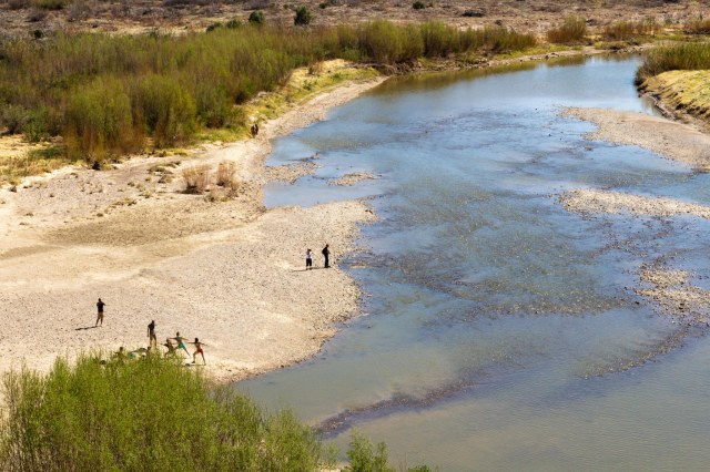
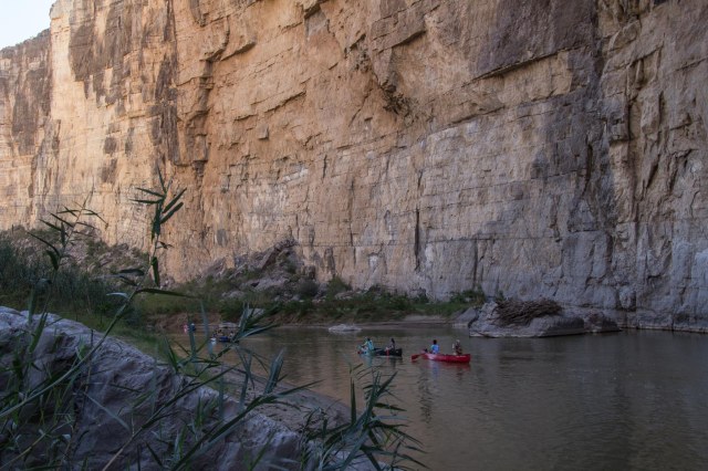
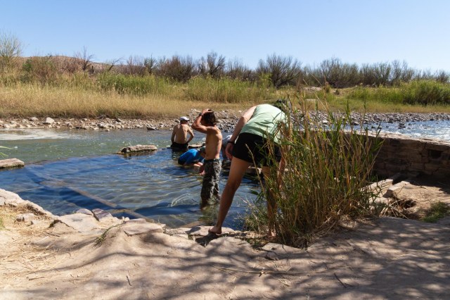
We enjoyed our time at Big Bend National Park and would love to return someday. A canoe trip down the Rio Grande, hikes, photo tour in Terlingua, and poking around the surrounding area are top on our list of things to do when we venture to the park next time.

Next up, we visit the Carlsbad Caverns before working our way back home. Until then, stay safe.

Winter 2016 Adventure – Big Bend National Park or Bust Part Seven

Westside of Big Bend National Park

For more information about this section of the park, see the Big Bend National Park overview in Part Five.

As we enter the Santa Elena Canyon where the Rio Grande meanders through high cliffs, I wonder how such a calm flow of water had carved out the space between the blocks of rock that rise 1,500 feet overhead.

Birdseye view of Rio Grande River and people on the shore
Yoga anyone?

It is the sand and salt in the water that has filed away the limestone, cutting deeper and deeper over millions of years, leaving the ancient limestone formations exposed.

Man standing along the Rio Grande River in the Santa Elena Canyon
Steep rock cliffs along Santa Elena Canyon trail

Of course, I’m sure thunderstorms and flash floods, which can occur any time beginning in May and running through September, sped up the carving process. Visitors should monitor weather forecasts during those months so they can avoid any danger. The water may look calm now, but I understand the weather can turn in a matter of minutes in Texas.

Canoes on river in Santa Elena Canyon
Floatin’ down the lazy river

Sign up for a half day or multi-day rafting tour on the river with one of the several tour groups. I knew there was another reason we need to travel back to Big Bend.

River and cliffs in Santa Elena Canyon
Rio Grande River reflection

Cerro Castellan contains several layers of lava flows and volcanic tuff, or ash deposits, with layers of gravel and clay. The same lava flow that created Cerro Castellan also created the south rim of the Chisos Mountains.

Cerro Castellan Peak
Cerro Castellan

We had seen plenty of places throughout the park where white rock was piled up and couldn’t tell whether it was something natural or something built up from the mining operations.

Road with desert with white mounds Tuff Canyon
Mounds of tuff along the road

We found our answer at Tuff Canyon when we read the information signs. The white stuff is tuff, which formed when a volcanic eruption forced ash through a vent and eventually consolidated into solid rock. The soft rock has been used since ancient times for construction. Some of the Moai statues on Easter Island are constructed from tuff. Visitors will find a couple trails that lead to overlooks of the canyon.

Tuff canyon from rim
Tuff Canyon

Mule Ears Peaks top out at 3,881 feet above sea level in the Chisos Mountains.

Man sitting on bench and Mule Ears Peaks
Mule Ears Peak. Are we having fun yet?
Woman sitting on bench and Mule Ears Peaks
Ha, ha, Jon.

Goat Mountain is one of many volcanic domes formed during Big Ben’s ancient geological history. The top portion is composed of silica-rich lava, the band of yellow is pyroclastic flow deposits, and the bottom portion is older volcanic rock.

Goat Mountain and desert
Goat Mountain

We stretched our legs on the Burro Mesa Pour-off Trail, which follows a dry wash full of flood debris, sand, and cobbles.

Yucca plant in bloom
Yucca in bloom

The hard lava that caps the mesa top prevented the torrents of water from carving out a stream here. Instead, the floodwaters from Javelina Wash rushed over the side, carving out the cliff.

Man at Burro Mesa Pour Off
Pour Off

The dark-rock Fins of Fire are called dikes and are found throughout the park for miles. They provide evidence of the molten rock that lies quiet under the desert surface. When they are all lined up in a row, they remind of spikes on a dinosaur back.

Fins of fire or dikes
Fins of Fire

The Chisos Mountains were also formed through a series of volcanic activity that shaped the peaks.

Chisos Mountain Range

Next week’s post will feature the Chisos Mountains and Basin. Until then, stay safe.

Winter 2016 Adventure – Big Bend National Park or Bust Part Six

Eastside of Big Bend National Park

Welcome back to Big Bend National Park, where we visited in February 2016. Of the 62 national parks in the nation, Big Bend clocks in at over 801,000 acres, making it the 14th largest in the system.

For more information about this section of the park, see the Big Bend National Park overview in Part Five.

The Rio Grande Village in the eastside of the park is 41 miles from the Maverick Junction entrance where we entered. Be sure to heed the posted speed limit of 45 mph. A park ranger had to warn Jon to slow down a tad.

desert floor and volcanic hill
Volcanic peak rising from the desert floor

From Terlingua, Highway 118 is the route to take to the eastside of the park. Although this tunnel is short compared to the Zion-Mount Carmel tunnel in Zion or the Wawona in Yosemite, when we see a tunnel and there’s a place to park, we have to take a picture.

Rio Grande Tunnel
Rio Grande Tunnel built in 1959

From the Rio Grande Visitor Center, the Rio Grande Village Nature Trail leads to a viewing platform on a pond and continues up a hillside for river and mountain views.

Viewing platform beside a pond
Viewing platform at pond
Great Blue Heron
Great Blue Heron
Golden-colored reeds against blue sky
Reeds against blue sky
Rio Grande River
Rio Grande River was low

We took a lunch break at the Daniels Farm House, which is a 1920 adobe farmhouse representing Texas pioneer farming. John O. Wedlen, a Swedish immigrant who came to Texas for greener pastures, built the building as a shed for farm equipment.

Picnic table with mountains in background
Picnic setting at Daniels Farm House

Daniels purchased the farm in 1937 and moved into the former storage shed as his residence. Later he added a room to use as a small store, serving the local residents in the Boquillas community.

Old adobe building
Daniels adobe-style farm house

Daniels converted 100 acres of land to cotton and moved away in 1944 when the park was established. The home, or shed, is 44 feet by 15 feet, or 660 square feet.

At the Hot Springs Historic District, visitors will find preserved buildings, pictographs, and the foundation from the old bathhouse. The 105-degree water entices guests to come on in, soak a while, the water’s fine.

Old stone building
I think this building was used as a store
Motel-style old stone building
Rooms for guests

When J. O. Langford heard about the healing powers of hot springs in Texas, he filed a claim under the Homestead Act sight unseen.

Pictographs on cliff rock
Pictographs and petroglyphs are visible on the cliffs
Trail in between a cliff and reeds
Trail leads to the bathhouse

After following a 21-day treatment of bathing and drinking the spring water and experiencing relief from his recurring bouts of malaria, he opened the spring to other bathers at 10 cents a day or $2.00 for the full 21-day treatment.

People soaking in spring water
Visitors try out the warm waters of the spring

Besides starting tourism in the area, he also became a schoolteacher, a self-taught doctor, and a postman.

There is plenty more to see in the eastside of the park, and I’d love to come back and spend a week or maybe two.

Next up we check out the westside of the park. Until then, stay safe.

Winter 2016 Adventure – Big Bend National Park or Bust Part Five

Hooray, we finally made it to our ultimate destination. On February 28, 2016, we rolled into Terlingua, Texas, for four nights and chose the Big Bend Motor Inn RV Park for our base camp while exploring Big Bend National Park.

Terlingua, listed on the National Register of Historic Places, is a living ghost town with a population estimated at 80 people. As a company town developed in the early 1900s to support mining activities of the Chisos Mining Company, the population grew to 1,000 Mexican and Anglo people. The Mexicans occupied one side of the town, the Anglos on the other, and up on a hill, a mansion overlooked the company-owned general store, water service, a school, gasoline station, a theater, and other amenities.

Sign about Terlingua, Texas,
 cemetery
History of Terlingua cemetery

Terlingua, Texas: The Town

Cinnabar, from which metal mercury was extracted, was what drew Howard E. Perry, a Chicago industrialist, to the area. He incorporated the Chisos Mining Company in May 1903. Although he controlled the activities in Texas and built the mansion on the hill, he rarely came to visit his business venture. The Chisos Mining Company became the largest producing mine and largest mercury producer in the United States at that time.

Gravesite memorial
Many of the gravesite memorials are elaborate

On Monday night, the Starlight Theater Restaurant and Bar offered a two for one hamburger deal for dinner. We wandered into the gift shop next door and checked out the sunset at the cemetery while we waited for the restaurant to open. A very nice couple invited us to sit with them for dinner, thinking we’d get a table easier that way. It worked, and we enjoyed our conversation and learned a bit about Texas.

Gravesite memorials
Some memorials are simpler, and others are crumbling

Our plan to return another day to take photos of the Starlight and other buildings around the town fell through, so the photos of the cemetery sprinkled throughout this post are all I have. Hmm, that sounds like a good excuse to go back to Terlinqua someday. It’s a long drive, but definitely worth it.

Gravesite headstone
Trinkets left behind on the headstone

Tourism is the primary economic driver in and around Terlingua and the Big Bend National Park. Businesses such as RV parks, motels, vacation rentals, restaurants and bars, and tour groups are establishments that support the residents and tourists.

Big Bend National Park: An Overview

At Big Bend National Park, visitors can enjoy three parks for the price of one. On the Westside visitors will find the Ross Maxwell Scenic Drive, Santa Elena Canyon, plenty of trails to hike, and the Castalon Visitor Center.

Elaborate gravesite memorial, David Tinsley
David Tinsley was a popular resident in the area

The Panther Junction and the Rio Grande Village Visitors Centers are located on the Eastside. From the Rio Grande center, visitors can hike along the Rio Grande river to see Daniels Ranch and the Hot springs. Access to 4-wheel drive roads leads to various camping sites. The Rio Grande Village is the place for travelers who desire full hookups for their RV. Reservations are needed for 20 of the sites. Or try your luck for the five first-come-first-served sites.

The third area of the park is the Chisos Basin, where the road climbs from 1,800 feet at the Rio Grande to 8,000 feet in the Chisos Mountains. To drive from the flatlands of the desert to the pine-filled mountains made me feel like I was entering another world. A visitor center, hiking trails, the Chisos Mountains Lodge and restaurant, and camping for small trailers (20’ or less) and RVs (24’ or less) are available. The sharp curves and steep grades prevent larger units from making the drive.

Two memorials with crosses at sunset
Two crosses at sunset

Over the next three weeks, we’ll dedicate a post to each of the park’s sections. Until then, stay safe.