Late Spring 2019 Tour

Week One – Kickoff

Aah! It feels good to be back on the road exploring these great United States. Between heart surgery and recovery for me, and sciatic nerve pain for Jon, we were ready to roll.

We pointed at the landscape that zoomed by as we left the Bay Area. “Look over there,” I said. “The hills were still green in the Tri-Valley. At the Altamont Pass they turned the color of a teddy bear.” Further on, the fruit and nut trees along Interstate 5 had already leafed out, and newly planted crops painted the San Joaquin Valley floor in patchwork fashion.

We stopped for the night at our favorite way station in Bakersfield, the Orange Grove RV Park. Dove calls, the chip-chip-chip of quail, and the trilling and singing of other birds welcomed us to the grove. Sure, we have birds in the Bay Area, but the abundance of birds nestled in the orange trees was like a chorus.

Orange Grove RV Park in Bakersfield, California

Guests are allowed to pick the fruit when in season so long as they don’t use ladders or climb in the trees.

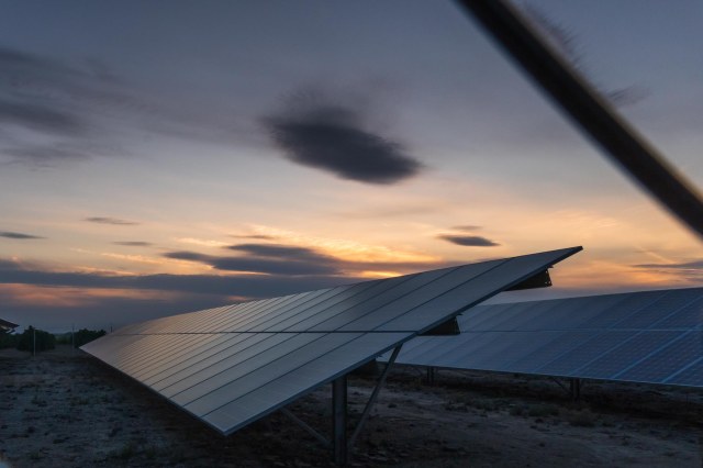
It seems like we are seeing more and more solar panels in use where ever we go.

Solar Panels at Orange Grove RV Park

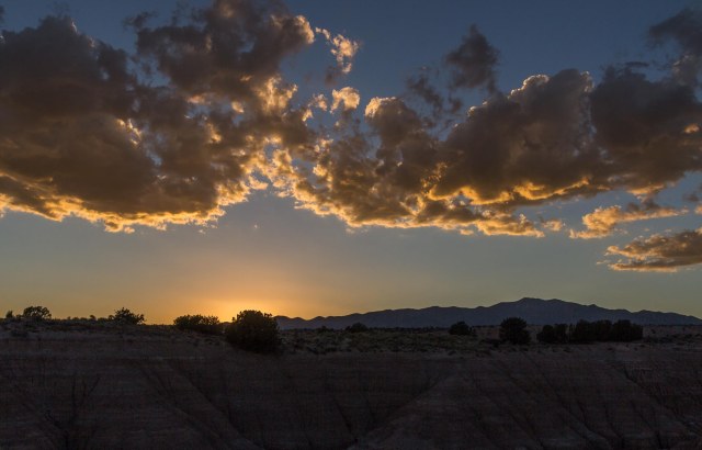
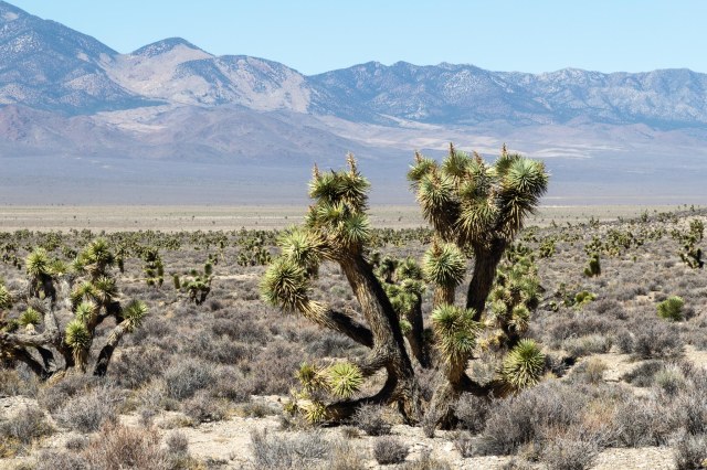
The next day, we continued oohing and aahing over the landscape. The sage, bristlebush, creosote, Joshua trees, and grasses colored the desert terrain green. Even yellow mustard still bloomed in the higher elevations.

A train of black tankers with double engines at the head, mid-train, and rear worked its way through Tehachapi pass. We wanted to know what the tankers held, where they were going, and where they began their journey. Our curiosity and taste for adventure returned quickly after the nine-month absence.

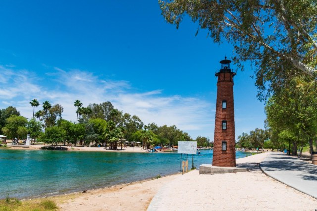
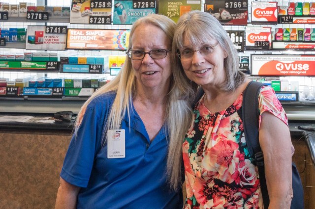
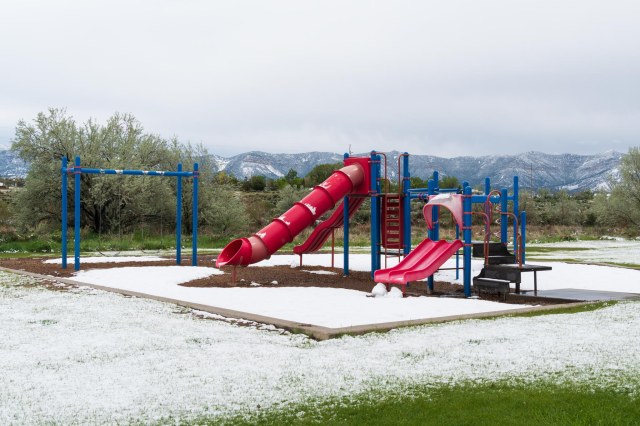
Lake Havasu City (LHC) came next so we could say hey to my sister Merri. Unfortunately, she had to work so we didn’t get to spend much time together during our three nights there. A breakfast meet-up at The Red Onion downtown and a quick goodbye at her place of business would have to suffice. We’ll have to make sure our next visit coincides with her days off.

A mural in downtown Lake Havasu City

One day while in LHC, Jon and I walked along the channel south of the London Bridge.

Lake Havasu City is home to replica famous lighthouses from across the United States. This one is of Currituck Beach Lighthouse constructed along the channel walkway.
The channel is a great place to boat and people watch
These little blackbirds are a common sight
JT taking a rest with the London Bridge in the background

We stopped in at Kokomo. A refreshing Mai Tai and a slice or two of pizza was the perfect snack.

Kokomo is not only a place to get drinks. You can play corn hole, drop a basketball in a trash barrel or jump in the pool for a game of volleyball.

Then we wandered about before making our way back to Rotary Park. It was a good thing the walkway included plenty of benches to sit and take a break in the shade. After almost a week of very little sciatica, Jon had trouble walking without pain for more than a few yards. We discussed turning back home, but he would not hear of it so we pressed on.

Love locks at the top of London Bridge
Trees are a welcome sight in 100-degree weather in Lake Havasu City
Closer view of the London Bridge

The weather forecast for May 19 predicted a high wind advisory for the state of Arizona and rain the next day in Cortez, Colorado, where we had reservations. We decided to skedaddle and called Cortez/Mesa Verde KOA for early arrival.

But before we left LHC, we stopped in to say goodbye to my Merri.

Bye, Merri. It was great to see you. Miss you already.

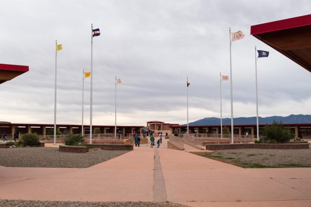
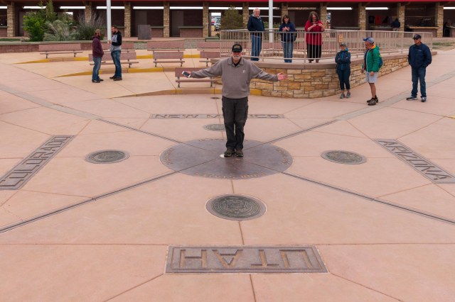
We made an overnight stay in Tuba City, Arizona, at the Quality Inn and RV park, and a quick stop at Four Corners Monument the next day.

Four Corners Monument
Photo op at Four Corners Monument

Then we arrived safe and sound at the KOA.

Site 46 at Cortez/Mesa Verde KOA
A bit of yard art at the KOA
View from the Cortez high school parking lot

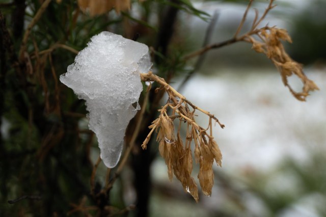
Our decision to arrive early turned out perfect. Snuggled in our fifth wheel on Monday, May 20, we gazed out at RVers arriving, not in the rain as forecast, but in the snow. The freak storm surprised the park operators as much as it did us. Accuweather.com sure got it wrong. It wasn’t until late in the day the app actually acknowledged that snow had fallen.

Three little cabins sitting in the snow
A bit of green among all the white

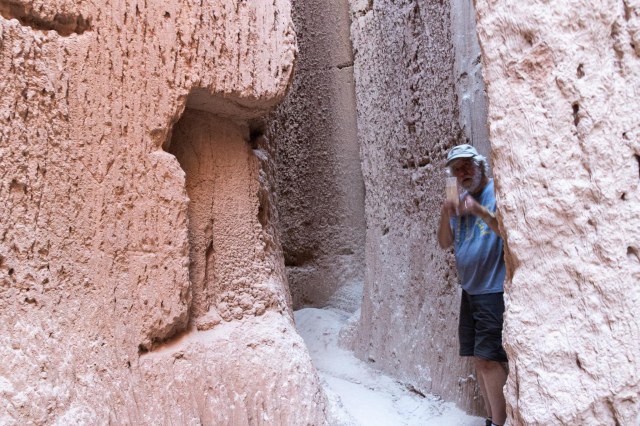
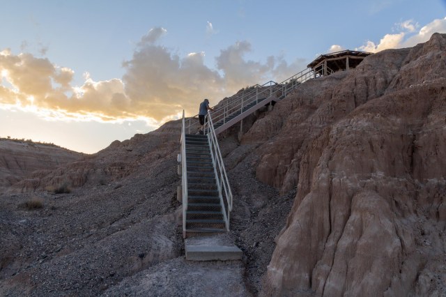
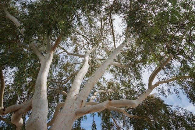
The snow stopped after about four hours. I zipped up my jacket, pulled on my knit cap, and slung my new Sony A6500 around my neck. I needed some quality time with my new camera. The smaller form factor and weight was my goal for purchasing new gear. A bonus was the 5-axis in camera stabilization. I wasn’t sure I’d like going mirrorless. But so far I’m quite pleased with the lighter weight and stabilization. I rarely use a tripod and have noticed an improvement in the sharpness of my photos. Editing the raw images also seems easier and quicker.

Canon Rebel T3i with Tamron 16 to 300 zoom lens versus the Sony A6500 with 18 to 135 lens. Which would you rather carry around?
Ice on a branch
The snow melted fast once it quit falling
Little yellow wagon in the snow
Playground at Denny Park
Denny Lake with campsites in background
From 90 degrees in Lake Havasu to 30 degrees in Cortez, Colorado

For the past few days, we’ve stayed close to camp because of the weather, but also because of the return of Jon’s sciatica. The week before we left on this trip, Jon’s pain had eased considerably with physical therapy and exercises. After being on the road for a few days, the beast struck again. His walks of a 1/2 mile to a mile have reduced to a few steps. Will acupuncture give him some relief? “I’m ready to try anything at this point,” Jon answered.

Stay tuned for the results and a little bit about Mesa Verde National Park, if we’re lucky.

Safe Travels

Cathedral Gorge State Park, Tonopah, Nevada, and Home Sweet Home

We continued our westward trajectory on September 16, 2018, the 55th day of our Summer 2018 Tour. Caliente, Nevada, seemed like a good distance to drive, except we didn’t get that far. Cathedral Gorge State Park popped up on the map so we decided to try it. With plenty of spots to choose from, we opted for paying $15.00 without electricity. We should have paid the extra $10.00.

Cathedral hills and water tower

After about an hour, strong gusts of hot wind blew and sand pelted the side of the trailer until shortly before sunset. As if the fifth wheel wasn’t dirty enough, a thick layer of sand settled on the floor, the dining table, countertop, and every available surface. All I could see was a full day of deep cleaning ahead of me.

IMG_0185
Cathedral Caves

Once the wind died down, we were able to stretch our legs and explore a little before the sun settled in for the night. Cathedral Gorge State Park, consisting of nearly 2,000 acres once occupied by the Fremont, Anasazi, and Southern Paiutes, became Nevada’s first state park in 1935.

A stone water tower and restroom building built in the 1930s by the Civilian Conservation Corps (CCC) are no longer in use but still standing. The original picnic facilities continue in use today.

Water tower built by CCC
Restroom building built by CCC

The formations, composed of silt, clay, and volcanic ash, aptly contain the reference to cathedrals, with their tall spires and skinny slot canyons and caves. It would be a great place to play hide and seek.

Peek a boo.
Inside one of the cathedral caves

We took the Miller Point Trail which traveled up a canyon and through a dusty wash until a set of stairs appeared. The several sets of stairs took us to the point where we had wonderful views and watched the sunset.

On our way to Miller Point

Although the campground filled up with other RVs and tent campers, it was quiet outside. As the sky turned dark, and the campers across the road finished up their dinner, someone treated us to a little guitar music. I couldn’t remember the last time I heard a guitar while camping. In my younger years, it seemed like everywhere we went there was always someone playing guitar. Are people not interested in picking up the instrument nowadays?

Not much further.
Almost there.
Whew! We made it.
View of canyon and trail from Miller Point
Another view from Miller Point
Goodnight sun.
On our way back.

When I woke up to close the windows in the middle of the night, I witnessed a spectacular show of twinkling stars along with the Milky Way streaking across the sky. That was something I hadn’t seen in a long time and it almost made up for the sand storm mess.

The next day, we drove through Caliente on our way toward Tonopah, Nevada. Young’s RV looked like it might be a decent place to stay. They even had tall shade trees and grass. The cute downtown area contained stores, restaurants, and shops. There was also a railway museum undergoing renovations that piqued our interest. Maybe we should have kept driving the day before. Oh, well chances are good that we’ll make it back there someday.

We drove the Extraterrestrial Highway 375. A couple of buildings and signs referred to aliens. And in Rachel, Nevada, where only about 50 people live, the Little A’Le’Inn Bar advertised food and lodging, but we weren’t in need of either so we drove on. For miles, there wasn’t much else to look at except the huge cattle ranches and open range. Pinon pines, junipers, and sage popped up going through Oak Summit, then we dropped into Tikaboo Valley, where Joshua Trees grow. We stopped at a BLM site that included information panels about the trees. This valley is unique in that both types of the trees are present, the tall tree-like western (Yucca brevifolia) species and the bushy eastern (Yucca jaegeriana) species. I found it interesting that each species of tree is pollinated by a different species of Yucca moth.

IMG_0214
Eastern Joshua Tree

Before we came into Tonopah, a group of hills looked like scoops of vanilla ice cream with crumbled Oreo cookies and caramel on top.

Yum! Vanilla ice cream topped with crushed Oreo cookies.

We were surprised to see a Tesla recharging center in Tonopah since we rarely see the cars in remote areas. It made sense once I thought about it though. The 7-hour 440-mile drive between Reno and Las Vegas on Interstate 95 puts Tonopah at about the halfway mark. The mileage range, depending on model and battery size, is 295 for the Model X to 335 for the Model S. The roadster, on the other hand, can make the trip with 180 miles to spare. (Mileage ranges obtained from Tesla’s website on February 8, 2019.)

Tonopah Information Center and Tesla charging station.

We settled into our site for the night at the Tonopah Station Hotel, Casino, Restaurant, and RV Resort. Boy, what a mouthful. I sure wouldn’t call it a resort, but for a quick stop, it fit the bill. RVs park behind the building on an asphalt parking lot with utility towers and trash barrels between each unit. The Tap Room at the Tonopah Brewing Company served up tasty BBQ and a nice selection of beer to satisfy any beer drinker’s taste.

IMG_2340
Tonopah Brewing Company Tap Room

The next day we traveled through Yosemite, staying the night at Yosemite Pines, a campground nestled in a valley on Old Highway 120. It offered covered wagons, cabins, retro trailers to rent, RV sites of all sizes, and tent sites. Outdoor play equipment, a pool, trail around the park with exercise stations, and an animal yard that included goats, burros, alpacas, and chickens. It would have been nice to stay awhile, but that didn’t work out so we drove the rest of the way home on September 19, 2018, our 58th day on the road.

For those readers who like statistics, here they are for our 2018 Summer Tour:

  • Days – 59
  • Total miles driven – 4,723
  • Miles pulling fifth wheel – 3,414
  • Diesel Fuel – 419.4 gallons
  • RV Parks/Campgrounds – 18
  • States – 4
  • National Monuments and Parks – 4
  • Museums and Historical sites – 12

It is February already and my recovery from surgery is going well and nearing completion. We are both itching to get back on the road. But before we do, Jon has a few fifth wheel projects in the works and we have other tasks to complete that will keep us at home until at least mid-April. I’m hoping we’ll be able to fit in a short trip here and there before April, so stay tuned.

Safe Travels


Richfield, Utah

We found the Richfield KOA to be one of the best places we have stayed. Their shaded sites are so large they can accommodate a tow vehicle and a large toy hauler or motorhome with plenty of room to spare for a few ATVs. Since our rig is not large and we don’t tug along ATVs we enjoyed the extra room to move about. The park also has easy access to the miles of trails that wind their way throughout Richfield and the surrounding area.

Fremont Indian State Park and Museum

Besides the ATV trails there is the Fremont Indian State Park and Museum, and Candy Mountain within a reasonable driving distance.

Fremont Indian State Park and Museum

We started out by visiting the Fremont Indian State Park and Museum where we watched a movie about how the museum came about. It all started with the construction of I70 during the 1980s. The plan was to take down four of the five-finger range hills and use them as fill to build up the valley after diverting the river/creek.

The last of the five finger hills

When the crew began digging, they found an ancient Indian settlement consisting of several pit houses and storage facilities. Archeologists rushed to the area to document and preserve what they could. It turned out that this was the largest Fremont Indian settlement found.

A depiction of family life in a pithouse
Possible trapper attire and tools of his trade

The neighboring community did not want the artifacts to sit in a university somewhere and pushed for the state park. Their dream came true and the park preserves the history of these ancient peoples.

What a find this jar was. It was found upside down in a pithouse

The museum depicts life as it was including a mockup of a pithouse with a vent that brought fresh air in and a hole at the top where smoke escaped.

Possible meanings of petroglyphs

Cooking and work areas are also displayed. One of the most interesting objects was a recreation of remains that were found a few miles away. The recreation shows how the woman might have looked like when she was alive. A push of a button starts audio so visitors can hear her story and learn how tall she was, the condition of her teeth, the age when she died, and how she was buried.

Layers of time

Clear Creek Road and I70 run through the middle of the narrow park with trails on both sides of the freeway to explore the terrain and view petroglyphs and pictographs. When we finished in the museum, we ventured outside to explore more. a short drive on Clear Creek Road took us to panels where petroglyphs and pictographs have survived erosion.

Petroglyphs are carved into the stone and depict a story, the meaning of which has been lost over 500 to 1,000 years
Pictographs are drawn using some kind of coloring or pigment. These seem to represent blankets.
It’s amazing that these have lasted so many years

Across the freeway are caves and the Sevier River.

Sheep Shelter
The mirror in Sheep Shelter reflects a view of the ceiling where more petroglyphs are carved
I love it when wildlife poses for a photo. It sure is better than when they show me their backside.

This cabin is similar to what the Joseph Lott family may have built on this site when they settled here in the 1880s.

1880s cabin

The 100 Hands Cave caught my interest. When were they placed here? Why did they make the pictograph? Was it some kind of ritual? How long did the pigment stay on their hands?

100 Hands Cave

It’s a good thing the park protects this art with a wrought iron gate. Given the evidence that modern day artists had a mind to destroy this artifact, I can’t imagine what it would look like if not for the protection.

Close up of 100 Hands Cave

The last stop on our adventure at the Fremont State Park was the Jedediah Strong Smith Memorial. Yes, the same hunter, trapper, and explorer of the American West who traveled through the Great Salt Lake, Colorado River, Mojave Desert, California, and Oregon. To think of all the changes made since the 1820s when Smith roamed the west, it boggles the mind. I wonder what it will all look like in another 200 years.

Jedediah Strong Smith Memorial

Big Rock Candy Mountain

What attracted us to Big Rock were the mountains that looked like cakes dripping with yellow, white, and caramel icing. Volcanic activity is what gave the mountains their colorful feature. Different types of minerals produced different colors.

Big Rock Candy Mountain

Besides the mountain, hiking and ATV trails and access to the Sevier River are also available.

Big Rock Candy Mountain across the field. On the far right and middle of the photo is the RV park under the cluster of trees

The Big Rock Candy Mountain Resort offers places to stay in an RV Park with about 30 sites including water, sewer, and electricity; eight suites in the lodge; and 12 converted train cars in the Caboose Village. It looks like Big Rock Grill and Smokehouse serves breakfast, lunch, and dinner. At least as I write this.

Caboose Village from across the river

Piute State Park

No, I did not misspell the word Piute. Although the park was named after the Native Americans who lived in the area at one time, the state legislature decided to change the spelling. I’m not sure why they would want to do that.

The park was abandoned when we visited, most likely due to the low level of water in September. The reservoir is used for irrigation purposes, so I guess it was all used up. I’m not sure how fish could remain alive in the reservoir at this low level, though. The water was quite murky, as was the runoff.

Low tide at Piute Reservoir. This is the boat ramp.

The park sits on the Sevier Plateau and contains a portion of the Piute Reservoir where anglers can try their luck for a trophy-sized rainbow, cutthroat, or brown trout. A boat ramp and day-use shade shelters are also available.

Day use shade cabanas

The park is quite primitive, including the campground. Only pit toilets are available and there is no water, so be sure to bring what you need. There are also three ATV trail systems accessible from the park.

Looking south across the Piute Reservoir

Next up we continue our trek west toward California.

Safe Travels

Montrose, Colorado, and Black Canyon at the Gunnison National Park

Decision time had arrived. Our original plans were to hang around Mesa Verde for a few days or a week and then drop down into New Mexico, staying on the road until the first part of November. Except one of those life-happens-as-your-making-plans moments popped up on the day before we began our Summer 2018 Tour.

When my cardiologist broke the news that it was time to repair my weakened mitral heart valve, I thought I could push it off until April or May. After spending a month and a half on the road, I realized it was best to get the surgery over with as soon as possible. The worry hung over me like an anvil and I needed to get out from under it. We cut our trip short and turned the truck for home on September 9, 2018. But that didn’t mean we weren’t going to stop to see a few more sights along the way.

Preferring the back roads, we took the scenic route heading west on U.S. 24, making a left at U.S. 285 and continuing to U.S. 50 toward Montrose, Colorado, passing through Monarch Pass. The colorful hills and forests kept us alert during our 4-1/2 hour drive.

The hills begin their fall displays
San Isabel National Forest
Dillon Pinnacles and Gunnison River in Curecanti National Recreation Area

We checked in at Black Canyon KOA, a nice campground with large spots and plenty of shade trees. Our focus for staying in Montrose was to visit the Black Canyon at the Gunnison National Park. Established as a national monument in 1933, Black Canyon became a national park on October 21, 1999.

South Rim

The park features a 7-mile road along the south rim with 12 overlooks where we found differing views of the canyon and the river 2,000 feet below. Some of the overlooks were more popular than others, especially with the tour buses. If we missed an overlook going one way, we caught it on the return trip.

Tomichi Point View toward the east
View from visitor center

While at the visitor center we noticed what looked like a natural bridge. When we asked one of the rangers about it, he said, no. Not a bridge. He had never seen it before and guessed the rock recently fell and wedged itself between the pillars. It was cool to think we were one of the first people to have seen this phenomenon.

I dub thee Fallen Rock Bridge

The Painted Wall was definitely a do-not-miss overlook. The cliff stands 2,250 feet above the river. The stripes on the wall consist of pegmatite, a type of granite containing quartz, feldspar, and mica.

Painted Wall with photographer
Painted Wall with Gunnison River
Spires in Black Canyon of the Gunnison

When we arrived at the High Point overlook, we were ready to stretch our legs on the 1-1/2 mile Warner Point Nature Trail. The pamphlet led us through pinyon pines, juniper, Douglas fir, and Gambel oak trees.

We kept our eye on the storm brewing across the valley. Luckily, it stayed east of us during our entire walk.

Keep eyes on any storm
View of Uncompahgre Valley from Warner Trail
View of Adobe Hills and Uncompahgre Valley from Warner Nature Trail
Warner Nature Trail – Fall is rushing in
Warner Nature Trail and greener pastures thanks to the Gunnison Tunnel

East Portal

The East Portal road is the access route to the Gunnison River, Gunnison Tunnel, Gunnison Diversion Dam, Crystal Dam, a campground, and picnic area. It sounds like a lot to see after reading that list, but everything is contained within about a mile, so not really. And a chainlink fence with concertina wire on top prevents anyone from getting near the Crystal Dam. Take note that the road includes a 16% grade and numerous switchbacks. Vehicles over 22 feet long are prohibited.

East Portal Road switchbacks

Water diverted from the Gunnison River flows through the Gunnison Tunnel, built between 1905 and 1909. I marvel at the engineering it must have taken to blast through rock to create the 11-foot by 12-foot tunnel 5.8 miles long through the granite cliffs of Black Canyon. Starting at opposite ends of the mountain the workers met in the middle using a heading and bench system. First, a heading was cut out of the rock at the top of the bore then cut down six to eight feet, leaving a bench of seven to five feet. Then they cut deeper into the rock and eventually removed the bench portion. President William Taft dedicated the tunnel on September 23, 1909.

Gunnison River from 1/2 way up the East Portal Road

The tunnel is not visible, however, a pump house containing a 5-hp pump and a flat surface under the water is.

Gunnison River Diversion Dam
The dam at end of East Portal Road
Gunnison Tunnel and Diversion Dam Parking and Picnic Cabana

All of our sightseeing must have been too much for us (I mean Jon) to cook dinner while in Montrose because we ate out twice in the short time we were there. First up was the Horsefly Brewing Company. We both opted for the fried shrimp basket. I had sweet potatoes fries with mine, and Jon chose onion rings. A crisp cold Hefeweizen washed it all down.

Horsefly Brewing Company

Check out the barstools at the end of the bar on the right.

Horsefly Brewing Company

Mi Mexico served bargain margaritas for $3.00 when we stopped in for an early dinner. While a bargain price wise, the restaurant did not skimp on the volume or taste. The taco/enchilada lunch special filled our bellies and did not disappoint our taste buds.

Next up we leave Colorado behind and head for Richfield, Utah.

Safe Travels