October 2020 COVID-19 Adventure: Bishop, California and Manzanar National Historic Site

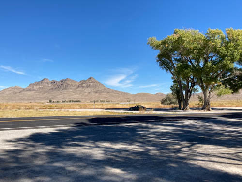
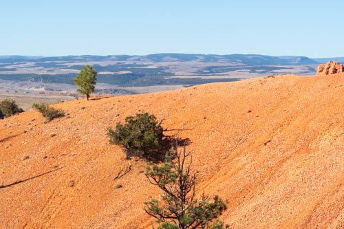
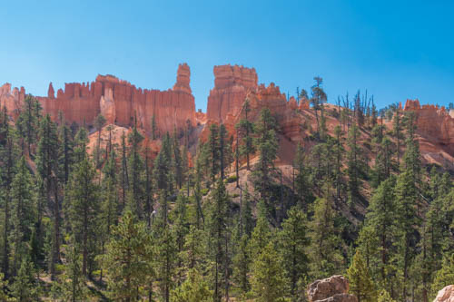
We left Alamo, Nevada, on October 21, 2020, with Bishop California as our destination. Welcome to the smoky Eastern Sierras. When I made the reservations, the dirty air had not yet filled the Owens Valley with ash and smoke that obliterated the mountains from sight.

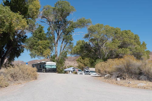
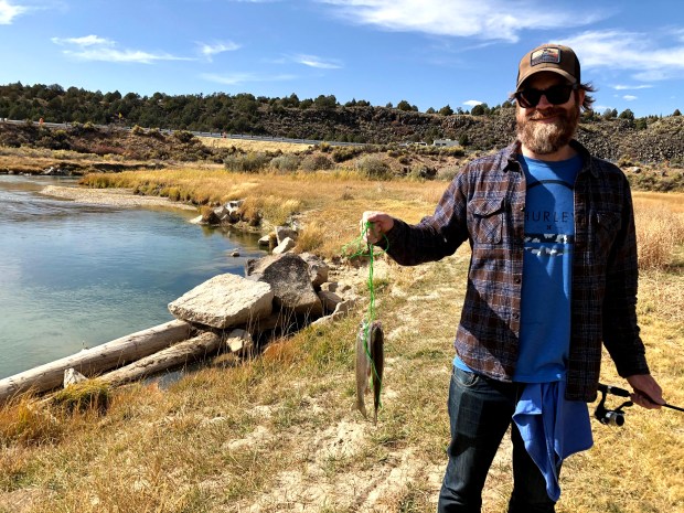
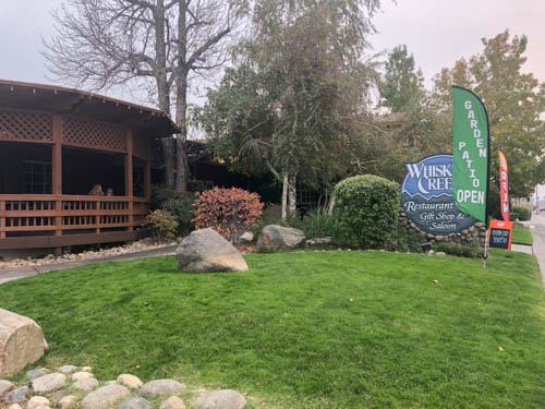
The only spot I could find in Bishop was at the Inyo County Fairgrounds. The best part about the campground was the high-speed Wi-Fi connection, which allowed us to stream Netflix. We treated ourselves to dinner out on the patio of Whiskey Creek Restaurant, a place we sometimes visited when passing through town on our way to or from Mammoth Lakes decades ago.

Brown building, green grass, boulders, and sign for Whiskey Creek Restaurant
Whiskey Creek Restaurant Patio Dining
Street corner, semi trailer, cars, and setting sun obliterated by smoke in the air
Smoke shrouds the Sierra Mountains

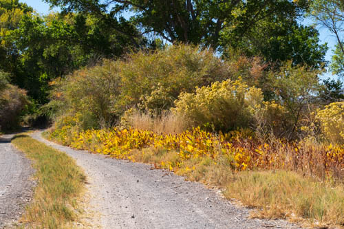
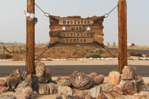
The next morning, the air quality was worse, reducing visibility to about a quarter mile. Lone Pine’s air quality wasn’t as bad, so we headed south to see Manzanar National Historic Site. We had driven by the property for years when all we could see was a gate, fence, and a sign listing it as a historic landmark. We were eager to find out what was behind the fence.

Wood sign for Manzanar War Relocation Center
Manzanar War Relocation Center is close to U.S. 395

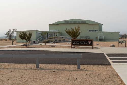
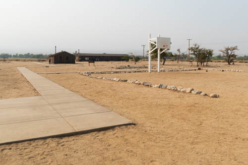
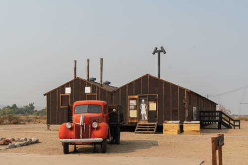
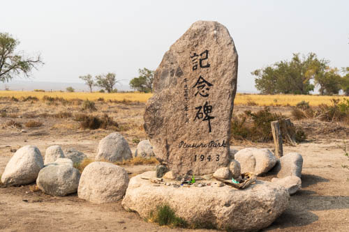
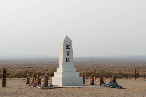
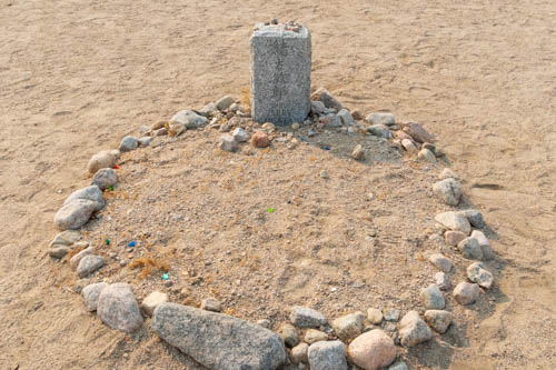
A driving tour took us around the camp where there were places to park and explore different sites with information panels to tell us what we were looking at. Only a few buildings had doors open that we could peek into but not enter.

Desert landscape with large green building and signs
Visitor center closed during pandemic

In reaction to the Japanese bombing of Pearl Harbor on December 7, 1941, President Franklin D. Roosevelt signed Executive Order 9066 in February 1942. The order authorized the Secretary of War to remove individuals deemed a threat to the war effort for relocation at one of 10 centers in seven states around the country.

Sidewalk, rocks, sandy area with a few trees and brown buildings in the background.
Baseball and basketball were favorite sports the internees enjoyed

It turned out the threatening individuals were 120,000 men, women, and children of Japanese ancestry living in the United States. Whether they were American citizens by birth or lived in the country for decades, they entered the camps with only a small amount of what they had owned.

Man standing near a wood and tar paper clad building, white pickup truck, basketball hoops in background
Jon checks the exterior walls made of only thick tar paper instead of stucco or siding.
Inside wood barracks with cots, bedding, hanging clothes and information signs.
Reconstructed barrack room depicts life in camp
Inside wood framed barracks showing information signs
The building was closed so we couldn’t go inside to read the information panels in the Block Manager’s Office

Manzanar was not one of those fancy summer camps near a lake. Military police manned eight guard towers with searchlights and patrolled a barbed wire fence that enclosed a 500-acre housing section comprising 504 barracks arrayed into 36 blocks. The remaining 5,500 acres outside of the fence included housing for military police, a reservoir, a sewage treatment plant, and agricultural fields.

Wood and tar paper building used as women's latrine
Women’s latrine

Several Japanese American men and women arrived in Manzanar in March 1942 as volunteers to help the Army build the camp. It was the first camp to open. The War Relocation Authority (WRA) took over operations on June 1.

World War II era red delivery pick up with wood framed tar papered brown buildings in background
World War II Era Mess Hall
Dishes, cups, pot, and counter inside mess hall
Inside recreated WWII mess hall

Around 10,000 Japanese American internees occupied the camp by September 1942. Imagine the disappointment on their faces as they descended the bus steps and encountered 110-degree weather. Carrying their meager belongings, they walked along paths, sand filling their shoes.

Sign for John Shepherd Ranch, blocked off road, and clumps of trees
The location of the camp was near the former John Shepherd Ranch, who settled in Owen’s Valley in 1861, and the former Town of Manzanar, a once-thriving community filled with fruit orchards.

When they reached their assigned barrack, they found it divided into four 20-by-25-foot rooms to be shared by eight individuals. The only furnishings included an oil stove, a single hanging light bulb, cots, blankets, and straw-filled mattresses. Families shared a laundry room and mess hall and endured communal toilets and showers lacking any kind of privacy.

Large veritcal rock with painted Japanese characters, Pleasure Park, and 1943
Pleasure Park is one of many parks and gardens built by internees
Coins, bracelets, origami and other trinkets at foot of Pleasure Park 1943 sign
Trinkets and origami left by visitors
Sandy area, boulders, wooden bridges, cement pond with no water
Water features, bridges, and shade at Pleasure Park

As if the hot temperatures weren’t enough, the weather dropped below freezing during the winter months. During the year, the internees dealt with strong winds blowing dust and sand through the camp and into the barracks and up through the floorboards.

White obelisk with black Japanese characters, Soul Consoling Tour, smoky skies
Manzanar Japanese erected the “Soul Consoling Tower” in August 1943 as a permanent tribute to the 150 people who died there.
Round gravesite outlined with rocks in the sand and headstone
Family members relocated most of the graves after the camp’s closure, but a few remain.
Origami wedged among rocks
Origami and other trinkets decorated the gravesites

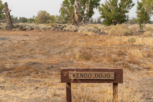
I admire the way the Japanese Americans managed during their incarceration. With ingenuity and cooperation, they established boys and girls clubs, churches, and temples. They built gardens and ponds, developed recreational activities, sports, music, and dance, and even published the Manzanar Free Press, a newspaper, even though the people were not free. Growing vegetables and raising chickens, hogs, and cattle were among their enterprises. Through the pooling of resources they operated a general store, beauty parlor, barbershop, and a bank.

Kendo Dojo sign, cut yellow shrubs, and trees in the background.
Site of the Kendo Dojo

The way the Japanese Americans prospered under such an oppressive situation impressed on me how we humans are a resilient lot able to overcome adversity.

World War II ended with Japan’s surrender on August 14, 1945. Manzanar War Relocation Center closed on November 21, 1945. In 1972, California established Manzanar as a California Registered Historical Landmark. It became a National Historic Site on March 3, 1992, and the interpretive center opened on April 24, 2004.

Wooden guard tower in a field of desert shrubs and grasses, and smoky sky.
One of the eight guard towers

I’m embarrassed when I learn how our country has mistreated groups of people during our history. Places like Manzanar National Historic Site tell the stories of what happened there, what people endured, and how they survived and thrived. They bring light to the darkness of those days to future generations who hopefully avoid a repeat of our misguided actions.

Stay tuned for more Bishop, California, fun coming up next.

Stay Safe

October 2020 COVID-19 Adventure Part Seven

Welcome back to our 2020 COVID-19 Adventure after the holiday pause. I thought I could finish up the series of posts this week. Silly me. With twelve more days of travel and sightseeing, there was no way I could fit it into one post. This week we focus on Alamo, Nevada, where we made a three-night stop on our way to Bishop, California.

Before we left Utah on October 18, 2020, we stopped in Cedar City so Jon could get his second shingles shot at Walgreens and a supply of Blue DEF for the truck. The next day in Alamo, he woke up with mild reactions to the vaccine that lasted about half the day. This reduced our poking around time, which turned out okay. We found only two places to explore while in Alamo.

Extraterrestrial Highway

The Extraterrestrial Highway (Nevada SR 375) cuts off of SR 318 at the Crystal Springs Rest Area and continues for about 98 miles to US Route 6 in Warm Springs. At about half the distance sits the area of Rachael, where travelers will find the Little Al’e’inn restaurant, bar, and motel.

Road, two tall trees, blue sky, and hills
Crystal Springs rest area at the Y

The rest stop was a good place to eat lunch. It’s near the ghost town of Crystal Springs. Before white settlers entered the area, a Native American village used the spring. People traveling the Mormon Trail stopped there to replenish their water supplies. The thermal spring, with an 81 degree Fahrenheit temperature, still supplies water to ranches and farms up to 5 miles away.

Heavily vegetative site
Crystal Springs hides in the vegetation

The Alien Research Center is easy to spot from the road. Look for the giant metal alien figure on top of a hill and in front of a Quonset hut. The center is nothing more than a gift shop for the delight of tourists and alien seekers. It’s worth a stop to see all the items they sell, even if you aren’t interested in buying anything.

Aluminum space alien statue in front of a Quonset hut with woman standing up to its knee
Alien Research Center Gift Shop

Our next landmark was the Black Mailbox. Not sure what we were looking for, we stayed alert and watched the south side of the road, trying to find the box. A bare spot up ahead caught our attention. Sure enough, there was a black mailbox out in the middle of nowhere.

Black mailbox in the desert
The Black Mailbox. A link to Aliens from outer space?

So what is so special about the mailbox? Apparently beginning in 1973, Steve Medlin, a local rancher, used it to send and receive mail. Sixteen years later, Bob Lazar claimed the Airforce was hiding alien spacecraft that crashed in the desert near Area 51. ET-seeking enthusiasts swarmed the region and turned the mailbox into a communication device, leaving messages for Aliens and expecting return mail.

Black mailbox, broken stand for another black mailbox, and painted rock.
Who thought a plastic mailbox was a good idea?

Since then, visitors shot up the mailbox. It was replaced with a white box. Someone stole the white box, and it was replaced, then it was vandalized and replaced again. It appears that Mr. Medlin long ago gave up using the mailbox as his own.

Snacks, rocks, and random stuff inside a black mailbox
Random snacks, rocks, and cans left for the Aliens?

You’d think we would have been disappointed by what we found. Not so. We had no expectations starting out and enjoyed the ride through the lovely desert.

Pahranagat National Wildlife Refuge

The next day we visited The Pahranagat National Wildlife Refuge, which gave us an opportunity for an easy hike. Along a creek, we enjoyed the abundant flora and fauna along the way.

Tree, dirt road, and sign for Pahranagat National Wildlife Refuge
The Pahranagat Visitor Center was closed
Dike , creek, and shrubs
A dike in the Riparian Habitat

Thousands of migratory birds and endangered species use the refuge as a waypoint on the Pacific Flyway. The refuge includes three distinct habitats that provide rest, food, and nesting spots for the traveling birds.

Yellowed plants lining a gravel trail
The trail connects the Upper and Lower Lakes

Cottonwood and willow trees grow at the lake shores and springs, inviting birds to nest and feed. Meadows and grasses attract rodents, reptiles, and small mammals that find shelter and food in the desert uplands. Coyotes, raptors, and roadrunners find plenty of prey to satisfy their hunger in all three habitats.

Yerba Mansa plant and spent flower
Yerba Mansa
Branch covered with spider's web
Spider’s web?

The Desert Uplands portion of the refuge contains lava rock hills and yucca trees and other cactus.

Lava rock hill covered with dry grass and yucca plants
Lava Rock Hill in the Desert Uplands

None of the fifteen free primitive camping sites were available. The sites are spaced along the east shore of Upper Lake. Good luck finding a spot. There were none when we were there. And come prepared because there is no electricity, water, or sewer facilities, only vault toilets. Many of the sites can accommodate RVs or multiple tents. The campground below was a cluster of campsites at the end of the lake.

Large trees, an RV, cars, and canopies
A campground cul-de-sac

Seasonal boating, fishing, and hunting are available. Or enjoy guided walks and wildlife observation at Pahranagat.

Lower Lake of Pahranagat NWR with row of trees and yellowed grass
Upper Lake
Trail on the top of a dike, bunch of trees and brown hills.
Trail across Upper Lake
Birds on a branch
These little birds (finches?) did not want to pose. They preferred flitting back and forth.

There may be more to Alamo, Nevada, than what we found during our three nights there, but we were ready to move on.

Up next is our 7-day stop in Bishop, California, which served as our base camp to see Manzanar National Historic Site, Ancient Bristlecone Pine Forest, and other locations.

Stay Safe

October 2020 COVID-19 Adventure Part Five

We continue our Panguitch, Utah, visit with more of Bryce Canyon National Park and hikes in Red Canyon State Park.

Kevin and Bailey found the Bryce Canyon to Red Canyon Bike Trail a perfect road for trying out their new foldable bicycles. We dropped them off at Inspiration Point in Bryce Canyon and picked them up at Thunder Mountain Trailhead in Red Canyon State Park.

Man and woman posing with foldable bicycles
Kevin and Bailey pose before their ride.

While Kevin and Bailey navigated the peaks and valleys of the trail on their bikes, Jon and I enjoyed the views at Inspiration Point. What impressed me the most at the point was the overlook that jutted out into the canyon.

People talking at Inspiration Point in Bryce Canyon
Inspiration Point jetty at Bryce Canyon

I had the feeling I was walking on a jetty with views of hoodoos to the right of me and more hoodoos to the left of me.

Pine branch and hoodoos
Hoodoos to the left
View of hoodoos, valley, and trail
And Hoodoos to the right

On our way out of the park, we stopped at a few of the overlooks and went in the store at Ruby’s Inn to wander around the gift shop.

Bryce Canyon hoodoos, walls, and windows
Looking back at Inspiration Point

On Scenic Byway SR-12, we had seen the turnout with information signs that had a splendid view of a meadow and Bryce Canyon Airport. We stopped to see what we could learn from the signs. The airport doesn’t look like much from the road, but it is a valuable asset to the community.

Landscape of Bryce Canyon Airport, meadow, and hills in the background
Bryce Canyon Airport from SR-12

The airport, listed on the National Register of Historic Places, comprises the Great Depression Era hangar built of native ponderosa pine in 1936 through the Works Progress Administration (WPA) project. Eleven years later, on October 24, 1947, flames erupted on a DC-6. Flight 608 didn’t make it to the landing strip during its emergency landing. Instead, it crashed in Bryce National Park 1.3 miles away, killing all on board. To determine the cause of this aviation disaster, investigators reconstructed the charred remains. A process used for the first time and ever since.

Today thousands of tourists arrive by air each year to visit Bryce Canyon National Park and the surrounding area. The airport also serves as critical emergency support for the area, a staging area for search and rescue operations, and fire monitoring and management during fire events. After reading the information signs, I felt safer knowing that if I was hurt or became ill, help was only a short helicopter or plane ride away.

Bryce Canyon Pines Restaurant enticed us with their sign advertising fresh pies and ice cream. While we shared a sandwich and a slice of cherry pie with ice cream, we watched for the bicyclists to pass by but never saw them.

Bryce Canyon Pines Restaurant building, sign and cars
Great pies at Bryce Canyon Pines Restaurant

We continued on and checked out a few more overlooks on our way to Thunder Mountain Trailhead where we had arranged to meet.

Red rock formations next to a road
View of Red Canyon from Thunder Mountain Trailhead parking lot

So, how was Kevin and Bailey’s bicycle ride? They enjoyed the 18.6-mile ride that took them through the forest at certain points and alongside the scenic SR-12, SR-63, and US-89 roads. Although, they almost gave up after fighting against a steep grade and seeing the truck parked outside of Bryce Canyon Pines. The trail was mostly downhill after that, so they kept going.

We visited Red Canyon State Park more than once. The Pink Ledges Trail is an interpretive hike with numbered posts that correspond to a guide available at the Visitor Center. We followed it along to the Hoodoo Trail and then back to the parking lot.

Rocky
Remnants of sedimentary and metamorphic rocks deposited here from 200 miles away.

These hoodoos reminded me of sentries standing guard outside of the castle walls.

Red rock formations that look like sentries
Rock sentries
Rock formations that look like angel wings and butterfly
Butterfly and Angel Wings

The Tunnel Trail was a steep climb with switchbacks, one of which seemed carved into the slope of the mountain and would be quite difficult for anyone with vertigo to navigate. The view from the top was well worth the hike.

Red rock formations on top of mountain with pine trees
Fortress across the valley
Pine trees on red mountains and more mountains in the distance.
Visibility for miles
Mountains road with two short tunnels
Two short tunnels

For the Birdseye Trail, we parked at a turnout west of the Visitor Center and crossed the street. This is a well-used trail with Ys and Ws that branch off the main trail and led us off in the wrong direction a few times.

Red sandy hill with a valley in the distance
Red hill
Hiker on red rocky trail
Great views from the Birdseye Trail
Red rock formations at the top of a mountain
Hoodoos in the making

Check out the spirals on this tree. Is it a sign the tree has adapted to the environment? Causes of the spirals might include poorly drained or uneven soil, windy conditions, or a heavy or uneven canopy. The spiral pattern may occur to allow sap and food to more efficiently distribute to all the roots and branches.

Spiral tree trunk
Spiraling tree trunk
Hoodoo that looks like a camel laying down
The Camel (kneeling)
Red rock formations, blue sky, and pine trees
Looking up

Next up in part six, we continue our Panguitch visit by hiking the Arches Trail in Lossee Canyon and drive out to Kodachrome State Park.

Until then, stay safe.

October 2020 COVID Adventure Part Four

Hitch-N-Post Campground was our base camp in Panguitch, Utah. We checked in on October 9, 2020, for a nine-night stay. Since our last visit in 2018, the owner had doubled the size by adding an entire section with plenty of room to accommodate big rigs and space for off-road enthusiasts to park their ATV toys. Our site was snug between the office and the neighboring rig, which I wasn’t too keen on in the beginning. When the wind came up, I was glad for the close quarters.

Wood 2-story building and fifth wheel trailer
Home base at Hitch-N-Post

The gang that likes to fish, which does not include me, took off two days during our stay to fish the Sevier River. The campground owner mapped out his secret fishing spot a few miles from Panguitch.

Angler in chair on the banks of a river
Fishing Sevier River (Photo by Bailey Bishop)

The few fish the gang caught weren’t big enough for us to have a full dinner, so Bailey cooked up some dynamite fish cakes to serve as tasty appetizers.

Man with beard holding two fish on a stringer
Catch of the day (Photo by Bailey Bishop)

While the gang went fishing, I worked on mundane household chores, cleaning the trailer’s sandy floor after our escapade at Wright Family Ranch and washing the laundry. Every day can’t be a holiday for a clean freak like me.

View of hoodoos at Bryce Canyon National Park
View from Sunset Point Overlook

We drove into Bryce Canyon National Park on one of our first days and found a parking spot at Sunset Point. Our goal was a hike on the Navajo Trail through Wall Street, connecting with the Queen’s Garden Trail, and climbing out of the valley at Sunrise Point.

Hikers on Navajo Trail in Bryce Canyon National Park
Where’s the trail?
Man and woman posing in front of an arch at Bryce Canyon National Park
Oh, I see. Through the arch.

The whole route was about three miles. This is a popular hike where we encountered several people along the way. Fortunately, the trail was wide enough in most spots to avoid people without their masks.

Hiker standing in front of a tall narrow slot between rock cliffs
Steep switchbacks lead to Wall Street
View looking up at trail switchbacks and rock outcroppings
Looking up from the mid-point of the switchbacks

So how were these hoodoos formed? According to the Bryce Canyon website, the canyon and rock formations were formed through a three-step process that began around 50 million years ago. The three steps are: 1. Deposition of Rocks, 2. Uplift of the Land, and 3. Weathering and Erosion.

View of rock formations above pine forest
Looking up at hoodoos from valley floor.
Pine trees, rock formations, and blue skies
Scene along the trail

In the first step, Bryce Canyon started out in a low-lying area near sea level and surrounded by higher ground on the west side. Rain washed through the higher ground, developing into streams that picked up tiny particles of limestones, dolostones, mudstones, siltstones and sandstones and deposited them in the valley below. Limestone, mainly composed of calcium carbonate, bonded the particles together, and created the canyon’s rock.

Rock formations and blue skies
Queen Victoria (sitting profile) and Magic Lamp in Queen’s Garden
Rock formations, blue sky, and pine trees
Backside of Queen’s Garden

The second step occurred when the Farallon Plate descended underneath the North American plate, creating heat to rise and elevate the “Four Corners” area of the Colorado Plateau. As such, the Bryce rocks ended up at the perfect elevation for creating the hoodoos. Can you imagine the power, energy, and force it took to raise 240,000 square miles from sea level to 9,000 feet? It’s mind-boggling. Of course, the event did not happen overnight. It took millions of years.

Hikers on trail below tall rock formations
Walking around the castle-like formations.
Olympic flame rock formations against blue sky
Olympic Flames

Weather and erosion sculpt the hoodoos in the third phase. The varying degree and types of deposition and calcium carbonate that occurred in the first step determine how quickly the rock layers erode. Slightly acidic rain dissolves the calcium carbonate faster than other types of rock.

View of Bryce Canyon rock formations
View from Navajo Trail
One lone hoodoo on top of rolling hills
This hoodoo, composed of less calcium carbonate, still stands as the neighboring rock has already eroded.

That’s why the hoodoos have different shapes or a lone hoodoo might stand off all by itself. That lone hoodoo contains less calcium carbonate than the rock that surrounded it. The hoodoos we see today may look a little different the next time we see them, if enough time has passed.

Rock formation with small window against blue sky
Window in the wall
Kissing rock formations against blue sky
Kissing rock formations

Bryce Canyon sits at an elevation of 9,000 feet. At this elevation, the park counts over 200 nights out of the year when both above-freezing and below-freezing temperatures occur during the same night.

View of Shipwreck Rock formation, pine trees and cliffs in the background
Shipwreck Rock is my favorite formation
Long view of the valley beyond Bryce Canyon
Long view from trail

In the third step, rain or melting snow seeps into cracks in the rock and freezes into ice. The ice expands up to 9%, causing pressure on the surrounding rock and breaking it apart. Over millions of years, plateaus become fins and walls. Then windows develop. And eventually, the sculpted hoodoos take shape.

Arch in a rock wall formation named Natural Bridge.
Named “Natural Bridge” this is actually an arch.
Various rock formations in Fairyland in Bryce Canyon National Park
A peek at Fairyland

This post shows only a small portion of what is available to explore in Bryce Canyon. With 15 hikes ranging from one hour to five hours, hikers have plenty to choose from whether their visit is for one day or more.

Next up we continue our exploration of Bryce National Park and the surrounding area.

Personal Note: Because of the increase in COVID-19 cases and hospitalizations the past few weeks, our county reverts to shelter-in-place beginning Monday, December 7, 2020, through January 4. We’re all holding our breaths, saying prayers, crossing our fingers, and staying safe until the vaccine is available. Hope you all stay safe too.