
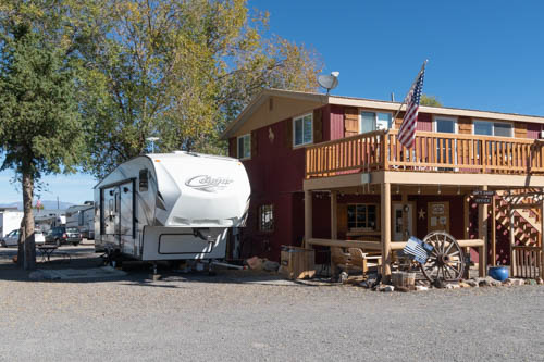
Hitch-N-Post Campground was our base camp in Panguitch, Utah. We checked in on October 9, 2020, for a nine-night stay. Since our last visit in 2018, the owner had doubled the size by adding an entire section with plenty of room to accommodate big rigs and space for off-road enthusiasts to park their ATV toys. Our site was snug between the office and the neighboring rig, which I wasn’t too keen on in the beginning. When the wind came up, I was glad for the close quarters.
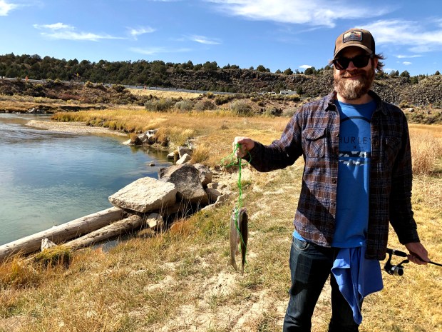
The gang that likes to fish, which does not include me, took off two days during our stay to fish the Sevier River. The campground owner mapped out his secret fishing spot a few miles from Panguitch.

The few fish the gang caught weren’t big enough for us to have a full dinner, so Bailey cooked up some dynamite fish cakes to serve as tasty appetizers.
While the gang went fishing, I worked on mundane household chores, cleaning the trailer’s sandy floor after our escapade at Wright Family Ranch and washing the laundry. Every day can’t be a holiday for a clean freak like me.

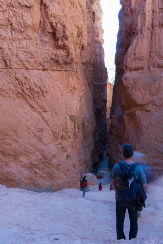
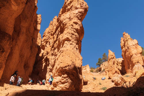
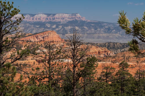
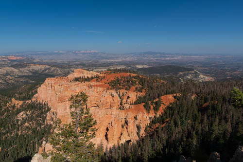
We drove into Bryce Canyon National Park on one of our first days and found a parking spot at Sunset Point. Our goal was a hike on the Navajo Trail through Wall Street, connecting with the Queen’s Garden Trail, and climbing out of the valley at Sunrise Point.
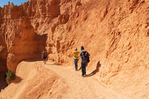

The whole route was about three miles. This is a popular hike where we encountered several people along the way. Fortunately, the trail was wide enough in most spots to avoid people without their masks.
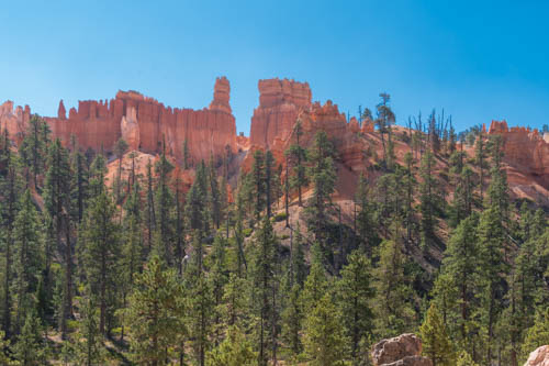
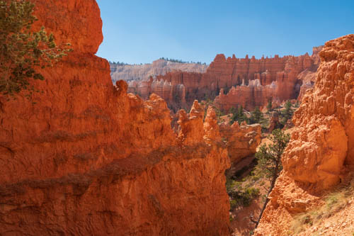
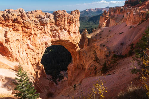
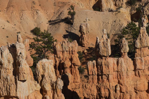
So how were these hoodoos formed? According to the Bryce Canyon website, the canyon and rock formations were formed through a three-step process that began around 50 million years ago. The three steps are: 1. Deposition of Rocks, 2. Uplift of the Land, and 3. Weathering and Erosion.

In the first step, Bryce Canyon started out in a low-lying area near sea level and surrounded by higher ground on the west side. Rain washed through the higher ground, developing into streams that picked up tiny particles of limestones, dolostones, mudstones, siltstones and sandstones and deposited them in the valley below. Limestone, mainly composed of calcium carbonate, bonded the particles together, and created the canyon’s rock.


The second step occurred when the Farallon Plate descended underneath the North American plate, creating heat to rise and elevate the “Four Corners” area of the Colorado Plateau. As such, the Bryce rocks ended up at the perfect elevation for creating the hoodoos. Can you imagine the power, energy, and force it took to raise 240,000 square miles from sea level to 9,000 feet? It’s mind-boggling. Of course, the event did not happen overnight. It took millions of years.


Weather and erosion sculpt the hoodoos in the third phase. The varying degree and types of deposition and calcium carbonate that occurred in the first step determine how quickly the rock layers erode. Slightly acidic rain dissolves the calcium carbonate faster than other types of rock.
That’s why the hoodoos have different shapes or a lone hoodoo might stand off all by itself. That lone hoodoo contains less calcium carbonate than the rock that surrounded it. The hoodoos we see today may look a little different the next time we see them, if enough time has passed.


Bryce Canyon sits at an elevation of 9,000 feet. At this elevation, the park counts over 200 nights out of the year when both above-freezing and below-freezing temperatures occur during the same night.
In the third step, rain or melting snow seeps into cracks in the rock and freezes into ice. The ice expands up to 9%, causing pressure on the surrounding rock and breaking it apart. Over millions of years, plateaus become fins and walls. Then windows develop. And eventually, the sculpted hoodoos take shape.
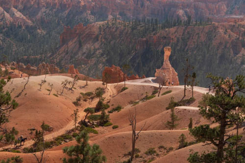
This post shows only a small portion of what is available to explore in Bryce Canyon. With 15 hikes ranging from one hour to five hours, hikers have plenty to choose from whether their visit is for one day or more.
Next up we continue our exploration of Bryce National Park and the surrounding area.
Personal Note: Because of the increase in COVID-19 cases and hospitalizations the past few weeks, our county reverts to shelter-in-place beginning Monday, December 7, 2020, through January 4. We’re all holding our breaths, saying prayers, crossing our fingers, and staying safe until the vaccine is available. Hope you all stay safe too.

Stay safe and healthy!
LikeLiked by 2 people
Thanks. That’s the plan.
LikeLiked by 2 people
We love Bryce Canyon and that hike (Navajo/Queen’s Garden Trail) was one of our all time favorites. Thanks for taking me back!
LikeLiked by 2 people
These pictures are amazing! I have not visited Bryce Canyon, but it is on my bucket list. Hopefully, by the time I get there, Covid will be a distant memory. I am glad to know there are a variety of hikes. I am looking forward to your next post about the area. Stay safe!
LikeLiked by 2 people
So glad you liked the photos. Bryce makes an interesting subject to photograph. Hope you make it to Utah some day. Seeing it in person is inspiring.
LikeLiked by 1 person