October 2020 COVID-19 Adventure Part Five

We continue our Panguitch, Utah, visit with more of Bryce Canyon National Park and hikes in Red Canyon State Park.

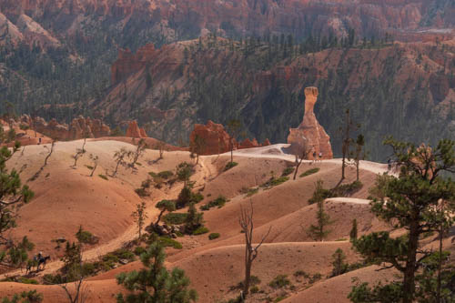
Kevin and Bailey found the Bryce Canyon to Red Canyon Bike Trail a perfect road for trying out their new foldable bicycles. We dropped them off at Inspiration Point in Bryce Canyon and picked them up at Thunder Mountain Trailhead in Red Canyon State Park.

Man and woman posing with foldable bicycles
Kevin and Bailey pose before their ride.

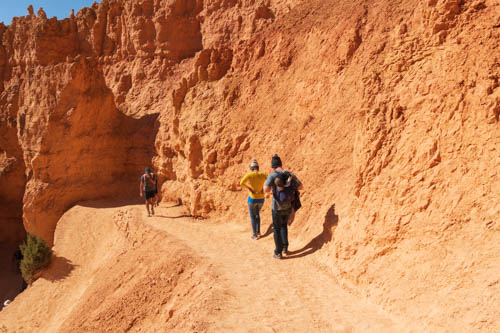
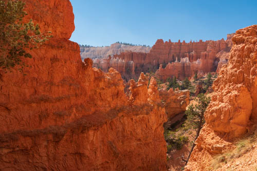
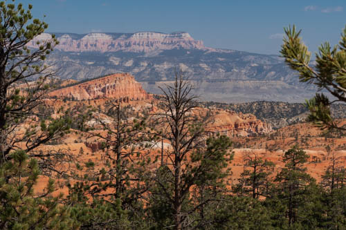
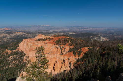
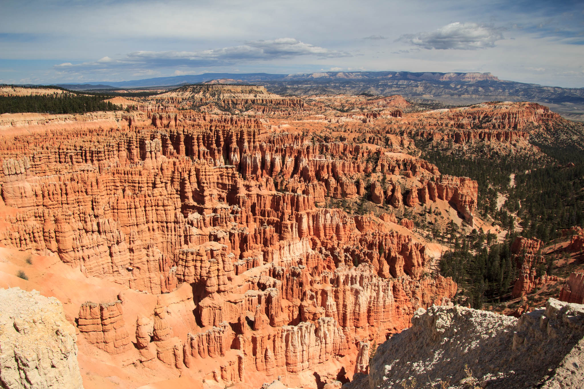
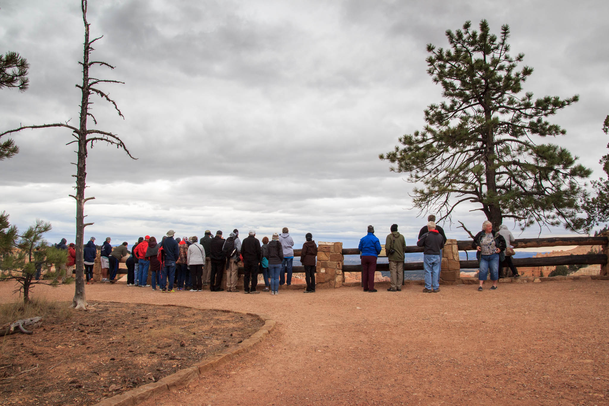
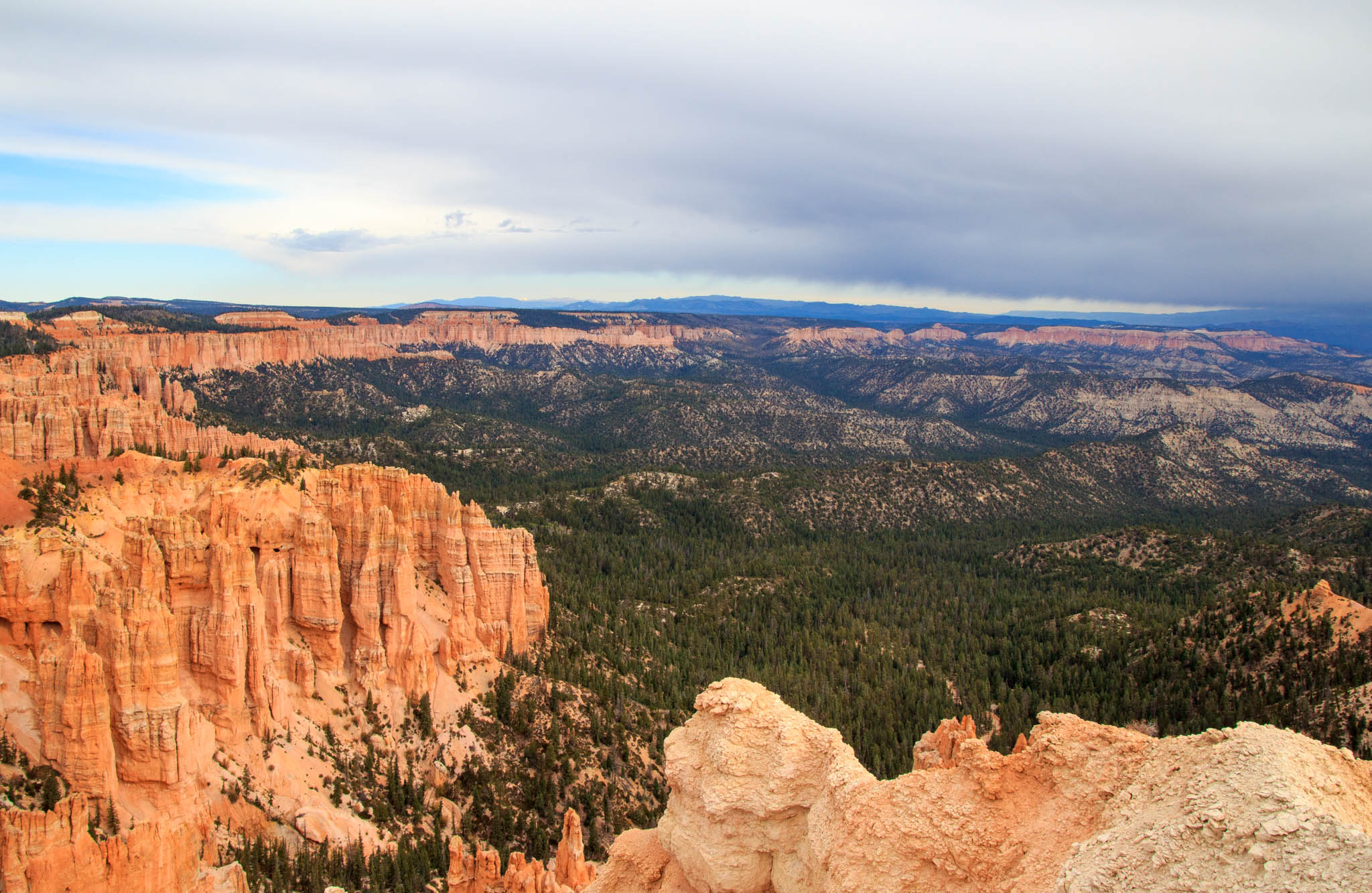
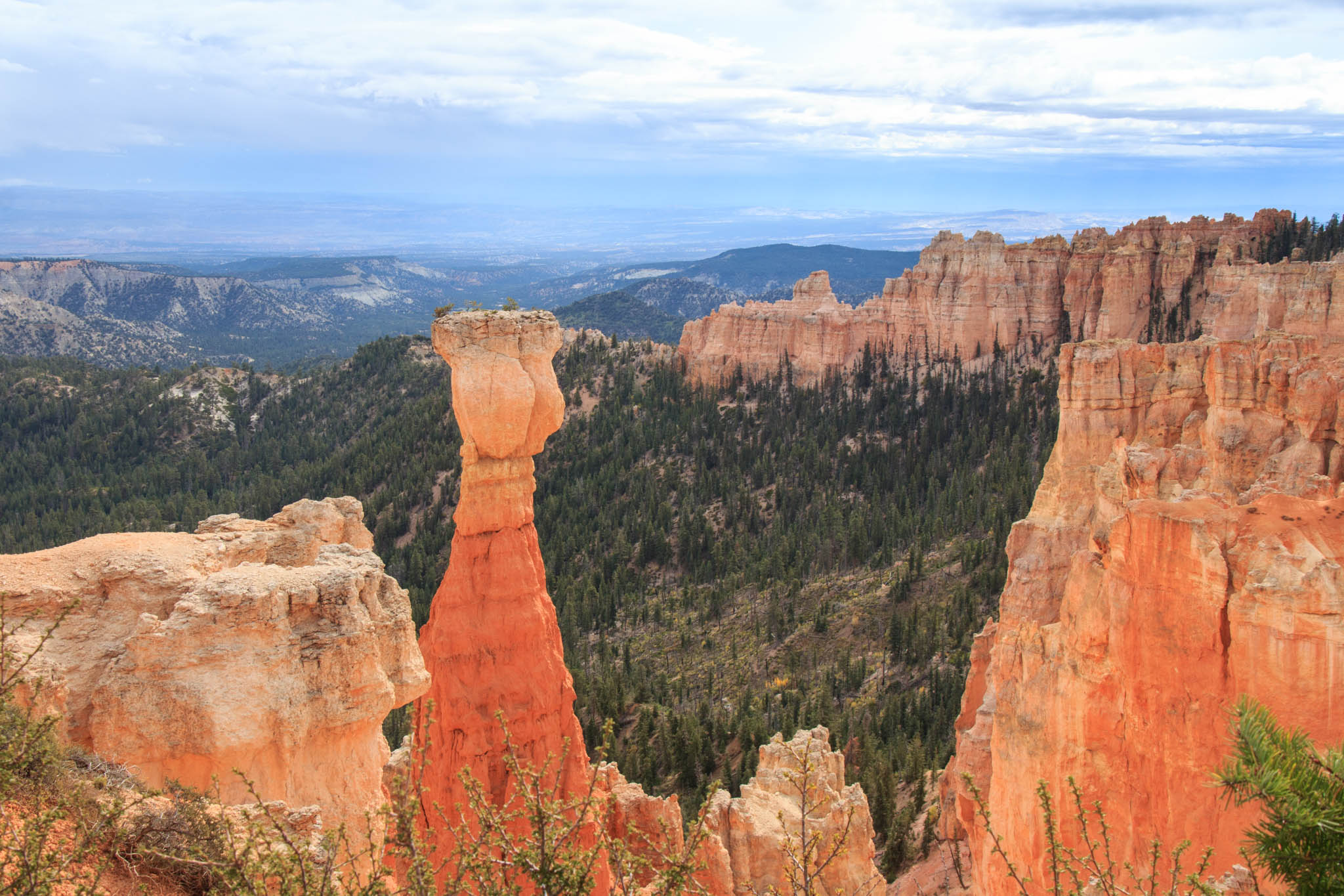
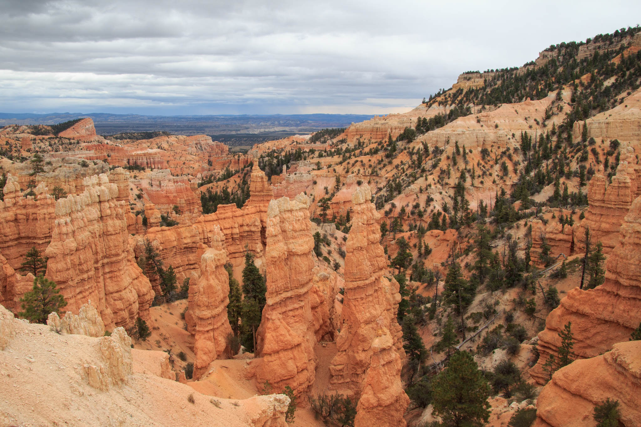
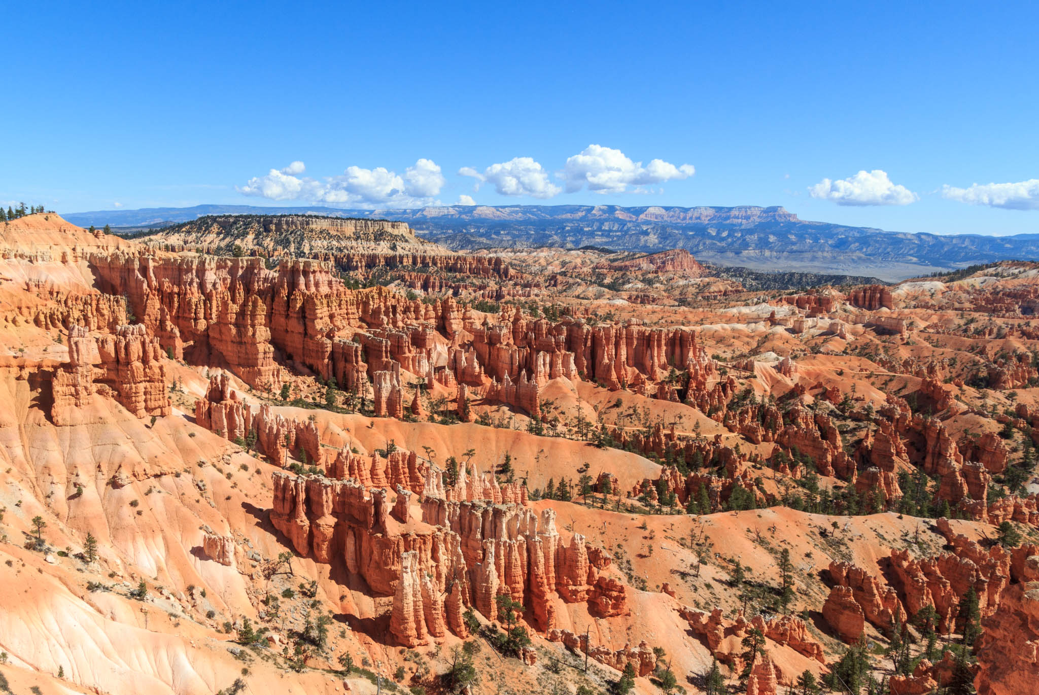
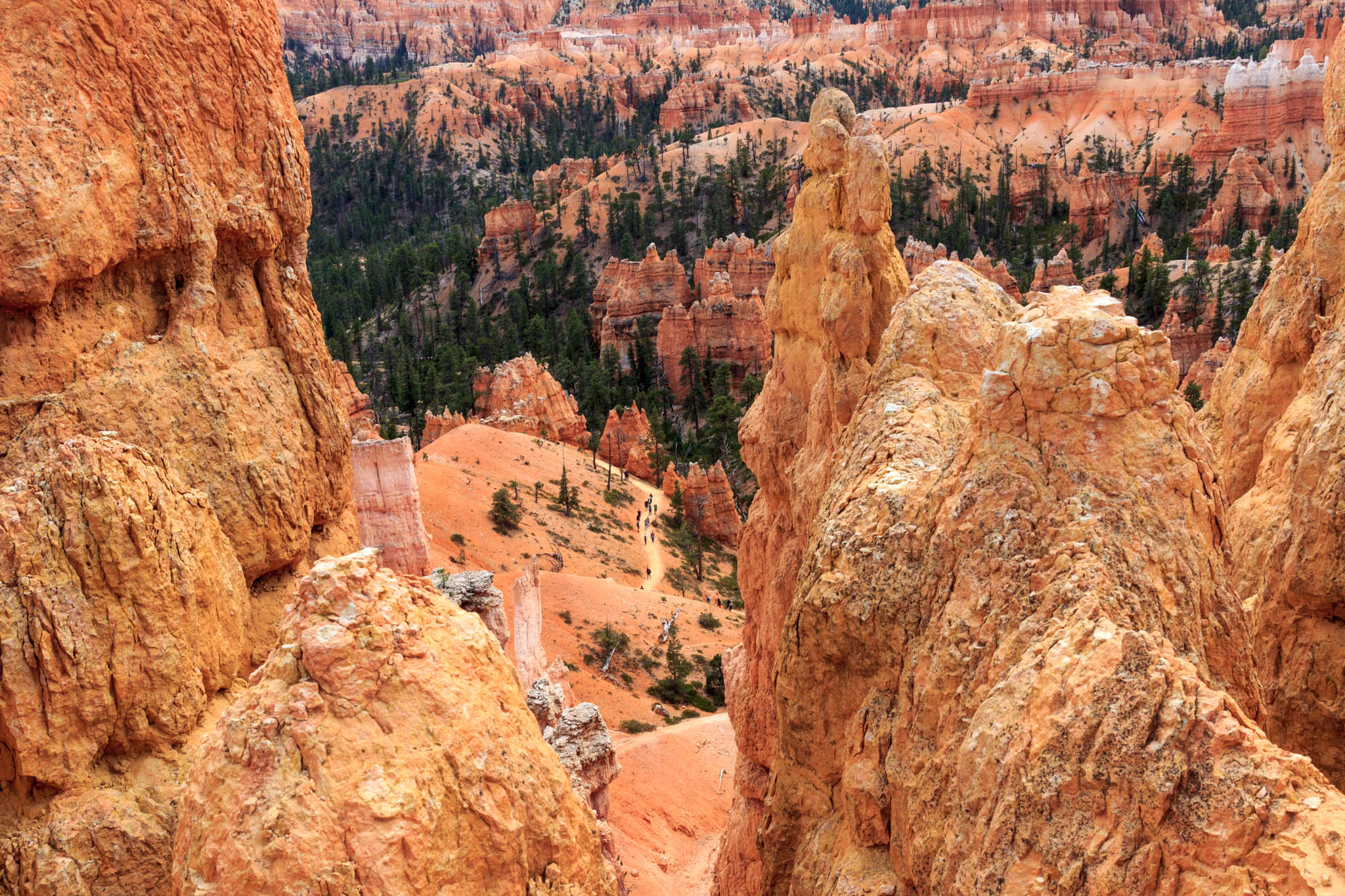
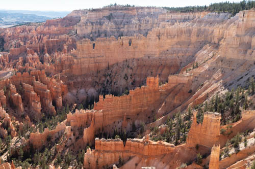
While Kevin and Bailey navigated the peaks and valleys of the trail on their bikes, Jon and I enjoyed the views at Inspiration Point. What impressed me the most at the point was the overlook that jutted out into the canyon.

People talking at Inspiration Point in Bryce Canyon
Inspiration Point jetty at Bryce Canyon

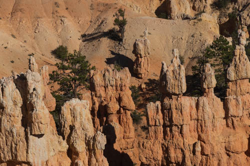
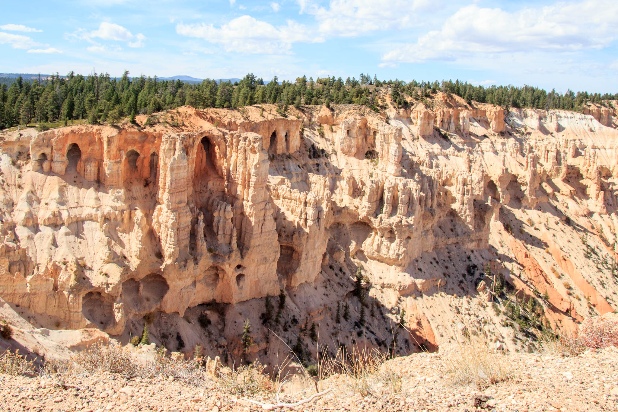
I had the feeling I was walking on a jetty with views of hoodoos to the right of me and more hoodoos to the left of me.

Pine branch and hoodoos
Hoodoos to the left
View of hoodoos, valley, and trail
And Hoodoos to the right

On our way out of the park, we stopped at a few of the overlooks and went in the store at Ruby’s Inn to wander around the gift shop.

Bryce Canyon hoodoos, walls, and windows
Looking back at Inspiration Point

On Scenic Byway SR-12, we had seen the turnout with information signs that had a splendid view of a meadow and Bryce Canyon Airport. We stopped to see what we could learn from the signs. The airport doesn’t look like much from the road, but it is a valuable asset to the community.

Landscape of Bryce Canyon Airport, meadow, and hills in the background
Bryce Canyon Airport from SR-12

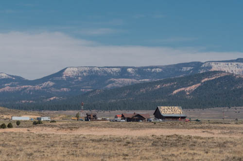
The airport, listed on the National Register of Historic Places, comprises the Great Depression Era hangar built of native ponderosa pine in 1936 through the Works Progress Administration (WPA) project. Eleven years later, on October 24, 1947, flames erupted on a DC-6. Flight 608 didn’t make it to the landing strip during its emergency landing. Instead, it crashed in Bryce National Park 1.3 miles away, killing all on board. To determine the cause of this aviation disaster, investigators reconstructed the charred remains. A process used for the first time and ever since.

Today thousands of tourists arrive by air each year to visit Bryce Canyon National Park and the surrounding area. The airport also serves as critical emergency support for the area, a staging area for search and rescue operations, and fire monitoring and management during fire events. After reading the information signs, I felt safer knowing that if I was hurt or became ill, help was only a short helicopter or plane ride away.

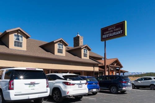
Bryce Canyon Pines Restaurant enticed us with their sign advertising fresh pies and ice cream. While we shared a sandwich and a slice of cherry pie with ice cream, we watched for the bicyclists to pass by but never saw them.

Bryce Canyon Pines Restaurant building, sign and cars
Great pies at Bryce Canyon Pines Restaurant

We continued on and checked out a few more overlooks on our way to Thunder Mountain Trailhead where we had arranged to meet.

Red rock formations next to a road
View of Red Canyon from Thunder Mountain Trailhead parking lot

So, how was Kevin and Bailey’s bicycle ride? They enjoyed the 18.6-mile ride that took them through the forest at certain points and alongside the scenic SR-12, SR-63, and US-89 roads. Although, they almost gave up after fighting against a steep grade and seeing the truck parked outside of Bryce Canyon Pines. The trail was mostly downhill after that, so they kept going.

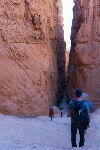
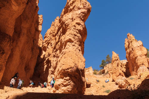
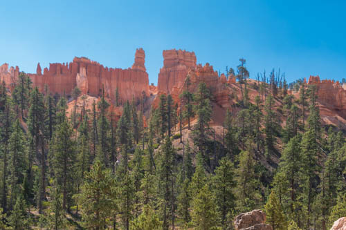
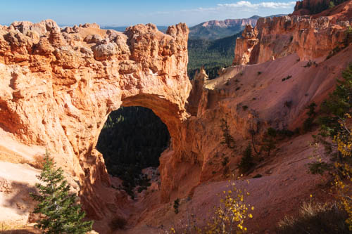
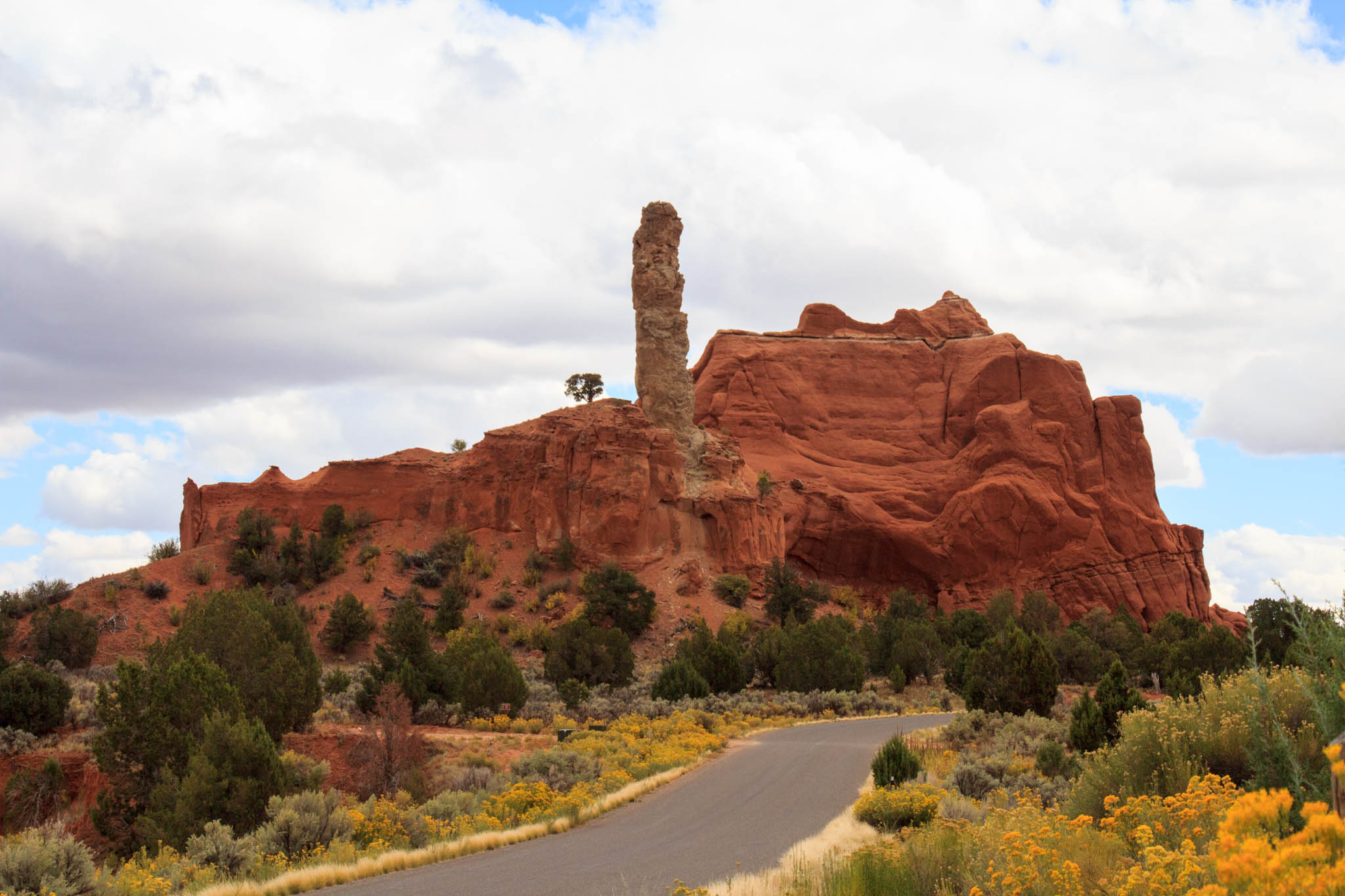
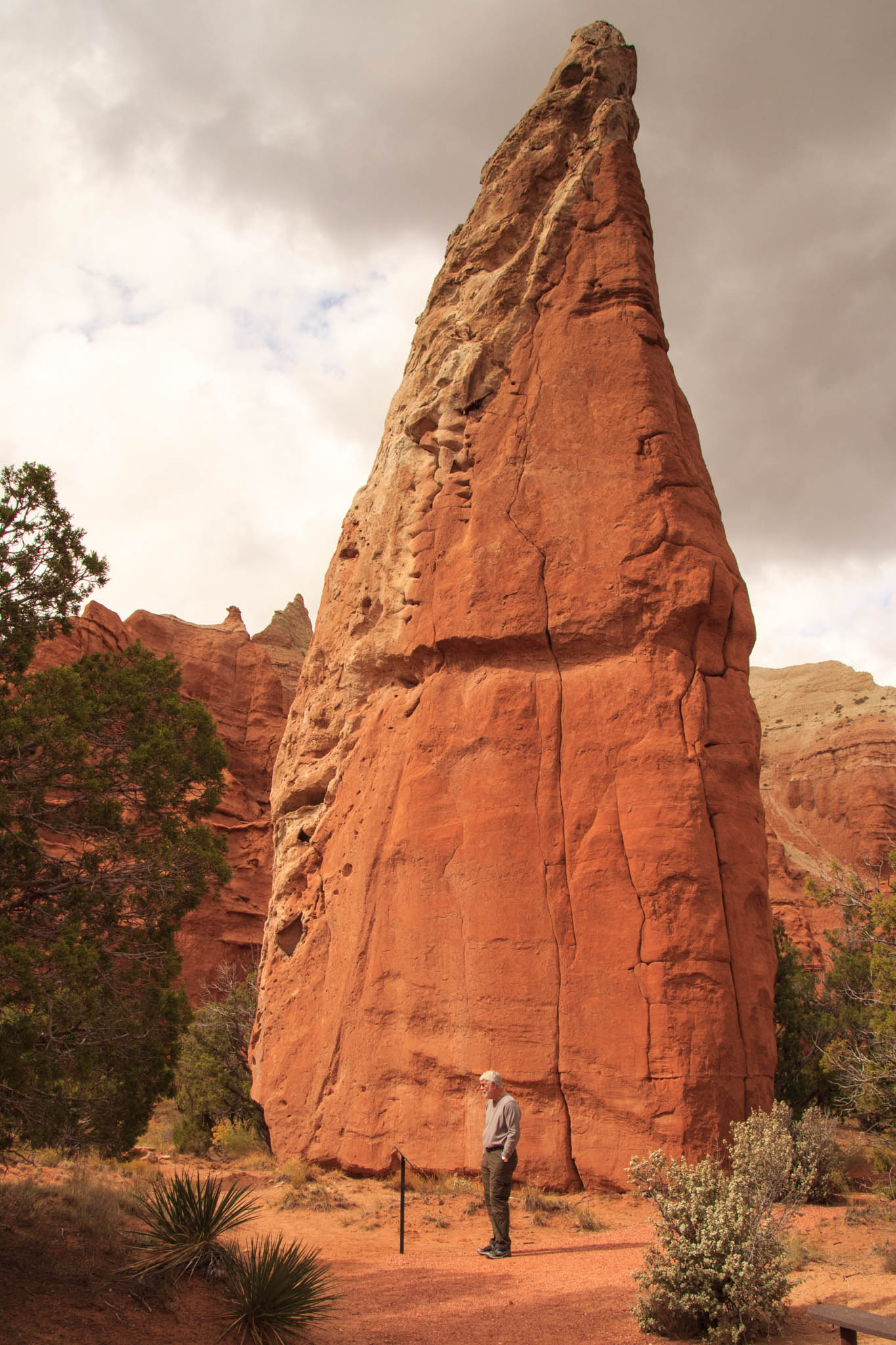
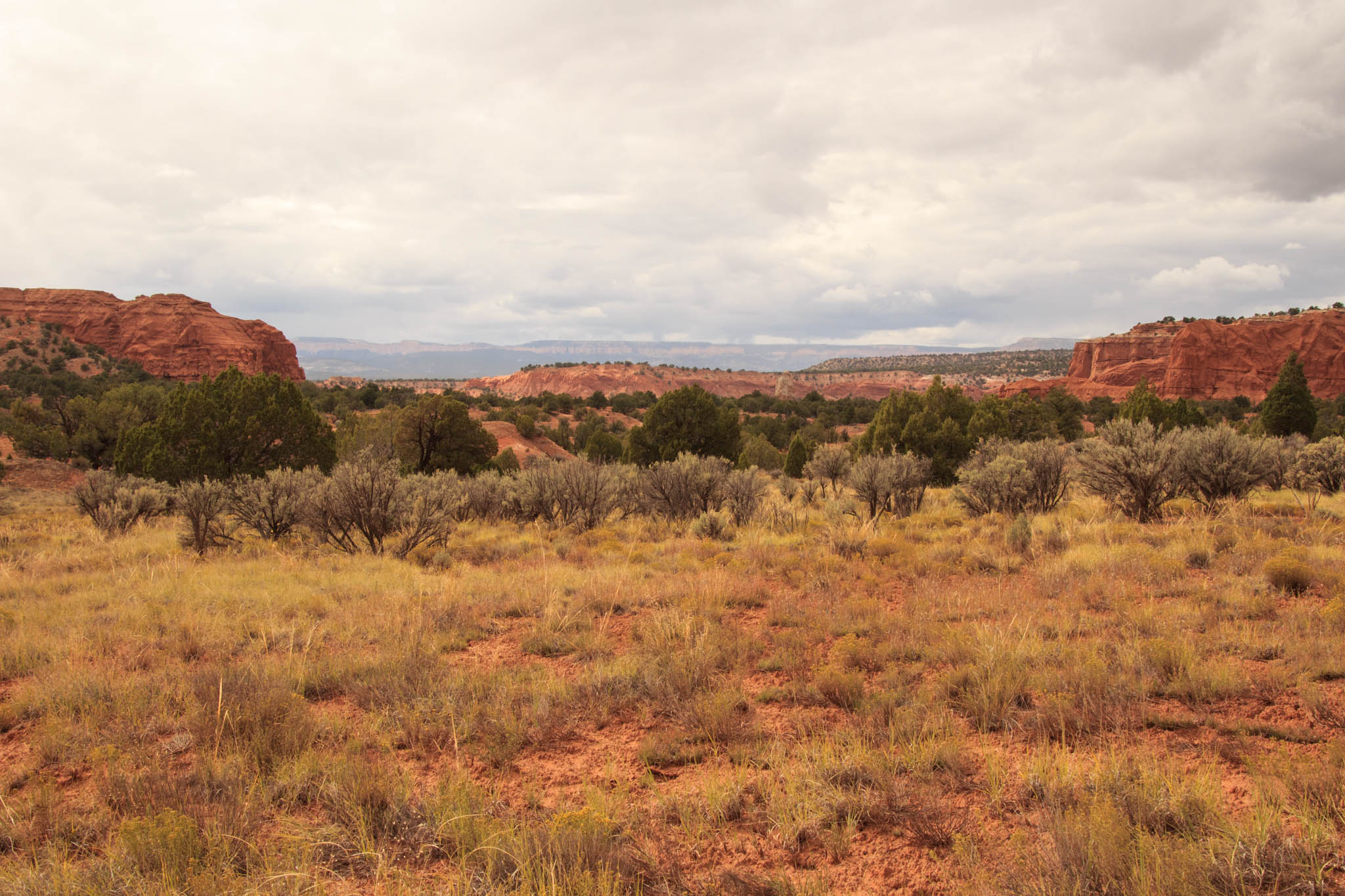
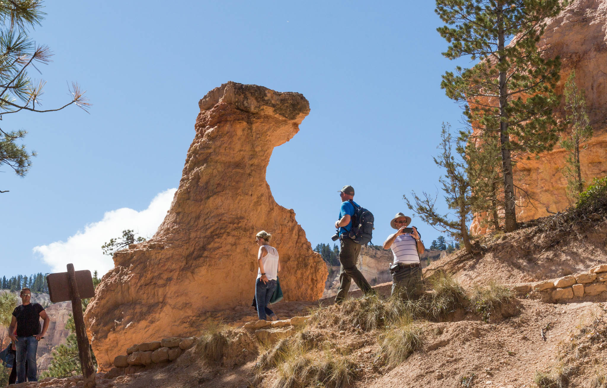
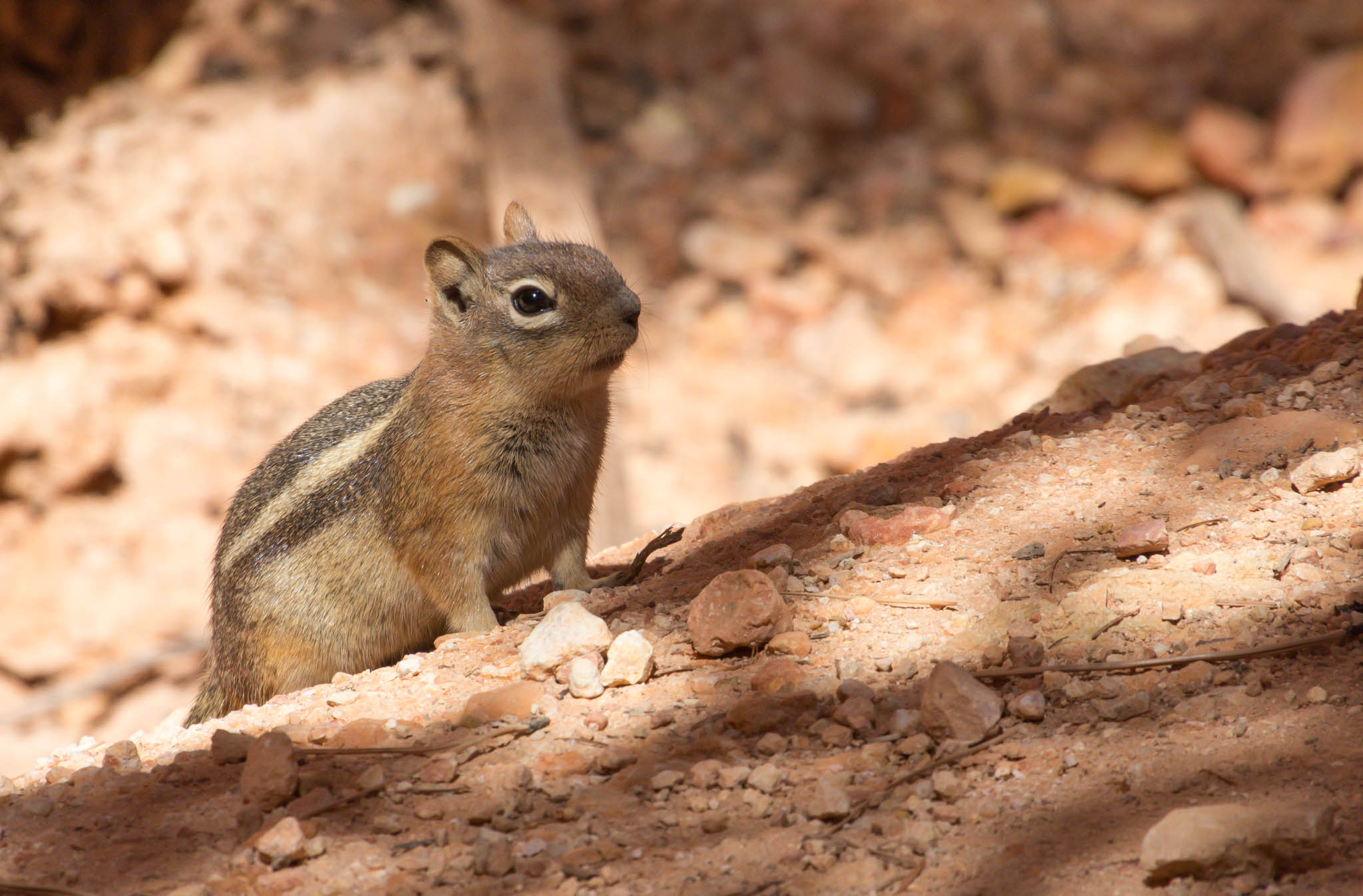
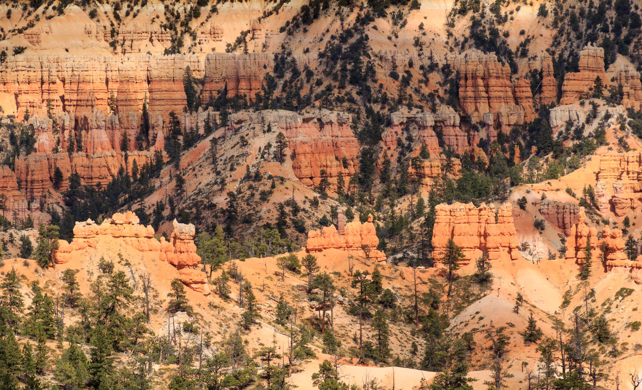
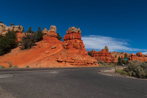
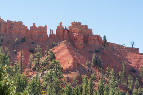
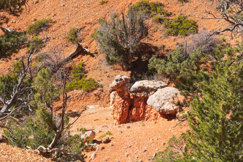
We visited Red Canyon State Park more than once. The Pink Ledges Trail is an interpretive hike with numbered posts that correspond to a guide available at the Visitor Center. We followed it along to the Hoodoo Trail and then back to the parking lot.

Rocky
Remnants of sedimentary and metamorphic rocks deposited here from 200 miles away.

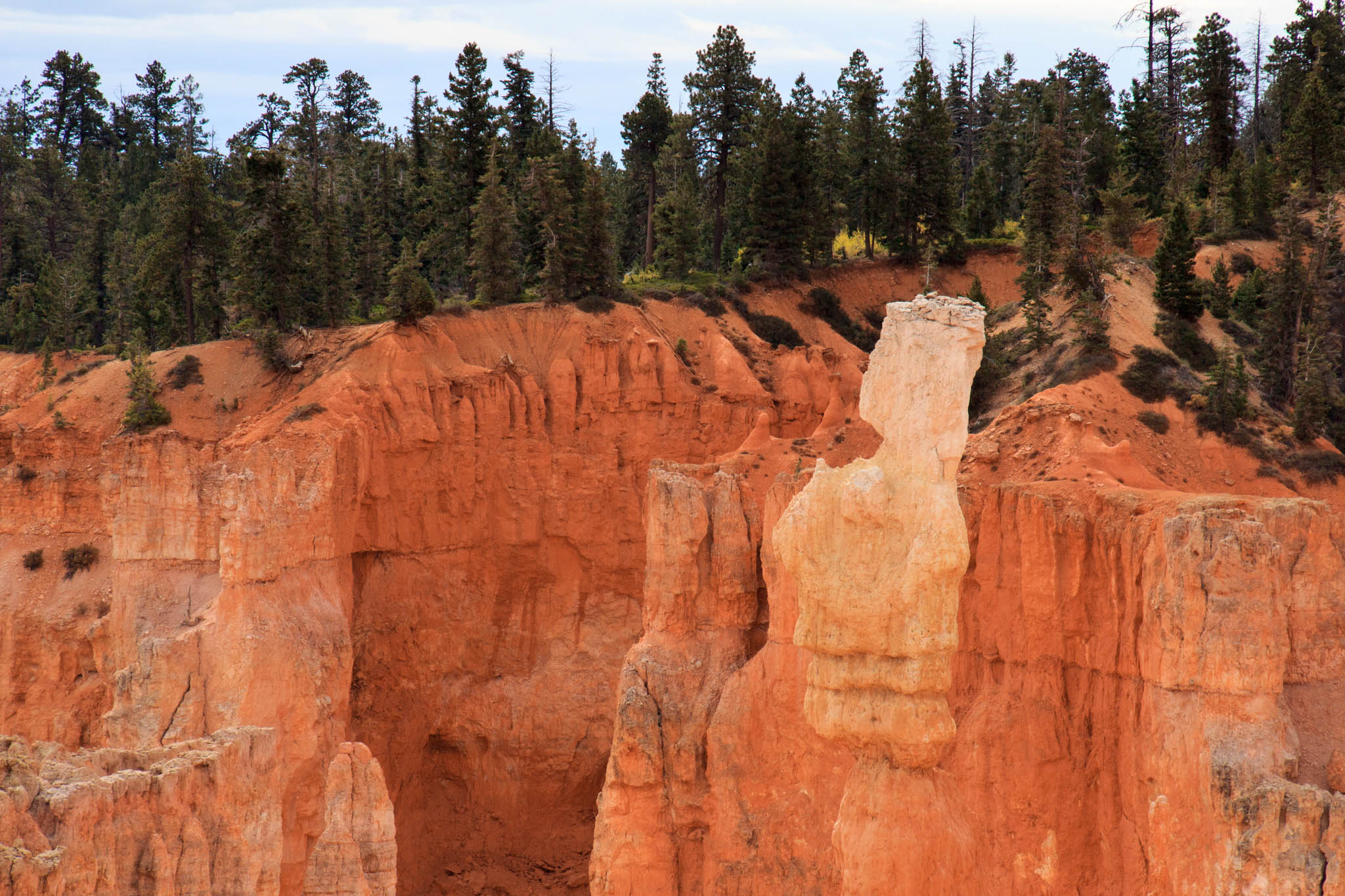
These hoodoos reminded me of sentries standing guard outside of the castle walls.

Red rock formations that look like sentries
Rock sentries
Rock formations that look like angel wings and butterfly
Butterfly and Angel Wings

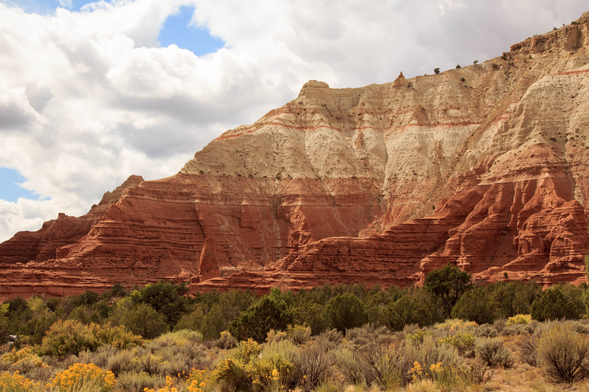
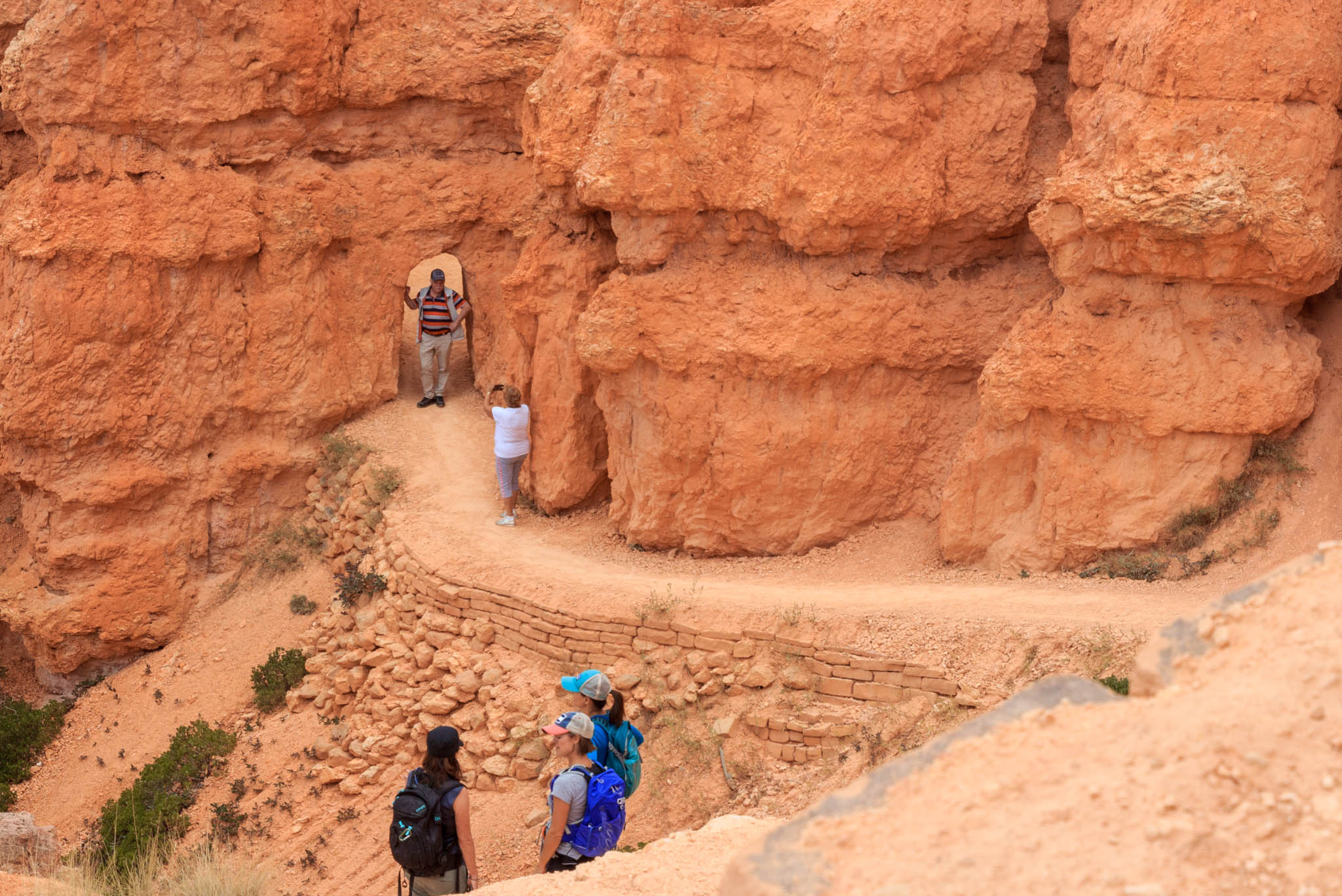
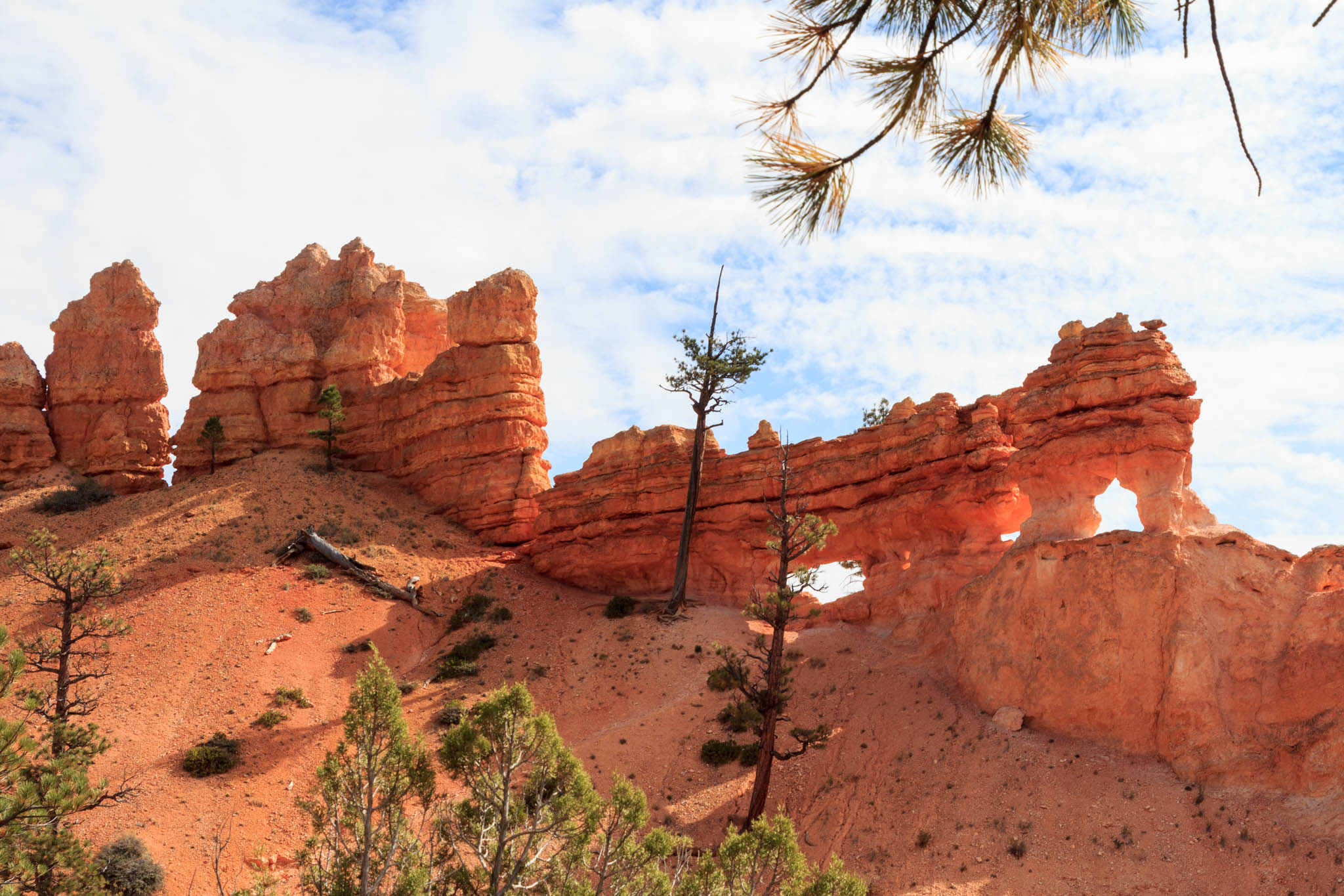
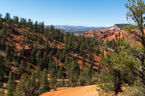
The Tunnel Trail was a steep climb with switchbacks, one of which seemed carved into the slope of the mountain and would be quite difficult for anyone with vertigo to navigate. The view from the top was well worth the hike.

Red rock formations on top of mountain with pine trees
Fortress across the valley
Pine trees on red mountains and more mountains in the distance.
Visibility for miles
Mountains road with two short tunnels
Two short tunnels

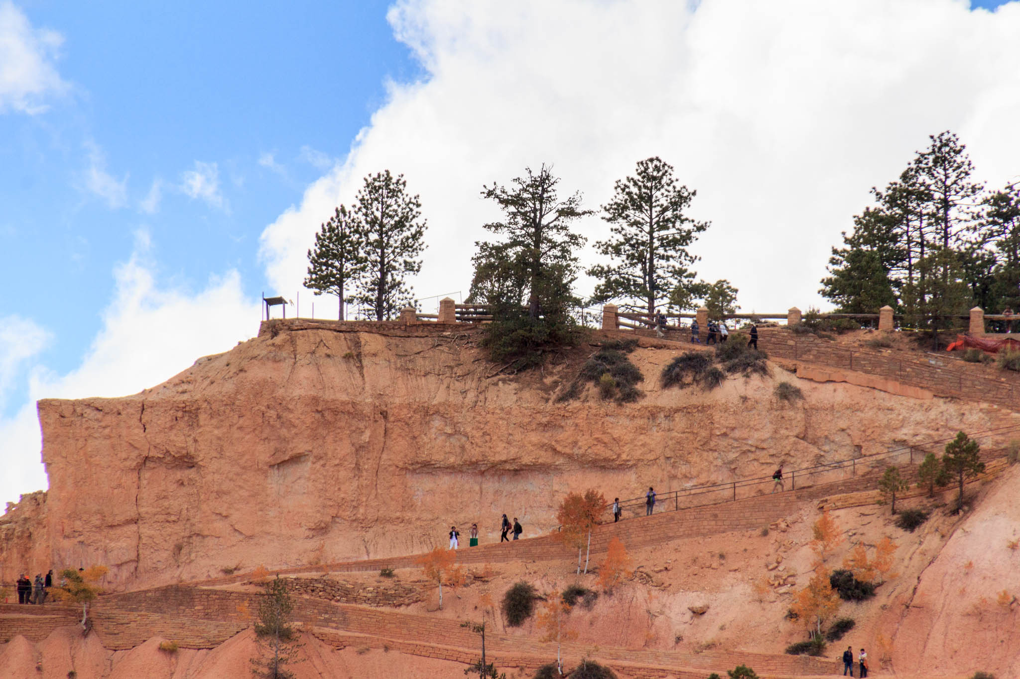
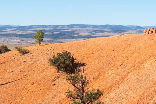
For the Birdseye Trail, we parked at a turnout west of the Visitor Center and crossed the street. This is a well-used trail with Ys and Ws that branch off the main trail and led us off in the wrong direction a few times.

Red sandy hill with a valley in the distance
Red hill
Hiker on red rocky trail
Great views from the Birdseye Trail
Red rock formations at the top of a mountain
Hoodoos in the making

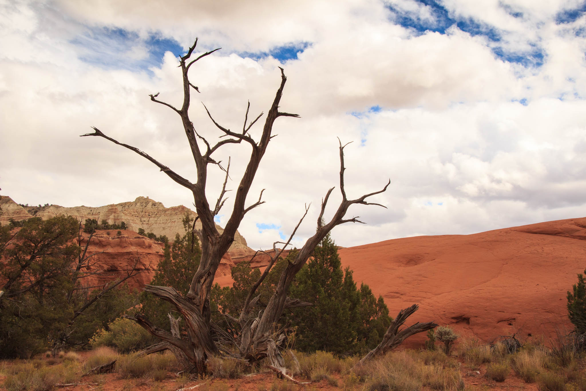
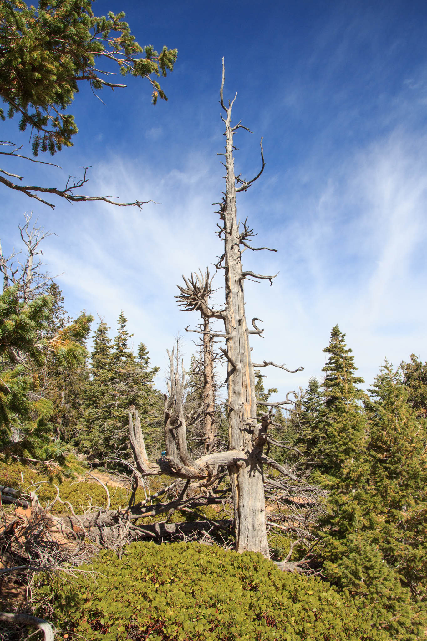
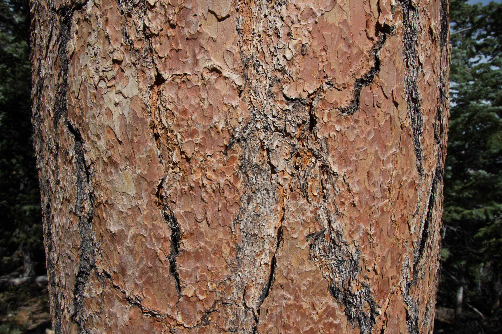
Check out the spirals on this tree. Is it a sign the tree has adapted to the environment? Causes of the spirals might include poorly drained or uneven soil, windy conditions, or a heavy or uneven canopy. The spiral pattern may occur to allow sap and food to more efficiently distribute to all the roots and branches.

Spiral tree trunk
Spiraling tree trunk
Hoodoo that looks like a camel laying down
The Camel (kneeling)
Red rock formations, blue sky, and pine trees
Looking up

Next up in part six, we continue our Panguitch visit by hiking the Arches Trail in Lossee Canyon and drive out to Kodachrome State Park.

Until then, stay safe.

October 2020 COVID Adventure Part Four

Hitch-N-Post Campground was our base camp in Panguitch, Utah. We checked in on October 9, 2020, for a nine-night stay. Since our last visit in 2018, the owner had doubled the size by adding an entire section with plenty of room to accommodate big rigs and space for off-road enthusiasts to park their ATV toys. Our site was snug between the office and the neighboring rig, which I wasn’t too keen on in the beginning. When the wind came up, I was glad for the close quarters.

Wood 2-story building and fifth wheel trailer
Home base at Hitch-N-Post

The gang that likes to fish, which does not include me, took off two days during our stay to fish the Sevier River. The campground owner mapped out his secret fishing spot a few miles from Panguitch.

Angler in chair on the banks of a river
Fishing Sevier River (Photo by Bailey Bishop)

The few fish the gang caught weren’t big enough for us to have a full dinner, so Bailey cooked up some dynamite fish cakes to serve as tasty appetizers.

Man with beard holding two fish on a stringer
Catch of the day (Photo by Bailey Bishop)

While the gang went fishing, I worked on mundane household chores, cleaning the trailer’s sandy floor after our escapade at Wright Family Ranch and washing the laundry. Every day can’t be a holiday for a clean freak like me.

View of hoodoos at Bryce Canyon National Park
View from Sunset Point Overlook

We drove into Bryce Canyon National Park on one of our first days and found a parking spot at Sunset Point. Our goal was a hike on the Navajo Trail through Wall Street, connecting with the Queen’s Garden Trail, and climbing out of the valley at Sunrise Point.

Hikers on Navajo Trail in Bryce Canyon National Park
Where’s the trail?
Man and woman posing in front of an arch at Bryce Canyon National Park
Oh, I see. Through the arch.

The whole route was about three miles. This is a popular hike where we encountered several people along the way. Fortunately, the trail was wide enough in most spots to avoid people without their masks.

Hiker standing in front of a tall narrow slot between rock cliffs
Steep switchbacks lead to Wall Street
View looking up at trail switchbacks and rock outcroppings
Looking up from the mid-point of the switchbacks

So how were these hoodoos formed? According to the Bryce Canyon website, the canyon and rock formations were formed through a three-step process that began around 50 million years ago. The three steps are: 1. Deposition of Rocks, 2. Uplift of the Land, and 3. Weathering and Erosion.

View of rock formations above pine forest
Looking up at hoodoos from valley floor.
Pine trees, rock formations, and blue skies
Scene along the trail

In the first step, Bryce Canyon started out in a low-lying area near sea level and surrounded by higher ground on the west side. Rain washed through the higher ground, developing into streams that picked up tiny particles of limestones, dolostones, mudstones, siltstones and sandstones and deposited them in the valley below. Limestone, mainly composed of calcium carbonate, bonded the particles together, and created the canyon’s rock.

Rock formations and blue skies
Queen Victoria (sitting profile) and Magic Lamp in Queen’s Garden
Rock formations, blue sky, and pine trees
Backside of Queen’s Garden

The second step occurred when the Farallon Plate descended underneath the North American plate, creating heat to rise and elevate the “Four Corners” area of the Colorado Plateau. As such, the Bryce rocks ended up at the perfect elevation for creating the hoodoos. Can you imagine the power, energy, and force it took to raise 240,000 square miles from sea level to 9,000 feet? It’s mind-boggling. Of course, the event did not happen overnight. It took millions of years.

Hikers on trail below tall rock formations
Walking around the castle-like formations.
Olympic flame rock formations against blue sky
Olympic Flames

Weather and erosion sculpt the hoodoos in the third phase. The varying degree and types of deposition and calcium carbonate that occurred in the first step determine how quickly the rock layers erode. Slightly acidic rain dissolves the calcium carbonate faster than other types of rock.

View of Bryce Canyon rock formations
View from Navajo Trail
One lone hoodoo on top of rolling hills
This hoodoo, composed of less calcium carbonate, still stands as the neighboring rock has already eroded.

That’s why the hoodoos have different shapes or a lone hoodoo might stand off all by itself. That lone hoodoo contains less calcium carbonate than the rock that surrounded it. The hoodoos we see today may look a little different the next time we see them, if enough time has passed.

Rock formation with small window against blue sky
Window in the wall
Kissing rock formations against blue sky
Kissing rock formations

Bryce Canyon sits at an elevation of 9,000 feet. At this elevation, the park counts over 200 nights out of the year when both above-freezing and below-freezing temperatures occur during the same night.

View of Shipwreck Rock formation, pine trees and cliffs in the background
Shipwreck Rock is my favorite formation
Long view of the valley beyond Bryce Canyon
Long view from trail

In the third step, rain or melting snow seeps into cracks in the rock and freezes into ice. The ice expands up to 9%, causing pressure on the surrounding rock and breaking it apart. Over millions of years, plateaus become fins and walls. Then windows develop. And eventually, the sculpted hoodoos take shape.

Arch in a rock wall formation named Natural Bridge.
Named “Natural Bridge” this is actually an arch.
Various rock formations in Fairyland in Bryce Canyon National Park
A peek at Fairyland

This post shows only a small portion of what is available to explore in Bryce Canyon. With 15 hikes ranging from one hour to five hours, hikers have plenty to choose from whether their visit is for one day or more.

Next up we continue our exploration of Bryce National Park and the surrounding area.

Personal Note: Because of the increase in COVID-19 cases and hospitalizations the past few weeks, our county reverts to shelter-in-place beginning Monday, December 7, 2020, through January 4. We’re all holding our breaths, saying prayers, crossing our fingers, and staying safe until the vaccine is available. Hope you all stay safe too.

Kodachrome Basin State Park

Kodachrome Basin State Park

We noticed Kodachrome Basin State Park on our area map and decided to drive out to take a look. After visiting Bryce, it was difficult to imagine anything as spectacular. Boy, were we wrong. Just driving along the road was evidence enough that we were entering a special place.


IMG_4179
Kodachrome Basin State Park


Kodachrome became a state park in 1963. At an elevation of 5,800 feet, it is an easier place to visit for people who cannot tolerate the higher altitudes of Bryce Canyon.

The layered sandstone hills and sedimentary pipes that range from six to 170 feet in height reveal the geological formations that began 180 million years ago.

IMG_4136

The Carmel Formation, noted by the white striations in the red colored cliffs at lower levels, forms the base. The red sandstone, along with gypsum, shale, quartz, and clay, makes up the Entrada Formation. The white to tan portions of the cliffs are from the Henrieville Sandstone deposited toward the end of the Jurassic Period.

IMG_4160

The Dakota and Tropic Shale Formations top the previous layers. A sea that covered much of the interior of North America deposited this layer 95 million years ago. Geologists haven’t quite yet agreed on how the spires were formed, but there are three theories that attempt to explain their creation. You can be read about them here on Wikipedia if your interest is piqued.

IMG_4150
Another Sandstone Hill

Since then, wind, rain, and earthquakes have left their marks on the cliffs and monolith shapes we see today.

IMG_4142
Indigenous Woman Wrapped in a Shawl

IMG_4191
The Priest

There are several trails in the park ranging from easy to strenuous. We only had time for the 0.5-mile nature trail, which included informational panels on the plants, animals, and geology. This trail is also ADA accessible.


IMG_4164
Red Sandstone and Snag

IMG_4189
View from Kodachrome Basin State Park


The state park would be a good place to spend a few nights so we could explore more. I have a feeling, though, that reservations are difficult to obtain.

A few miles from the park’s entrance, we came across an alternative to the Kodachrome campgrounds.

IMG_4198
Bryce Luxury Camping Near Kodachrome Basin State Park

How about a luxury tent complete with chairs, table, barbecue, and fire pit? Select a site with neighbors close by.


IMG_4200
Luxury Tent Camping


Or opt for one with a bit more privacy.


IMG_4203
Great Views from Luxury Campsite


Cannonville, Utah

On our way back to the trailer, we stopped off at the visitor center in Cannonville, Utah. Although they were not open, we wandered around outside where they have interpretive panels and displays.


IMG_1586
Cannonville, Utah,  Visitor Center Farming Display


This fence looked rickety to me, but apparently, a ripgut (interlocking) fence is said to be one the strongest for corraling livestock without the use of nails or baling wire.

IMG_1587
Ripgut Fence

A Little More of Bryce Canyon


Before we left Bryce, we attended a ranger talk at Rainbow Point. We drove into the park early to grab a parking spot before the lot filled. Thank goodness it was warmer than the first day we came out on our tour. The ranger talked about the geology and taught us how to distinguish among the white fir, bristlecone, limber, and ponderosa pine trees. I’m afraid I’ve forgotten this skill already.


IMG_4319
Snags are Left to Provide Shelter for Insects, Rodents, and Birds


He encouraged us to take a whiff of the cinnamon-colored bark of the mature ponderosa trees. They smelled like vanilla.


IMG_4321
Bark of a Ponderosa


This little squirrel was so busy munching on the pine cone that she, or he, ignored the group of people listening to the ranger impart tidbits about the green leaf manzanita.

IMG_4315

We stopped at a couple more overlooks on our way out of the park. This amphitheater reminded us of terracotta warriors.


IMG_4324
Terracotta Warriors


IMG_4326
Temple Cliff


After six nights at Ruby’s Inn and Campground, it was time to move on. But not too far away.  There was plenty more to see in the area.

Safe Travels

Bryce Canyon National Park

Bryce Canyon National Park was our destination on September 24, 2017. The California hills along Interstate 5 south of Tracy sported their summer golden highlights. Bands of scorched earth, patches in places and acres in others, signaled that the California fire season had arrived. We made an overnight stop in Barstow at Shady Lane RV Camp. Its location away from the freeway was a better pick than the KOA at Calico Ghost Town where we had previously stayed.

IMG_4297

We selected Ruby’s Inn RV Park & Campground as our home for six nights. Ruby’s accommodates all types of travelers whether they need a motel experience, full hookups for an RV, a cabin, tipi, or tent site. The restaurant serves up delicious western grub and the store contains food items, camping equipment, clothing, and gifts. The convenient shuttle stops for the national park, one near the motel and the other near the RV park, were a bonus.

Our first venture into the park was on the Rainbow Point Shuttle Tour, included with admission to the park by reservation. Our driver, Jay Evans, regaled us with the history and geology of the park, information about the flora and fauna, stories about the people, and a few jokes during the 3.5-hour tour. The tour allowed us to acclimate to the change in elevation from sea level to 8,000 feet and to figure out the areas of the park we wanted to explore in more depth. What we didn’t acclimate to was the cold wind that cut through our thin pant legs. Why did I not pack my long johns?

IMG_4113
Our Tour Group Overlooking One of the Fourteen Amphitheaters of Hoodoos
Bryce Canyon became a national park in 1928 and is named after Ebenezer Bryce who was a Mormon pioneer. The canyon is best known for its long and narrow 56 square miles which contain unique geological formations of hoodoos, fins, windows, arches, domes, and pinnacles.

IMG_4073
View From Rainbow Point
While on the tour, Jay pointed out the names of some of the hoodoos we looked down on from the rim of the cliffs.

IMG_4087
The Hunter is Known for His Ear Muffs

IMG_4084
The Rabbit Or Bart Simpson?

IMG_4090
Natural Bridge

IMG_4091
Olympic Flame

IMG_4093
Kneeling Monk
Layers of silt, sand, and lime in beds that run up to 2,000 feet thick provided the base of sedimentary rock for Bryce Canyon. Erosion from wind, rain, and the freeze-thaw action, which causes fracturing, created the formations and continue their impact on the landscape. In addition, plant roots, and burrowing animals loosen the rocks and accelerate the erosion.

IMG_4106
Fairyland Overlook Fin Hoodoos
We topped off our day at Ebenezer’s Barn & Grill for some old fashioned western fun, music, and cowboy chow. Members of the Bar G Wranglers, the evening’s entertainment, greeted the guests, escorted them to their seats, and made sure the diners followed the proper route through the chow line. Surprisingly, the food was delicious, the music great, and we enjoyed meeting the other couples at our table.

IMG_4114
Ebenezer’s Barn & Grill

IMG_4122
Jay Evans: Best Shuttle Bus Driver and Fastest Strumming Guitar Player
One day, we rode the shuttle to Sunset Point where we hiked the Navaho Loop Trail, connected with Queen’s Garden and came up out of the canyon at Sunrise Point.

IMG_4204
View from Sunset Point

IMG_4216
Navaho Trail Slot Canyon

IMG_4219
Looking Up at the Hoodoos

IMG_4223
Squirrel? Prairie Dog?

IMG_4218
Sorry Squirrel. No Feeding the Animals.

IMG_4235
Queen Victoria Standing on the Back of a Camel

IMG_4237
The Fortress

IMG_4246
Olympic Flame

IMG_4250
Queen’s Garden Trail

IMG_4251
Sunrise Point Queen’s Garden Trail

IMG_4252
Shipwreck Rock
 

IMG_4265
People on the Trail Below are Barely Visible
 

IMG_4261
Photographers Abound on the Trail

IMG_4270
The Sentinels
Not interested in a long steep hike? Take the Mossy Cave trail from Highway 12. The short walk follows the Tropic Ditch to a mossy cave and a waterfall. In 1890 and 1892, Mormon farmers, using picks and shovels, dug the ditch to bring water to the settlements around Tropic, Utah. Except for 2002 during the drought, the ditch has continued to carry irrigation water to the towns of Tropic and Cannonville.

IMG_4280
Mossy Cave

IMG_4275
Tropic Ditch Waterfall

IMG_4285
Tropic Ditch

IMG_4283
Hoodoos and Windows Along Mossy Cave Trail
Words and photos are not sufficient to portray the feelings that well up while walking among the hoodoos and gazing across the vistas. Bryce Canyon is a place to slow down, feel the sun on your back, breath in the fresh pine scent, hear the wind rustle through the pine needles and aspen leaves, and watch squirrels and lizards scurry around and raptors fly overhead. Oh, and don’t forget to look for queens, hunters, rabbits, Chinese terracotta soldiers, Scotty dogs, and whatever else you can make of the gazillion formations.

Safe Travels