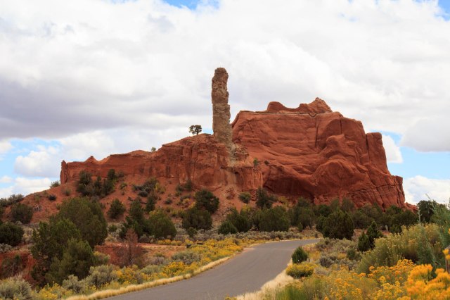
We noticed Kodachrome Basin State Park on our area map and decided to drive out to take a look. After visiting Bryce, it was difficult to imagine anything as spectacular. Boy, were we wrong. Just driving along the road was evidence enough that we were entering a special place.
Kodachrome Basin State Park
Kodachrome became a state park in 1963. At an elevation of 5,800 feet, it is an easier place to visit for people who cannot tolerate the higher altitudes of Bryce Canyon.
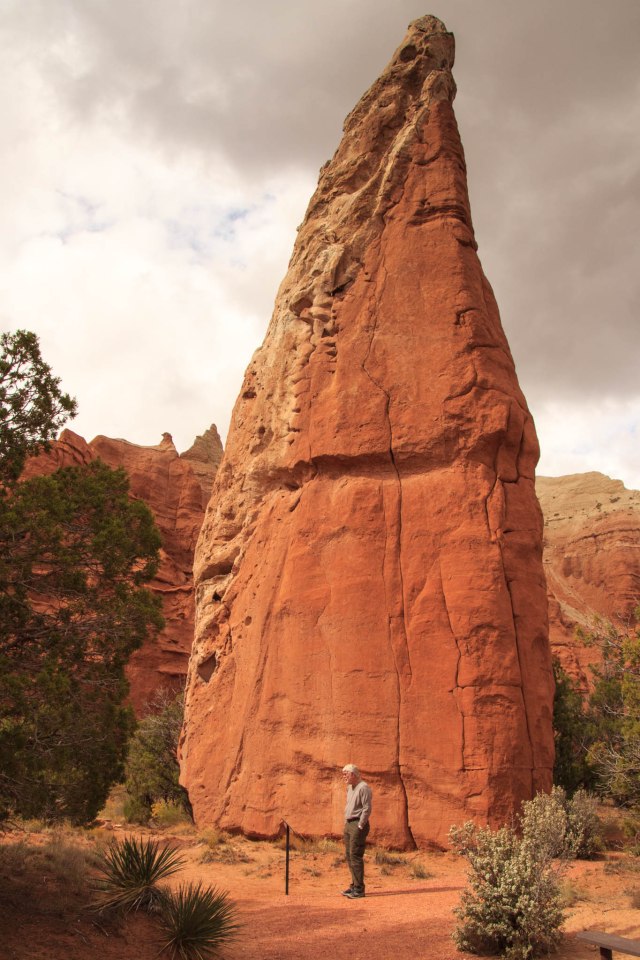
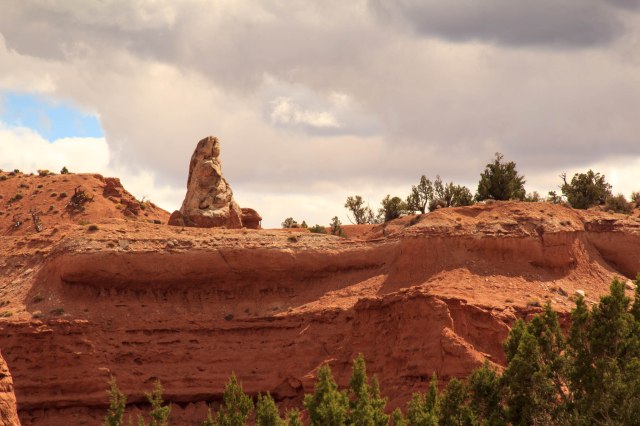
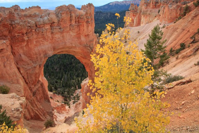
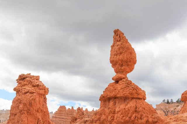
The layered sandstone hills and sedimentary pipes that range from six to 170 feet in height reveal the geological formations that began 180 million years ago.
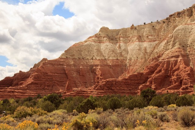
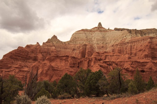
The Carmel Formation, noted by the white striations in the red colored cliffs at lower levels, forms the base. The red sandstone, along with gypsum, shale, quartz, and clay, makes up the Entrada Formation. The white to tan portions of the cliffs are from the Henrieville Sandstone deposited toward the end of the Jurassic Period.
The Dakota and Tropic Shale Formations top the previous layers. A sea that covered much of the interior of North America deposited this layer 95 million years ago. Geologists haven’t quite yet agreed on how the spires were formed, but there are three theories that attempt to explain their creation. You can be read about them here on Wikipedia if your interest is piqued.
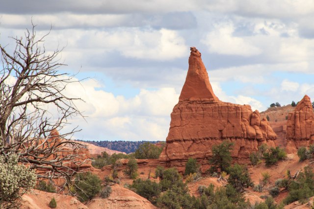
Another Sandstone Hill
Since then, wind, rain, and earthquakes have left their marks on the cliffs and monolith shapes we see today.
Indigenous Woman Wrapped in a ShawlThe Priest
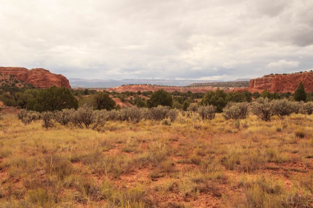
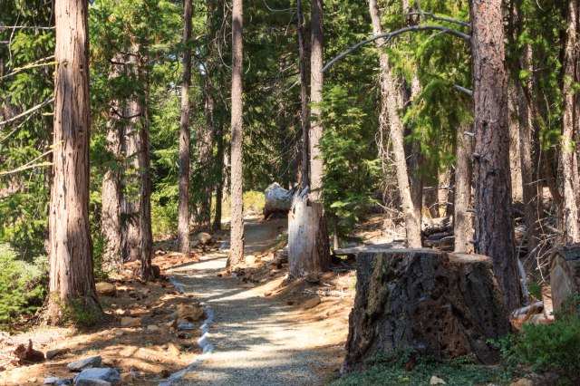
There are several trails in the park ranging from easy to strenuous. We only had time for the 0.5-mile nature trail, which included informational panels on the plants, animals, and geology. This trail is also ADA accessible.
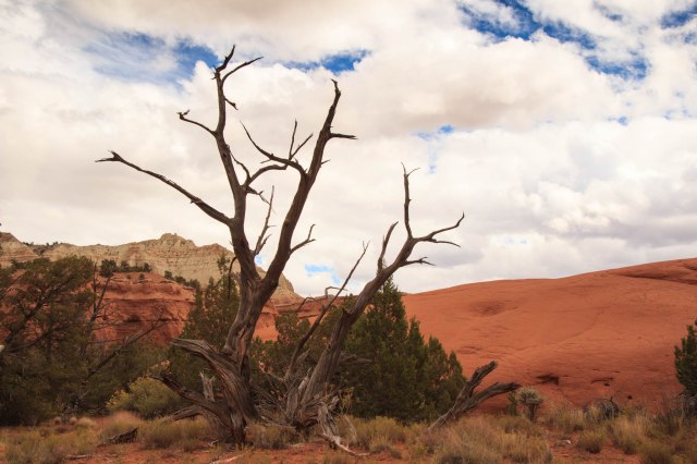
Red Sandstone and SnagView from Kodachrome Basin State Park
The state park would be a good place to spend a few nights so we could explore more. I have a feeling, though, that reservations are difficult to obtain.
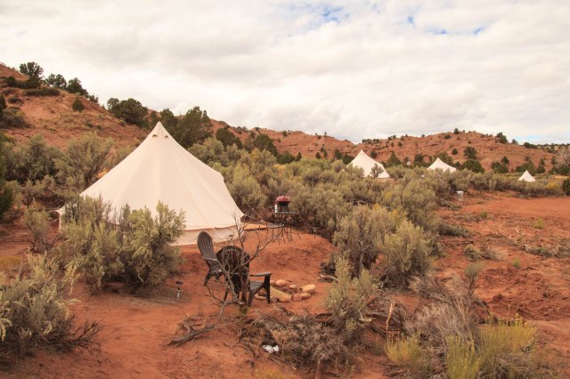
A few miles from the park’s entrance, we came across an alternative to the Kodachrome campgrounds.
Bryce Luxury Camping Near Kodachrome Basin State Park
How about a luxury tent complete with chairs, table, barbecue, and fire pit? Select a site with neighbors close by.
Luxury Tent Camping
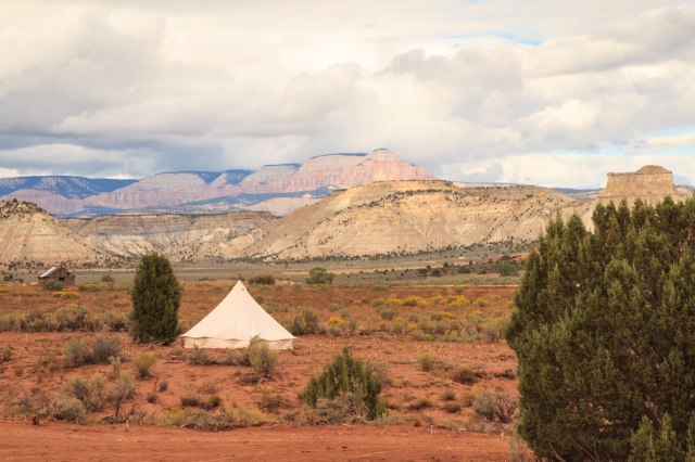
Or opt for one with a bit more privacy.
Great Views from Luxury Campsite
Cannonville, Utah
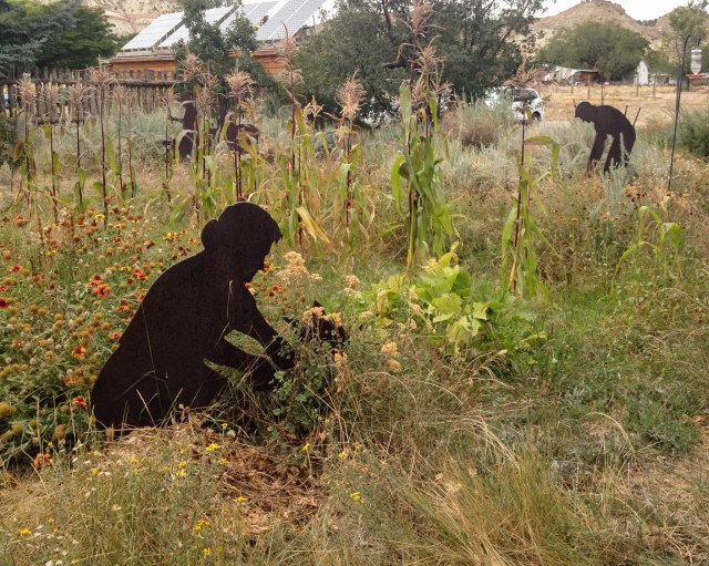
On our way back to the trailer, we stopped off at the visitor center in Cannonville, Utah. Although they were not open, we wandered around outside where they have interpretive panels and displays.
Cannonville, Utah, Visitor Center Farming Display
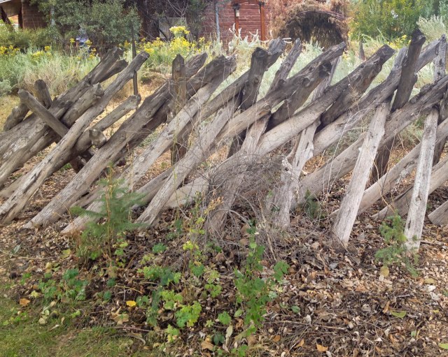
This fence looked rickety to me, but apparently, a ripgut (interlocking) fence is said to be one the strongest for corraling livestock without the use of nails or baling wire.
Ripgut Fence
A Little More of Bryce Canyon
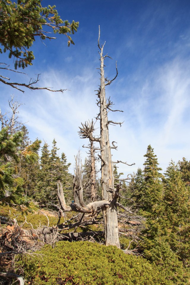
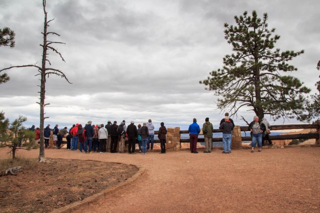
Before we left Bryce, we attended a ranger talk at Rainbow Point. We drove into the park early to grab a parking spot before the lot filled. Thank goodness it was warmer than the first day we came out on our tour. The ranger talked about the geology and taught us how to distinguish among the white fir, bristlecone, limber, and ponderosa pine trees. I’m afraid I’ve forgotten this skill already.
Snags are Left to Provide Shelter for Insects, Rodents, and Birds
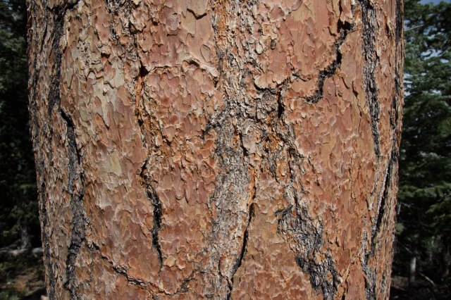
He encouraged us to take a whiff of the cinnamon-colored bark of the mature ponderosa trees. They smelled like vanilla.
Bark of a Ponderosa
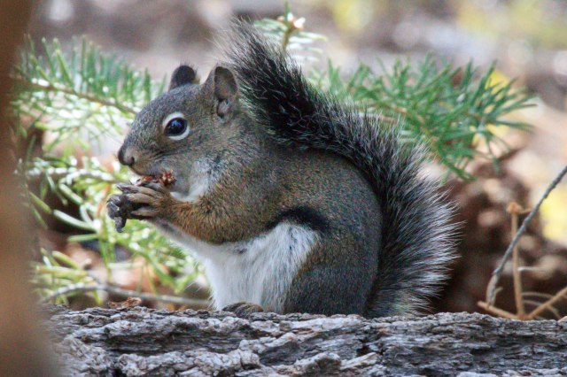
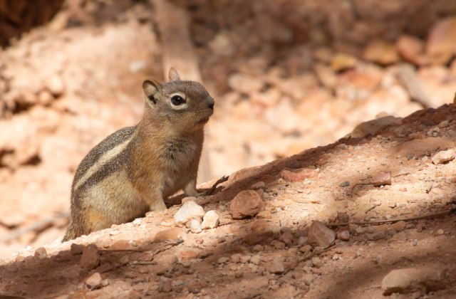
This little squirrel was so busy munching on the pine cone that she, or he, ignored the group of people listening to the ranger impart tidbits about the green leaf manzanita.
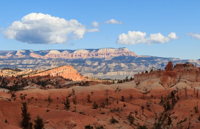
We stopped at a couple more overlooks on our way out of the park. This amphitheater reminded us of terracotta warriors.
Terracotta Warriors
Temple Cliff
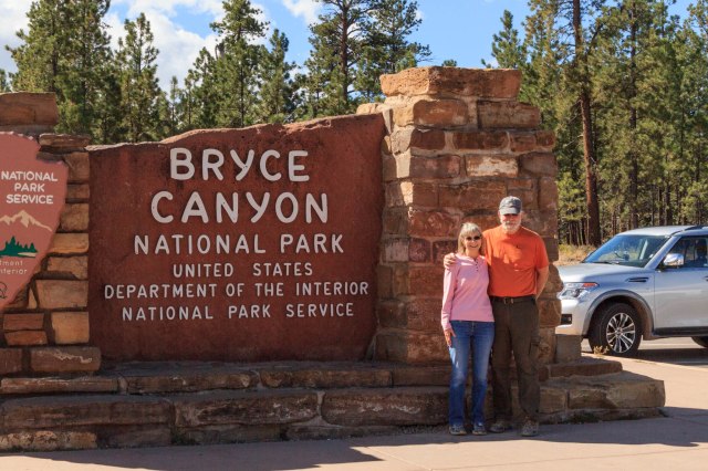
After six nights at Ruby’s Inn and Campground, it was time to move on. But not too far away. There was plenty more to see in the area.
Bryce Canyon National Park was our destination on September 24, 2017. The California hills along Interstate 5 south of Tracy sported their summer golden highlights. Bands of scorched earth, patches in places and acres in others, signaled that the California fire season had arrived. We made an overnight stop in Barstow at Shady Lane RV Camp. Its location away from the freeway was a better pick than the KOA at Calico Ghost Town where we had previously stayed.
We selected Ruby’s Inn RV Park & Campground as our home for six nights. Ruby’s accommodates all types of travelers whether they need a motel experience, full hookups for an RV, a cabin, tipi, or tent site. The restaurant serves up delicious western grub and the store contains food items, camping equipment, clothing, and gifts. The convenient shuttle stops for the national park, one near the motel and the other near the RV park, were a bonus.
Our first venture into the park was on the Rainbow Point Shuttle Tour, included with admission to the park by reservation. Our driver, Jay Evans, regaled us with the history and geology of the park, information about the flora and fauna, stories about the people, and a few jokes during the 3.5-hour tour. The tour allowed us to acclimate to the change in elevation from sea level to 8,000 feet and to figure out the areas of the park we wanted to explore in more depth. What we didn’t acclimate to was the cold wind that cut through our thin pant legs. Why did I not pack my long johns?
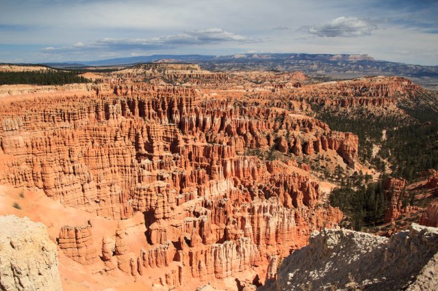
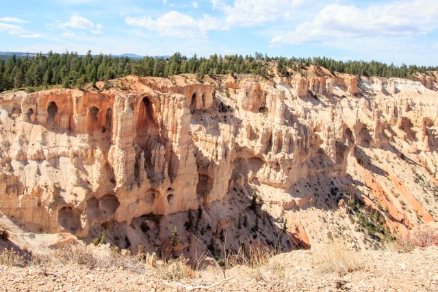
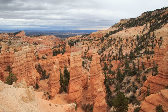
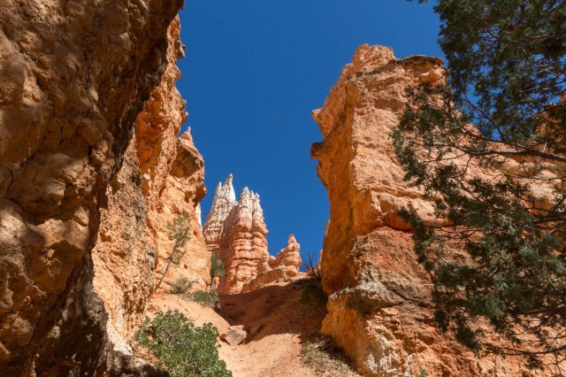
Our Tour Group Overlooking One of the Fourteen Amphitheaters of HoodoosBryce Canyon became a national park in 1928 and is named after Ebenezer Bryce who was a Mormon pioneer. The canyon is best known for its long and narrow 56 square miles which contain unique geological formations of hoodoos, fins, windows, arches, domes, and pinnacles.
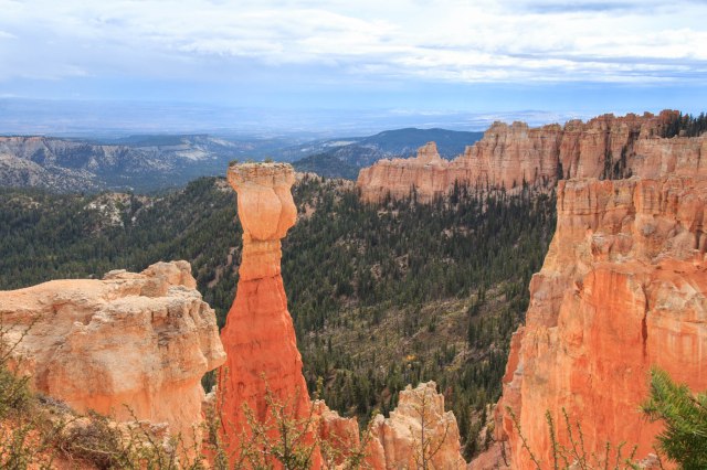
View From Rainbow PointWhile on the tour, Jay pointed out the names of some of the hoodoos we looked down on from the rim of the cliffs.
The Hunter is Known for His Ear Muffs The Rabbit Or Bart Simpson? Natural Bridge Olympic Flame Kneeling MonkLayers of silt, sand, and lime in beds that run up to 2,000 feet thick provided the base of sedimentary rock for Bryce Canyon. Erosion from wind, rain, and the freeze-thaw action, which causes fracturing, created the formations and continue their impact on the landscape. In addition, plant roots, and burrowing animals loosen the rocks and accelerate the erosion.
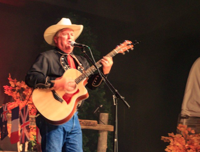
Fairyland Overlook Fin HoodoosWe topped off our day at Ebenezer’s Barn & Grill for some old fashioned western fun, music, and cowboy chow. Members of the Bar G Wranglers, the evening’s entertainment, greeted the guests, escorted them to their seats, and made sure the diners followed the proper route through the chow line. Surprisingly, the food was delicious, the music great, and we enjoyed meeting the other couples at our table.
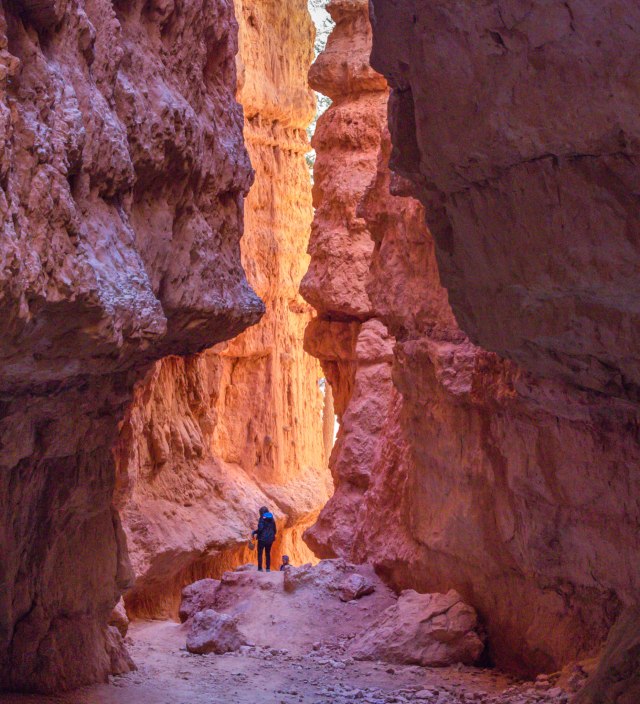
Ebenezer’s Barn & Grill Jay Evans: Best Shuttle Bus Driver and Fastest Strumming Guitar PlayerOne day, we rode the shuttle to Sunset Point where we hiked the Navaho Loop Trail, connected with Queen’s Garden and came up out of the canyon at Sunrise Point.
View from Sunset Point Navaho Trail Slot Canyon Looking Up at the Hoodoos Squirrel? Prairie Dog? Sorry Squirrel. No Feeding the Animals. Queen Victoria Standing on the Back of a Camel The Fortress Olympic Flame Queen’s Garden Trail Sunrise Point Queen’s Garden Trail Shipwreck Rock
People on the Trail Below are Barely Visible
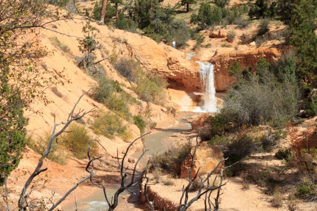
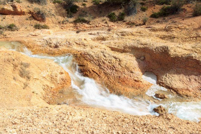
Photographers Abound on the Trail The SentinelsNot interested in a long steep hike? Take the Mossy Cave trail from Highway 12. The short walk follows the Tropic Ditch to a mossy cave and a waterfall. In 1890 and 1892, Mormon farmers, using picks and shovels, dug the ditch to bring water to the settlements around Tropic, Utah. Except for 2002 during the drought, the ditch has continued to carry irrigation water to the towns of Tropic and Cannonville.
Mossy Cave Tropic Ditch Waterfall Tropic Ditch Hoodoos and Windows Along Mossy Cave TrailWords and photos are not sufficient to portray the feelings that well up while walking among the hoodoos and gazing across the vistas. Bryce Canyon is a place to slow down, feel the sun on your back, breath in the fresh pine scent, hear the wind rustle through the pine needles and aspen leaves, and watch squirrels and lizards scurry around and raptors fly overhead. Oh, and don’t forget to look for queens, hunters, rabbits, Chinese terracotta soldiers, Scotty dogs, and whatever else you can make of the gazillion formations.
On July 26, 2017, Junipers Reservoir RV Resort in Lakeview, Oregon, turned out to be another working ranch. We have had good experiences staying at ranches and hoped for the best here.
Junipers Reservoir RV Resort and Ranch
About a mile down a gravel road off the main highway and tucked behind hills, the RV sites were arranged in a circle with tent sites at the edge of the grassy center field.
Junipers RV Resort
This was a great place to clean the trailer, wash clothes, then sit back and relax.
One evening, we walked along one of the ranch roads and veered off onto a trail where a deer grazed among the trees.
Hello There.
The trail continued until we came to a creek. “Come on,” Jon said. “We can cross on those dead tree trunks by the barbed wire fence.” Say what? With care not to fall in the little creek or grab one of the fence barbs, we balanced on the logs and found the trail up the hill. I was glad to see a road that connected with the resort and relieved to have made it back to the trailer with no damage to any of our body parts.
Here are a few more photos from around the ranch.
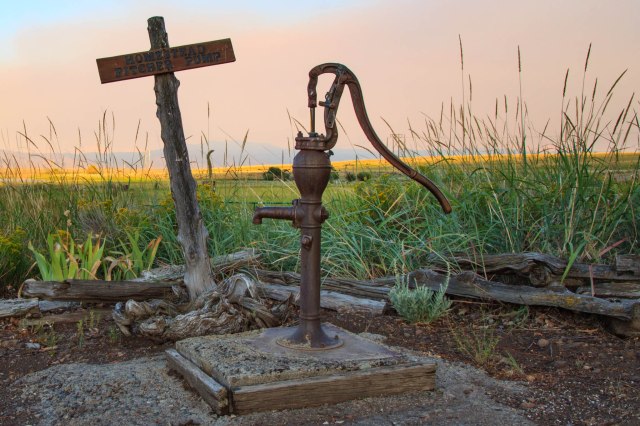
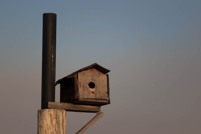
Farm EquipmentHomestead Pitcher Pump. Smoke Rolling into the Valley.Little Birds Flitted In and Out of the Birdhouses
Before leaving the area we headed into town to restock the refrigerator and the pantry. While there, we found a little nature trail that circled up a hill at the city park. We didn’t make it through the entire trail because at one point bushes grew over the trail. I wasn’t about to blaze the trail with bare legs and arms. Before heading back down, we enjoyed the view.
Town of Lakeview
We bought a bag of limes and other items from the smallest Safeway I had ever seen. We then drove to Goose Lake. There is not much there except a state park that would be a good spot for an overnight, but not much longer. Smoke from a fire in Alturas blew in overnight raining ash even though we were an hour away.
Contraband Confiscation
On July 29, 2017, we turned the wheels toward Graeagle, California, our next stop. Smoke grew thicker as we continued on Highway 395 and approached Alturas, California. We slowed and stopped at the California Agriculture Inspection. The woman greeted us with the usual questions of where we had stayed and then said she had to look inside our trailer. What? We’ve never had that happen before. After her grand tour, she stepped out of the trailer carrying our newly purchased bag of limes. Really? The limes we purchased yesterday from Safeway? Safeway had probably transported the limes into Oregon from California, now California Agriculture was confiscating them? Note to self, when traveling from Oregon into California, don’t carry any citrus products.
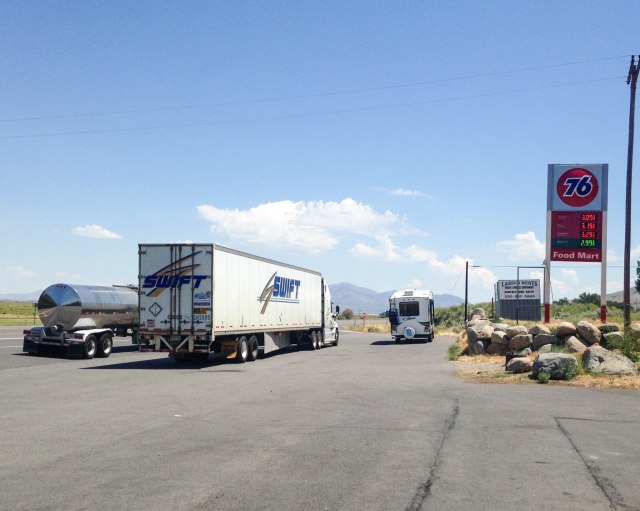
About ten miles from the crappy rest stop with pit toilets and some kind of water feature, the skies turned blue and clouds became visible. We stopped in Herlong, California, at a The Mark mini-mart and 76 Station for fuel and as a bonus purchased fresh made-to-order deli sandwiches. Be aware the sandwiches are huge. They also sold the usual pizza and fried food, such as corn dogs, chicken, and burritos. The picnic table inside and the one outside were both filled with people chowing down their lunch, so we stood next to a retaining wall, which was the right height for eating our sandwiches. When driving on Highway 395 we recommend a stop at this 76 station. As you can see there is plenty of room for RVs and semis to park
The Mark Mini-Mart and 76 Gas Station
Moving West RV Resort
We arrived at Moving West RV Resort and they assigned us one of the best spots in the park. The fifth wheel fit snuggly among a stand of trees. On the curbside was a large grassy area with a triangle tarp for afternoon shade and a newly installed redwood fence along the dusty lane, which rarely saw a vehicle pass.
Moving West Campsite
Raptor Adventures
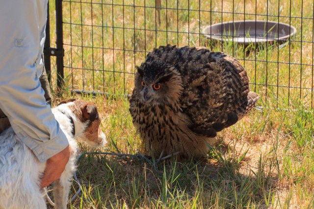
The reason we stopped at Graeagle was so Jon could take advantage of his Christmas present, a Raptor Adventure with Jim Tigan. How wonderful to be up close with Louise the owl,
Louise the OwlMy What Large Eyes You Have
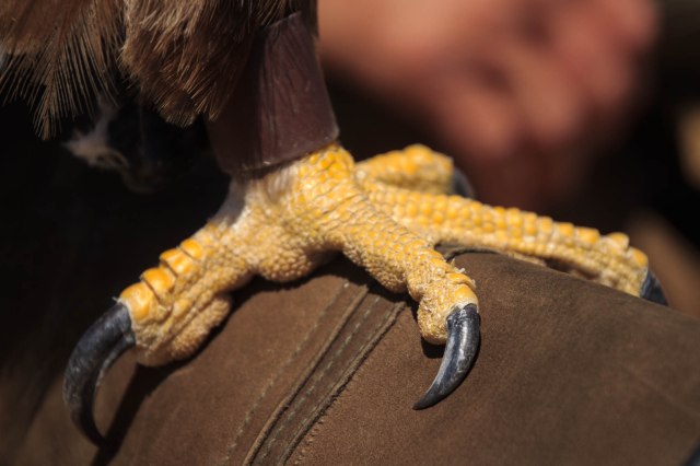
Fifi the golden eagle,
Fifi the Golden EagleCheck Out Her TalonsOkay, I Posed. Now, Where’s My Meat?Soft Feathers
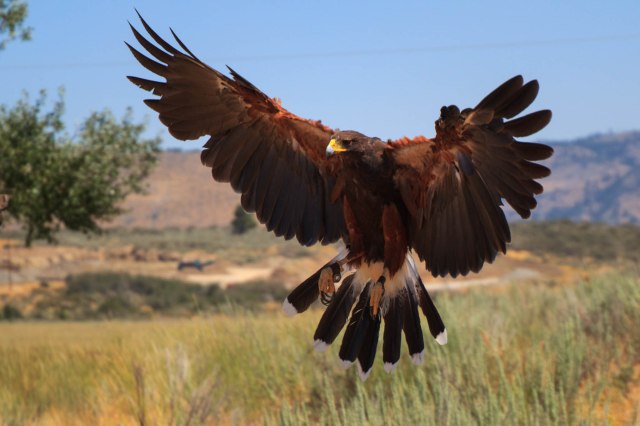
and go for a walk with Sonia the Harris hawk.
Sonia the Harris HawkLook at My Wing Span
The owl didn’t much care for Bonnie, the new terrier that joined the family two weeks earlier. Louise ruffled her feathers and hissed at the little dog. Bonnie was more curious than scared of the owl.
Get Back Dog
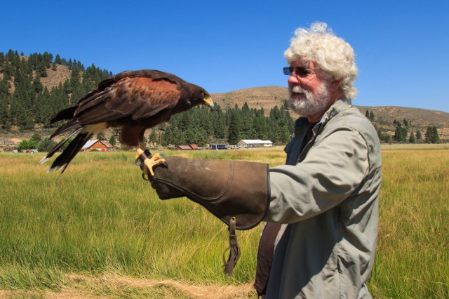
Although apprehensive at first to be nose to beak with the birds, Jon warmed up and was soon talking to them like he would an old dog. He petted their soft feathers and felt them breathe under his hand. The birds were so sweet and docile, soft to the touch, yet they possessed strong talons.
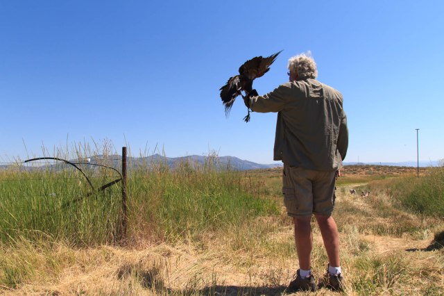
Jim taught Jon how to call Sonia from her perches, land on the glove, and peck at the meat he held in his hand.
Sonia Soars From Her PerchWatch Out. Coming in for a Landing.Whew! Made it.Meat Please
I even got a chance to feed Sonia. She was so light she didn’t jostle my arm when she landed or when she plucked at the piece of meat I held in the space between my gloved thumb and first finger.
We always marvel at these creatures whenever we see them atop electric poles searching for their dinner or in the sky coasting on thermals with their wings spread wide. We appreciate their magnificence even more after meeting them up close and personal.
To see a PBS program about Jim and his birds, click here. To see a Youtube video of best friends Annabelle the dog and Louise the owl click here.
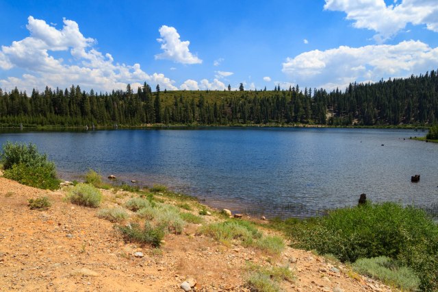
Madora Lake
The next day we took a hike to Madora Lake. We saw signs the trail was under construction, but no one was working that day. In places, large rocks edged the trail and fine gravel filled the space between the edges.
Madora Lake TrailCome On. Let’s See Where This Bridge Goes.Madora Lake TrailOne of the Few Places to See the Lake
Eureka Lake
We next drove to Eureka Lake on a dirt road for 1.3 miles and hiked up a trail until we had broken through the tree line. From the side of the mountain, the view gave us the feeling that we were on top of the world.
Alpine Eureka LakeHeading Down the Trail
A cold Frostee was in order after our drive and hikes.
Make Mine Cherry
On Tuesday, August 1, 2017, we put the adventures and miles behind us and turned the truck toward home. We’ve seen wonderfully beautiful mountains during our travels these past few months, but Donner Pass on Highway 80 in California had to be one of the best with its high cliffs that rise above the freeway and rushing river that flows not far from the road. As we dropped down into the Central Valley, blue skies and puffy white clouds gave way to gray haze and smog. Temperatures nearing 100 degrees and a spare-the-air day welcomed us home to the San Francisco Bay Area.
Stay tuned for our next adventure to Southern Utah and Northern Arizona where we gazed down at the hoodoos of Bryce, up at the cliffs of Zion, and across the Grand Canyon from the North Rim.
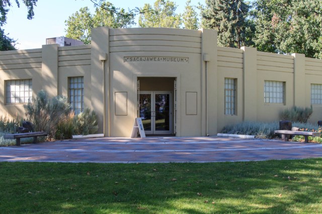
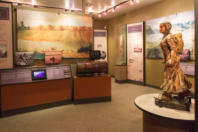
The museum tells the story of Sacagawea, her husband, and the Lewis and Clark expedition near the site where the party made camp for two nights at the confluence of the Snake and Columbia Rivers while traveling to the Pacific Ocean. Other displays include the stories of the Native Americans who resided in the area.
Sacajawea Interpretive Center
Why the different spelling of the Shoshoni woman? Recent research and study of the original journals indicate the proper spelling and pronunciation with a hard ‘g’ not a ‘j.’ The name of the state park kept the original spelling.
Sacajawea State Park
Besides the Sacajawea Center, the 257-acre day-use park includes two boat ramps, fishing, swimming, boating, and 1.2 miles of hiking trails.
View of Rail Bridge from Sacajawea State Park
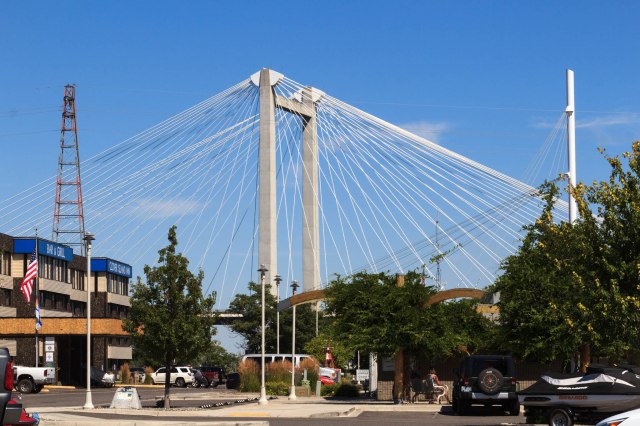
We made one more visit to the Ice Harbor before we left the area. This time we opted for the Clover Island Marina location, which is an upscale version that includes a more inviting building, more food selections, and the same great beer.
Ice Harbor Brewing Company at the MarinaCable Bridge
The American Empress came into view near the harbor so I managed to snap this photo between the trees. I wish I could have gotten the paddle wheel. The steamboat vessel cruises the Columbia and Snake Rivers along the Lewis and Clark trail.
Glimpse of American Empress
After spending the past couple of weeks in noisy locations near or on major highways and freeways, we craved a quiet place. We made reservations at Crooked River Ranch RV Park near Redmond, Oregon and crossed our fingers that it would satisfy our craving.
On to Oregon
On Sunday, July 23, 2017, we followed the Columbia River through golden cliffs, rivers the width of small lakes, windmills on top of cliffs, a few farms, of course, and Mount Rainier poking his snowcapped peak above the terrain. In Washington, the air had a smoke haze look to it, but cleared as we entered Oregon. At one point, we could see the snowcapped peaks of Mt. Rainier, Mt. Hood, Mt. Jefferson, and the Three Sisters. What a sight.
When we arrived at Crooked River Ranch RV Park, we were pleased to find that for at least three nights we would be far from any major roads.
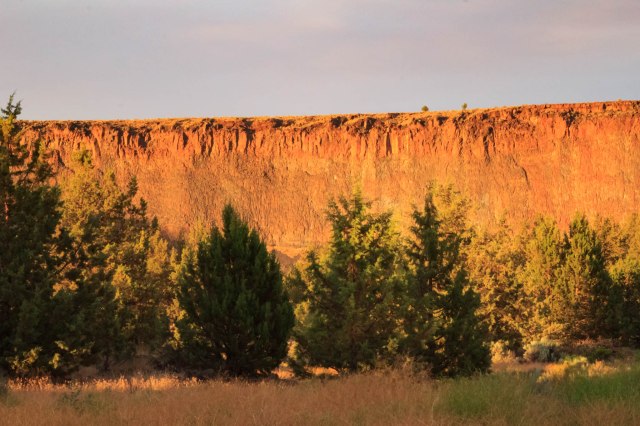
Sunset View of Cliffs from Crooked River Ranch
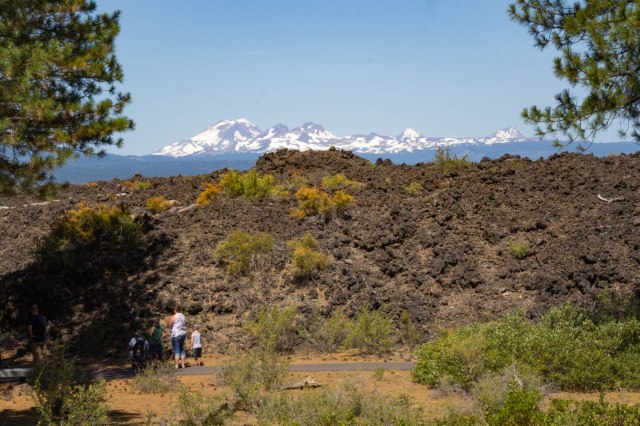
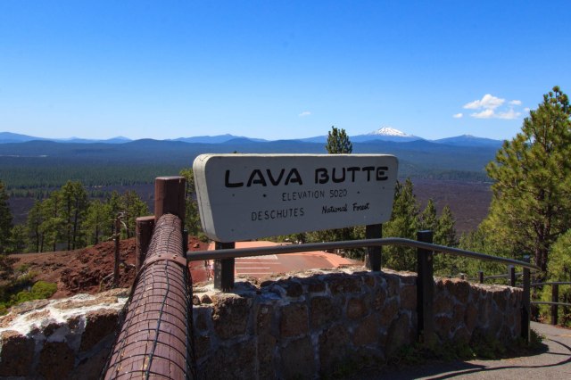
Newberry National Volcanic Memorial Park
The next day we visited the Newberry National Volcanic Memorial Park. We arrived just in time to hear a ranger talk on the geology of the park. Afterward, we took a hike with him partially up Lava Butte, a cinder cone, where he pointed out examples of what he had discussed on the patio.
Lava Butte Kind of Looks Like a Dinosaur Back
Path Around the Lava Flow
A shuttle bus took us to the top of Lava Butte where there were magnificent views of the valley below and peaks to the west. The lava flow reminded us of Craters of the Moon in Idaho.
Lava ButteView From Atop Lava Butte
Lava Butte erupted 7,000 years ago creating a 9 square mile lava flow. Besides Lava Butte, visitors can see Lava River Cave, Big Obsidian Flow, and Paulina Falls and Paulina Peak, which rises 7,984 feet. Hikers, horse riders, and bicyclists can enjoy the many trails within the park that range from easy to difficult. Several tent campsites are available in the Newberry Caldera and East Lake has one RV campground with 45 sites, all of which are reservable, while the tent sites have some first-come-first-served sites.
Sisters Oregon
We also visited Sisters, Oregon, a small town of less than 2 square miles and a population of 2,038 as of the 2010 census. We found Sisters a quaint little town with plenty of stores to keep any shopper busy, restaurants to satisfy hunger, and places to rest at night.
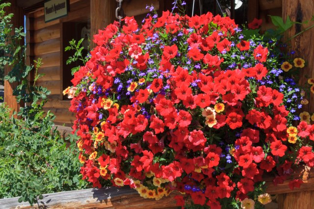
Sisters MarketBaskets of Petunias Hang from LightpostsLoved the Restored BuildingsFor Cooking Equipment and Utensils, Stop in at The Cook’s NookIt was Too Early in the Day to Grab a Cold One at Sisters Saloon
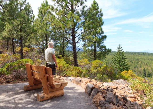
A small park with a couple picnic tables was the perfect place for us to eat our packed lunch before heading to the Whychus Creek Overlook Trail.
View from Whychus Creek Overlook Trail
Whychus Creek Overlook
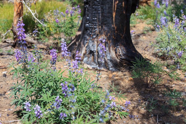
Continuing down the road, we came across a burned out area giving way to views of the peaks.
Peaks Rise Above a Burned Out AreaNaked Trees Against Blue Skies and CloudsSigns of Forest Rebirth
On our way back to Crooked Ranch, we drove by alpaca grazing in a field.
Alpaca Grazing in a Field
There are a total of four alpaca farms in the Bend, Oregon, area. We come across a lot of cows and cattle in our travels, but this was the first time we saw alpacas.
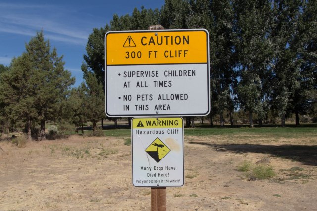
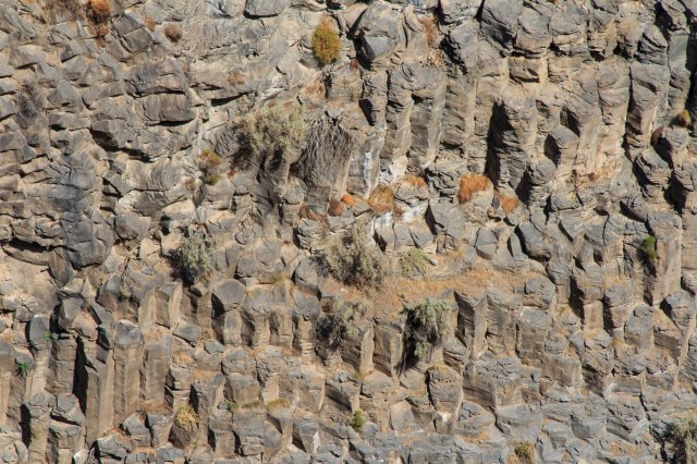
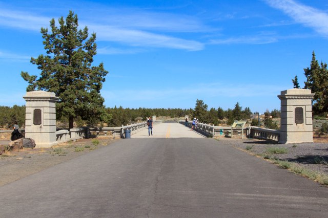
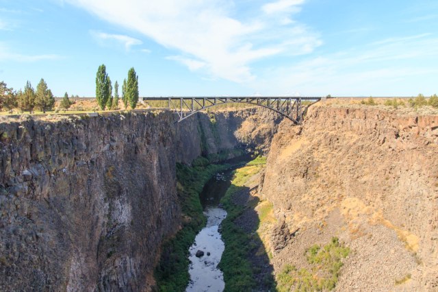
Peter Skene Ogden State Scenic Viewpoint
We stopped in at the Peter Skene Ogden State Scenic Viewpoint in Terrebonne, Oregon. The viewpoint includes views of basalt cliffs, river, and peaks along with the closed Rex T. Barber Veterans Memorial Bridge. Several signs warn visitors to watch children at all times and leave pets in the car.
Keep Children and Dogs Safe
Rex T. Barber Veterans Memorial Bridge U.S. Highway 97Detail of Cliffs at Peter Skene Ogden State Scenic ViewpointView From Top of Cliff Down to RiverCrooked River High Bridge Built in 1926 Now Closed to TrafficTrunk Railroad BridgeCanyon Below Trunk Railroad Bridge
The night before leaving Crooked River Ranch, smoke drifted into the valley creating a spectacular sunset view of the hills and sky beyond the bridge.
Rex T. Barber Veterans Memorial Bridge U.S. Highway 97
Next up we continue searching for out of way places and Jon redeems a Christmas gift.