Our 2014 Pacific Northwest adventure continued on May 6 as we headed south and a bit east toward Central Point, Oregon. We had stopped at the KOA in Central Point on our way north to Washington State. This time we planned to stay a few days so Jon could reconnect with an old friend from high school.
About 15 miles north of Grants Pass, we noticed a covered bridge near Interstate 5, so we had to stop to have a look. Covered bridges are not a common sight in our home state of California.
Grave Creek Bridge
The Grave Creek Bridge in Josephine County was built in 1929 and once carried traffic from U.S. Route 99, the Pacific Highway. In 1979 the bridge was added to the National Register of Historic Places. Closed in the late 1990s for repairs, it reopened in 2001. The 105-foot Howe truss bridge includes six Gothic windows on each side, rounded portals, and a shake roof.
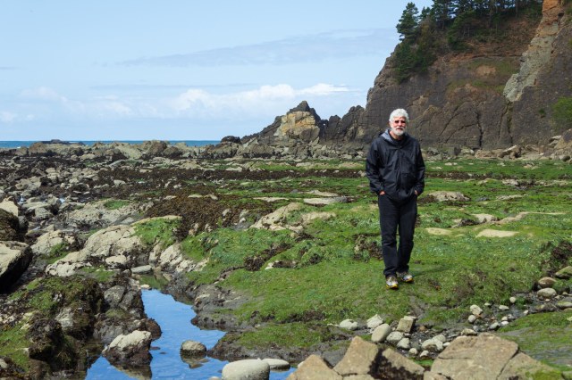
Jon connected with his friend, and we enjoyed a dinner with him and his wife. They recommended the Upper Table Rock trail for a bit of exercise and a fantastic view of the Rogue Valley from the volcanic rock plateau. The clear skies and warmer weather were welcomed as we walked through the trees that towered above the trail on either side.
Upper Table Rock Trail
Wildflowers dotted the terrain here and there with their blossoms tracking the sun. Pacific Madrone trees along with California black oak, Douglas fir, and incense cedar provided shade for hikers and homes for the birds and rodents that live in the area.
Ookow wildflowerUnidentified hairy flower. Does anyone know its name?
Pacific Madrone trees
Daisy-like flower
I always find it interesting to learn about the geology of a place. The Upper and Lower Table Rocks brochure tells the story that began 7.5 million years ago when a shield volcano (similar to Kilauea and Mauna Loa in Hawaii) erupted.
Upper Table Rock plateau with basalt showing through the grass
The volcano’s lava spread over the entire valley causing the valley floor to rise 800 feet to the height of the plateaus. Over millions of years, the ancient Rogue River eroded and carved out 90 percent of the lava rock, leaving the rich valley, a few monoliths, and the two horseshoe-shaped mesas known as Table Rocks.
The Rogue Valley
As I stood back from the edge of the mesa, I tried to imagine the valley filled with lava rock. It must have looked similar to Craters of the Moon National Monument in Idaho. Then I tried to image a river flowing so powerfully to clear out the basalt. It’s the same old geological story of building up and breaking down. It makes me wonder what Craters of the Moon might look like in a few million years.
View of Lower Table Rock from Upper Table Rock
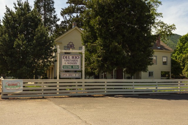
After our hike, we stopped in at the Del Rio Winery for a tasting and to see if they had a bottle of something we might enjoy.
Del Rio Winery
The tasting room is located in Gold Hill in the historic Rock Point Stage Hotel. Constructed in 1865, the hotel, as noted on their website, has quite a history of ownership.
Del Rio Vineyards
The winery offers both red and white varietals, a picnic area for visitors to use, and concerts during the summer.
Next up we continue our 2014 tour and make a stop in Eureka, California.
Our mini-vacation in Victoria, B.C. came to an end, so we boarded the ferry and returned to the rainy cold weather in Port Angeles, Washington. On May 1, 2014, we headed south in search of sunny skies. We weren’t sure how much sun we’d see, though. The Oregon coast is known more for its foggy and wet weather. We selected the Astoria Seaside KOA for a two-night stay.
Astoria, Oregon
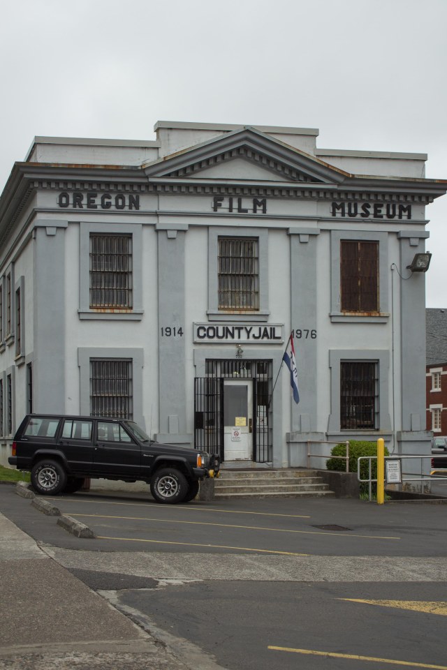
The Goonies is one of my favorite movies and I’m not ashamed to say so. There’s a sentimental reason for my selection, but today is not the day to spin the tale. I can say that when visiting Astoria, all dedicated fans of the movie must visit the Oregon Film Museum. The movie was filmed there, after all.
The museum is housed in the old county jail, which was used as a movie set not only for The Goonies but Come See the Paradise and Short Circuit. Inside, visitors will find exhibits and galleries where they can learn the movie-making craft by producing their own movie. One gallery is dedicated to all things Goonies and, of course, there is a museum store.
Is that the Fratelli’s Jeep Cherokee from The Goonies?
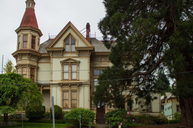
Across the street from the museum stands the Captain George Flavel House Museum. The house, constructed in 1885 in the Queen Anne style, was listed on the National Register of Historic Places in 1980. We weren’t able to tour the home during our visit, but I sure want to in the future. While conducting research, I came across interesting stories about Captain Flavel, his descendants, and the home’s restoration while conducting research. Now I want to walk through the rooms where these people lived to feel what it’s like to live a Victorian home.
Captain George Flavel House Museum
Lewis and Clark National Historical Park
We made it into the visitor’s center at the Lewis and Clark National Historical Park by dodging raindrops. While we waited for a cloud burst to pass by, one of the volunteers pointed out places on a map for us to explore. Armed with our rainproof hoodies and umbrellas, we ventured out onto the soggy trail.
The replica of Fort Clatsop gave us an idea of how the Corps of Discovery spent their winter from December 1805 to March 1806. It must have been a cold and wet place to settle in the early 1800s.
Fort Clatsop replica
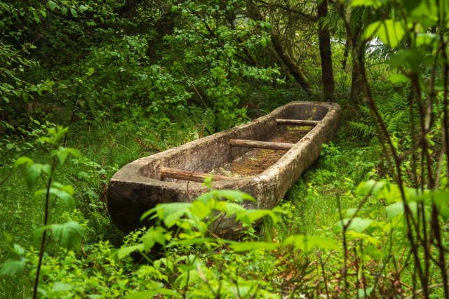
The replica dugout in the photo below depicts one of three the Corps used when they left Fort Clatsop on March 23, 1806, along with four Indian canoes they bought, and another one they found.
Replica of a dugout the Corps of Discovery may have used
Visiting the Lewis and Clark National Historical Park inspired us to incorporate additional Lewis and Clark historical sites in our future trips. We have ticked off two spots. This one in Astoria, and the Sacajawea State Park and Interpretive Center in Pasco, Washington, which is included in our “Tri-Cities Wrap Up and On to Oregon” post. Only 14 states left for us to explore out of the 16 located along the Lewis and Clark National Historic Trail. Under the 2019 John D. Dingell, Jr. Conservation, Management, and Recreation Act, the trail was extended 1,200 miles to Pittsburg, Pennsylvania. Hope we’re back on the road again soon so we can get started.
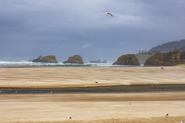
We continued south from Astoria to Seaside, Oregon. Seaside is where the Corps produced salt needed to preserve meat. Due to the inclement weather, we didn’t venture out to the Salt Cairn, but we did make it to Cannon Beach to see Haystack Rock. I was only able to capture an obscured view in the photo below. The fog hung so close to shore it reduced visibility to only a few yards.
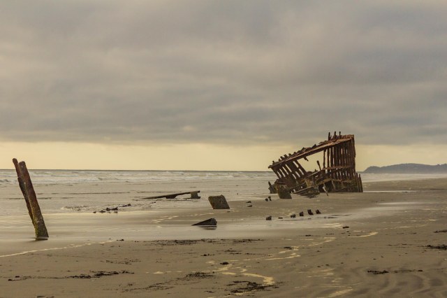
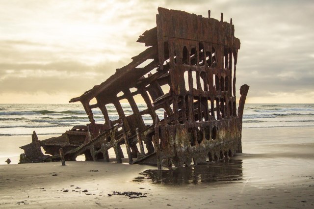
Then it was back up the peninsula to Fort Stevens State Park where we walked to the beach. I thought it strange to find the remnants of the Peter Iredale shipwreck. The four-masted steel sailing vessel ran ashore on October 25, 1906, and there she rested on the beach 108 years later at a point along the Graveyard of the Pacific.
Peter Iredale shipwreck
The Peter Iredale is but one of more than 2,000 shipwrecks that have occurred along the northwest coast from Tillamook Bay to Cape Scott Provincial Park on Victoria Island.
Peter Iredale shipwreck
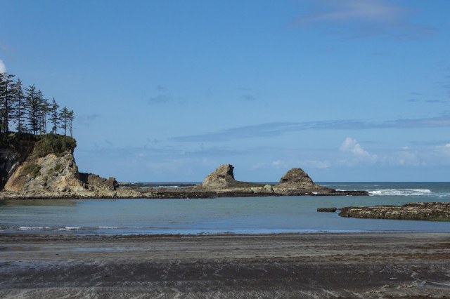
I missed capturing Haystack Rock but took home the next shot as a consolation photo. Unfortunately, I have no idea exactly where the photo was taken, somewhere along the Oregon coast between Astoria and the Waldport/Newport KOA, where we stayed for one night in gale-force winds.
Rocks on the shoreline
Coos Bay and Cape Arago
Coos Bay was our next stop for two nights where the highlight of our visit was exploring Cape Arago.
Overlook along Cape Arago HighwayTide Pools along Cape Arago Highway
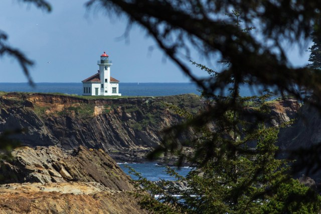
The lighthouse that remains on Chief’s Island, was the third lighthouse built. An original lighthouse met its demise in 1936, a keeper’s duplex and the second lighthouse were razed in 1956 and in the 1960s, respectively. Also, a bridge from the mainland to the station was removed to prevent unauthorized access and restore the shoreline to a natural state.
Cape Arago Lighthouse from Sunset Bay Trail
The Coast Guard signed over twenty-four acres of land including Chief’s Island to the Confederated Tribes on August 3, 2013. Under the terms of the agreement, the tribes are required to make the light station available to the general public for cultural, educational, recreational, and historic preservation purposes. Apparently, the Confederated Tribes plan on developing an interpretive center, but a quick search did not reveal anything available for visitors as of July 2019.
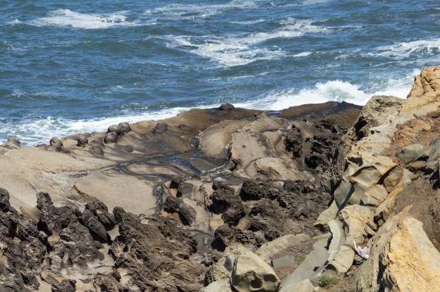
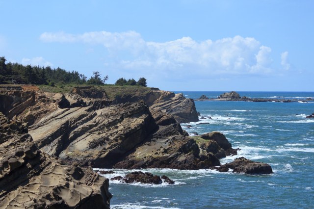
Along the highway are places to get out of the car and view the rocky cliffs and beaches.
Rock formations along Cape Arago HighwayUplifted Rock Formations along Cape Arago Highway
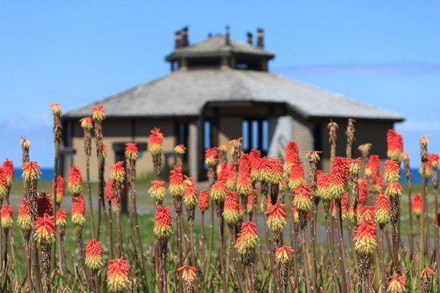
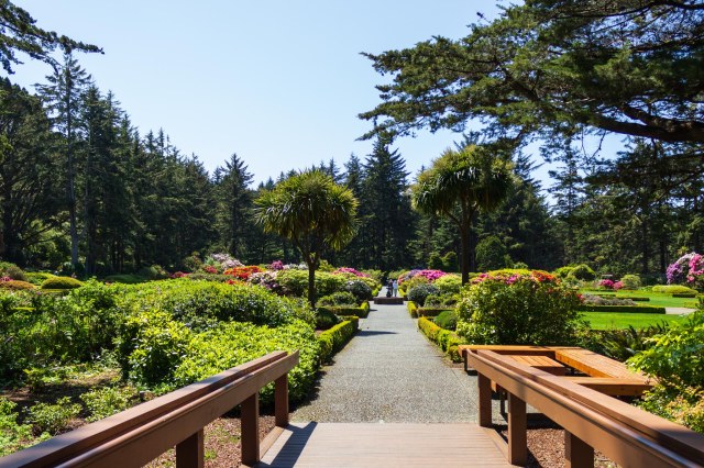
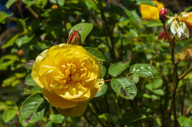
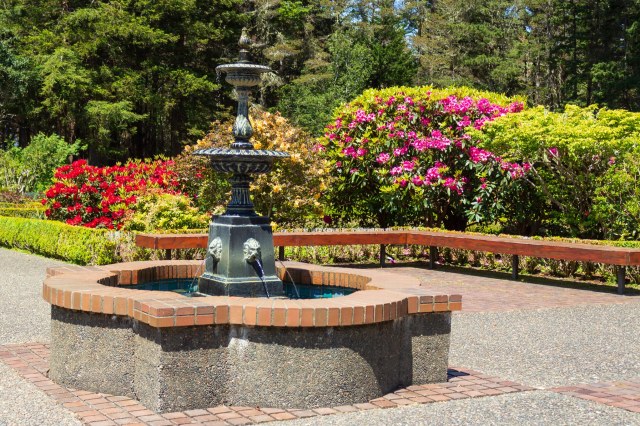
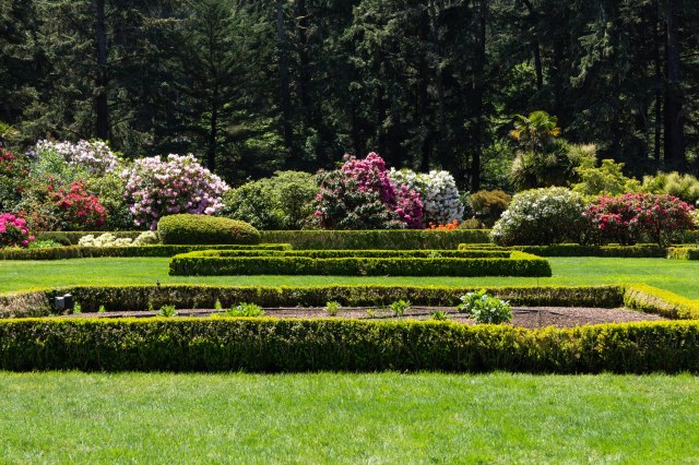
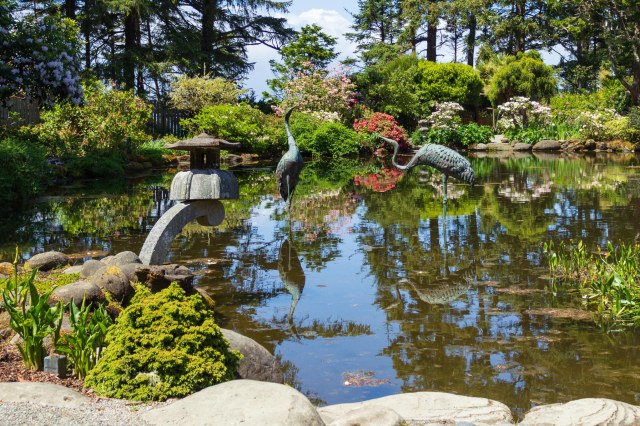
Then there is the Shore Acres State Park. The park began with the 1942 purchase of the Louis J. and Lela G. Simpson’s oceanfront estate and formal garden. Additional acquisitions expanded the park boundaries to its current size. In 1970, garden restoration efforts began, returning the garden to its earlier grandeur.
Kniphofia Papaya Popsicle or Red Hot Pokers in front of the Shore Acres Observation BuildingShore Acres GardenYellow RoseWater FountainRock RoseGarden delightsHeron sculptures in the Lilly pondDoes anyone know what kind of trees these are?Shoreline view
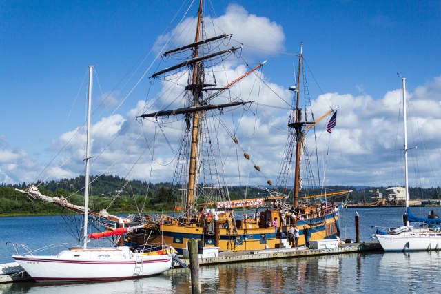
Back in Coos Bay, we checked out the Boardwalk. The Lady Washington was docked next to a couple of smaller and more modern looking sailing craft.
The Lady Washington Tall ShipThe Lady Washington
The Lady Washington and the Hawaiian Chieftan tall ships offer 3-hour tours when in the harbor. These replicas of historic ships travel the coasts of Washington, Oregon, California, and B.C. The crew let us on board to walk around the deck before they shut down for the day. But it was too late for a tour.
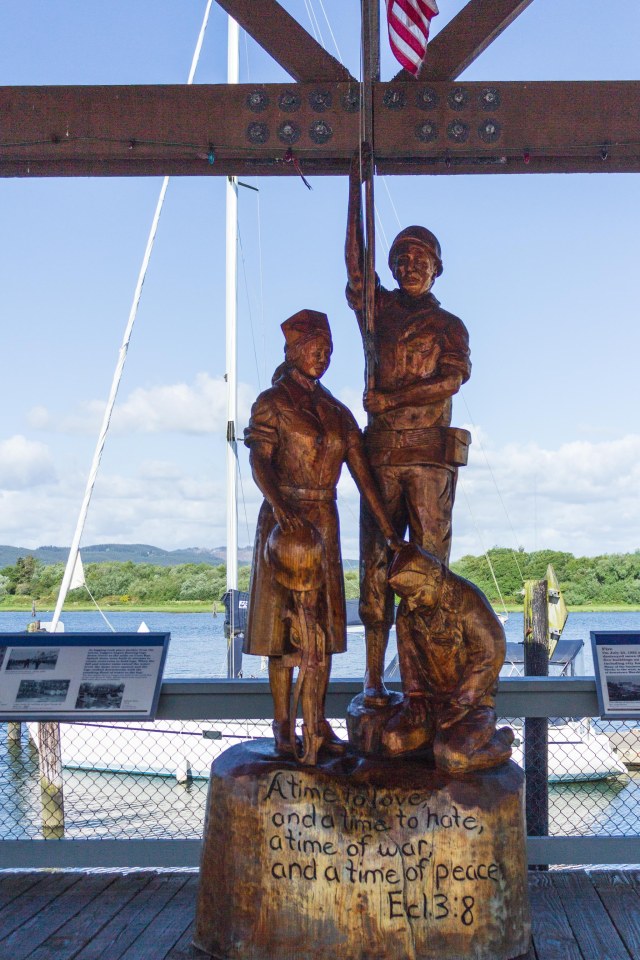
Also on the boardwalk, we found this sculpture as a tribute to veterans.
Ecclesiastes 3:8 calls for a time to love and a time to hate, a time of war, and a time of peace
It would be my preference that there was never a time for hate or war. Unfortunately, since hatred and war have been in the world since the beginning of time, I doubt my dream will ever occur.
Next up: We stop at the Central Point KOA again to take in a hike and taste a bit of Oregon wine.
After we had our fill of all things tulips, we headed across the bay to the Port Angeles KOA. They had opened a few days before our arrival at the end of April 2014 and were still in the process of completing maintenance projects.
Port Angeles KOA campsite
It wasn’t the finest KOA we had stayed at but the pretty wildflowers in bloom were a bonus. Since we were leaving the trailer for a night and taking the ferry to Victoria B.C., it suited us fine.
Dandelions and Daisies
Their website now lists the campground as a Journey classification, they have new camp hosts and updated amenities. Although they are open year-round, amenities and the number of sites during winter are limited.
While in Port Angeles, we had time to explore a small bit of the Olympic National Park. A short distance from U.S. Highway 101 we found Marymere Falls to be an easy roundtrip hike of 1.8 miles.
Marymere Falls Trail
There was no doubt we were walking in a rain forest when we saw tree limbs dripping with lichen, and moss clinging to the trees like a green coat. I expected fairies and gnomes to appear any minute.
Lichen draped like a sweater on tree limbsAn Alder tree (??) dwarfs the bus.
Blue Forget Me Nots and wild white trilliums poked their blossoms up through the undergrowth of sword ferns, while polished roots snaked there way around the base of the trees toward the ground.
Forget Me NotsBridge across rippling watersWhite TrilliumPolished roots, ferns, and moss
The falls weren’t particularly spectacular, surely nothing like Niagara Falls or even Twin Falls in Idaho. But, hey, who doesn’t like feeling the spray on their face or marveling at the power of water flowing into the pool below?
Marymere Falls
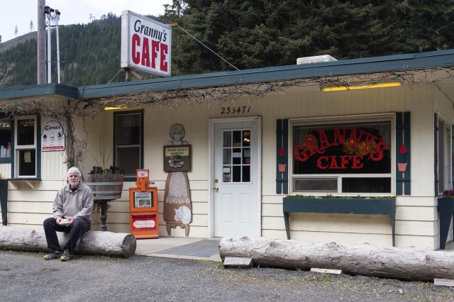
We stopped at Granny’s Café for a home-style meal after our drive and hike. Granny’s history dates back to the 1950s. Their website details how each owner has honored the original vision of the restaurant while adding touches of their own. I’m sure we’d have another great meal there if we visited today.
Granny’s Cafe going strong for over 65 years
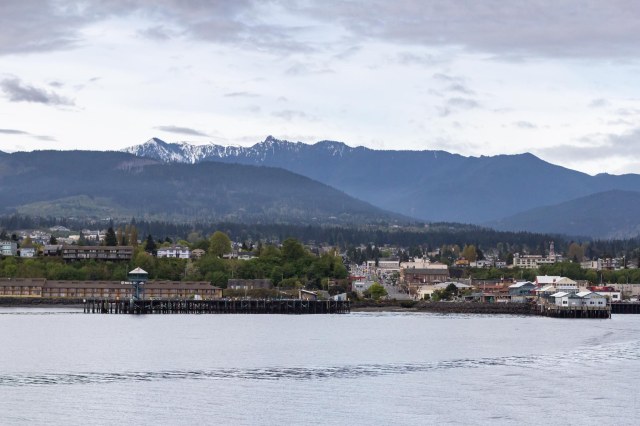
The next day we waved good-bye to the Olympic Mountains and Port Angeles as we ferried to Victoria B.C. We arrived on the first ferry to give us plenty of time for exploration.
Port Angeles, Washington, and the Olympic Mountain Range
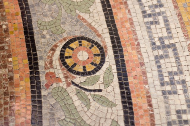
And explore we did. First stop was the British Government Parliament Building for a tour.
Some kind of event in front of the buildingStaircase inside Parliament BuildingTile mosaic floorQueen Victoria Diamond Jubilee Window commemorating the 60th year of her reign from 1837 to 1897
Of course, we couldn’t pass up Afternoon Tea at the Empress Hotel.
The Empress HotelTea at the Empress HotelFresh berries with whip cream was the first course
We walked off our meal around the harbor, through downtown, and took a Dark and Stormy break at the Sticky Wicket.
Wish we had time for a 3-hour sailDave Harris, One Man Band, Victoria B.C.Ferry BoatPlenty of street art to admire“Daddy, you’re home.”“Them some tall tulips, Henry.”McDonald’s everywhere we goThe Sticky Wicket Pub & RestaurantInside Sticky Wicket looking out
Then we went on to Beacon Hill Park, making for a long day and miles of walking. If visiting Victoria with no time to make the drive to Butchart Garden, try Beacon Hill Park as a substitute.
Beacon Hill Park is full of flowers
The garden provides visitors with peaceful surroundings to enjoy the colorful display of flowers, trees, and water features, along with geese, ducks, and blackbirds. Oh, and don’t forget the garden art.
Bouquet of flowers“One o’clock, lady with a camera. Turn to your left. I’ll turn right.”What you lookin’ at?Where have all the fairies gone?Red HibiscusBlue and lavender bell-shaped flowersOkay, yellow tulips, point your faces to the right.Monkey Puzzle tree. Watch your back.DaffodilsWater fountain in the pondOkay, here I come. Who needs a drink of water?
The Royal Scot Hotel & Suites served as our home for the night and boy did we ever have a good night’s sleep after our long day.
Royal Scot Hotel & Suites
We had plenty of time to tour the Craigdarroch Castle the next day before we caught the ferry back to Port Angeles. The Victorian era building incorporates 11th and 12th century southern French, Spanish, and Italian Romanesque elements, all evident by the arches, columns, and towers.
Craigdarroch Castle would make a great setting for a murder mysteryInlaid tiles and woodFireplace detailStained glass window
When I heard that the man who built the castle between 1887 and 1890 was Robert Dunsmuir, I thought about the Dunsmuir House in Oakland, California, which we had visited years ago. Could there be a connection? Yes, indeed. Robert’s son Alexander Dunsmuir built the house in Oakland for his bride Josephine. Unfortunately, Alexander never lived in the Oakland home. He died in New York while on his honeymoon with Josephine who died two years later.
Information about Craigdarroch Castle can be found here.
Next up we continue looking back on our 2014 Pacific Northwest adventure as we turn south along the rugged Oregon coastline.
Our look back on our 2014 Pacific Northwest trip continues with our arrival at the Burlington/Anacortes KOA on April 23.
Our campsite at Burlington KOA
It looks like we had the place to ourselves. We did at first. Then the rain came. And then other travelers came with their trucks and campers, fifth wheels, trailers, and motorhomes. Outside our dinette window, we watched as pets and their owners ventured out to take care of business, protected by hooded jackets and umbrellas.
We shook our heads when two large German shepherds jumped out of a camper followed by their humans and wondered how they all fit in such a small space. We could barely ward off claustrophobia in our 23’ trailer. Having to share with a dog or two was out of the question. Maybe we should have opted for the model with the slide.
Everyone gets into the tulip spirit in Skagit Valley. I found these in the gardens around the KOA park during a walk in between the drizzles.
Five tulips and a daffodil
The next day we hit the roads in search of the fields and fields of tulips. What we found were fields of wet earth newly turned under, fields of green plants with the blossoms lopped off, and fields that still bloomed bright under the dark skies.
Tulip farmTulip field
Tulip Town and RoozenGaarde are the main growers in Skagit County, planting the majority of the 450 acres of tulips in the valley. RoozenGaarde is open year round. At their 3-acre show garden, they plant three hundred thousand spring-flowering bulbs.
Tulip Town Windmill
Tulip Town is open from March 30 through May 1. They dedicate about 10-acres of farmland to tulips in a rainbow pattern. Hop on the trolley for a ride through the fields. An International Peace Garden is also on display as is a windmill. Inside is an indoor flower and garden show, which allows visitors to get their tulip fix even when rain falls from the sky. Wander around and enjoy the art and gift shop or buy a bulb or two or twenty to display in your yard.
Tulips, and tulips, and more tulips
Skagit Valley Tulip Festival runs the entire month of April with activities throughout the county. Don’t miss the Downtown Mount Vernon Street Fair held on the third weekend in April.
Downtown Mount Vernon Street Fair
If going, pick up a Skagit Valley Tulip Festival brochure at tulipfestival.org. Knowing when and where the events occur will ensure arrival at the best time.
Music, music, everywhere at the street fair.
Vendors and artists of all kinds display their wares at the Street Fair. Jon bought his first Big Skinny wallet at the fair. I bought a beanie, and the Chinook salmon he is holding in the photo below swims around in one of our empty raised beds.
Do you Chinook, Chinook?
Jon stopped planting a vegetable garden when we started traveling so much. No sense doing all that work just to see it all go to waste when we leave.
Musical Band at Downtown Mount Vernon Street Fair
We took a drive along the Chuckanut Scenic Highway (WA 11) to Bellingham one day, which has great views of the sound and San Juan islands.
View across the sound from Chuckanut HighwayBellingham street scene
While we were in Bellingham, we found the Whatcom Falls Park. Referred to as the Picnic Ground in the 1890s the park grew to its 241 acres by the 1930s through the generosity of local philanthropists, volunteers, donations, and federal grants.
Overlooking the Whatcom Creek FallsWhatcom Creek FallsStone bridge built in 1939 of Chuckanut sandstone arches reclaimed from a burned-out building.Moss and roots make for an interesting formation.
In Fairhaven Historic District, we came across the 1924 Zodiac Sailing Schooner. Top on my list of things to do during my next visit to Skagit Valley is a cruise throughout the San Juan Islands on the tall ship. Choose a sailing cruise ranging from a few hours to multiple days. Sign me up for the 3-day history or maybe the 4-day lighthouse tour.
1924 Zodiac Sailing Schooner
I can hear the flap of the sails and feel the spray on my face just thinking about the tall ship slicing through the waters.
At Marine Park, we couldn’t beat the view across Bellingham Bay toward Lummi and Portage islands. It was the perfect setting for our picnic lunch, especially when the train passed by.
Marine Park
Before we left Burlington, we made a trip to Camping World to pick up some kind of gizmo for the trailer. “Hey, let’s take a peek at their trailers,” I said.
So we did. The Cougar half-ton towables looked nice. “But, wait, what about the fifth wheels? We never did look at those when we bought the Aluma-Lite.”
As we drove back to the KOA Jon asked, “What do you think of the one with the kitchen in the rear?”
“It sure had a lot of counter space, plus a couch and a swivel recliner where we can sit, not just a dinette like we have now. And we wouldn’t have to get dressed in the living area.”
“We’d have to buy a new truck.”
And so the next day we headed to our stop in Port Angeles, with the Cougar brochure tucked safely in my backpack.


 Pacific Madrone trees