
Our 2014 Pacific Northwest adventure continued on May 6 as we headed south and a bit east toward Central Point, Oregon. We had stopped at the KOA in Central Point on our way north to Washington State. This time we planned to stay a few days so Jon could reconnect with an old friend from high school.
About 15 miles north of Grants Pass, we noticed a covered bridge near Interstate 5, so we had to stop to have a look. Covered bridges are not a common sight in our home state of California.

The Grave Creek Bridge in Josephine County was built in 1929 and once carried traffic from U.S. Route 99, the Pacific Highway. In 1979 the bridge was added to the National Register of Historic Places. Closed in the late 1990s for repairs, it reopened in 2001. The 105-foot Howe truss bridge includes six Gothic windows on each side, rounded portals, and a shake roof.
Jon connected with his friend, and we enjoyed a dinner with him and his wife. They recommended the Upper Table Rock trail for a bit of exercise and a fantastic view of the Rogue Valley from the volcanic rock plateau. The clear skies and warmer weather were welcomed as we walked through the trees that towered above the trail on either side.

Wildflowers dotted the terrain here and there with their blossoms tracking the sun. Pacific Madrone trees along with California black oak, Douglas fir, and incense cedar provided shade for hikers and homes for the birds and rodents that live in the area.


 Pacific Madrone trees

I always find it interesting to learn about the geology of a place. The Upper and Lower Table Rocks brochure tells the story that began 7.5 million years ago when a shield volcano (similar to Kilauea and Mauna Loa in Hawaii) erupted.

The volcano’s lava spread over the entire valley causing the valley floor to rise 800 feet to the height of the plateaus. Over millions of years, the ancient Rogue River eroded and carved out 90 percent of the lava rock, leaving the rich valley, a few monoliths, and the two horseshoe-shaped mesas known as Table Rocks.

As I stood back from the edge of the mesa, I tried to imagine the valley filled with lava rock. It must have looked similar to Craters of the Moon National Monument in Idaho. Then I tried to image a river flowing so powerfully to clear out the basalt. It’s the same old geological story of building up and breaking down. It makes me wonder what Craters of the Moon might look like in a few million years.

After our hike, we stopped in at the Del Rio Winery for a tasting and to see if they had a bottle of something we might enjoy.
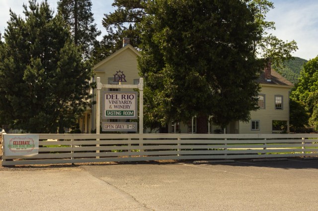
The tasting room is located in Gold Hill in the historic Rock Point Stage Hotel. Constructed in 1865, the hotel, as noted on their website, has quite a history of ownership.

The winery offers both red and white varietals, a picnic area for visitors to use, and concerts during the summer.
Next up we continue our 2014 tour and make a stop in Eureka, California.
Safe Travels

Sadly, one of the few covered bridges in California burned during the “Camp Fire” in the Paradise area last November. The bridge was a landmark there for a very long time.
LikeLike
So sad. So much much loss. It’s hard to fathom the destruction of an entire town.
LikeLike
Love the Grave Creek Bridge! Seems like a fun trip and you can’t go wrong with a winery! Thanks for sharing 😊
LikeLike
Glad you enjoyed the ride along, Bel. Thanks for your comment.
LikeLiked by 1 person