Heading Home with a Stop in Sparks, Nevada

Traveling without confirmed reservations or any idea where we’ll stop makes me nervous. For some reason, I felt a sense of freedom not knowing where we would land when we left Cortez, Colorado, on Tuesday, June 4, 2019. We were just heading toward Sparks, Nevada, and when we got tired, we’d stop.

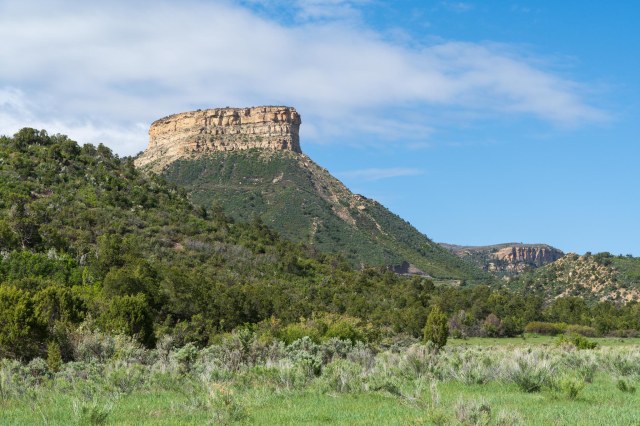
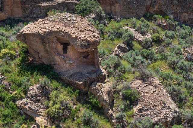
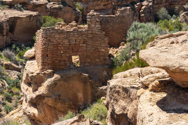
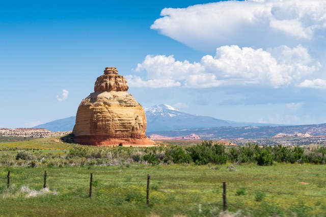
Our route led us through farmland and canyons and one particularly interesting sight. This bulbous sandstone formation stood in the middle of a field all by itself.

Church Rock on U.S. 191 in Utah

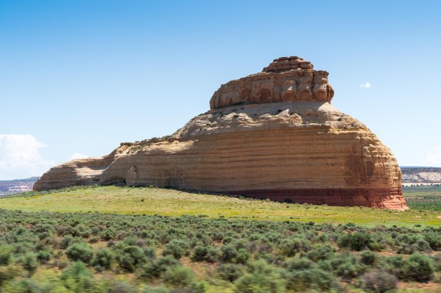
To demonstrate how one perspective can differ from another, look what was behind.

Church, Beehive, Whale? What do you see?

A search on Wikipedia reveals a myth about how the formation earned its name, in case you are interested.

I’ve read many a blog post on Moab and Arches National Monument, but never got the impression the bustling town was more than a gas station and a convenience store. With over 20 RV parks and campgrounds, it was clear the population of 5,250 swelled with visitors during the spring and fall seasons. Too bad we couldn’t join them and fit in a hike or two in Arches.

We passed up a few eating establishments through town because they lacked enough space for us to easily park. Then, at the edge of town, we saw it. A Denny’s sign. With plenty of parking next door. This was our last chance until we hit the next town, which was hours away. I had not eaten at a Denny’s for over twenty years. My expectations for a quality lunch were extremely low.

When our server set down our plates piled high with old-fashioned grilled hamburgers including all the trimmings, I tucked away my restaurant snobbery and dug in. Even the salad tasted like the cook had freshly picked the ingredients from the garden.

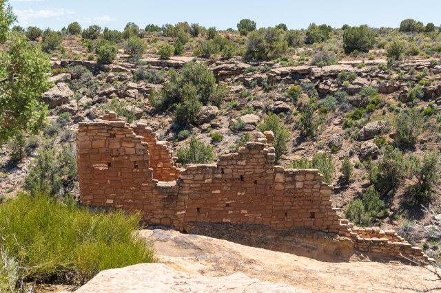
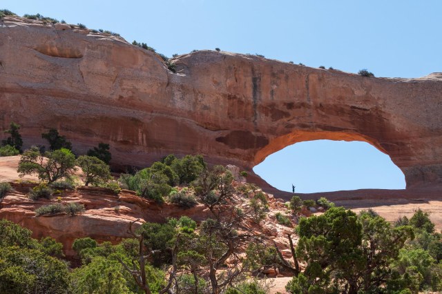
Back on the road, I was so happy to see a pullout on Highway 191 at Wilson’s Arch. The preview of what awaits inside the park had me scouring the RV park listings for the perfect place to stay. We definitely need to arrange a trip this way again, including plenty of time for exploration.

Wilson’s Arch seen from U.S. 191

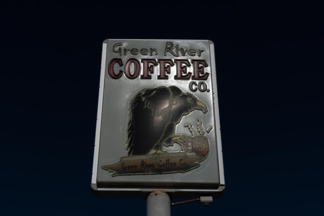
We pulled into the KOA in Green River, Utah, for the night. The next morning we bought lattes at the Green River Coffee Co. and a pound of freshly roasted decaf beans. That bag of beans had the cab of the truck smelling like a coffee roaster for the rest of the day.

Green River Coffee Co.

West Wendover, Nevada, was a good place to stop for the night. The next day we drove to Sparks, Nevada. After three days of driving, we needed a break so we settled in Sparks for two nights at the Sparks Marina RV Park.

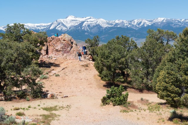
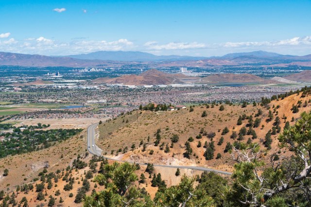
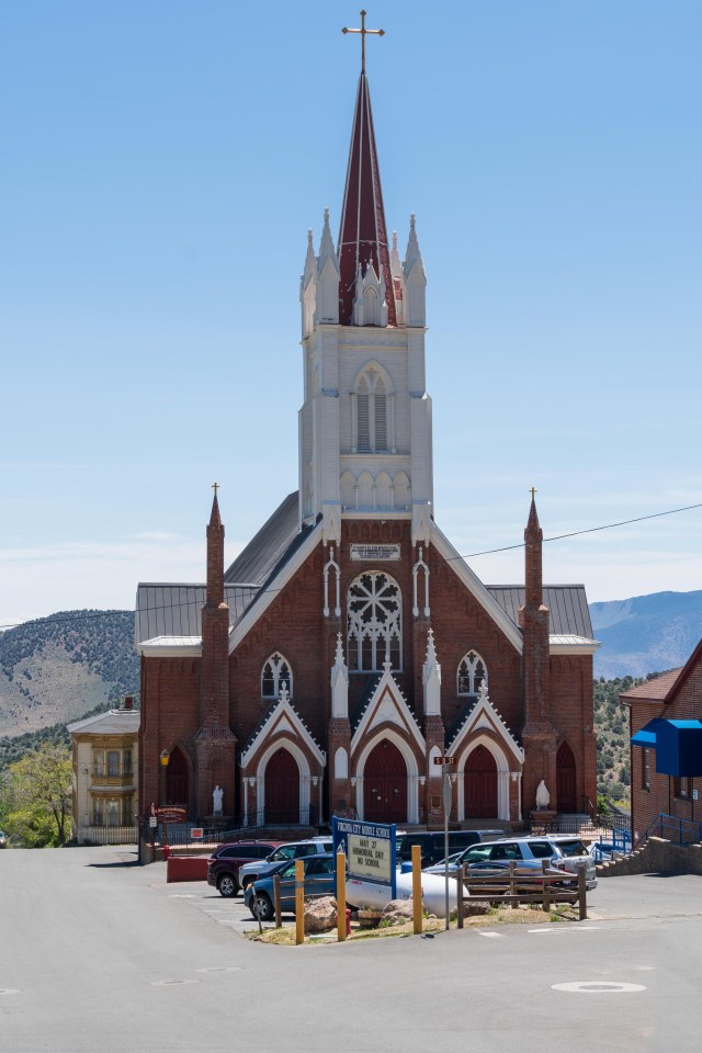
Not content to sit still for too long, a visit to Virginia City was in order. It had been years since we were there last. The skies were clear making it a perfect day to view Reno and Sparks from Geiger Lookout Wayside Park.

Geiger Lookout – No need to climb the stairs unless you need exercise. The view is best from the parking area.

We marveled at all the housing developments that have sprung up in the area recently. Spurred by Tesla’s Gigfactory and other industries moving into the region, it’s easy to see why Nevada was the fastest growing state in the union last year.

View of Reno (to the left) and Sparks (to the right) from Geiger Lookout

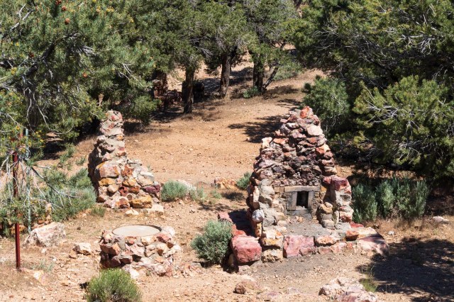
I thought there would be an information sign explaining the purpose of the stone fireplaces scattered around, but I never found it. I did find mention of the park at livingnewdeal.org, which listed the overlook as a Works Progress Administration (WPA) project completed in 1938. What looked to me like fireplaces were barbecues. Picnic tables and restrooms were also once located there.

Picnic area ruins from a WPA project.

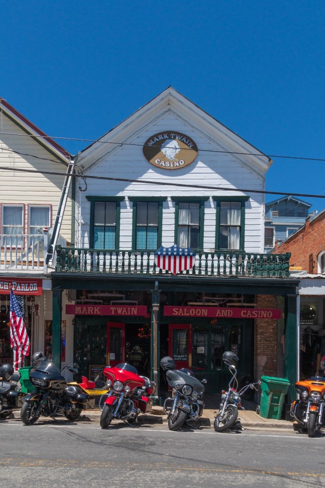
When we arrived in Virginia City we noticed several motorcyclists were in town. They must have been from the Spring Street Vibrations event.

Motorcycles parked in front of the Mark Twain Casino

It seems like Reno and Sparks have some kind of event three or four times a month throughout the year. Watch the Great Reno Balloon Race in the fall, drool over classic cars at Hot August Nights, cheer on cowboys at the Reno Rodeo, and vote for the best ribs at a Rib Cook Off. There’s always something happening in the Biggest Little City in the World.

Territorial Enterprise Mark Twain Museum

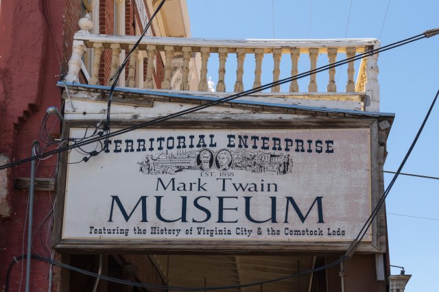
Virginia City proudly boasts its connection to Samuel Clemmons. On March 5, 1862, he published his first news stories in the Virginia City Territorial Enterprise under his pseudonym Mark Twain.

He eventually became the paper’s editor and stayed on until May 29, 1864. His time at the paper was not without controversy given his habit of mixing in fictional narratives with the news as a hoax.

St. Mary’s in the Mountains

Many prominent members of politics and society in Virginia City, Carson City, and Washoe County were not sorry to see him leave. Wikipedia details the saga here.

Chollar Mansion

Jon was able to walk from one end of the town to the other with the aid of plenty of benches lined up on the boardwalk.

On the boardwalk

A tip from a proprietor at one of the bars led us to The Canvas Café. When I heard the word canvas, a tent came to mind, which is what I was on the lookout for when we searched for the cafe.

The Canvas Cafe

I should have paid more attention while eating my lunch. Now that I look closely at the photo of Jon, I see that Canvas refers to all the art hanging on the walls. Duh!

JT waiting for his lunch

The Reno River Walk and the Truckee River was our next stop. With all the snow and rain received in the west this past winter, we were curious to see the height of the water.

Portal of Evolution by Bryan Tedrick

Here is the view of the Truckee River raging through downtown from one of its many bridges.

Truckee River in downtown Reno, June 2019

And here is a view from October 2014 when families dipped their toes and whole bodies in the middle of meandering stream.

Truckee River through downtown Reno, October 2014

To spend a few hours along the River Walk is to spend time enjoying nature, the sound of rushing water, and the delightful squeals of children. To finish off our time in Reno/Sparks, we found a comfortable place to sip a beer, reflect on our trip, and people watch along the River Walk at The Sierra Tap House.

Sierra Tap House has a patio with tables and umbrellas on the Riverwalk

And so we cut short our Late Spring Adventure with dreams of our travels ahead once Jon resolves his back issue. Our fingers are crossed his appointment with the spine specialist will reveal a solution.

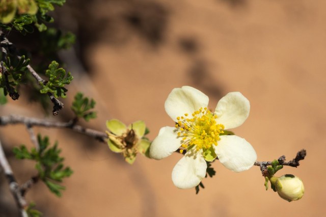
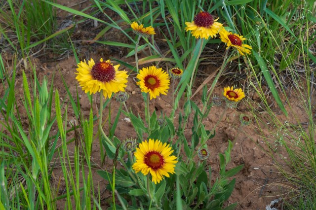
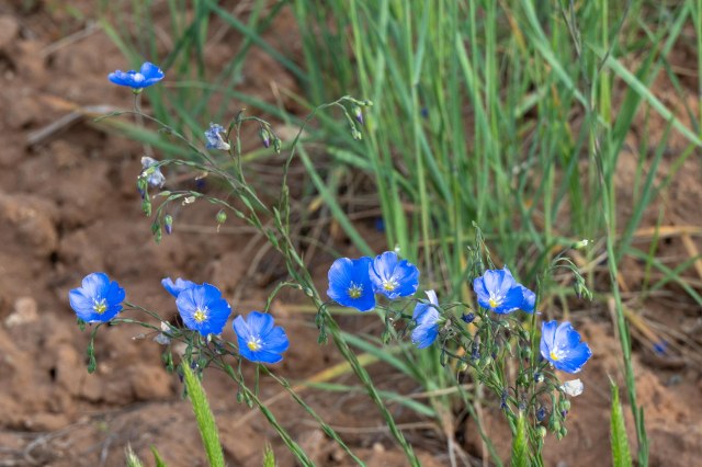
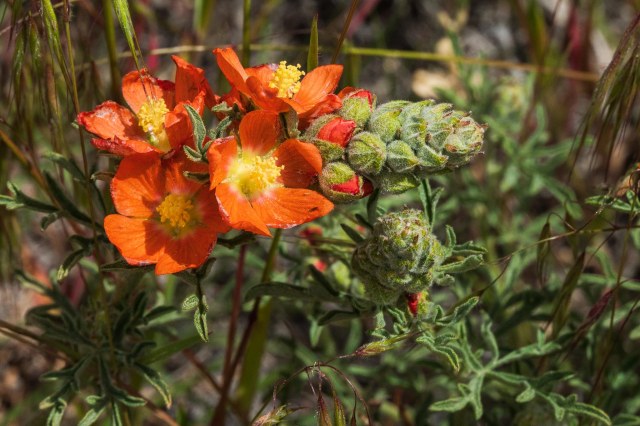
But before we go, just for fun, here are a few random shots of flowers that didn’t fit in with the previous posts on Cortez.

Mountain Daisy
Blue Flax
Munro’s Globemallow

Safe Travels

Week Four – A Drive to Silverton, Colorado, and the Murals of Cortez

We almost didn’t make the 2-hour drive to Silverton, Colorado, but I’m so glad we did. Mammoth Lakes in California has been a favorite mountain destination of mine for over forty years. Silverton, Colorado, comes in at a close second or maybe even a tie for the No. 1 spot.

San Juan County Courthouse

The San Juan Forest contains an assortment of trees ranging from gamble oak, rocky mountain juniper, and maple to pines and firs of all sorts. What I thought most impressive were the acres upon acres of quaking aspen. I’m not content with imagining the burst of golds, yellows, and orange that will paint the hills when the leaves turn. I need to experience it in person. Hmmm! I wonder if we can make it back there during the fall?

City Hall

After driving for miles through thick forest, a valley opened up below, revealing the little town laid out in grids like an oasis surrounded by tall snowcapped peaks.

Silverton, Colorado

Incorporated on November 15, 1883, Silverton serves as the county seat of San Juan County. It is one of the highest cities in the United States at an elevation of 9,318 feet.

Plenty of shops and restaurants in Silverton, Colorado

Although Silverton started out as a silver mining camp, it now draws tourists to the quaint town all year round. Winter brings in the skiers to swoosh down Kendall Mountain. Expert skiers can challenge their skill level on Silverton Mountain’s un-groomed terrain, or take a helicopter to a ski location.

Hungry Moose Bar & Grill
Durango and Silverton Train
One of the many restaurants ready to serve train passengers and other visitors
Hop on the stagecoach for a ride around town
The Wyman Hotel

Four-wheel enthusiasts descend on the town from spring through fall attracted by the numerous trails that traverse the San Juan Mountains. Even the hungry and thirsty passengers arriving on the Durango & Silverton train enjoy the restaurants and shops on Greene and Empire streets. Overnight accommodations are also available in the hotels, inns, and B&Bs.

American Legion Post 14 Building

Our last stop in Silverton was the hardware store. The colorful flowerpots out front invited us to take a peek while the owners sat in rockers on their front porch. They offered wood for campfires, lumber and pipe to build a house, and the usual products found in most hardware stores.

Silverton Hardware Store

We thoroughly enjoyed our short visit to Silverton, Colorado, and plan to make our way back someday. Maybe we’ll even rent a 4-wheeler and take it for a ride on one of the trails.

Molas Lake and Campground

At Molas Lake and Campground it looked like a late opening for the season. The lake was still frozen and the campground covered in snow.

Molas Lake and Campground

Pinkerton Hot Springs

When we saw the soft-served-ice-cream shaped rock off the side of the road, we had to stop and find out what it was all about. It turned out to be a spring that flows over the formation coloring the rock to look like it was dipped in butterscotch. Once a resort and tourist attraction, today it is merely a roadside attraction stop to marvel at the mineral-rich spring that continues to build upon itself.

Pinkerton Hot Springs

Cortez, Colorado, and the Building Murals

In the two weeks we spent in Cortez, Colorado, we came to know the town better than most places we have stayed. Formed in 1886, the town housed men working on the tunnels and irrigation ditches to divert water from the Dolores River to the Montezuma Valley. Farming and ranching is still a major economic driver for the region along with tourism.

The town had pretty much anything we needed. We found groceries at City Market, Safeway, or Walmart, filled a prescription at Walgreens, and Slavens True Value had the perfect thermometer for the fifth wheel. I found it refreshing that there were no malls and very few strip malls with major retailers.

The colorful and whimsical murals on the sides of historic buildings was a special bonus. The murals feature life and the cultural history of Cortez and the surrounding area.

Slavens True Value features “Four Seasons” by Kathleen King

Summer Blush – Exploration – Rain
Autumn Rush – Remembering – River
Spring Crush – Anticipation – Lake

Walking past “The Old Spanish Trail” by Mariah Kaminsky gave me the impression the man was looking right at me as his burros kicked up dust.

“The Old Spanish Trail” by Maria Kaminsky

“Harvest Time: McElmo Peaches” depicts the farming spirit in the region.

“Harvest Time: McElmo Peaches” by Brad Goodell

Gustavo’s Mexican Restaurant displays “The Rancher” by Kathleen King. The sizzling fajitas for two and warm tortillas were quite tasty. Beware of the freshly made margaritas, though. The large size and heavy alcohol content had us drinking large glasses of water to dilute the buzz.

“The Ranger” by Kathleen King

In search of a decaf mocha drink, we came across the building below with the buffalo sculpture out front. Unfortunately, the owner could not serve what we desired because she was waiting for equipment to arrive. We did find regular coffee, tasty pastry, a nice clock for our house, and good conversation. When passing through Cortez, be sure to stop at Cozy Cabin Living for a cup of coffee and a chat with Tenley Rees, the proprietress. Then take a look around the shop for unique gifts or decor items. Cozy Cabin Living is located at 90 North Mildred across the street from the Colorado Welcome Center.

Cozy Cabin Living

Jon made four visits to the Cortez Family Acupuncture office for his treatments. Although his sciatica did not go away completely, the sessions did ease the pain enough to get him home.

Cortez Family Acupuncture

The Historic Montezuma Valley National Bank building now houses KSJD Public Radio station and the Sunflower Theater. We enjoyed listening to the morning news on the station, and in the afternoon, jazz and other music programs entertained us.

KSJD and SunFlower Theater Building

Sleeping Ute Mountain

We encountered a view of Sleeping Ute Mountain just about everywhere we went in and around town. Although it was visible from the back window of our fifth wheel, I found the view below more pleasing without electrical wires and power poles to clutter the photo. Picture a Ute chief laying on his back with his arms crossed over his chest. That is the highest peak. To the right of the peak is the man’s head. To the left is his torso, knees, and toes at the far left.

Sleeping Ute Mountain Viewed from in front of the high school

That wraps up our time in Cortez, Colorado. It didn’t seem like we did a lot while there at the time, but putting together the blog posts I can see that we managed to explore plenty despite Jon’s impairment. We left Cortez on June 4, 2019, and headed back to California.

Next up: our drive through Moab, Utah, and a couple days in Sparks, Nevada, before making it home.

Safe Travels

Week Three – Mesa Verde National Park

Week Three – Mesa Verde National Park

Mesa Verde National Park was the reason for our trip to the southwest corner of Colorado. Finally, after snow, and rain, and wind, we rose from bed with a forecast for good weather. Our first stop in any national park is the visitor center.

Mesa Verde National Park Visitor and Research Center

Don’t pass up the visitor center at Mesa Verde. This is the place to purchase tickets for the ranger-guided tours of Cliff Palace and Balcony House on Chapin Mesa and Long House on Wetherill Mesa. These tours provide visitors with an up-close experience that requires short or long hikes, crawling through tunnels, and climbing up ladders. Tours book up fast and may not be available the day of arrival. The $5.00 tickets are available up to two days in advance and can also be purchased at the Durango Welcome Center.

Having tickets in hand before making the one hour drive to the tours will reduce the likelihood of disappointment. Although the roads to the tours are only 23 – 26 miles from the visitor center, it takes about an hour to drive there, even longer if stopping at the various overlooks.

Do not despair, if tickets are sold out. There are plenty of sites to see without the need for tour tickets.  Several overlooks offer views of the landscapes, cliff dwellings, and pit house villages. Here is a sampling of those sights.

Center stage in front of the visitor center we encountered a sculpture titled “The Ancient Ones” by Edward J. Fraughton. A man, burdened with a basket of what looks to be corn, navigates a cliff side using hand and toe holes. We couldn’t help but be inspired to explore the park after marveling at the man’s struggle.

“The Ancient Ones” by Edward J. Fraughton

Behind the visitor center is a good place to view Point Lookout. Hikers can catch the trail to the top at the Morefield Campground.

Point Lookout

The Spruce Tree House near the Chapin Mesa Archeological Museum is the park’s third largest cliff dwelling and was constructed between 1211 and 1278 AD. The dwelling contains 130 rooms, eight kivas, and may have housed at least 60 – 80 people. The self-guided tour of the house was closed due to the risk of falling rock. I walked down the trail a bit to gain a better view for photos only to find that the terrace at the Chapin Mesa Archeological Museum offered the best perspective of the structure. Oh, well. At least I was able to stretch my legs get my heart pumping a bit.

Spruce Tree House

Knife Edge Road carried travelers to Mesa Verde in the early 1900s. The dirt road was eventually paved with asphalt, but abandoned in 1956 when the Morefield-Prater tunnel was constructed.

Remnant of Knife Edge Road

Fire Temple is one of the few sites that contained no evidence of domestic tasks. It was used as more of a public place possibly for ceremonies that included dancing or other types of performances.

Fire Temple

To the right of the public space, is New Fire House, where domestic activity was found in the 22 rooms and 3 kivas. Perhaps the caretakers resided here?

New Fire House

Square Tower House is the tallest structure in the park. The three-story building stands at 28 feet.

Square Tower House

Navajo Canyon View

Navajo Canyon

Pit Houses and Villages depict the life of the Ancestral Puebloans who settled in the area around AD 550 and occupied houses built underground. Archeological evidence shows three villages built on top of each other over the course of several hundred years. Around AD 750 people started building houses above ground, using poles and mud to fashion upright walls and utilizing the pit houses as kivas. By AD 1000 stone masonry replaced the poles and mud construction. The thick stone walls rose two to three stories high and consisted of 50 rooms or more. The building of cliff dwellings occurred between the late 1190s to the late 1270s.

Restored Kiva in a Pit House
Excavated pit house

To see the Sun Temple requires only a few steps from the parking lot. Archeologists have yet to determine the purpose of the kiva and the tower. Was it for communication, defense, storage, ceremonial, social gatherings, or a religious purpose? Whatever their use, it is clear the buildings were important to the people since they are found everywhere throughout the park and at the other sites we visited.

Sun Temple
Kiva at Sun Temple

Cliff Palace, the largest dwelling in the park, is viewed from across the canyon. After taking photo after photo at a distance, I had to see it up close, so I booked a tour for another day.

Cliff Palace from across the canyon

The Cliff Palace overlook provides a good view of the ruin without the ¼-mile walk and climb up four 8- to 10- foot ladders. A ranger-led tour is the only way to view Cliff Palace up close and personal along with 40 other people.

Cliff Palace from the overlook

Archeologists have determined Cliff Palace contained at least 150 rooms, 23 kivas, and housed 100 people or more. This compares to the nearly 600 structures within the park, 75% of which only contain 1-5 rooms each. One theory is that the Ancient Puebloans used Cliff Palace for social, administrative, and ceremonial purposes.

Cliff Palace

Starting in AD 550 people from the Four Corners region arrived at Mesa Verde. Over the next 700 years, they progressed in their architecture until they built the elaborate stone structures in the alcoves of the canyon walls that we see today.

Cliff Palace

Farming took place above on the mesa tops. Using hand-and-toe holds carved into the soft sandstone, the Ancient Puebloans navigated between the alcoves and the mesa tops.

Cliff Palace close up of construction

Imagine carrying tools and supplies for farming up the steep cliffs and toting crops back down using only the hand-and-toe holds, much like the sculpture we saw in front of the visitor center. The ladders were hard enough for me to use with my small backpack on my shoulders and camera strapped around my neck.

Cliff Palace Kiva
Cliff Palace close up

Mesa Verde National Park, along with Hovenweep National Monument and Canyon of the Ancients National Monument are very special places to visit. To think that more people lived in the region surrounding Mesa Verde between AD 550 and AD 1250 than live there today strains my brain. Their skills as master potters, weavers, architects, and builders using only basic primitive tools that they manufactured themselves, says so much about the perseverance of mankind.

As I sit at my desk, surrounded by electronics, cool air blowing in the room from the air conditioner, I can’t help but think how small my life is in comparison with the ancient people. They grew their own food, while I drive to the grocery store and push around a cart gathering products from the shelves. They made their own clothes, shoes, pottery, rugs, and blankets, while I head to the mall or order online. They erected elaborate structures that sheltered hundreds of families to keep them safe and warm using only the products in their immediate surroundings. If I want shelter I call a realtor or the closest RV dealer.

I look at how far we have come as a civilization in the past 1500 years and question whether we are truly better off or have we lost something of our humanity along the way. Just something to ponder. I’m in no way wanting to give up my air conditioning when the temperatures rise above 100 degrees. I only want to know what the ancient peoples had that I might be missing, be it sociological, philosophical, psychological, or spiritual.

Okay, all that pondering is bringing on a headache. Time to wrap up here.

Next, we take a drive to Silverton, Colorado, I take photos around Cortez, and we head for home. Jon’s had enough of sciatica. Time for an MRI.

Safe Travels

Cortez, Colorado

Week Two – Cortez, Colorado

It’s May 31, 2019, and we’re still hanging out in Cortez, Colorado. Several days of rain and snow kept us inside for the first few days, which was okay since Jon was dealing with his sciatica. Since we weren’t on a strict timeline, we could afford to snuggle up in the trailer during the winter weather and wait for sunny warmer days.

Did acupuncture work?

Jon’s excitement for a miracle pain relief dissipated after the first treatment. Discouraged there was no improvement, he wanted to cancel the next appointment. “You can’t expect it to work the first time,” I said. He persevered, though, dragging his feet and skepticism into Dr. Hawes’s office. When he noticed improvement after the second and third visits, he said, “Maybe there is something to this after all?”

By the fourth visit, he hurriedly stripped to his skivvies, climbed onto the table face down, and immediately relaxed, offering up his body as a human pin cushion.

Whether it was the acupuncture, the CBD oil, the natural course of things, or a combination, the moans and groans have subsided. Not yet ready for a ½-mile hike, he can now make it halfway around the grocery store. This is a great improvement over our first days in Cortez when he could barely make it inside the store before having to grab a seat at the Starbucks kiosk.

Although we weren’t able to hit the trails with our new trekking poles, we still had fun exploring the Canyons of the Ancients National Monument, Hovenweep National Monument, and Mesa Verde National Park.

Enough with the medical issues and on to the explorations. Let’s start off with Canyons of the Ancients and Hovenweep National Monuments and leave Mesa Verde National Park for the next post.

Canyons of the Ancients National Monument

Canyons of the Ancients National Monument, designated on June 9, 2000, covers over 176,000 acres of federal land administered by the Bureau of Land Management (BLM). The number of sites contained within the monument is estimated at 30,000, more than 6,355 of which have been recorded.

Canyons of the Ancients Visitor Center and Museum

Humans who have inhabited the area for the past 10,000 years left evidence of homes below ground, above ground and tucked under cliff overhangs, towers of some sort, and sweat lodges, along with reservoirs and dams for irrigation of crops. Some areas contain more than 100 sites within a square mile.

A replica pit house shows how people lived

A stop at the Canyons of the Ancients Visitor Center and Museum is recommended before venturing out to the public sites. The cost is $3.00 for adults March to October and free in November through February. Federal Interagency passes are accepted. At the center, visitors gain an appreciation of the people who once occupied the land through the movies and exhibits that depict native cultures of the Four Corners region. Key archeologists and their work are also on display.

Artifacts contained in display cases and timeline depictions on the walls

What I found amazing is the condition of the structures and their contents at the time they were located. Architects found intact pottery and baskets, tools and cooking implements, and shoes made from the yucca plant. To think these items survived untouched for thousands of years is mind-boggling.

Seasonal calendar

Computers are set up that detail the timelines and different cultures. The information covers the different types of dwellings each culture built as well as the enterprises they engaged in such as weaving or pottery.

Gardens and art in front of the visitor center

Follow the concrete paved trail around the side of the building to the Escalante Pueblo for a bird’s eye view of the surrounding landscape, mountains, and McPhee reservoir. Time for a picnic? Find tables with protective covers at the start of the paved trail. While the wind blew hard in front of the visitor center, the path side of the hill had very little wind until I reached the top.

San Juan Mountain Range
Escalante Pueblo at Canyons of the Ancients Visitor Center and Museum
Escalante Pueblo
Kiva at Escalante Pueblo

Lowry Pueblo

Twenty-five miles from the visitor center is the Lowry Pueblo. Constructed around 1060 AD, it housed at least 40 – 100 people at a time for approximately 165 years. The entire structure consisted of 40 rooms and multiple kivas. Archeologists found evidence of hunting, farming, pottery, and cotton weaving up until the early 13th century.

Lowry Pueblo
Is that hole in the wall a window?
The doorway was so short I had to squat my way through.
View of the ruins after crawling through the doorway

As I stood inside the walls, I couldn’t help but wonder what the niches were used for. Were they places to stash belongings, decorations, supplies, pots filled with water, baskets holding herbs and seeds and nuts, or maybe tools used in farming.

What was the purpose of the niches?

Hovenweep National Monument

President Warren G. Harding proclaimed Hovenweep a part of the National Park Service in March 1923.

As many as 2,500 people lived in the six prehistoric villages built between 1200 and 1300 A.D. Hovenweep is known for its multistory towers lining the canyon rims and balanced atop boulders. Photos are from the Square Tower group. The only group of ruins accessible from a paved path.

The Twin Towers

The function of the towers, many shaped like the letter D, remains a mystery. Some theorize they were used as celestial observatories, defensive structures, storage facilities, civil buildings, homes, or a combination of all these.

Eroded Boulder House

Occupation ended around the later part of the 13th century due to a prolonged drought and depletion of resources, or factionalism, or warfare. The actual reason is still unclear. However, it is believed the ancestral Puebloans migrated south to the Rio Grande Valley in New Mexico and the Little Colorado River Basin in Arizona. The Pueblo, Zuni, and Hopi people of today trace their heritage to culture from the Four Corners region.

Unit Type House
Stronghold House

To wrap up this post, I present a delicate flower I found along the pathway to the ruins. With its soft white petals and yellow stamen, I couldn’t pass up the photo opportunity to contrast with the masonry work of the ancients.

Stansbury Cliffrose

It would seem as though once you see one stone building lasting over a thousand years, you’d seen them all. That wasn’t the case for me. All of the structures were unique in their craftsmanship and given the tools they had available to them, the architecture and construction impressive.

Next up: We visit Mesa Verde National Park in the next post.

Safe Travels