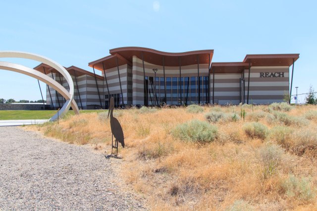
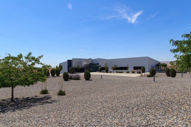
Sacajawea State Park
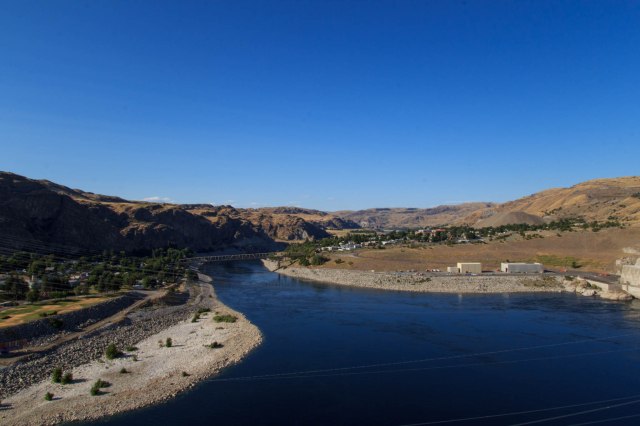
Our last visit in the Tri-Cities area was the Sacajawea Historical State Park and the Sacajawea Interpretive Center along the Columbia River.
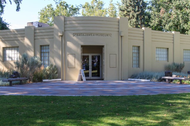
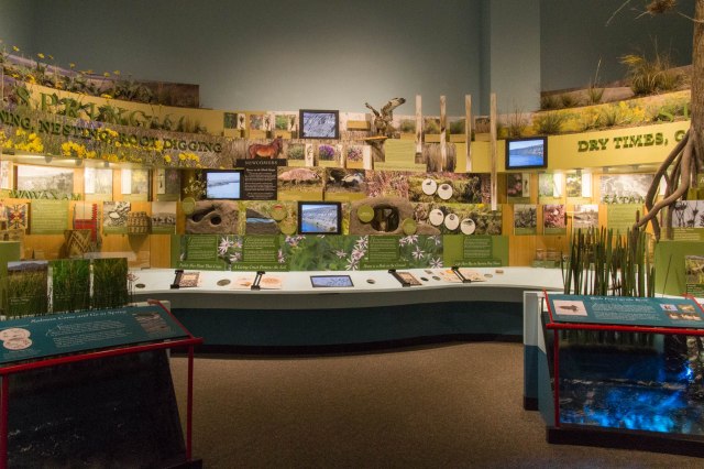
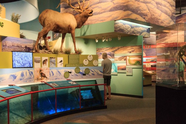
The museum tells the story of Sacagawea, her husband, and the Lewis and Clark expedition near the site where the party made camp for two nights at the confluence of the Snake and Columbia Rivers while traveling to the Pacific Ocean. Other displays include the stories of the Native Americans who resided in the area.
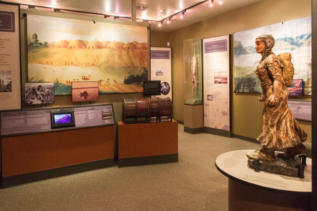
Why the different spelling of the Shoshoni woman? Recent research and study of the original journals indicate the proper spelling and pronunciation with a hard ‘g’ not a ‘j.’ The name of the state park kept the original spelling.

Besides the Sacajawea Center, the 257-acre day-use park includes two boat ramps, fishing, swimming, boating, and 1.2 miles of hiking trails.

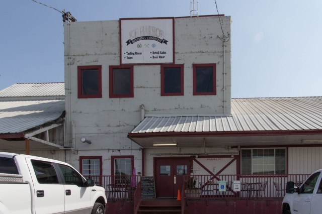
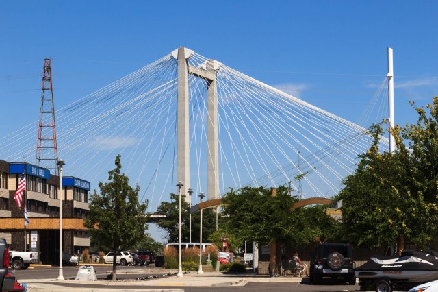
We made one more visit to the Ice Harbor before we left the area. This time we opted for the Clover Island Marina location, which is an upscale version that includes a more inviting building, more food selections, and the same great beer.

The American Empress came into view near the harbor so I managed to snap this photo between the trees. I wish I could have gotten the paddle wheel. The steamboat vessel cruises the Columbia and Snake Rivers along the Lewis and Clark trail.

After spending the past couple of weeks in noisy locations near or on major highways and freeways, we craved a quiet place. We made reservations at Crooked River Ranch RV Park near Redmond, Oregon and crossed our fingers that it would satisfy our craving.
On to Oregon
On Sunday, July 23, 2017, we followed the Columbia River through golden cliffs, rivers the width of small lakes, windmills on top of cliffs, a few farms, of course, and Mount Rainier poking his snowcapped peak above the terrain. In Washington, the air had a smoke haze look to it, but cleared as we entered Oregon. At one point, we could see the snowcapped peaks of Mt. Rainier, Mt. Hood, Mt. Jefferson, and the Three Sisters. What a sight.
When we arrived at Crooked River Ranch RV Park, we were pleased to find that for at least three nights we would be far from any major roads.
Newberry National Volcanic Memorial Park
The next day we visited the Newberry National Volcanic Memorial Park. We arrived just in time to hear a ranger talk on the geology of the park. Afterward, we took a hike with him partially up Lava Butte, a cinder cone, where he pointed out examples of what he had discussed on the patio.

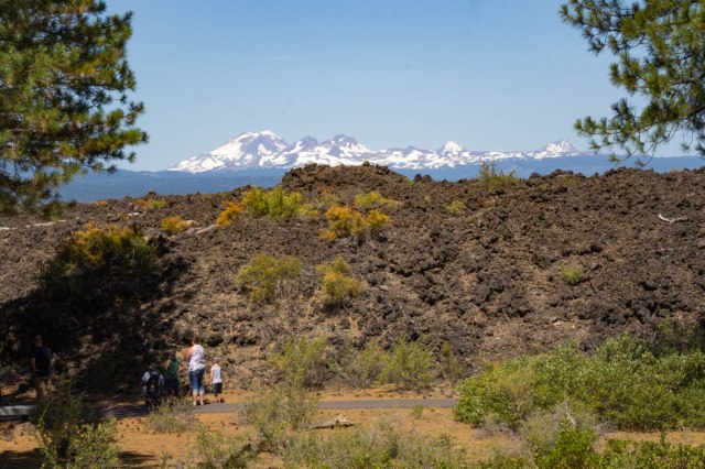
A shuttle bus took us to the top of Lava Butte where there were magnificent views of the valley below and peaks to the west. The lava flow reminded us of Craters of the Moon in Idaho.
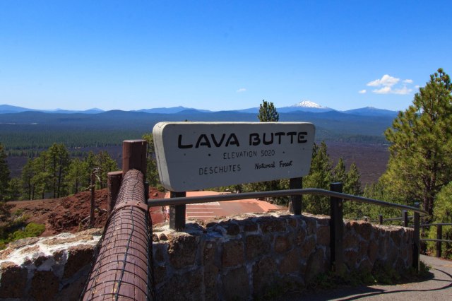

Lava Butte erupted 7,000 years ago creating a 9 square mile lava flow. Besides Lava Butte, visitors can see Lava River Cave, Big Obsidian Flow, and Paulina Falls and Paulina Peak, which rises 7,984 feet. Hikers, horse riders, and bicyclists can enjoy the many trails within the park that range from easy to difficult. Several tent campsites are available in the Newberry Caldera and East Lake has one RV campground with 45 sites, all of which are reservable, while the tent sites have some first-come-first-served sites.
Sisters Oregon
We also visited Sisters, Oregon, a small town of less than 2 square miles and a population of 2,038 as of the 2010 census. We found Sisters a quaint little town with plenty of stores to keep any shopper busy, restaurants to satisfy hunger, and places to rest at night.


A small park with a couple picnic tables was the perfect place for us to eat our packed lunch before heading to the Whychus Creek Overlook Trail.

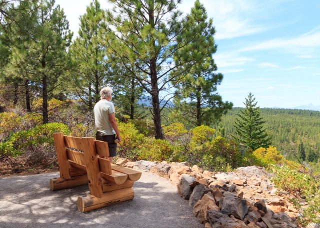
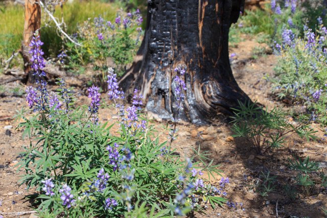
Continuing down the road, we came across a burned out area giving way to views of the peaks.


On our way back to Crooked Ranch, we drove by alpaca grazing in a field.

There are a total of four alpaca farms in the Bend, Oregon, area. We come across a lot of cows and cattle in our travels, but this was the first time we saw alpacas.
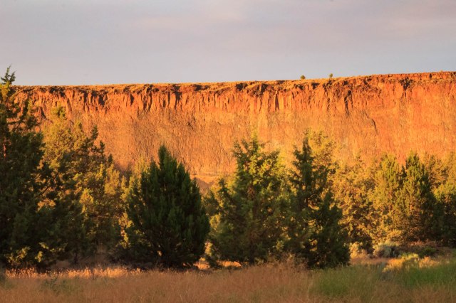
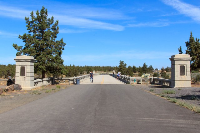
Peter Skene Ogden State Scenic Viewpoint
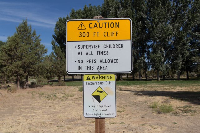
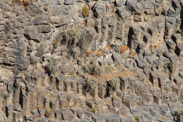
We stopped in at the Peter Skene Ogden State Scenic Viewpoint in Terrebonne, Oregon. The viewpoint includes views of basalt cliffs, river, and peaks along with the closed Rex T. Barber Veterans Memorial Bridge. Several signs warn visitors to watch children at all times and leave pets in the car.


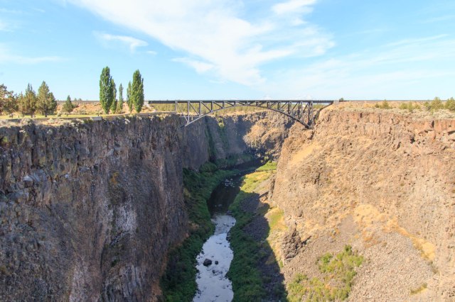
The night before leaving Crooked River Ranch, smoke drifted into the valley creating a spectacular sunset view of the hills and sky beyond the bridge.

Next up we continue searching for out of way places and Jon redeems a Christmas gift.
Safe Travels