Torrey, Utah, and Capitol Reef National Park

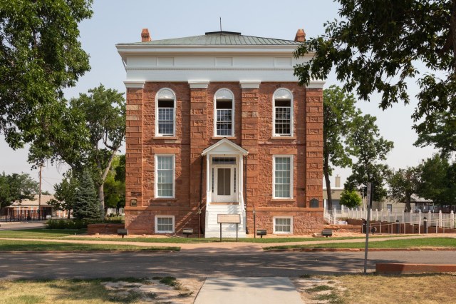
On Monday, August 6, 2018, we had one more stop in Utah before crossing into the State of Colorado. We couldn’t have been happier when we pulled into our space at Wonderland RV Park in Torrey, Utah. Under large shade trees and backed up against a fence, our view each morning out of our rear window featured cows and horses grazing. The apple and peach trees strategically placed around the park showed signs that harvest was soon near. The only drawback was smoke in the sky. Again.

Wonderland RV View
View from our fifth wheel rear window at Wonderland RV

We ventured out to the information center across the street and then drove into Capitol Reef National Park for maps and pamphlets to help plan our stay.

Capitol Reef National Park

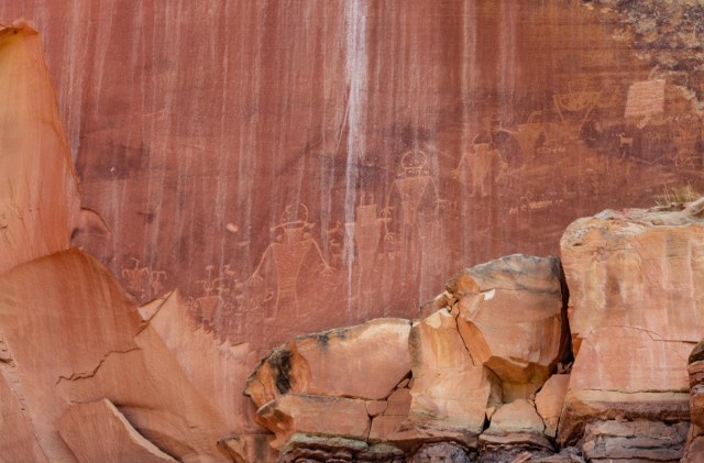
The known history of Capitol Reef and surrounding area dates back to the Fremont Culture. Settling in the area around 500 CE, the Fremont grew corn, beans, and squash. Petroglyphs and pictographs on nearby rock walls tell the story of these ancient people. If only there was a translation of each panel, we could read and understand the meaning of the stories. Instead, we must use our imaginations to figure out what the art depicts. Is the picture below a family portrait, or does it represent an encounter with alien beings?

IMG_8946
The viewpoint of the petroglyphs is 1.1 miles from the visitor center on Highway 24

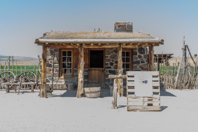
Mormon pioneers arrived in the 1800s settling in the Fruita Rural Historic District of the national park. They planted apple, pear, and peach orchards, fruit trees that still produce fruit, which is available to pick free when in season.

IMG_8931
One of the fruit orchards on the left side of the photo

Ephraim Portman Pectol, a Mormon Bishop in Torrey, Utah, and his brother-in-law, Joseph S. Hickman campaigned to have the geologically sensitive area protected from development. President Roosevelt set aside 37,711 acres of the Capitol Reef as a national monument in 1937 and in December 1972, the monument became a national park.

IMG_8890
Chimney Rock

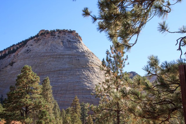
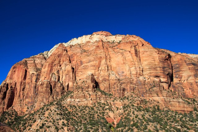
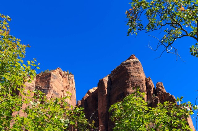
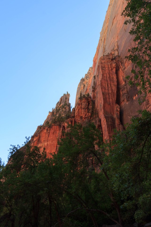
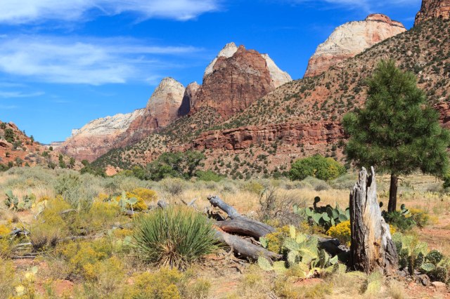
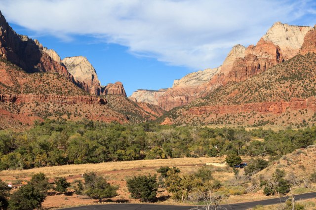
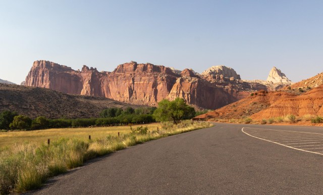
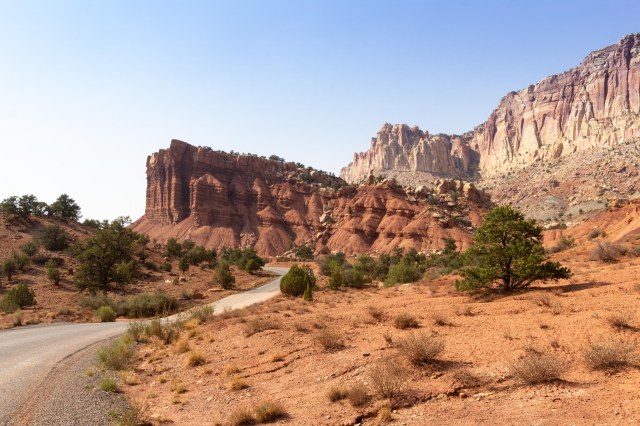
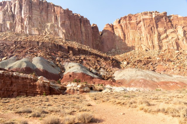
The main attraction at Capitol Reef is the varied layered cliffs that rise from the valley floor and the different rock formations. Geological events occurring between 50 and 70 million years ago created the warp in the Earth’s crust. The warp, referred to as the Waterpocket Fold, or monocline, runs approximately 100 miles from Boulder Mountain to Lake Powell.

IMG_8903
Egyptian Temple

Slickrock Divide is a hill that separates Grand Wash to the north and Capitol Gorge to the south. Streambeds channel rain runoff and debris to the respective drainages.

IMG_8908
South view from Slickrock Divide

The Waterpocket Fold is the result of the rock layers on the west side of the fold lifting more than 7,000 feet higher than the layers on the east side. Within the last 15 to 20 million years, erosion has exposed the fold at the surface.

IMG_8923
Water creates fissures in the rock

Erosion gets the credit for creating the colorful cliffs, massive domes, soaring spires, stark monoliths, twisting canyons, and graceful arches that are present today. These formations reveal the geological history from 65 to 290 million years ago. [source: nps.gov/care/learn/nature/geology.htm]

IMG_8920
Cassidy Arch

Only the 7-mile drive requires a fee in Capitol Reef National Park: $15.00 per vehicle, $10.00 for motorcycles, and $7.00 for bicyclists and pedestrians, with the typical passes accepted. Fees for commercial tours depend on seating capacity.

IMG_8925
Yikes! Gated uranium mine tunnels. Don’t get too close.

Developed campsites run $20.00 per night or $10 for senior and access pass holders. During the summer the majority of the 71 sites are offered through reservations, however, a few are offered on a first come, first served, basis. A few primitive campsites, which are first come, first served, no fee sites, are also available.

IMG_8926
White topped reddish mounds appear to support the steep cliffs

Having seen the sign for pies at the Gifford Homestead while driving the 7-mile road, we started the next day with a small pie each and a cup of coffee. Then we drove out to the petroglyph panel. Some of the petroglyphs were so faint we would have missed them if it hadn’t been for a woman who pointed them out to us.

IMG_8947
A hunting depiction?

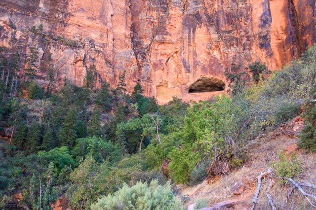
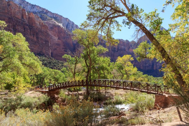
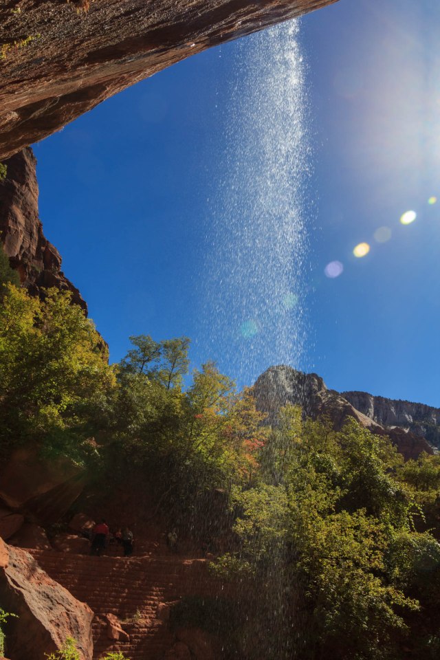
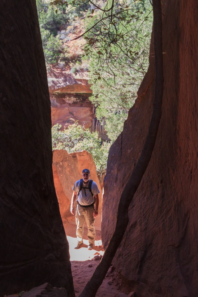
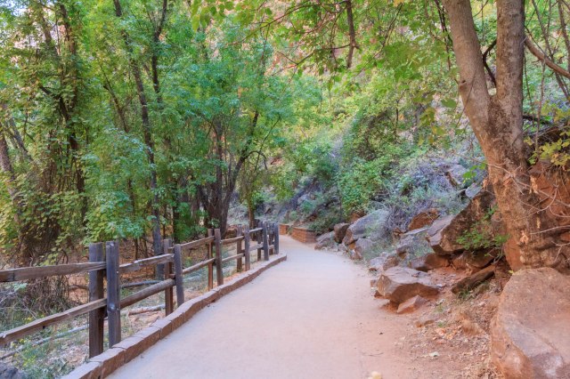
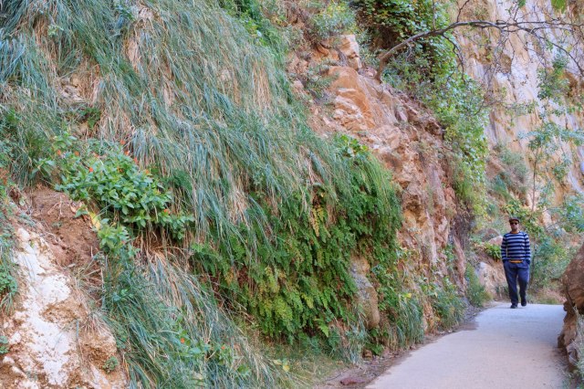
Next up was a hike to the Hickman Bridge. Rated moderate, .9 mile one way, and an elevation gain of 400 ft. A piece of cake, we naively thought. The heat, thin layer of smoke, and a 6,000-foot elevation conspired to hold us back as we trudged up the hill. Good thing we had the handy trail guide with us. It gave us an excuse to stop, catch our breath, and learn about what we saw on the trail.

View from Hickman Bridge Trail

Capitol Dome is made of Navajo sandstone, which consists of ancient sand dunes. The boulders in the foreground of the photo below are composed of andesite lava. Debris flows from melting glaciers deposited the boulders here from the west side of the park.

IMG_8959
Capitol dome and black boulders

I’m always on the lookout for General Land Office spikes. Jon pointed out this one from 1947. Check out the hefty penalty of $250. That would be $2,867 in 2018.

IMG_8963
1947 General Land Office Survey spike

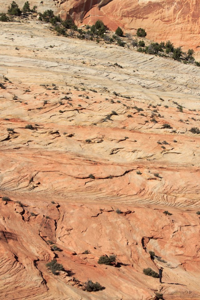
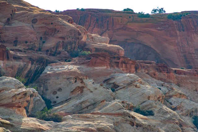
Shown in the photo below the small bumps on this hard surface are erosion resistant accumulations of iron.

Iron bumps resist erosion

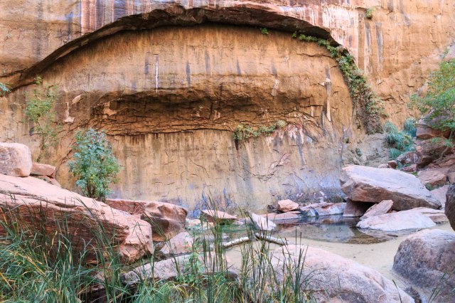
The rock wall in the photo below is composed of sandstone grains cemented by calcite. Acidic groundwater dissolved the calcite and created the holes called solution cavities.

Sandstone wall with solution cavities
IMG_8967
Hickman Bridge
IMG_8972
JT resting in the shade of Hickman Bridge

Our respite was spoiled, when twenty to thirty college students descended on the slick rock near the bridge, chasing other hikers away, and taking up all the space. While they waited for the rest of their group to arrive, they took turns climbing on a boulder and having their photos taken. We worked our way through the crowd and continued on our walk.

Where’s Jon among the tilted and slanted terrain?

Finally, the parking lot, fresh water, and air conditioning. Outa my way, coming through.

Hickman Bridge parking lot and Fremont River

I was so glad we pushed ourselves to the end. The shade was refreshing, the views wonderful, and the bridge unique in that the trail looped around underneath the arch and behind the cliff. It would have been a shame if we had missed it.

Other stops in the park

Panorama Point, Sunset Point trail, and Goosenecks Overlook are other sites in the park. The Sunset Point Trail was .4 mile one way. Although it was 2:30 p.m. and hot on the day we were there, the short hike wasn’t too bad, mostly flat.

Layers of sandstone look like chunks of cardboard piled up

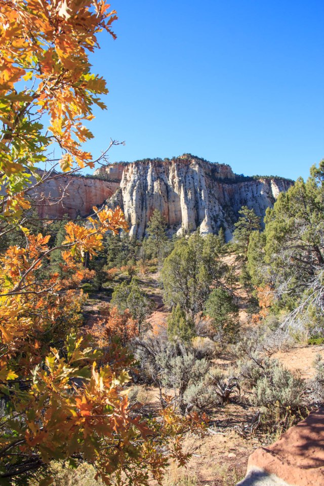
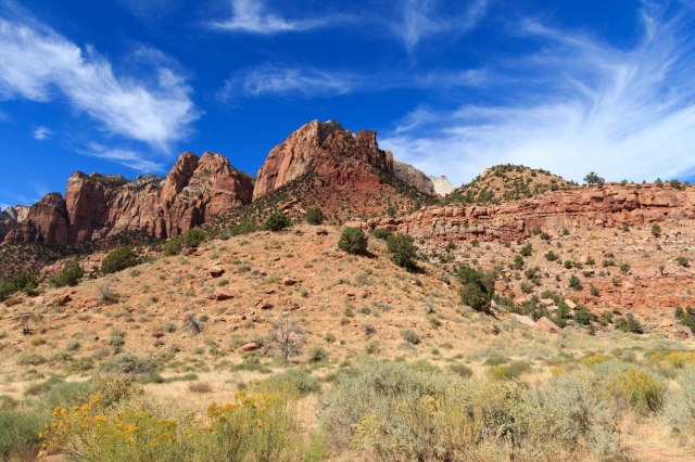
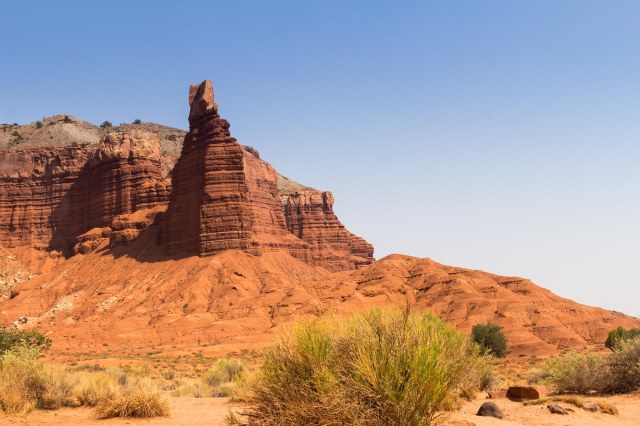
There are plenty of interesting formations outside of the fee area for visitors to see. The Castle is one of these.

The Castle
View from the visitor center shows the layers of rock
Twin Rocks look like they may have been triplets at one time

JT waited in the truck while I investigated Goosenecks Overlook. The views of the canyon were spectacular, but I feared the little kids running around would somehow slip through the railing and drop to their death. Parents, please hold on to your precious children when near canyon cliffs and don’t let them run around playing tag.

Goosenecks Overlook

Panorama Point was truly a 360-degree panoramic view of the park. If a person could only see one thing in the park, I would suggest they check out Panorama Point to get a great overview of the canyons, the colors, and the cliffs.

View from Panorama Point
Another view of layered rocks

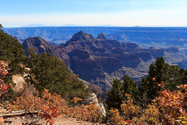
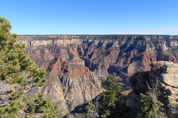
Whoa, we saw a lot in Capitol Reef National Park and still didn’t see it all. A visit to the park in cooler weather someday may be in order. Next up are a few other places we visited while staying in Torrey, Utah, before making it into Colorado.

Unfortunately, I have to take a break from the blog posts for a few weeks. When this post publishes at 6:00 a.m. on Thursday, October 11, I’ll be in heart surgery for a mitral valve repair. When I’m feeling up to it, I’ll continue with our Summer 2018 Tour.

Safe Travels

Territorial Statehouse in Fillmore, Utah, and Cove Fort

It was a good day to leave Ely, Nevada, on Saturday, August 4, 2018. After three days of clear skies, we woke up to hazy smoke that blocked the view of the hills only a quarter mile away. We continued on our easterly route stopping in Fillmore, Utah, for two nights, giving us one full day for exploring.

Territorial Statehouse State Park Museum

Brigham Young designated Fillmore as the first Utah Capitol on September 8, 1851. Construction of the south wing of the building started in 1852. Grand plans called for a much larger facility than the one that still stands today. The fifth territorial legislature used the building on October 10, 1855, then in 1856 Salt Lake City became the home of the state government, eliminating the need for the larger building in Fillmore.

IMG_8828
Territorial Statehouse State Park Museum

The building served as a courthouse and county headquarters and housed a Presbyterian Mission School for several years after the Civil War. The primary goal of the school was eliminating polygamy and educating children. The education part worked out fine, eliminating polygamy, not so much. Although the discontinuance of the plural marriages practice was approved by the church’s general conference in 1890,  existing marriages continued until the 1940s and 1950s.

IMG_8830
Territorial House side view

Restored in 1928, The Territorial Statehouse was dedicated as a state museum on July 24, 1930, for visitors to enjoy, except on Sundays and major holidays when it is closed.

The park setting also includes a rock schoolhouse and a few cabins. Informational signs outside of the buildings explain their origin and use.

IMG_8838
Territorial Statehouse State Park and Museum

The first public school in Fillmore, the Old Rock schoolhouse built in 1870, was used by the school district until 1971 when it became part of the state park in 1972.

IMG_8841
Old Rock Schoolhouse

If our timing had been different, we could have seen inside the museum where artifacts include military weapons, pioneer-era tools, a jail cell, musical instruments, and antique china, pottery, and textile displays. Instead, I had to be content to take photos through the windows of the inside of the schoolhouse, which worked out better than I thought when I clicked the shutter button.

IMG_8843
Inside Little Rock Schoolhouse

Cove Fort

Our next stop was Cove Fort, an interesting historical site run by the LDS church. Elder Ray Turley was our guide and a wealth of historical information and stories. Elder Turley gave us a personal tour of the fort, walking us in and out of each of the rooms, leading us to the garden and the barn, all the while explaining how the fort was built, and telling stories about the family who occupied the property.

IMG_8888
Howdy from JT and Linda at Cove Fort

The fort, constructed with four-feet thick walls made of volcanic rock found nearby, housed the Hinckley family who moved to the area to develop a waypoint between Salt Lake City and St. George, Utah. It provided a place for travelers to rest and have a hot meal.

IMG_8845
Another view of the kitchen and dining area
IMG_8847
Kitchen area with dutch ovens galore
IMG_8848
Dining area

He also told stories that brought the site to life, even a personal anecdote about bringing his wife to the fort before its restoration for a romantic camping adventure. He thought himself clever when he set up their newly purchased tent under a tree at the corner of the fort walls, shielded from the wind. When they returned home, his wife showed him what she thought of the trip by burning the tent. They travel in an air-conditioned RV these days.

IMG_8875
View of south side of Cove Fort. Elder Turley camped with his wife under the tree on the right.

Elder Turley hinted that the sister wives were not always happy with the plural marriage arrangement when he told about Ira Hinckley, the patriarch. Ira was married to four women, but no more than three at any one time. He took over the church-owned ranch and built the fort with the help of his brother and other men in 7 months during 1867.

IMG_8853
Telegraph Office
IMG_8854
1800s battery technology used wet cells, which were open containers that held liquid electrolyte and metallic electrodes
IMG_8855
Another view of the telegraph office

Living quarters included a room for the traveling men, a room for the Hinckley boys, and another for the girls.

IMG_8849
The men’s guest room

Ira’s wife Adelaide, their five children, and Ira’s oldest daughter from a previous marriage moved in during 1868, followed by Ira’s wife Angeline (also Adelaide’s sister) and her four children the following month. I sure wouldn’t be happy about sharing a husband with my sister so I could imagine the cold stares and arguments that might have ensued while everyone was busy with their household chores.

IMG_8858
The rolling pin on the headboard lifts off and was used to beat the mattress to rid it of bed bugs
IMG_8860
The tool on the window sill was used to tighten the bed ropes

Although the fort was built to protect against attacks from American Indians, interaction with the neighboring Ute tribe produced only peaceful meetings. The Indians sometimes came to the fort to trade with Ira and were treated as guests often enjoying a good meal during their visit.

IMG_8853
Telegraph office

By 1872 stagecoaches stopped at the fort twice a day requiring the preparation of food as well as taking care of the horses. The railroads arrived by 1881, reducing the need for the fort and by 1890 the Hinckley family left the area. The church leased the property to other ranchers and eventually sold out to free up funds for other projects. Unfortunately, the fort was left in ruins by the time descendants of the Hinckley family formed the Cove Fort Acquisition and Restoration Foundation and deeded the property back to the church. After restoring the fort to its earlier glory, including furnishing the rooms in the period similar to when the Hinckley’s lived there, the church reopened Cove Fort as a historic site in 1994.

IMG_8861
Gunport from inside the fort wall
IMG_8864
Elder and Sister Crow guard the garden
IMG_8863
Garden on the west side of Cove Fort

The original barn had long since deteriorated by the time the renovations began, however, plans were located. Those in charge of the renovations were interested in having the barn built using the same tongue and groove construction from the 1800s so they contracted with an Amish group to build the barn using wooden dowel rods rather than metal plates and nails. Once built, the barn was disassembled and trucked across the country to its new home at Cove Fort.

IMG_8874
The barn constructed with wooden dowel rods built by Amish
IMG_8865
Blacksmith Shop
IMG_8870
Inside Blacksmith Shop

I commented to Elder Turley that I had seen the handcarts at the Mormon Temple in Salt Lake City the year before and was amazed that families would carry all of their possessions in a handcart as they traveled across the plains on their way to Utah. He replied that the handcarts were actually the fastest mode of transportation at that time traveling up to 3 miles per hour, compared to horses at 2 miles per hour and oxen at 1-1/2 miles per hour. Hearing that, I think I would have chosen the handcarts too had it been me. Thankfully, these days we travel up to 70 miles per hour and pull our bathroom, kitchen, living area, and bedroom behind us. I’m not sure I would have traveled at all if I’d have to do it with a handcart.

IMG_8889
Cove Fort Gate and Handcart

We enjoyed learning about the history of Fillmore, Utah, and Cove Fort during our short stay, although we missed out on the museum. It was time, however, to continue our drive east. Next stop is Torrey, Utah, and Capital Reef National Park.

Safe Travels

Kanab, Utah

Kanab, Utah

With no reservations or idea where we would stop, we left Zion on October 9, 2017, taking Highway 89 south from Mt. Carmel Junction. Kanab looked like a nice little city as we drove into town, and it would be a good jumping off point for North Rim Grand Canyon. All we had to do was find a place to set up the fifth wheel.

The first park we tried was booked solid for the month. Back toward town, we passed Hitch-N-Post. Although a sign on the street said they had no RV sites, we stopped and asked anyway. Good luck was shining on us that day. A cancellation had come through a few minutes before.

 Coral Pink Sand Dunes

After situating the rig beside one of the cabins, a short drive to Coral Pink Sand Dunes State Park was in order. The Dunes became a state park in 1963 providing off-road enthusiasts a place to play. On the look out for the dunes, we drove through areas where juniper, pinyon pine, and Gambel oak were rooted in a soil of beige to pink sand. At an elevation of nearly 6,000 feet, even ponderosa pines are found within the park boundaries.

IMG_4650
Pink Coral Dunes

The dunes, formed by wind carrying away eroded Navajo sandstone, are believed to be 10,000 to 15,000 years old. The grains of sand have to be the right size to travel the distance from the mountains or plateaus, not too large and not too small.

We walked out onto the observation boardwalk near the visitor center and watched hikers trekking across the ridge and ATVs roaming around with their whip flags flying. It looked like fun, if not a bit dangerous. I would sure hate to see an ATV crest a dune ridge and encounter one of the hikers.

IMG_4651
Coral Pink Sand Dunes
IMG_4655
Footsteps Across Ripples

The park includes a campground with 22 spaces, each with a loop drive to provide plenty of parking for RVs and trailers loaded with off-highway vehicles (OHVs). With the convenience of trails leading from the campsites to the dunes and restrooms and showers for the campers to rinse sand off after a day of riding, this campground has it all for avid off-road adventurers.

North Rim – Grand Canyon

The next day we drove 80 miles south of Kanab to North Rim Grand Canyon National Park. We were lucky to have arrived when we did because the lodge and campground were set to close for the winter in four days.

We drove through beautiful forests and meadows noting the aspen had already lost their leaves.

IMG_4704
One of the Meadows on the Drive to North Rim

Although North Rim is advertised as the quieter side of the canyon, a campground-full sign sat outside the check-in kiosk and the visitor center and the lodge was teeming with tourists.

We walked around the visitor center and lodge gawking at the view through the panes of glass. On the patio, visitors gathered around a ranger who gave a talk about the Grand Canyon geology.

IMG_4697
Grand Canyon Lodge Patio
IMG_4693
Dining Room at the Lodge
IMG_4695
Lobby Area

Then we ventured out along Bright Angel Point Trail for some spectacular views.

IMG_4671
Are you coming?

I squinted to see if I could make out any of the facilities along the south rim. Even with my 300 mm zoom lens, I could not see anything. I guess the 11.5-mile distance from rim to rim was too far to see such details.

The skies were clear enough, however, to see the San Francisco Peaks popping their heads up across the canyon 64 miles away.

IMG_4665
Looking South Toward San Francisco Peaks

Sitting on the ledge with feet dangling seemed to be a favorite pastime for some visitors. I guess they wanted some alone time.

IMG_4688
Couple on a Ledge
IMG_4683
Canyon Foothills
IMG_4684
Southwest View
IMG_4679
View Toward the East from Bright Angel Point

It seemed as though I could see the depth of the canyon better from the north vantage point. The views from the South Rim are also spectacular, but I think I like the views from the North rim better. They seemed more dramatic somehow. Perhaps the angle of the light created a sense of depth that I never experienced from the perspective of the South Rim.

The North Rim is a place I would like to return to someday to spend more time, assuming we could manage to obtain a reservation.  I’d like to hike down into the canyon on the North Kaibab Trail.

On our way back to Kanab, the Vermillion Cliffs came into view. Another place we will need to return to. There are several photos on the internet of swirling rock formations at the monument I’d love to see in person.

IMG_4708
Vermillion Cliffs

Join us next week as we hang out in Flagstaff, Arizona, for a few days.

Safe Travels

Zion National Park

Day 13 of our fall tour, October 6, 2017, time to pack up, hook up, and move on down the road. Around lunchtime, we pulled into Hi-Road Campground, formerly Zion RV Campground, in Mt. Carmel, Utah, for a three-night stay. Trees dressed in yellow, gold, and orange, signaled fall’s arrival on the east side of Zion National Park, Utah’s First National Park.

IMG_4536
View of Canyon from Campsite

Although Zion’s visitors’ center was only twenty miles from our site, it took at least an hour to make it to the canyon bottom by way of a twisty-turny road with slow speed limits, hairpin curves, and a delay to enter one of the tunnels.

IMG_4533
Zion-Mt. Carmel Highway

The scenery along the way was the silver lining, however, consisting of sandstone slickrock, Checkerboard Mesa, and cliffs that towered 2,000 feet from the valley floor.

IMG_4524
Sandstone Slick Rock
IMG_4534
Checkerboard Mesa
IMG_4507
Red Cliffs of Zion

We stopped in at the visitors’ center, picked up pamphlets and information, and then drove out of the west entrance and into the town of Springdale, which looked nothing like we remembered from twenty years ago when we last visited.Construction of the Zion-Mt. Carmel Highway and one-mile tunnel, which took two years and ten months to complete, was dedicated and opened on July 3, 1930. The highway was the last link in the Grand Circle Tour of Zion, Bryce, and Grand Canyon National Parks.

The construction crew blasted gallery windows into the cliff face above Pine Creek Canyon to gain access to the interior of the mountain so the crew could carve out space to create the tunnel. The windows were also used to remove the rock debris and supplied ventilation and lighting. In 1937, the entire tunnel was lined with concrete.

IMG_4509
One of the Tunnel Gallery Windows

One-way traffic control is required for large vehicles traveling through the tunnel. The park charges $15.00 for a permit in addition to the park entrance fee for vehicles 7 feet 10 inches in width and/or 11 feet 4 inches in height, or larger.

We remembered driving our truck to all the sights along Zion Canyon Scenic Drive in the 1990s. Now a shuttle is the only way to get around unless you’re staying at Zion Lodge. During peak hours the shuttles fill up with standing room only, so it is wise to arrive at the visitors’ center before 9:00 am, even in the offseason. There is also parking in Springdale, but when we drove through, everything looked pretty parked up.

The next day, we rode the shuttle to Zion Lodge in search of a cup of coffee only to find a long line. “How about the dining room?” We arrived about a half hour before the buffet ended and noted only a few people seated at tables. “This shouldn’t take too long.” We decided to go ahead and order breakfast with our coffee since we planned on taking a hike. We waited for our food as we sipped our steaming cups of coffee. Then we waited, and waited, and waited some more. Oh well, we had a nice view of a park-like grassy area with large trees. When our eggs benedict arrived my eggs were overcooked and Jon’s were undercooked. The long wait and the mix of cook on our eggs must have been a sign that the concessionaire reduced the employee headcount after the peak season.

With our bellies full, we walked across the road to the trailheads for the Lower and Upper Emerald Pools. Most of the trails were easy going except for the large boulders we had to navigate and the slippery rocks near the Upper Pools.

IMG_4545
Bridge Over River
IMG_4547
Towering Cliffs
IMG_4551
Hanging Garden
IMG_4558
Falls at Hanging Garden
IMG_4560
Trail Narrowed in Spots
IMG_4561
Lower Pools
IMG_4570
Upper Pools
IMG_4573
Typical View from Lower and Upper Pools

We connected with the Kayenta Trail, which took us along the river toward the Grotto where picnic tables huddled under large trees and restrooms were a welcome sight.

IMG_4581
Kayenta Trail Along Virgin River
IMG_4583
Virgin River

Then we continued on to the lodge where we picked up the shuttle for the ride to the Zion Human History Museum. We sat on the back patio eating our lunch of tuna sandwiches and apples and enjoyed the views while we waited to listen to the geological ranger talk.

IMG_4584
View from Museum Patio
IMG_4585
View from Museum Patio
IMG_4591
View from Museum Patio
IMG_4602
More Views

Zion is part of the Colorado Plateau and the second step of the Grand Staircase with geological layers at the top of Zion consisting of the layers we saw at the bottom of Bryce: Carmel Formation, Navajo Sandstone, Kayenta Formation, and Kaibab Formations. It was interesting to learn that rain flows through the porous Navajo sandstone until it reaches the Kaibab Formation of limestone and siltstone, which is not porous and blocks the water so that it seeps through the sides of the cliffs. This sounded similar to how water seeps through the basalt in Idaho to find its way to the Snake River.

On Sunday, we woke up early again and rode the shuttle to the Temple of Sinawava to take the Riverside Walk. It didn’t look anything like what I remembered from when we were there before. Perhaps this was because of flash floods that had occurred during that time.

IMG_4607
Trail to Temple of Sinawava

Ferns and other plant life clung to the red cliffs and trees grew near the river. We watched people prepare for the walk across the icy water. Some of them wore rented water tennis shoes and long pants that swished with each step. Other people only wore shorts, t-shirts, and normal walking shoes. I remembered years ago when we crossed the river in water socks on a sunny day with our children in tow. Bundled up in jackets, Jon and I weren’t about to venture into the rush of water this time.

IMG_4610
The Makings of a Future Arch
IMG_4613
Ferns Cling to Rock Cliffs
IMG_4616
The Crossing

Our next stop was Weeping Rock. This was a short steep hike with lots of trees, shrubs, ferns and a few remaining wildflowers. Water oozed from the overhang and gently dripped like rain on us.

IMG_4630
Along Weeping Rock Trail
IMG_4631
Late Blooming Wildflower
IMG_4637
View from Weeping Rock
IMG_4641
Plants Cling to Sandstone Cliff

These climbers came into view while we waited for the shuttle at Weeping Rock.

IMG_4644
Climbers on the Rock Cliffs

We thought we had been transported to Disneyland when we returned to the visitors’ center. Crammed under a shade structure, the line for the shuttle snaked back and forth through ropes and continued around the buildings toward the parking lot.

IMG_4646
Wait. What. Is this Disneyland?
IMG_4647
Coming and Going

We were glad we were on our way out of the park rather than arriving.

If we make it back to Zion, we will plan ahead and find a spot for our trailer on the west side of the park to avoid driving the hour on the Zion-Mt. Carmel Highway each day. The prospect of catching the shuttle in Springdale would also be a benefit.

The next day we headed south with no reservations, taking our chances that somewhere an RV site with our name on it would appear. Stay tuned to see where we hung our hats.