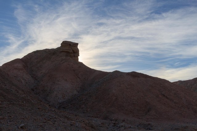
On the fourth day, let there be land. Islands popped up out of the ocean, and long stretches of hills and mountains took shape under puffy white clouds and blue sky. Spouts of water shot up from the surface of the water and dark shapes rolled out of and back into the water. Although they weren’t close enough to get a good shot, we enjoyed watching for the puffs of water that signaled whales were near.
Whale spout and a little itty-bitty piece of tailOne of the many islands along the Chatham Straight
The ship pulled up to the pier at 1:30 p.m. and the first thing we saw were eagles flying around from tree to tree, gliding on thermals, and landing on buildings and light poles. We had never seen so many eagles in one place before.
Shimmying in placeTie ‘er up boysEagles, eagles, everywhere. Wish they would have posed for a crisp photo.
I think all the passengers had cabin fever like us because it took us forever to get off the ship. Something must have happened to cause the delay, but we never heard. We selected a guided hike through a rainforest to see Mendenhall Glacier for our excursion.
Rainforest trail to Mendenhall Glacier on the Powerline Trail
We couldn’t have asked for a better day to take a rainforest hike. Prepared for showers, we soon stuffed our jackets in our backpacks. The high school student who served as our guide taught us about the different plants in the rainforest and about the glacier. It was interesting to hear her perspective on the receding glacier that differed from that which environmentalists espouse. If it hadn’t been for the melting of the glacier, there would be no rainforest, and some residents in Juneau love their rainforest as much as the glacier. I’m not sure who is right or wrong, but I’m positive time will provide the answer.
Section of a one-mile pipe that carried water from Nugget Creek to Nugget Creek Powerhouse.Steep CreekThis shelter was erected by the Civilian Conservation Corp sometime between 1934 and 1940This photo shows Mendenhall Glacier not far from the building and no rainforestMarkers show where the ice was in 1916 and 1936. They were about a football field distance from each other. Then we kept walking for quite a while.Mendenhall Glacier from the trail
We wanted to get a closer look at the lake and the waterfall, but we barely had time to visit the facilities before catching our bus back to town.
Mendenhall Glacier from the visitor center. Helicopters land behind the foot of the hills for a close-up adventure on ice.
We also wanted to take the Mount Roberts Tramway, but it had closed by the time we returned to town after our hike.
At the top visitors find a restaurant, gift shop, and plenty of trails to explore.
We finished off our day in Juneau with a cedar plank salmon dinner with green beans at Twisted Fish Company. They serve up a casual atmosphere and great food. We couldn’t have asked for more, and it was nice to eat something that didn’t come from the ship.
Back on board, we pulled away from the pier at 10:00 p.m. Next stop on the cruise was Skagway.
Leaving the truck and fifth wheel behind, we climbed aboard the Grand Princess in San Francisco on June 5, 2018, for a 10-day round-trip cruise to Alaska.
I was shocked at my first glimpse of the ship as we crossed the Bay Bridge. The San Francisco skyline impresses me every time it comes into view. But to see the ship tower over the embarcadero was something to behold. From the perspective of the ship’s sun deck, the city looks like a Lego set in comparison.
View of San Franciso skyline from Sun Deck
Sail Away
As soon as we entered our stateroom, I was giddy with excitement and wondered about our forthcoming sail on the high seas. Whoopee! A real vacation, I wanted to scream. I managed to contain myself, not wanting to alarm the neighbors.
Wait a minute. Didn’t we just spend almost three months traveling around the southwest in an RV? Isn’t that like a perpetual vacation? Well, sort of. When we’re on the road, we cook our own food (most of the time), wash up the dishes, launder our clothes, make the bed, clean toilets, dust and vacuum, and patronize grocery stores. All this plus Jon keeps busy with all the maintenance and we (mostly me) plan our route for our next stay, make reservations, and arrange sightseeing activities.
No, we’re not tired of our RV trips. We love traveling and driving the highways and byways of these beautiful United States. But ten whole days of doing none of those tasks listed above was going to be heaven.
We left our bags to unpack later and headed to the Horizon Court on the Lido deck for lunch. The pocket-sized map served as our GPS for getting around the ship. So many decks and keeping track of aft, forward, midship, starboard, and port was going to challenge these two novice sailors.
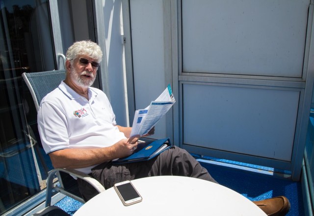
We found our way back to our cabin after lunch, unpacked our bags, and with an hour or so before our departure time, Jon relaxed on the balcony.
Jon studies the itinerary
Unable to sit still, I spied on the delivery inspections and the U.S. Coast Guard and captured a ton of city skyline photos from the perspective of the ship.
Inspectors at workCoast Guard checking things outFog City Diner and Trolley Car
When the captain announced that the ship would soon be on its way, we joined other passengers on the sun deck. As the ship prepared to sail through the San Francisco Bay, servers offered a specialty drink, for an extra fee, of course. Why not? We’re on vacation.
I spilled my drink after taking this photo. Boohoo!
Cruising the bay was nothing new to us, but from the height of the sun deck, it was magical. Especially the way the buildings shifted positions as we made our way toward the Golden Gate Bridge. Notice how Coit Tower (the fire hose looking building on top of a hill), the Transamerica Pyramid (the pointy building), and the new Salesforce building (the tallest of them all) shift positions in the triptych below.
I have driven on the Golden Gate Bridge and admired its beauty from the south, west, and north, but never have I sailed under the rust-colored steel structure. This would probably be my only chance to take a photo from underneath. With continuous shooting on and my eye to the viewfinder, I clicked away while fighting the wind and the movement of the ship.
Under the Golden Gate Bridge
And so our adventure began as we took one last look at the bridge and skyline and headed for open waters and north to Alaska.
Fort Point is under the bridge support on the right side of the photo. The national historic site, a popular place for photography, is open for self-guided tours on Friday, Saturday, and Sunday from 10:00 a.m. to 5:00 p.m.
Two Days at Sea
Managing to keep busy for the two days at sea was not an issue on the Grand Princess. Exploring the ship was like a treasure hunt with a lot of climbing up and down stairs multiple times a day. The elevators worked fine, I just prefer not to cram myself in one if I can help it. Then there was the calendar of events that began at 9:00 a.m. and continued into the night for I don’t know how long. I had trouble lasting much past 10:00 p.m.
Sea days are good days to walk the Lido deck
One afternoon, Kelley White demonstrated totem pole carving. Kelley, a member of the Tlingit tribe, learned his craft from Nathan Jackson, a master carver and famous Alaskan artist. Kelley amazed us with his storytelling and carving skills. He had the audience in his hands as he told stories about the Tlingit tribe, history, and purpose of totems while he wandered around the log, examining his cuts, thinking how he was going to approach a certain section, and chipping away the wood to create the animals that will adorn the totem. I was in awe at the way he kept talking while straddling the tree and digging bits of wood out with a hatchet pointed in his direction. I was so afraid he was going to slip and hit a knee, or worse, his private parts.
This looks dangerousFirst cuts made on the log
We learned the population of the ship included a number of Bay Area folks. On June 8, the ship broadcasted what turned out to be the last playoff game when the Warriors beat the Cavaliers. Passengers filled the room and hallways with their Warriors T-shirts and hats, and high-five slaps and hoots and hollers rang out at the end of the game. If there were any Cavaliers fans about, they must have kept quiet.
Fun Ship Facts
Built in Italy in 1998
24 knots maximum speed
2,600 passengers
1,150 crew
107,517 tonnage
949 ft. length
188 ft. height
Coming up next is the port of Juneau, our first stop on the cruise.
The weather forecast predicted a week of heat-wave temperatures for California and Arizona on April 9, 2018. Since the best places to hang out when it’s scorching hot are a forest at high altitudes or along the coast, we headed for the San Diego Resort-Sunland in La Mesa, California. Although in the 80s, it was better than panting in temperatures that approached 100 degrees.
Urban wildlife
The goal of our recent San Diego visits is to explore places we have never been before. We checked off Mt. Helix, Cabrillo National Park, and Lake Murray on this trip.
Mt. Helix
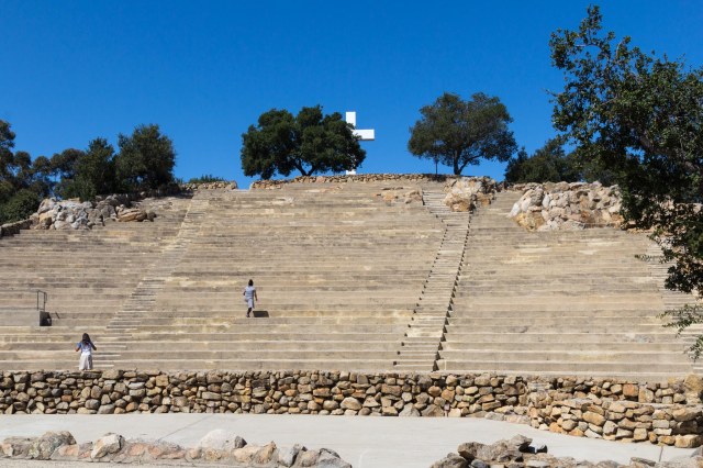
The children of Mary Carpenter Yawkey built the 12-acre Mt. Helix private, non-profit park as a tribute to their mother in 1925. Open year-round, the park attracts residents and visitors to explore the trail that circles the crown of the mountain; engage in a fitness work out by using the amphitheater steps, seats, and retaining walls; and to marvel at the 360° views. After tackling the steps five or six times, I surprised myself and managed the seats as well.
Mt. Helix AmphitheatreSmile for the photo opContemplating lifeCross at the top of Mt. HelixOne of the 360° views from Mt. HelixNot a clear day in San Diego
Cabrillo National Monument
We visited Cabrillo National Monument a few years back, but that was before I had my National Park Passport. So off to Point Loma to add another stamp in my book.
Gettin’ a bit shaggy there JT
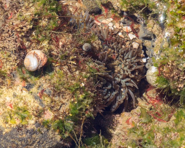
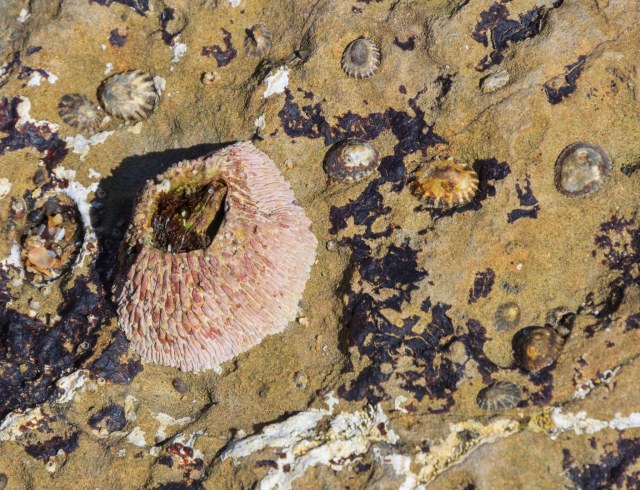
Lucky for us low tide coincided with our arrival. We wandered around the rocky intertidal zone for about an hour, peering into the pools to watch the sea anemones and snails going about their business. Witnessing sea life under the water takes a little patience A quick glance won’t do if the aim is to watch the animals move around. Other creatures clung to the cliffs for a bit of sunbathing while waiting for the onslaught of waves at high tide.
Tide pools at Cabrillo National MonumentGooseneck barnaclesSea anemone and snails in a small poolStaghorn kelp, perhaps?Couples share a moment as the waves roll inOh, how I adore your limpet eyesPink barnacle clinging to a rockA ranger leads students and chaperones through the tide poolsPelican Air Force on duty
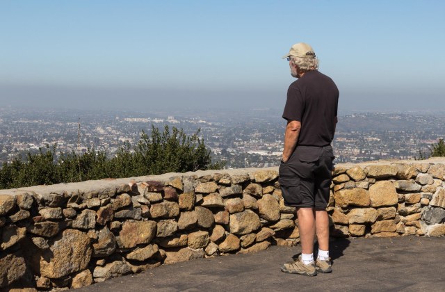
We stopped off at the Old Point Loma Lighthouse, cooled off while watching the movie at the visitor center, and gazed out at the views of San Diego’s skyline and watercraft in the bay.
Old Point Loma LighthouseExhibits inside depict life as a lighthouse keeper
The monument recognizes the arrival of Juan Rodriguez Cabrillo in September of 1542. Cabrillo was the first European to explore the west coast of the United States. He described the bay as “a closed and very good port,” and named it San Miguel. Another explorer, Sebastian Vizcaino, changed the name to San Diego 60 years later.
Juan Rodriguez Cabrillo monument statueBlack Phoebe flycatcher, perhaps?
Military uses of the point include a military reserve beginning in 1852, the installation of gun batteries in 1899, and a harbor defense system during World War I and II between 1918 and 1943. Visitors can see remnants of the batteries and an old radio station where an exhibit of “They Stood the Watch,” depicts the military history of Point Loma.
Battlement near the lighthouse
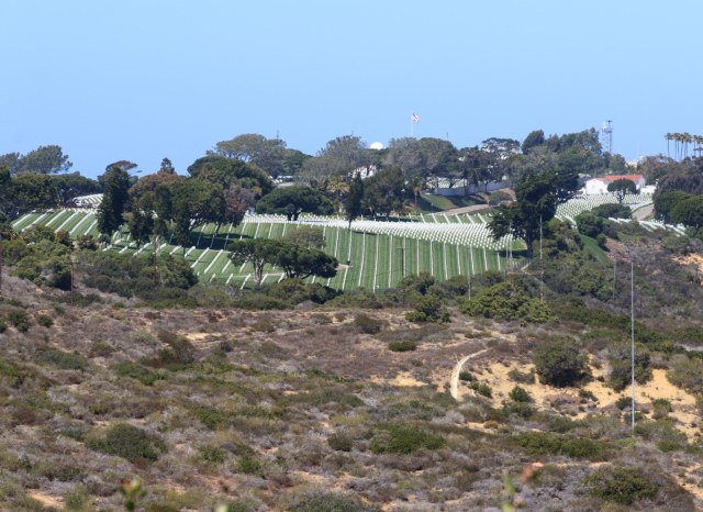
From the ocean to the San Diego skyline, the views are spectacular from the monument.
Ocean viewsSan Diego skylineRosecrans National Cemetery
Lake Murray Reservoir
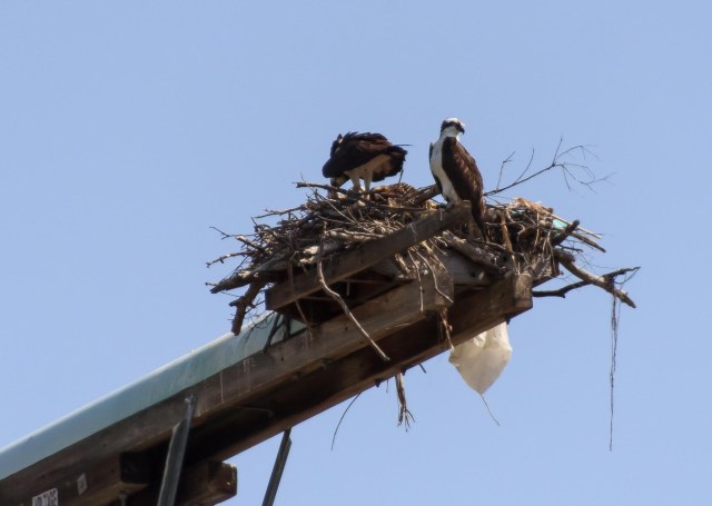
Less than two miles from our base camp, Lake Murray Reservoir is a convenient park to visit, enjoy a lakeside walk and a bit of nature, or grab a picnic table and eat lunch. A 3.2-mile paved service road outlining the lake’s perimeter and ending at the dam is popular with walkers, joggers, and bicyclists. Fishing is also available. Or, rent a paddleboat or a kayak on a first-come-first-served basis from the concessionaire. We chose a 6-mile walk around the lake, turning around just short of the dam.
Lake Murray ReservoirHere fishy, fishy, fishPaved trail around Lake MurrayRent a paddle boat or kayakOsprey nest
It’s a Wrap
That pretty much concludes our 2018 Winter Tour. We left San Diego on April 15, 2018, took a detour through Lake Havasu to take care of some business and arrived home on April 20. This was our longest tour yet, a total of 81 days, almost 12 weeks.
As much as we love being on the road, we were both glad to make it home safe and sound. Time to dust ourselves off and catch up with family and friends. Oh yeah, Jon has a long list of RV preventative maintenance projects to complete before our next tour.
Before we packed up the rig and hit the pavement again, we needed a little vacation. A roundtrip Alaskan cruise from San Francisco seemed the ideal adventure for these two road-weary travelers.
Onward we traveled to trade in the Orange County crowds for peace and quiet in Borrego Springs on April 4, 2018, the 68th day of our 2018 Winter Tour. We arrived at Palm Canyon Hotel and RV with time to check out the Anza-Borrego Desert State Park visitor center.
We watched the introduction movie and picked up a few pamphlets and maps to plan our days.
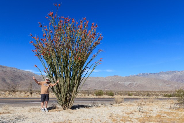
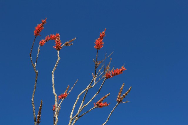
Anza-Borrego is known for its fabulous display of spring wildflowers when winter rains provide ideal conditions for the show. The winter of 2017-18 did not bring enough rain.
Wait, stop! A lone ocotillo in bloom. We wondered if someone drove by each day and gave it a drink.
The Hikes
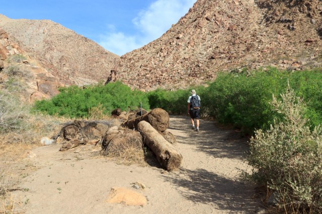
Borrego Palm Canyon Trail
Borrego Palm Canyon Trail is a popular hike that skirts a creek through a canyon. Doves cooed and bees buzzed, and sand-colored lizards dashed about as we walked by, and a few wayward cactus blooms poked out their heads
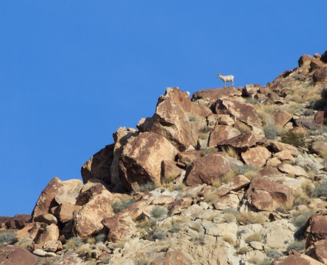
A white dot appeared on a ridge. Was it a bighorn sheep? I zoomed in to see and wished we were closer.
The 2004 flood uprooted a bunch of palms in the canyon and scattered them along the trail and in the creek bed.
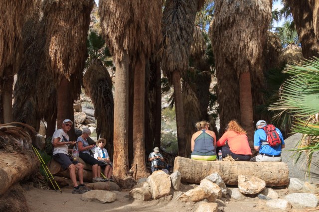
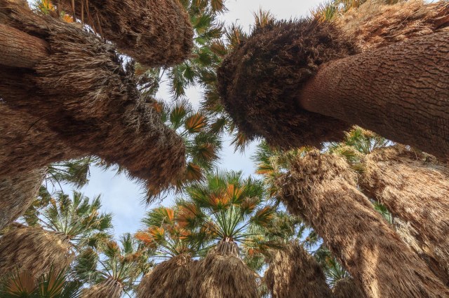
After scrambling over creek boulders, we entered an oasis. The canyon must have been a beautiful site before the flood.
JT navigates the creek crossing
We joined a group of people in the shade and enjoyed our snack before making our way back down.
Resting in the shadeCalifornia Fan Palms
The streaky clouds hardly subdued the heat.
Fallen palms
The Slot
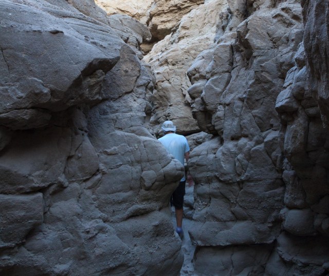
We woke early to hike The Slot, hoping to beat the heat. Although the sun had already risen over the horizon, the valley floor was still in shadow when we started out.
It was a good thing we woke early to hike The Slot. The tight squeeze through the canyon would have been challenging if we encountered people coming toward us.
How’d he fit through there?
Although the walls lacked the variated red of other canyons we’ve explored, the formations were still impressive.
Only a few cliffs showed off iron oxide layers.
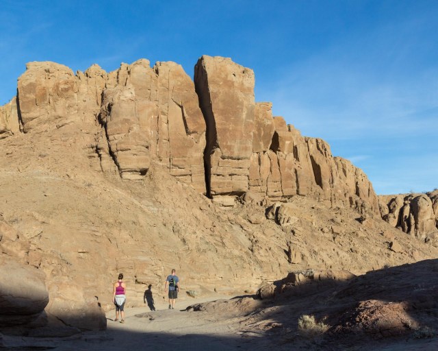
Onward
These man-made formations enhanced the interest of the landscape.
The rocks point the way, but which ones?
Yaqui Well
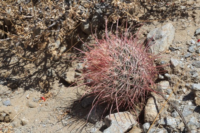
Yaqui Well is located near the Tamarisk campground. Parking along the road is available, some with shade. Sunscreen and plenty of water are recommended during hot weather. This trail is a desert botanical garden featuring several varieties of cactus.
Hedgehog cactus in bloomCalifornia barrel cactusOcotillo blooms but no leaves
Backlit Teddy-Bear Cholla
We didn’t find a well, only a spring. The greenery was a clue water existed, but it was not visible.
Where’s the water?
Narrow Earth Trail
We missed the turnoff for the Narrows Earth Trail and had to turn around. Although tire tracks were plentiful at our turn around spot, they disguised the deep sand. The back tires of the truck stuck hard. Our son, Kevin, and his girlfriend, Bailey, dug out sand from in front of the rear tires, then the three of us pushed the tailgate while Jon drove out, spewing sand all over us. We learned our lesson and now carry a shovel in the toolbox.
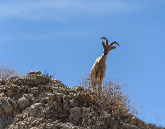
Bighorn sheep were our reward once we found the trailhead and started walking. We watched as a bighorn scrambled through the brush and climbed the hill. Then another one came and grazed while keeping an eye on us.
“I’m keeping my eye on you.”
“I see walking people.”“What you lookin’ at?”
They watched as we slowly made our way up the trail and whispered to each other, “Look, look, over there, kids and juveniles.”
“Look, Ma, there’s people down there.”“Come on Joey, watch your step.”
Although it was a pain in the behind to get stuck, our timing was perfect to see the Bighorn sheep up close.
The Town and Surrounding Area
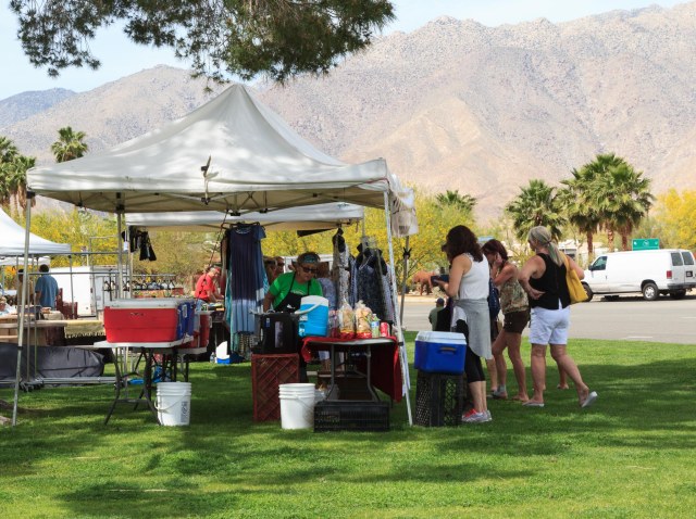
Christmas Circle Community Park
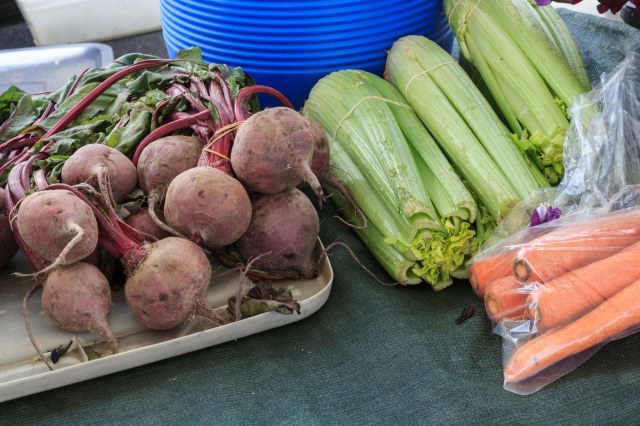
If something is happening in Borrego Springs, it is likely occurring at Christmas Circle Community Park. On Thursday, vendors set up shop at the farmers market. We chowed down on a couple of tamales from a woman who kept busy serving her patrons. The pico de gallo was the perfect complement for the chicken tamales.
Christmas Circle Farmers Market“Hot tamales, come get your hot tamales.”Nice selection of vegetables
Borrego Springs is completely surrounded by the Anza-Borrego Desert State Park and boasts a population of over 3,500 seasonal and year-round residents. It holds the distinction as California’s first International Dark Sky Community due to its distance of 55 miles from the highly populated California coastline.
With tourism as the primary industry, the town includes a variety of resorts and inns for all price ranges as well as restaurants. Borrego Outfitters offer clothing, footwear, outdoor gear, and gifts. Spas, fitness centers, medical services, a grocery store, and a library are other amenities available.
A chock-full calendar of events from October through May provides plenty of events for the tourists and residents.
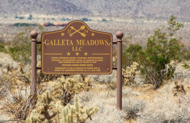
Galleta Meadows Estate
Visitors to Borrego Springs have fun with the sky art throughout the area. Dennis Avery turned his private estate into an art museum when he commissioned Ricardo Breceda to create a series of sculptures inspired by the history and nature of the Anza-Borrego Desert.
Permission is granted!
Dirt roads weave in and around the sculptures, which began arriving in April 2008, allowing visitors to get up close for photo opportunities.
“Settle down now, Colt. I’m bigger than you are.”
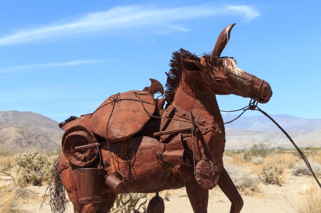
The detail of the metal structures speaks to the craftsmanship that went into their creation.
Detail of the horse
From prehistoric creatures to this miner and his mule, Breceda depicts life in the desert throughout the years.
“Just one more pan full and we’ll go, Betsy.”
Not only does he depict a mule burdened with the miner’s supplies, he sets it in motion as if the jenny is spooked and pulling away from something that has frightened it.
“What am I? A beast of burden?”
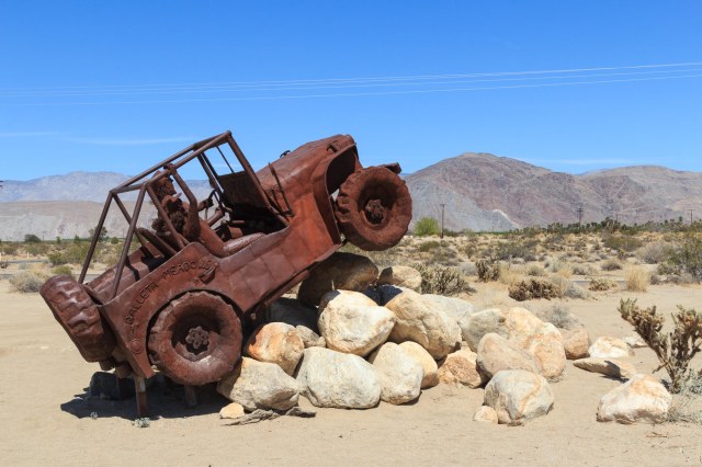
Breceda pays tribute to modern times with the jeep navigating boulders in the backcountry. In Anza-Borrego State Park and surrounding area offroaders have a dilemma figuring out which of the many primitive roads they want to explore.
Whoa, Nelly!
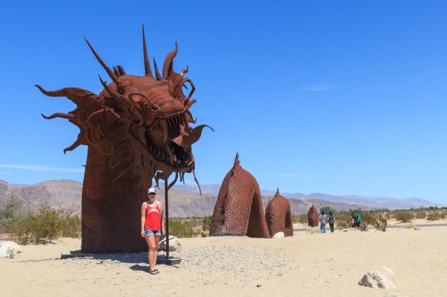
Visitors crowd around the serpent that crosses the road, taking one photo, two photos, and more. We waited several minutes in order to take our selfies. The tail of the serpent continues on the east side of the road.
Serpent’s head on the west side of the road and tail on the east side
Serpent detail
And here are a scorpion and a grasshopper poised for battle.
“I’ll give you 5 to 1 the scorpion clobbers the grasshopper.”
I can’t wait to get back to Borrego Springs and Anza-Borrego State Park to explore all the places we weren’t able to visit. In the meantime, I’m praying for lots of rain during the 2018-19 winter. Come on, rain, bring on the wildflowers.