2020 COVID-19 Adventure Part Ten: Ancient Bristlecone Pine Forest

For a look at some of the oldest trees in the world, we headed up to the Ancient Bristlecone Pine Forest in the White Mountains. The visitor center is in the Inyo National Forest, about 24 miles east of Big Pine. Take U.S. 395 to SR 168 east and continue to White Mountain Road. Don’t expect to arrive in 25 minutes. The hairpin turns and S-curves make for slow going, and you may want to stop along the way.

Man sitting on bench next to a rocky trail and bushes
Jon waits for me to put the camera down and catch up

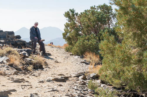
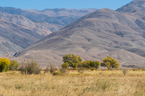
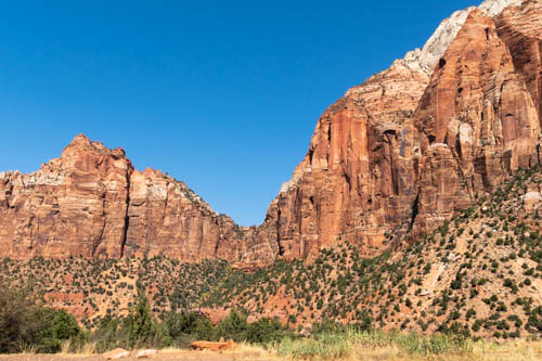
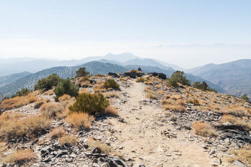
Along the way is Sierra View Overlook, about 20 miles from Big Pine, where a short hike from the parking lot took us to spectacular views that spanned almost 360-degrees. With smoke engulfing the lower altitudes, we weren’t able to see Mt. Whitney or Mt. Dana in Yosemite National Park or Mono Lake. Only a silhouette of the Sierra Nevada Range was visible.

Landscape view of shrubs, mountains and smoke below blue skies
View northwest from overlook
Landscape view of shrubs, mountains and smoke below blue skies
View southwest from overlook
Landscape view of trail, shrubs, mountains, and smokey skies
View west from overlook

The park had already prepared for winter by boarding up the visitor center. There were plenty of information panels along the boardwalk that detailed the trees and shrubs in Schulman Grove. The visitor center is new construction, having been built after a fire on September 4, 2008, destroyed the original.

Wood boardwalk leading to wood building with Steel roof and pine trees in background
Ancient Bristlecone Pine Forest visitor center

There are two trails at the visitor center: The 1.0-mile loop Discovery Trail and the 4.2-mile loop Methuselah Trail. Both are advertised as easy-moderate and start at the visitor center. We only had time for the Discovery Trail, where along the way, additional information signs told us about the trees and Schulman Grove.

Sandy looking hill with bristlecone pine trees
Future ancient trees grow on the steep slope

The park named the grove after Dr. Edmund Schulman who in 1953 discovered that the bristlecone trees were over 4,000 years old. His discovery led to a calibration of the carbon-14 dating technique and changed the estimate of when ancient man first possessed certain technologies.

Stump of ancient bristlecone pine tree
Ancient stump shows compressed circles of life
Fire damaged bristlecone pine tree trunk
This tree damaged by fire still lives

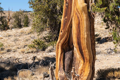
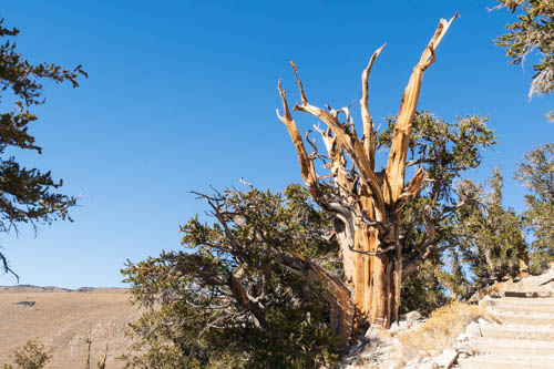
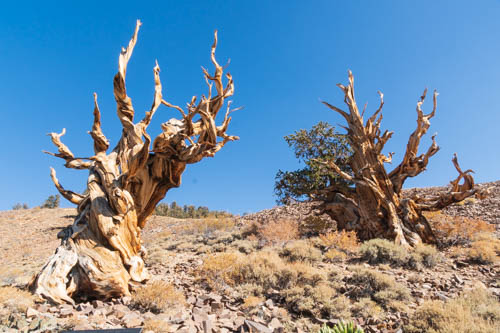
Younger bristlecone pines and those growing in nourishing soil stand tall with plenty of branches and needles. The ancient trees are my favorite, with their gnarly growth forms that twist this way and that way. They may have spikey dead tops, limbs and trunks with bare wood, or polished limbs, strips of bark growing up the tree, and exposed roots.

Ancient bristlecone pine tree
Exposed roots cling to the gravel and rocky soil

Steep, exposed slopes and the alkaline dolomite soil is the perfect growing medium for the long-lived trees. The white soil formed at the bottom of an ocean when deposits of small particles of dead organisms, sand, and silt formed sediment deposits 650 million years ago. Bristlecone pines that grow in better soils and receive more moisture grow faster and taller, but they die sooner.

Ancient bristlecone pine tree
Still alive after all these years

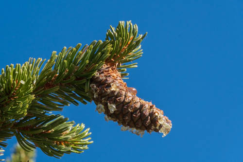
Short and dry growing seasons make for slow growth, allowing pines to produce only tiny amounts of extremely dense and resinous wood each year. Insects, animal pests, infection, heart rot, and even fire are not a danger to the bristlecone pines. The hard wood and resin protect the tree.

Many standing next to bristlecone pine tree at the side of a trail
Jon, worn out by the altitude, takes a rest

Bristlecones can lose 90% of their bark and keep growing with just a narrow bark strip connecting live limbs and roots. The trees spread out in their environment instead of crowding close together. This leaves a natural firebreak that can limit the spread of wildfires.

Ancient bristlecone pine tree
Barren land across the dirt road

I would have thought some of these ancient trees were ready to topple over when I saw their exposed roots. Not so. Scientists estimate the average rate of erosion in the Discovery Grove is one foot of soil loss per one thousand years. The exposed roots do make the trees susceptible to disease and insect infestation, so that is a factor in the trees’ lifespan.

Ancient bristlecone pine trees
Bristlecones in battle? Or are they dancing?

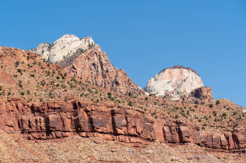
This is another place where the Pacific and North American plates created mountains that tower above the valley floors. Through the folding, faulting, and uplifting action of the plates, the bottom of an ocean rose over 10,000 feet to create the White Mountains. Standing at 10,000 feet above sea level, it’s hard to believe the ground on which we stood was once below sea level. Of course, this took hundreds of thousands of years, but the forces needed to achieve such a feat are hard to comprehend.

Landscape view of road cutting through bristlecone pines and golden hills
The road back to civilization

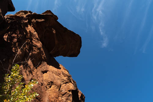
Extreme heat and pressure from the platonic movements altered sandstone grains, melting and fusing them together and creating the red quartzite in the photo below. Forces from wind and rain exposed the red rock. Rain seeped into cracks in the red rock where it froze, expanded, and broke the slabs apart. The pieces then fell, rolled, or slid down the mountain and collected in a talus slope.

Talus slope of red quartzite
A talus slope of red quartzite

Unfortunately, we missed seeing the largest bristlecone pine, the Patriarch Tree. A 12-mile dirt road with a 15 mph speed limit leads to Patriarch Grove, where the tree is located. It was too late in the day for us to travel farther than Schulman Grove.

View from top of Discovery Trail

It was a humbling experience to learn these trees were already 1,000 years old during Shakespeare’s time. Nothing like a 4,000-year-old tree to make me feel like my lifetime was but a microscopic speck in this great universe.

Other locations where the Great Basin bristlecone pines grow are Utah and Nevada. The Foxtail bristlecone pine grows in the Klamath Mountains of California and in the southern Sierra Nevada mountains. The Rocky Mountains claim their own species of bristlecone pines, which have gray-brown bark instead of the orange-yellow to light brown of those found in The Ancient Bristlecone Forest.

Bristlecone pinecone and needles

Scientists are not sure what fate awaits the trees because of climate change and global warming. Although they have noted that new generations of trees are taking root at higher elevations. Will the older generations survive? Time will tell as competing plants, insects, fire, and higher temperatures encroach on their ideal location. Only our descendants will discover the answer, if humans endure long enough.

Up next will be the last post detailing our October 2020 adventure during the pandemic.

Until then, stay safe.

October 2020 COVID-19 Adventure Part Nine

In this episode, we visit Laws Railroad Museum and Historic Site, a California Historical Landmark. The museum is also listed on the National Registry of Historic Places.

We first tried to visit Laws Railroad Museum on a day the wind was blowing so hard it picked up dust and dirt and flung it all around. The day after the windstorm, all the bad air had disappeared, leaving only blue skies behind and clear views of the mountains.

Landscape of yellow dry grass, trees and mountains in the background
View east from museum toward the White Mountains
Western looking building serves as reception center and ticket office
Reception Center and Ticket Office
Western buildings and boardwalk
Boardwalk and old buildings

The C & C Railroad rolled into the town of Laws for the first time in April 1883. Three years earlier William Sharon, Henry Yerington, and Darius Mills formed the Carson and Colorado Railroad Company and began construction.

Pathway next to tall trees and kids train ride
View from outside the Reception Center looking south

While crews laid the narrow-gauge tracks between Mound House, Nevada, and Laws, California, people arrived in town, drawn by the opportunities a new railroad would bring to the region.

Engine No. 9, a 1909 Baldwin 4-6-0

They built a depot, an agent’s house, and various amenities to support the railroad and the trains. Homes, barns, corrals, general stores, boarding houses, hotels, and warehouses sprang up around the depot.

Laws Depot
Western style potbelly stove inside ticket office of train depot
Visitors find the ticket office inside the depot.
Displays of train memorabilia inside train depot
There’s also memorabilia and model trains
Two wooden pole like objects that form a V at the top
We found these “Y” shaped poles in the depot. Any idea what they are?

By July 1883, the railroad completed its last 60 miles of the 300-miles, and in August trains rumbled down the tracks to the last stop in Hawley (known as Keeler today).

Yellow building with black framed windows and sign that says medical offices
Every town needs medical offices
Eye exam equipment
Looks like the same device my optometrist uses to check my eyes.

For nearly 50 years, the railroad provided passenger service and hauled freight. It supported the mining industry and local ranchers and farmers. The conversion from narrow gauge to standard gauge railroads was but one contributing factor in the demise of the C & C. Improved roadways, trucks, and automobiles allowed passengers and freight to travel farther, faster, and sometimes cheaper than the train so there was a steady decline in their use.

Singer sewing machine in wood cabinet and table with patterns and notions
Dressmaker’s shop
Sewing patterns and notions on a table
My grandmother made all my school clothes until I was in high school. I think the blouse and skirt pattern looks familiar.

In March 1900, Southern Pacific (S.P.) purchased and operated the railroad. S.P. discontinued passenger service in 1932, and the freight trains made their last run in 1943. The tracks north of Laws were removed, leaving only the 60-mile run to Keeler.

Fire station old wooden yellow building
Pioneer Building and Fire Station
Bishop Rural Fire Dist. R-2 fire truck
The 1947 White. built by Van Pelt, with original 10,000 miles, is still operational
Spider webs among fire fighting equipment
Antique fire equipment needs a cleaning

On April 30, 1960, Locomotive No. 9 pulled a string of cars into Laws Station for the last time. The City of Bishop and the County of Inyo became the owners of the property under a gift deed by S.P. and on July 6, 1964, they also transferred the land.

Printing press equipment
Working printing presses dating back to 1880
Potbelly stove and display cases inside a general store
General store
Small weathered wood building with Post Office sign
Laws last original post office

On April 1, 1966, eighty-three years from the day the train arrived, Laws Railroad Museum opened the doors to the public. It amazed us how much the museum had grown since our first visit in the early 1980s.

Black horse-drawn hearse inside building with western memorabilia
Hearse in the Western Display
Saddles, brands, horseshoes on display
Saddles, brands, and other paraphernalia in the Western Display

The engine and train cars are original, as are the depot, agent’s house, oil and water tanks, and a turntable. The rest of the town was torn down for salvage by 1959. The other buildings occupying the museum’s eleven acres were local structures saved from destruction and moved to the site.

Mustard colored 1900s house trimmed in brown with white railing and ramp
Original 1883 Agent’s House

One of the prized possessions of the museum is a restored circa 1900 local ranch house with period furnishings. The Shipley and Conway family tree hangs inside the home and shows the three generations that lived in it before it was moved to its new location at the museum.

Inside an early 1900s home with wood accents and papered walls
Pillars and decorative header separate the living and dining areas
Inside early 1900s home showing a mannequin in period costume, wood carved bed, quilt, water pitcher, and bowl
Bedroom one
Bedroom inside early 1900s house with bird cage, wood carved bed, rocking chair, and dolls
Bedroom two
Dining room inside early 1900s home, with wood built-in hutch and buffet
Love the built-in buffet and hutch
Early 1900s kitchen with stove, table, and dishware
All the modern conveniences in the kitchen
Early 1900s bathroom showing toilet, pedestal sink, and tub
Bath

Besides the ranch house, visitors will find the Library and Arts Building housed in Bishop’s first Catholic church, a gazebo, a 20 Mule Team Borax Wagon exhibit, gas station, farm and mining equipment, and train restoration shop. The following pictures are just a sample of some of these exhibits.

Early 1900s School house painted gray with white trim
Original 1909 North Inyo School House
Stone building with wood and tin roof used as blacksmith shop
Blacksmith shop
Table and icebox inside a miner's shack
Inside miner’s shack
Two bath tubs set in floor at early 1900s bath house
Bath house
Late 1800s train tracks, train turntable, and water tank
Tracks, original 1883 Armstrong turntable, and replica 1883 water tank
Mining equipment and replica mine tunnel
Replica mine tunnel comes complete with audio of pick axes, voices, and a blast

This isn’t the first actual, or replicated, western town we have visited, and I’m sure it won’t be the last. We find it fascinating to walk the streets, peek inside buildings, and imagine what life was like in the late 1800s and early 1900s. I can almost hear the clomp of horses’ feet, the jingle of their bridles, and a whistle in the distance announcing the train’s arrival.

Next up, we finish up our time in Bishop, California.

Stay Safe

October 2020 COVID-19 Adventure: Bishop, California and Manzanar National Historic Site

We left Alamo, Nevada, on October 21, 2020, with Bishop California as our destination. Welcome to the smoky Eastern Sierras. When I made the reservations, the dirty air had not yet filled the Owens Valley with ash and smoke that obliterated the mountains from sight.

The only spot I could find in Bishop was at the Inyo County Fairgrounds. The best part about the campground was the high-speed Wi-Fi connection, which allowed us to stream Netflix. We treated ourselves to dinner out on the patio of Whiskey Creek Restaurant, a place we sometimes visited when passing through town on our way to or from Mammoth Lakes decades ago.

Brown building, green grass, boulders, and sign for Whiskey Creek Restaurant
Whiskey Creek Restaurant Patio Dining
Street corner, semi trailer, cars, and setting sun obliterated by smoke in the air
Smoke shrouds the Sierra Mountains

The next morning, the air quality was worse, reducing visibility to about a quarter mile. Lone Pine’s air quality wasn’t as bad, so we headed south to see Manzanar National Historic Site. We had driven by the property for years when all we could see was a gate, fence, and a sign listing it as a historic landmark. We were eager to find out what was behind the fence.

Wood sign for Manzanar War Relocation Center
Manzanar War Relocation Center is close to U.S. 395

A driving tour took us around the camp where there were places to park and explore different sites with information panels to tell us what we were looking at. Only a few buildings had doors open that we could peek into but not enter.

Desert landscape with large green building and signs
Visitor center closed during pandemic

In reaction to the Japanese bombing of Pearl Harbor on December 7, 1941, President Franklin D. Roosevelt signed Executive Order 9066 in February 1942. The order authorized the Secretary of War to remove individuals deemed a threat to the war effort for relocation at one of 10 centers in seven states around the country.

Sidewalk, rocks, sandy area with a few trees and brown buildings in the background.
Baseball and basketball were favorite sports the internees enjoyed

It turned out the threatening individuals were 120,000 men, women, and children of Japanese ancestry living in the United States. Whether they were American citizens by birth or lived in the country for decades, they entered the camps with only a small amount of what they had owned.

Man standing near a wood and tar paper clad building, white pickup truck, basketball hoops in background
Jon checks the exterior walls made of only thick tar paper instead of stucco or siding.
Inside wood barracks with cots, bedding, hanging clothes and information signs.
Reconstructed barrack room depicts life in camp
Inside wood framed barracks showing information signs
The building was closed so we couldn’t go inside to read the information panels in the Block Manager’s Office

Manzanar was not one of those fancy summer camps near a lake. Military police manned eight guard towers with searchlights and patrolled a barbed wire fence that enclosed a 500-acre housing section comprising 504 barracks arrayed into 36 blocks. The remaining 5,500 acres outside of the fence included housing for military police, a reservoir, a sewage treatment plant, and agricultural fields.

Wood and tar paper building used as women's latrine
Women’s latrine

Several Japanese American men and women arrived in Manzanar in March 1942 as volunteers to help the Army build the camp. It was the first camp to open. The War Relocation Authority (WRA) took over operations on June 1.

World War II era red delivery pick up with wood framed tar papered brown buildings in background
World War II Era Mess Hall
Dishes, cups, pot, and counter inside mess hall
Inside recreated WWII mess hall

Around 10,000 Japanese American internees occupied the camp by September 1942. Imagine the disappointment on their faces as they descended the bus steps and encountered 110-degree weather. Carrying their meager belongings, they walked along paths, sand filling their shoes.

Sign for John Shepherd Ranch, blocked off road, and clumps of trees
The location of the camp was near the former John Shepherd Ranch, who settled in Owen’s Valley in 1861, and the former Town of Manzanar, a once-thriving community filled with fruit orchards.

When they reached their assigned barrack, they found it divided into four 20-by-25-foot rooms to be shared by eight individuals. The only furnishings included an oil stove, a single hanging light bulb, cots, blankets, and straw-filled mattresses. Families shared a laundry room and mess hall and endured communal toilets and showers lacking any kind of privacy.

Large veritcal rock with painted Japanese characters, Pleasure Park, and 1943
Pleasure Park is one of many parks and gardens built by internees
Coins, bracelets, origami and other trinkets at foot of Pleasure Park 1943 sign
Trinkets and origami left by visitors
Sandy area, boulders, wooden bridges, cement pond with no water
Water features, bridges, and shade at Pleasure Park

As if the hot temperatures weren’t enough, the weather dropped below freezing during the winter months. During the year, the internees dealt with strong winds blowing dust and sand through the camp and into the barracks and up through the floorboards.

White obelisk with black Japanese characters, Soul Consoling Tour, smoky skies
Manzanar Japanese erected the “Soul Consoling Tower” in August 1943 as a permanent tribute to the 150 people who died there.
Round gravesite outlined with rocks in the sand and headstone
Family members relocated most of the graves after the camp’s closure, but a few remain.
Origami wedged among rocks
Origami and other trinkets decorated the gravesites

I admire the way the Japanese Americans managed during their incarceration. With ingenuity and cooperation, they established boys and girls clubs, churches, and temples. They built gardens and ponds, developed recreational activities, sports, music, and dance, and even published the Manzanar Free Press, a newspaper, even though the people were not free. Growing vegetables and raising chickens, hogs, and cattle were among their enterprises. Through the pooling of resources they operated a general store, beauty parlor, barbershop, and a bank.

Kendo Dojo sign, cut yellow shrubs, and trees in the background.
Site of the Kendo Dojo

The way the Japanese Americans prospered under such an oppressive situation impressed on me how we humans are a resilient lot able to overcome adversity.

World War II ended with Japan’s surrender on August 14, 1945. Manzanar War Relocation Center closed on November 21, 1945. In 1972, California established Manzanar as a California Registered Historical Landmark. It became a National Historic Site on March 3, 1992, and the interpretive center opened on April 24, 2004.

Wooden guard tower in a field of desert shrubs and grasses, and smoky sky.
One of the eight guard towers

I’m embarrassed when I learn how our country has mistreated groups of people during our history. Places like Manzanar National Historic Site tell the stories of what happened there, what people endured, and how they survived and thrived. They bring light to the darkness of those days to future generations who hopefully avoid a repeat of our misguided actions.

Stay tuned for more Bishop, California, fun coming up next.

Stay Safe

2020 COVID-19 Adventure: Zion National Park Part One

We counted the trip to the California coast a success, so it was time to map out our next adventure. Initially, we planned on a week or two in San Diego to visit our son, Kevin, and his better half, Bailey. They had other ideas in store for us. When they mentioned Zion and Bryce, we said, “Sure. Let’s go.”

With the trailer loaded with food and clothes, we made our first leg of the trip to Barstow, California, on October 3, 2020. Smoke from the California fires filled the skies until we reached the Tehachapi Summit. I switched the AC from recycle to fresh air and we took big deep breaths as we descended into the Mojave Desert.

The next morning we left Barstow at sunrise, which wasn’t all that early, only 6:50 a.m. It sure looked like smoke or dust or something had shaded the sky with orange and yellow hues. The iPhone 8 captured a surreal image.

Sunrise in the desert
Desert Sunrise

In Las Vegas, Nevada, we caught our first glimpse of the new Raider’s Allegiant Stadium from the freeway. Bitterness that the team left Oakland, again, still exists in the Bay Area, although I’m sure fans in Las Vegas are happy about the move. The stadium should be a boom to the City of Las Vegas once we come out of the pandemic, and fans are let back into the sports arenas.

View of Raider's Football Team's Allegiant Stadium
Raider’s New Nation

The quick breakfast we ate that morning had long worn off when we hit Las Vegas, which would have been a good place to stop and have a bite to eat. We try to avoid the big cities for our stops because it’s too difficult to maneuver through traffic and find a place to park with the rig. So, we sucked it up and drove the next two hours to St. George. That Cracker Barrel sign never looked so good by the time we arrived.

Cracker Barrel restaurant parking lot and sign
Breakfast, here we come.

In the Bay Area, dining options were limited to takeout and outdoor seating. In Southwestern Utah, they offered inside dining or takeout. Since we hadn’t been inside a restaurant for seven months, we chose the takeout. Cracker Barrel isn’t usually my first choice for a restaurant. I much prefer to buy food from an independent store or a local chain. Jon, on the other hand, loves their pecan pancakes. We put on our masks, locked up the trailer, and set out to order our meals.

We were leery about all the people waiting outside, rocking in the chairs on the porch or standing next to the railing and ignoring the six feet of distance we had practiced since March. Only half of them wore masks. At the time, wearing face coverings was only a suggestion, not a state mandate. The state now requires masks in all state-owned buildings and individual counties may have their own requirements.

We kept our distance the best we could, stepped up to the podium, and ordered our meals. A few minutes later, we were inside the trailer, chowing down on the best Cracker Barrel breakfast and cup of coffee I had ever had. Either the cooks do a better job at the Cracker Barrel in St. George, or I was so hungry, a dog bone would have tasted good to me.

With our bellies filled, we drove the remaining thirty minutes to WillowWind RV Park in Hurricane, Utah, where we had booked three nights. Kevin and Bailey arrived a few hours later.

Rv and truck parked in campsite
Campsite at WillowWind RV Park

On our first day in Zion National Park, we checked out the situation for catching the shuttle (we couldn’t get tickets for the park shuttle, so paid for a private one) and renting equipment Kevin and Bailey would need for their river walk the next day. Then we drove to the east end to see other sections of the park and find a place to eat our lunch.

People taking selfie at foot of arch in the making cliff
An arch in the making
Zion cliffs with white tops
Reverse view from Arch in the making
Cliffs in Zion NP and shadows of people
Look at that view

We passed the Canyon Overlook Trail on our way to the tunnel, and there were no parking spots. So we kept driving and found a place with a bit of fall color to eat our lunch and take a break.

Two men and one woman in a desert setting
Shootin’ the breeze
Pine trees and mountain formation
Navajo sandstone
Closer view of trees and red cliffs
Fall is near
Rock formation with trees
View from picnic site

Checkerboard Mesa is a good place to stop for views. There is plenty of parking, information signs, and plenty of sites to see. Unfortunately, the position of the sun made it difficult to capture the checkerboard feature on the mesa. Earlier in the day would have been better.

Checkerboard Mesa mountain formation

Checkerboard Mesa

The sun was coming from a better angle, so the colors pop in the photo of East Temple.

Mountain Formation in shape of a wedding cake
East Temple

And here are two more views along the road.

View of mountains and cliffs
Geological formations
View of geological formations

Outside of the park on the east side is The Get and across the street is an RV and tent campground and cabins to rent.

Rock cliff looms over building
The Get sells a bit of groceries, sandwiches, gifts, and souvenirs.

On our way back to the west side of the park, we scouted around for a parking space at the Canyon Overlook and ended up having to stop and wait for one-way traffic to clear. When the west-bound vehicles started flowing, a car just ahead of us pulled out, and we slipped right in as if it was all planned perfectly.

View from Canyon Overlook Trail

At first we thought the overlook was close by. It turned out further than we thought. I brought my water bottle with me, but no one else did. We hoofed it most of the way, at least to the section where the cave was and we could peek down into the canyon. So, word of caution: come prepared for a hike, not a short walk.

Zion cliffs, yellow flowers i the foreground
View from Canyon Overlook Trail
Horse head rock formation
Anyone else see a horse’s head?
View of cave opening
View of cave from Canyon Overlook Trail
View of canyon opening
A place to rest
View from cave into canyon

Heading west through the tunnel gives a person a good view out the windows. Luckily, no one was behind us, so Jon stopped the truck for a couple of seconds so we could capture the view with our cameras.

Zion cliffs from tunnel window
View from one of the tunnel windows

After the tunnel there are a few places to stop and take in the views and spot the windows in the rock walls.

Cliff in Zion showing the makings of a natural arch
Another arch in the making
Zion-Mt. Carmel Tunnel window

Next up we have another day of more fun and games in Zion.

Stay Safe