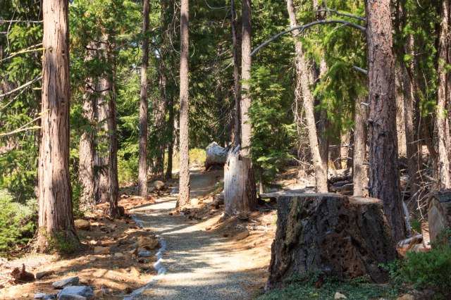
After four nights in Twenty-nine Palms exploring Joshua Tree National Park, we were ready to find new places to explore. We had Boron, California, in our sights, on October 23, 2017. Not to stay overnight, just to check out the Borax Visitor Center, a place we had driven by for the past thirty or forty years going between northern and southern California. It was time to visit the company that once sponsored the Death Valley Days program on television.
The Borax Mine is located on State Route 58 about 12 miles west of Kramer Junction—where US Route 395 and State Route 58 intersect. We weren’t sure we were headed in the right direction. All we could see as we drove down the road were tall towers, steam rising in columns, and hills, nothing that looked like a visitor center.
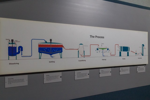
Borax Processing Plant
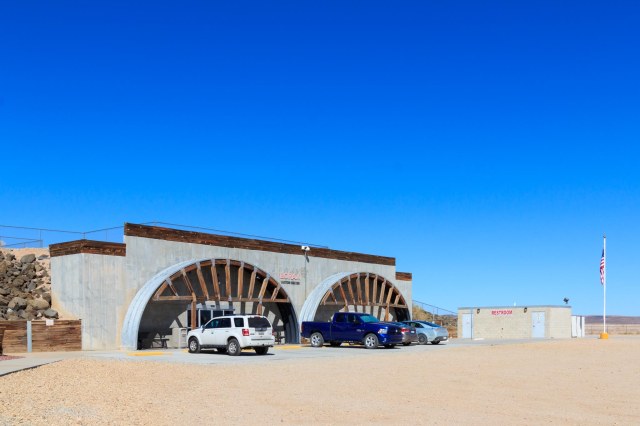
When we came to the end of the road, signs directed us toward an unmanned booth along a dirt road. We trusted the billboard that advertised plenty of RV parking at the top of a hill and kept on driving. When we reached the top, the road turned left and sure enough, there was plenty of space to accommodate multiple fifth wheels and buses.
Borax Visitor Center
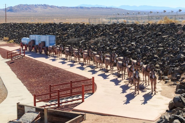
An original 20-Mule Team Wagon set complete with hitched up mule statues welcomed us at the visitor center. The teams carried borax out of Death Valley 165 miles to the nearest railroad junction in Mojave. The round trip took 20 days to deliver 20 tons of borax between 1883 and 1888.
20-Mule Team Wagon with Statues
Today the operation mines colemanite, ulexite, kernite, and borax, from a borate deposit, which has been mined since 1927. These minerals are used in agriculture, ceramics, detergents and personal care products, fiberglass and glass, and as a wood treatment to prevent fungal decay and damage from termites, ants, and roaches.
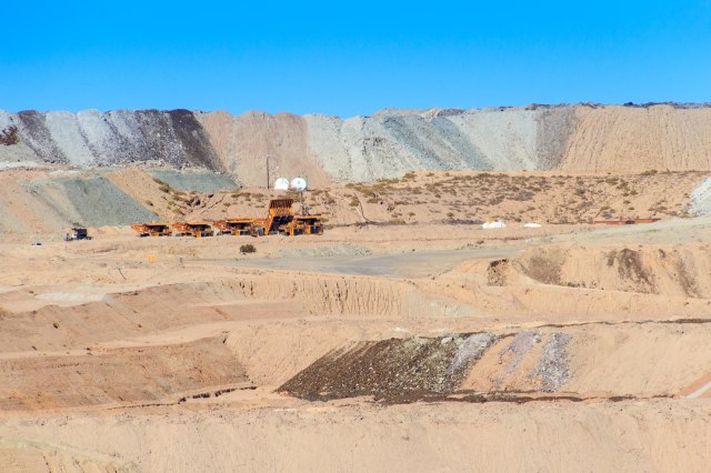
Pit and Tailings
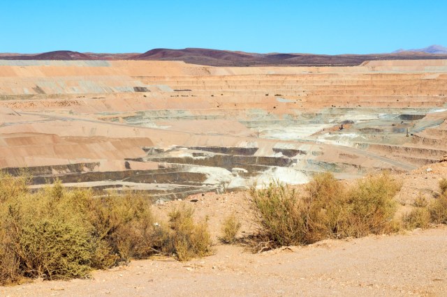
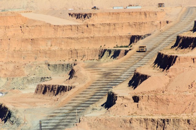
The visitor center is open 7 days a week from 9 a.m. to 5 p.m., except holidays or during bad weather. Admission is free. Inside the building is a theater where a short movie and talks by docents provide information about the Rio Tinto Mining Company and the history of the pit. Displays show how borax is mined and processed, what products the minerals are used in, and the different types of minerals mined. Outside a ramp takes visitors to a platform where they can watch the giant dump trucks, which look like ants where we stood, maneuver atop the tiers.
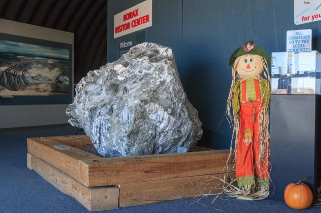
Sample of Borate Ore (Kernite) Taken from Mine in 1997Diagram that Explains the Process
The pit is almost like looking into the Grand Canyon. At 1 mile wide, 1½ miles long, and 650 feet deep, the heavy equipment is dwarfed by the vast landscape. A few pieces of equipment are barely identifiable in the mid-right gray area.
Borax Pit
Even Zoomed in, the Equipment Appears Like a Toy Among the Towering Tiers
Back in Boron is the Twenty Mule Team Museum. Unfortunately, we ran out of time and had to get back on the road so we could arrive before dark in Tehachapi where we planned to spend the night.
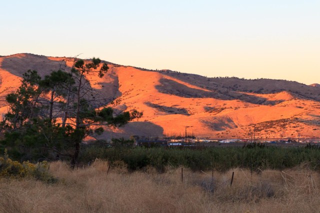
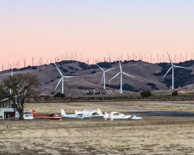
We found a quiet spot away from the trains and freeway at Mountain Valley RV Park where they offer water, electricity, restrooms, showers, and laundry. There is a dump station but no sewer hookups. A short walk away is the Mountain Valley Airport that serves small aircraft and gliders and operates a café.
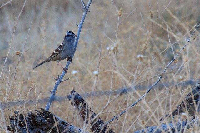
Looking South From Mountain Valley RV Park the Last Bits of Sun Paint the Hills Little Birds Flitted About in the Dry GrassHills and Windmills Create a Backdrop for the Hidden Valley Airport
Coyotes woke us around 4:00 a.m. and as the sun rose, the wind grew stronger. Time to hit the road.
From Prescott we headed toward Twenty-nine Palms, California, to explore Joshua Tree National Park, a place we had wanted to return to for many years. We checked in at Twenty-nine Palms RV Resort on October 19, 2017, for four nights.
Joshua Tree National Park Visitor Center
This desert area became a national park in 1994 after being set aside as a monument in 1936 by President Roosevelt. Jon and I had driven by the park several times going to and from other places and often commented that we needed to go back and spend some time. I was curious about what had changed since I camped at Jumbo Rocks with a group of friends while still in high school. Finally, I’d find out.
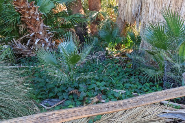
Oasis Visitor Center
We started our exploration at the Oasis Visitor Center where we picked up a pamphlet and a map of the 794,000-acre park. We also walked around the Oasis Trail with a volunteer ranger. She had a grade school teacher’s personality that roused our interest as she pointed out features of the palms, the different plants, and the animals that visited the pond. She explained that they do not trim the dead palm fronds from the trees because they serve as homes and protection for birds, owls, and other critters.
Oasis Trail at Visitor Center
The main highway traffic ebbed into white noise leaving only the sounds of wind whistling through the palm fronds, the trickling spring, birds trilling their songs, and scampering lizards and mice rustling in the brush.
There’s a Spring Under All that Greenery
Along the path is a series of signposts that tell the story of what happens when a seventeen-year-old girl of the Chemehuevi falls in love with a white man. The story gave me a glimpse into the people who visited the oasis in the early 1900s.
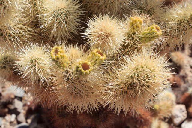
Cholla Cactus Garden
Be sure to wear closed-toe shoes while navigating the quarter-mile loop trail in the Cholla Cactus Garden.
Cholla GardensCholla Garden
Although the branches appear as if they are covered with something soft and fluffy, don’t touch. The prickly barbs will latch onto shoes and clothing and you’ll have a jolly time trying to remove them. The cone shapes tipped with yellow are what is left from the flowers that bloom from March through May.
Cholla Close Up
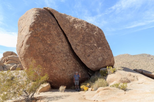
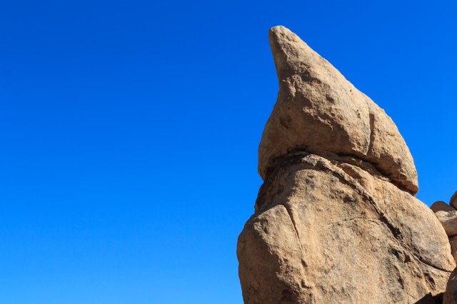
Split Rock Loop Trail
Take the Split Rock short loop trail to see rocks and cactus up close, or extend the hike to a full 2.5 miles by taking the extension to Face Rock.
JT Waving at Split RockMy, What a Big Toe You HaveSleeping Baby Elephant?Yucca Plant Cuddles With a Prickly PearStone Steps Mark the TrailYucca Plants Hanging on to the Last of Their Bloom StalksBalancing Rocks Are A Common SightThe Olympic Flame Just Like in Bryce Canyon
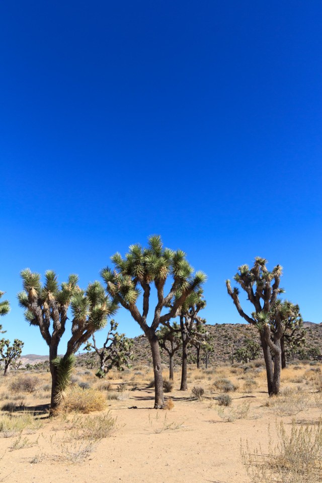
Joshua Trees
Joshua Tree National Park is unique in that it encompasses portions of both the Mojave Desert on the western half of the park and the Colorado Desert on the eastern half. The Joshua Trees, a species of yucca rather than a true tree, are most prevalent on the western side where elevations are greater than 3,000 feet.
Acres and Acres of Joshua TreesJoshua Tree Forest
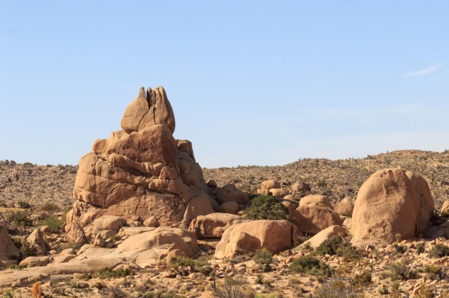
Skull Rock Trail
This is another loop trail and quite popular with cars and trucks parked on both sides of the road for about a quarter mile on either side. Start at Jumbo Rocks Campground, or at Skull Rock. There are trails on both sides of the highway and plenty to see.
View from Atop The Jumbo Rocks
A sampling of plants seen on the trails.
Red Top Buckwheat
Paper Bag Bush
Beaver Tail Cactus
Or, is This a Baby Elephant?Skull Rock Crawling with People
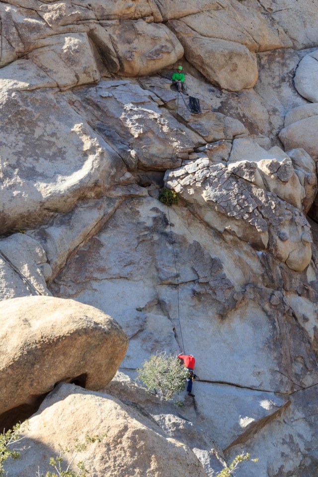
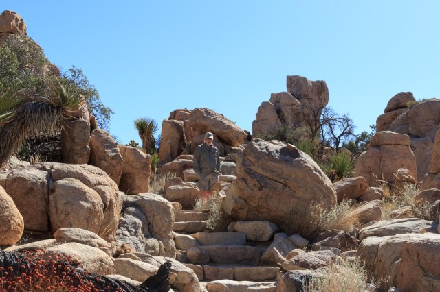
Hidden Valley Trail
I think Hidden Valley Trail was one of my favorites. It’s such a surprise to break through the tight boulder formations and encounter a rock enclosed valley that cattle rustlers may have used to hide out.
Yucca and Other Plants Find Cracks and Crevices to GrowClimbers Have Plenty of Spots to Navigate The Steep Rock Faces in Hidden ValleyLook Ma, I’m King of the HillStairs Make the Trek Easier
Hershey Kiss?
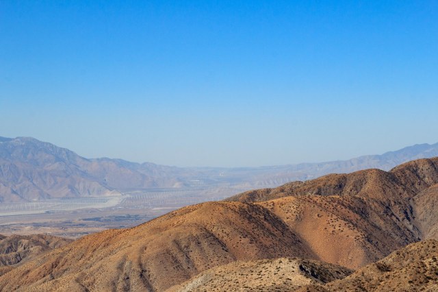
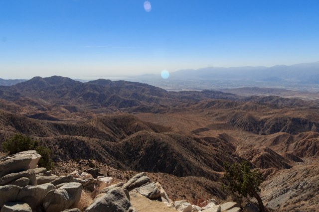
Keys View (5,183 feet)
Keys View overlooks Highway 10 and across the valley stands the Indio Hills.
San Gorgonio PeakSan Gorgonio Pass Looking WestCoachella Valley In the Haze
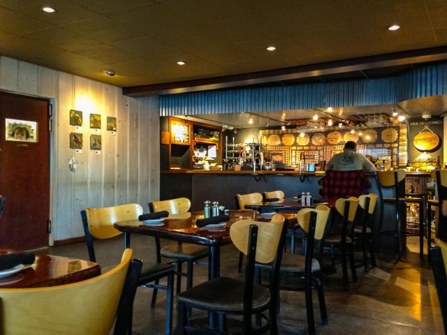
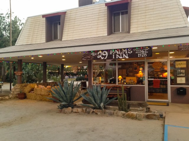
29 Palms Inn and Restaurant
We didn’t expect much in the way of a decent restaurant in town since the main drag was where most of the fast-food chains set up shop. We were surprised, however, when we drove to the end of a road, skirted the pool, and walked into the restaurant at the 29 Palms Inn on the Oasis of Mara. They have been dishing up tasty food since 1928.
29 Palms Inn Restaurant
Dining room at 29 Palms Inn Restaurant
The inn includes several adobe bungalows, suites, wood frame cabins, and other accommodations guests wanting a quirky place to stay. Oh, the stories those bungalows could tell if only given a chance.
29 Palms Inn Lobby
Camping at Joshua Tree National Monument
Camping is available year round. No reservations are needed during the summer when the temperatures rise to 100 degrees or more. October through May is the busiest time and mid-February to mid-May and holidays are the busiest. Two of the campgrounds accept reservations and six are first come, first served. By Friday morning, October 20, 2017, the campgrounds were already full. I’m glad we had arranged for accommodations outside of the park, although it would have been fun to look up at the pitch black sky and watch the Orionid meteor shower without ambient light getting in the way. Oh, about what has changed at Jumbo Rock Campground? Although I noticed a definite upgrade in the amenities, the crowded sites turned me off. Maybe Sunday through Wednesday wouldn’t be so bad.
Another Restaurant Recommendation
On our way from Prescott, Arizona, to Twenty-nine Palms, California, we passed through Wickenburg, Arizona, at lunchtime. The Tastee Freez looked to be the best bet in town, and we weren’t disappointed. Expecting only grilled hamburgers and French fries, this Tastee Freez, along with Sundance Pizza, has a large menu to satisfy any guest, including deli sandwiches and salads. If you are traveling through Wickenburg and it’s time to eat, don’t be shy about giving this Tastee Freez a try.
Tastee Freez in Wickenburg
Tastee Freez in Wickenburg
If the timing is right the next time we roll through Twenty-nine Palms, we’ll have to stop and explore more of Joshua Tree National Park. Plenty of trails still remain for us to take.
Coming up is the Borax Visitor Center in Boron, California, and then on to Sequoia and Kings Canyon National Parks.
On July 26, 2017, Junipers Reservoir RV Resort in Lakeview, Oregon, turned out to be another working ranch. We have had good experiences staying at ranches and hoped for the best here.
Junipers Reservoir RV Resort and Ranch
About a mile down a gravel road off the main highway and tucked behind hills, the RV sites were arranged in a circle with tent sites at the edge of the grassy center field.
Junipers RV Resort
This was a great place to clean the trailer, wash clothes, then sit back and relax.
One evening, we walked along one of the ranch roads and veered off onto a trail where a deer grazed among the trees.
Hello There.
The trail continued until we came to a creek. “Come on,” Jon said. “We can cross on those dead tree trunks by the barbed wire fence.” Say what? With care not to fall in the little creek or grab one of the fence barbs, we balanced on the logs and found the trail up the hill. I was glad to see a road that connected with the resort and relieved to have made it back to the trailer with no damage to any of our body parts.
Here are a few more photos from around the ranch.
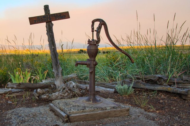
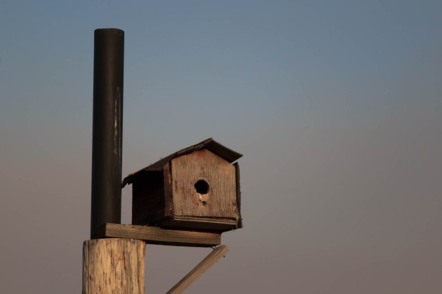
Farm EquipmentHomestead Pitcher Pump. Smoke Rolling into the Valley.Little Birds Flitted In and Out of the Birdhouses
Before leaving the area we headed into town to restock the refrigerator and the pantry. While there, we found a little nature trail that circled up a hill at the city park. We didn’t make it through the entire trail because at one point bushes grew over the trail. I wasn’t about to blaze the trail with bare legs and arms. Before heading back down, we enjoyed the view.
Town of Lakeview
We bought a bag of limes and other items from the smallest Safeway I had ever seen. We then drove to Goose Lake. There is not much there except a state park that would be a good spot for an overnight, but not much longer. Smoke from a fire in Alturas blew in overnight raining ash even though we were an hour away.
Contraband Confiscation
On July 29, 2017, we turned the wheels toward Graeagle, California, our next stop. Smoke grew thicker as we continued on Highway 395 and approached Alturas, California. We slowed and stopped at the California Agriculture Inspection. The woman greeted us with the usual questions of where we had stayed and then said she had to look inside our trailer. What? We’ve never had that happen before. After her grand tour, she stepped out of the trailer carrying our newly purchased bag of limes. Really? The limes we purchased yesterday from Safeway? Safeway had probably transported the limes into Oregon from California, now California Agriculture was confiscating them? Note to self, when traveling from Oregon into California, don’t carry any citrus products.
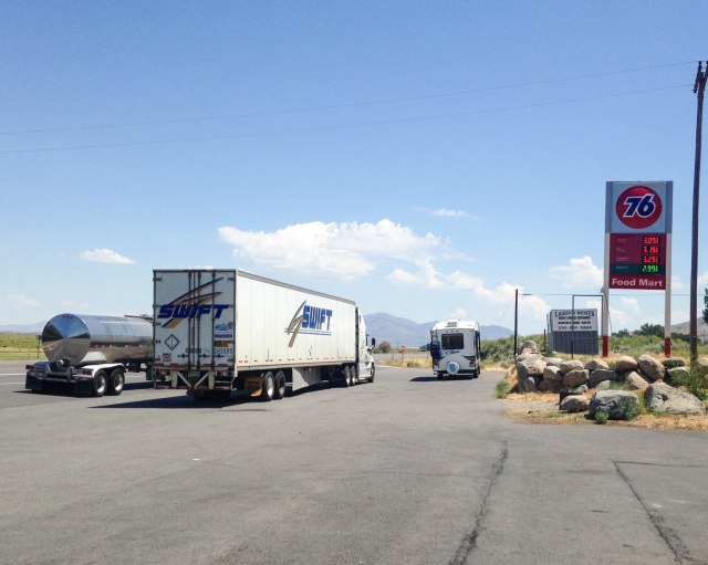
About ten miles from the crappy rest stop with pit toilets and some kind of water feature, the skies turned blue and clouds became visible. We stopped in Herlong, California, at a The Mark mini-mart and 76 Station for fuel and as a bonus purchased fresh made-to-order deli sandwiches. Be aware the sandwiches are huge. They also sold the usual pizza and fried food, such as corn dogs, chicken, and burritos. The picnic table inside and the one outside were both filled with people chowing down their lunch, so we stood next to a retaining wall, which was the right height for eating our sandwiches. When driving on Highway 395 we recommend a stop at this 76 station. As you can see there is plenty of room for RVs and semis to park
The Mark Mini-Mart and 76 Gas Station
Moving West RV Resort
We arrived at Moving West RV Resort and they assigned us one of the best spots in the park. The fifth wheel fit snuggly among a stand of trees. On the curbside was a large grassy area with a triangle tarp for afternoon shade and a newly installed redwood fence along the dusty lane, which rarely saw a vehicle pass.
Moving West Campsite
Raptor Adventures
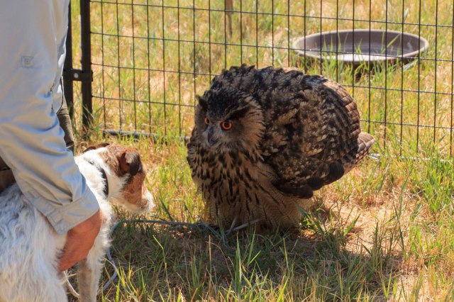
The reason we stopped at Graeagle was so Jon could take advantage of his Christmas present, a Raptor Adventure with Jim Tigan. How wonderful to be up close with Louise the owl,
Louise the OwlMy What Large Eyes You Have
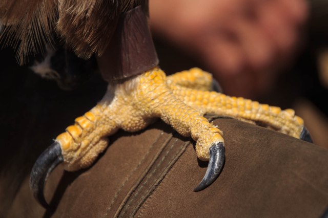
Fifi the golden eagle,
Fifi the Golden EagleCheck Out Her TalonsOkay, I Posed. Now, Where’s My Meat?Soft Feathers
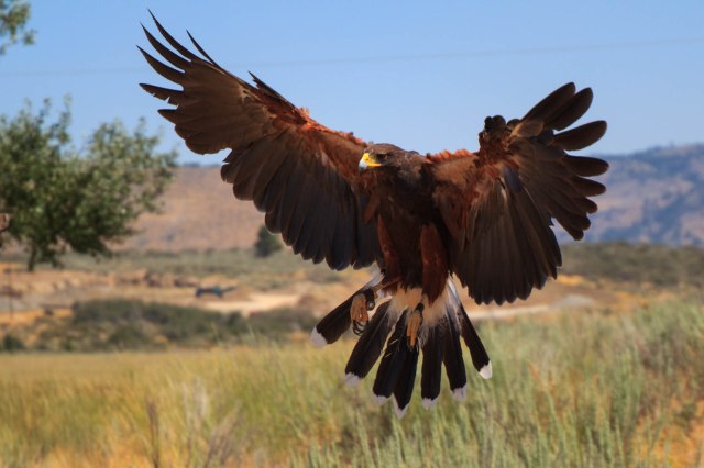
and go for a walk with Sonia the Harris hawk.
Sonia the Harris HawkLook at My Wing Span
The owl didn’t much care for Bonnie, the new terrier that joined the family two weeks earlier. Louise ruffled her feathers and hissed at the little dog. Bonnie was more curious than scared of the owl.
Get Back Dog
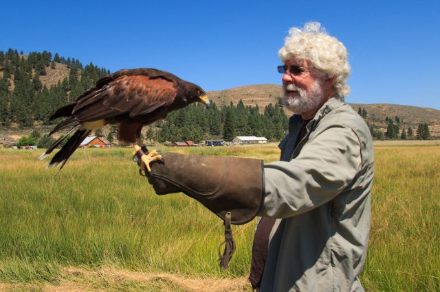
Although apprehensive at first to be nose to beak with the birds, Jon warmed up and was soon talking to them like he would an old dog. He petted their soft feathers and felt them breathe under his hand. The birds were so sweet and docile, soft to the touch, yet they possessed strong talons.
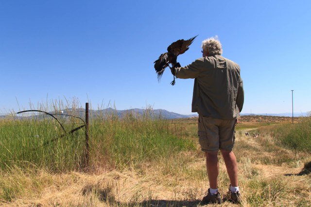
Jim taught Jon how to call Sonia from her perches, land on the glove, and peck at the meat he held in his hand.
Sonia Soars From Her PerchWatch Out. Coming in for a Landing.Whew! Made it.Meat Please
I even got a chance to feed Sonia. She was so light she didn’t jostle my arm when she landed or when she plucked at the piece of meat I held in the space between my gloved thumb and first finger.
We always marvel at these creatures whenever we see them atop electric poles searching for their dinner or in the sky coasting on thermals with their wings spread wide. We appreciate their magnificence even more after meeting them up close and personal.
To see a PBS program about Jim and his birds, click here. To see a Youtube video of best friends Annabelle the dog and Louise the owl click here.
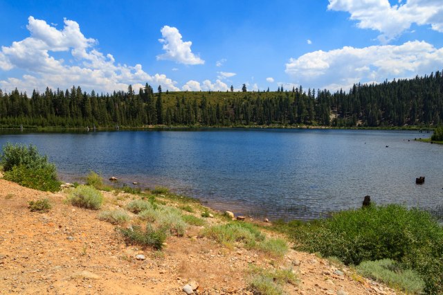
Madora Lake
The next day we took a hike to Madora Lake. We saw signs the trail was under construction, but no one was working that day. In places, large rocks edged the trail and fine gravel filled the space between the edges.
Madora Lake TrailCome On. Let’s See Where This Bridge Goes.Madora Lake TrailOne of the Few Places to See the Lake
Eureka Lake
We next drove to Eureka Lake on a dirt road for 1.3 miles and hiked up a trail until we had broken through the tree line. From the side of the mountain, the view gave us the feeling that we were on top of the world.
Alpine Eureka LakeHeading Down the Trail
A cold Frostee was in order after our drive and hikes.
Make Mine Cherry
On Tuesday, August 1, 2017, we put the adventures and miles behind us and turned the truck toward home. We’ve seen wonderfully beautiful mountains during our travels these past few months, but Donner Pass on Highway 80 in California had to be one of the best with its high cliffs that rise above the freeway and rushing river that flows not far from the road. As we dropped down into the Central Valley, blue skies and puffy white clouds gave way to gray haze and smog. Temperatures nearing 100 degrees and a spare-the-air day welcomed us home to the San Francisco Bay Area.
Stay tuned for our next adventure to Southern Utah and Northern Arizona where we gazed down at the hoodoos of Bryce, up at the cliffs of Zion, and across the Grand Canyon from the North Rim.
After nine weeks on the road, you would think our routine for leaving a campsite would be ingrained. Rarely do we forget anything. I wash dishes, breakdown the table, secure the contents of the refrigerator and cabinets, stow the laptop, latch the bathroom and shower doors, close any open vents or windows, and then double and triple check to make sure I didn’t miss something. JT dumps the holding tanks, cleans the toilet, stows the camp stove and table, folds up the outdoor mat, raises the stabilizer jacks, and coils up the electrical cord and water hoses.
Usually, Jon fills the black tank full of clean water and flushes three or four times to clean it out. He runs in and out of the trailer twenty times or more checking to see if the tank filled enough to flush out the yuck in the black tank. This was not the case when we prepared to leave San Diego. He hadn’t been around for what seemed like fifteen minutes. Then I heard water running, a whole lot of water, spilling over the toilet edge, in a waterfall, onto the floor, into the heater vent, under the sink cabinet, and seeping into the bedroom carpet. “Flood, flood. Where are you?”
JT rushed to turn off the water and open the dump valve while I flung towels on the floor. Instead of leaving by our noon checkout time, I sat in the laundromat watching towels go round and round in the dryer. It was bad enough cleaning up a flood because the trailer had a leak, but to cause a flood. Grrrr! Good thing our faux pas occurred on the fourth flush of the tank and not the first.
We hit the road about 1:30 p.m., just enough time to make it to Yucaipa before they closed. Barely thirty miles out of San Diego on Interstate 15, we heard a noise that sounded like we ran over something, except the trailer didn’t buck the truck like it does when hitting a pothole or going over speed bumps. Did the spare tire fall off the back of the trailer? Jon put on the flashers and pulled the rig over. The spare was in place. Everything seemed okay and then we noticed the treadless tire on the rear passenger-side of the trailer and the section behind the wheel to the bumper that had curled up on itself. Five tire failures in one year. What were the odds?
We limped into the nearest town, Escondido, and found a parking lot at a Mexican restaurant where Jon could change the tire. After lunch at the restaurant, we drove to the nearest Discount Tire Co. store to ensure the spare and the rest of the tires had sufficient air.
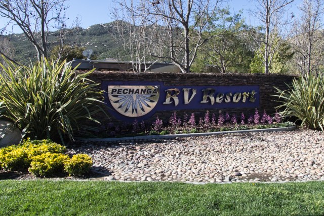
Too late to make it to Yucaipa, we stopped at Pechanga Casino and RV Resort for the night. I had heard casino RV spots were reasonably priced so I didn’t expect the $50 rate for a pull-through deluxe site. Then again, the sites were nice. They offered plenty of amenities such as a pool, clean bathrooms, and a shuttle to the casino, if one was inclined to flip their pockets inside out and donate their cash to the reservation.
Pechanga RV Resort
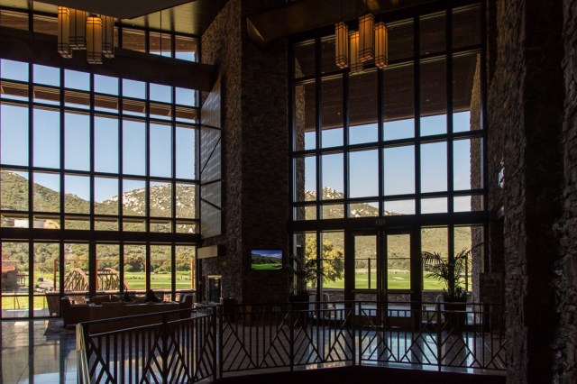
Journey’s Inn was a perfect place for breakfast the next morning, a reward for our troubles of the day before. The rock covered walls, large windows overlooking the golf course, and the hills in the background, along with a tasty breakfast, soothed our worries away.
Journey’s InnJourney’s Inn Lobby ViewJourney’s Inn Outdoor SeatingPechanga Resort Golf Course
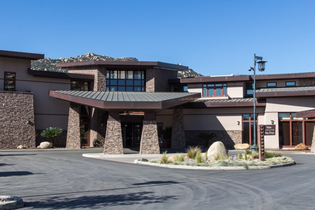
Pechanga is in the middle of a $285 million expansion which will include an additional 568 rooms, a 70,000 square foot spa, convention space, pool complex, and two new food and beverage outlets. The completion of the expansion is expected by the end of 2017.
Pechanga Expansion Construction
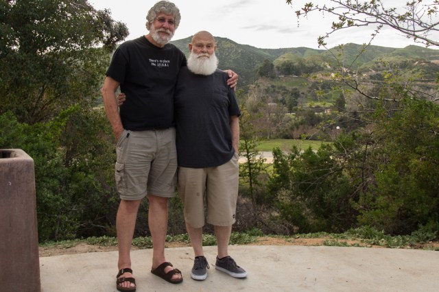
We continued on to Yucaipa Regional Park, arriving by 11:00 a.m., which allowed us time to have our pick of spots. A friend Jon has known since grade school came for dinner and they enjoyed sitting at the picnic table and catching up on their lives.
Jon with Ed Simpson. The bearded ones look like they coordinated outfits.
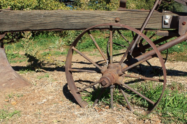
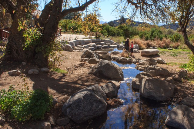
The next day, my friend and her husband picked us up for lunch, and a drive to the Oak Glen Preserve and Southern California Montane Botanic Garden, a Wildlands Conservancy. We followed the trail around the garden grounds and rested at the Discovery Center. The following photos were taken during a previous visit to the preserve during the fall.
Entrance to The Wildlands Conservancy Southern California Montane Botanic GardenHistoric Farming Equipment is Displayed Along the Loop TrailFarming EquipmentAquatic Feature Includes This Creek and a PondView From Botanic Trail
Wouldn’t it be nice if every picture taken turned out perfect? This is definitely not the case for me. Where the heck did that water bottle come from and why do Jon and I look like we’re sitting on kindergarten chairs? One of these days, I’ll remember to check the foreground and background for distracting objects, and the placement of people.
Dan and Susie Bloomer with Jon and I
On Friday, March 17, 2017, we headed for Sky River RV in Paso Robles so they could repair the damage from the tire failure. Loaded up with what trailer contents would fit in the truck, we drove home with memories of all we had seen swirling in our heads and sadness in our hearts that our Winter 2017 trip had ended.