Wilbur, Washington – Grand Coulee Dam

Wilbur, Washington, was our first stop back in the states on July 16, 2017, where we checked in at Country Lane RV Park.

IMG_3562
Our Site at Country Lane RV Park

Our main objective, besides getting forty winks, was to visit the Grand Coulee Dam. We dropped the trailer and drove the 23 miles to the visitor center in time to catch the last tour of the day.

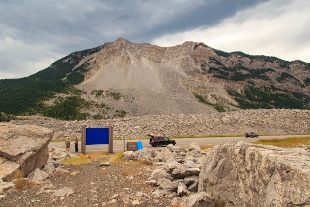
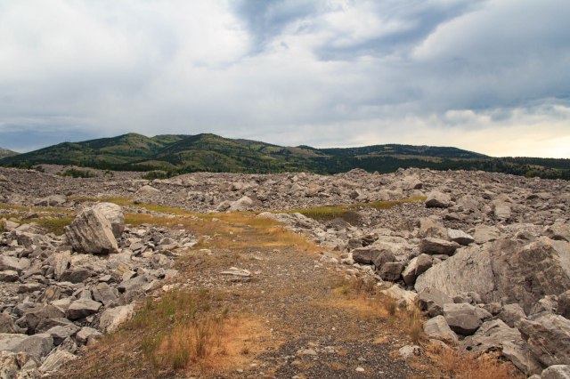
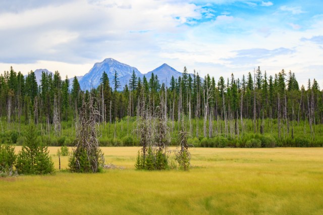
The volcanic rock terrain reminded us of Craters of the Moon, only several thousand years later after the rock had broken down and soil had covered the surface allowing trees and bushes to grow. Farmers made use of the land by arranging their fields around the larger rock formations.

Grand Coulee Dam

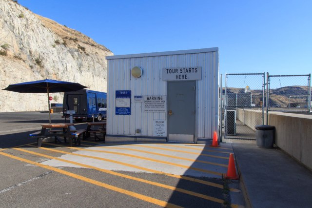
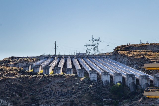
The visitor center tells the story of the dam, and the guided tour gives an up-close view of the generators, the pumps, and top of the dam. The tour starts here, not at the visitor’s center, but they provide directions.


IMG_3579
Location of Guided Grand Coulee Dam Tour. The Only Way to See the Dam Up Close


A concrete gravity dam, Grand Coulee Dam contains 421 billion cubic feet of concrete, enough concrete to build a highway across the United States. Operated by the Bureau of Reclamation, it is the largest producer of hydroelectric power in the United States and the third largest hydroelectric facility in the world.


IMG_3583
Grand Coulee Dam


The dam’s twenty-eight generators within four power plants can produce up to 6,809 megawatts annually and are the primary source of electricity to many Northwest states.

IMG_3565
Power Plant Seen on Guided Tour of Grand Coulee Dam

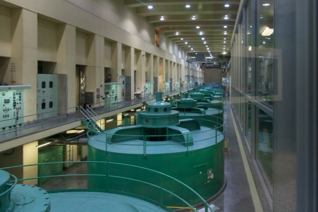
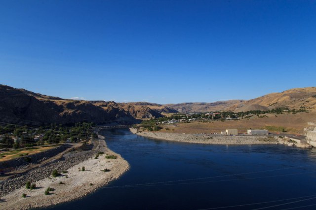
In addition to the power plants, the dam also provides irrigation water through the Pump-Generator Plant located on the east bank of the Columbia River. Twelve pumps lift water up the hillside to a canal that flows into Banks Lake, the 27-mile-long reservoir for the Columbia Basin Project.


IMG_3569
Water Pumped Uphill for Irrigation


IMG_3574
Top of Grand Coulee Dam


IMG_3570
Columbia River


I asked the guide a couple of questions that went unanswered, like what is the purpose of that Honeywell gizmo down there? The tour guide said he either could not tell me or did not know the answer due to security measures. However, he did not prevent me from taking a picture.


IMG_3573
What Does This Gizmo Do?


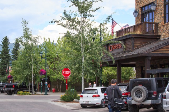
We drove through the Town of Coulee Dam—The Green Oasis at the Foot of Grand Coulee Dam—which was populated with quaint cottages, plenty of trees, green grass, and flowers.


IMG_3584
Town of Coulee Dam


I would love to see these trees ablaze with yellows, reds, and oranges during the fall.

The town, founded in 1933 by the U.S. Bureau of Reclamation, served as headquarters for construction of the Grand Coulee Dam.  One part of the town, known as Mason City, housed the lead contractor. The other part was known as Engineers Town and owned by the government.  In 1948, Mason City was incorporated in Coulee Dam, and by 1959, the government had completed its process of selling the town to the public.

A Short Jaunt to Poulsbo, Washington

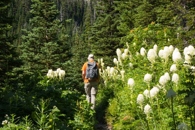
We left Wilbur, Washington, the next day for a six-night stay at Cedar Glen RV Park in Poulsbo, Washington to visit friends. As we decided on what to do in our spare time while near Seattle, miles and miles of wheat fields and other grains mesmerized us. We would crest a hill, and all we could see in a 360-degree radius were fields of wheat and other grains. No cities, no buildings, not even an out building in sight. Some of the fields had recently been cut, others newly plowed, while others still contained stalks standing tall. About every ten or fifteen miles, clumps of trees, shimmering silos, and barns, would appear in the distance. The acres of agribusiness was a side of the Washington State I had never seen before and was as amazing as its coastline and waterways.

About two hours before we arrived, the RV Park manager called. Oops! Our six-night stay was now only two nights, so much for seeing a couple of sights. At least we had a good visit with our friends in Silverdale.

It was probably a good thing we only had two nights. I didn’t think I could take the road noise another night. The large evergreen barrier that separated our space from the main road did little to muffle the roar of nonstop traffic to and from the naval base and ferry in Bremerton and other populated areas.

One more word about the State of Washington: The state grows the friendliest toll takers we have ever encountered. The woman who took our money smiled at us and wished us a good day. After fighting the traffic to get to the bridge, her attitude made the rest of our daily journey pleasant.

Next up: The Tri-Cities Area of the State of Washington along the Columbia River.

Safe Travels

Waterton National Park

Waterton Lakes National Park in Alberta, Canada, was our next destination on July 13, 2017. We made Crooked Creek Campground our home away from home for a short two-night stay. Fortunately, we arrived around noon, which gave us plenty of time to drive into the park and have a look around.

Waterton Village

Waterton Lakes borders Montana’s Glacier National Park and is part of the Waterton-Glacier International Peace Park created in 1932 and designated as a UNESCO World Heritage Site in 1995.

The Prince of Wales Hotel, a National Historic Site, is a nice little chateau-style inn that serves afternoon tea from 1:00 p.m. to 5:00 p.m. each day complete with a three-tier curate stand filled with little sandwiches and other delectable items. We weren’t ready for a meal so we bought Frappuccino’s instead.

IMG_3479
Prince of Wales Hotel

Waterton Village is a typical resort area with restaurants and gift shops. We drove through the Townsite Campground, which looked like a great place to stay with extra wide spots that included full hookup, electric and water only, or tent camping. Some sites will accommodate both an RV and a tent, which is rare in most campgrounds. Ninety percent of the sites are reserved six months in advance. Only ten percent are available on a first-come-first-served basis.

IMG_3476
View of Peaks and Waterton Lake From Waterton Village
IMG_3483
View of Surrounding Peaks From The Village
IMG_3478
View of Prince of Wales Hotel From The Village

Cameron Lake

The next day, we drove to Cameron Lake. The drive took us through twisting turns, each with breathtaking views of the mountain peaks, forested areas, and an abundance of wildflowers. Several times on the drive we asked, “Is this the right way? Did we miss our turnoff?” The Akamina Parkway map didn’t seem to correspond to the route we traveled and took longer than I had expected.

Along the way, we encountered the roadkill clean-up crew. The bear stood at the side of the road for a few seconds before he ambled over, snatched the dead rabbit between his teeth, and disappeared into the forest.

IMG_3491
Roadkill Clean-Up Crew

A few miles later, we came across a few deer munching on something in a parking lot. It must be a popular place because they were there when we drove in the other direction several hours later.

IMG_3510
Grazing Deer

When we arrived at Cameron Lake, only a few cars were in the parking lot, and the rental store had not yet opened. We saturated ourselves with a generous spray of Off to prevent the flying insects that hovered around us from flying into our eyes or opened mouths. We walked along the short lakeshore trail that skirted the west side of the lake. A sign that warned us this is bear country made us a bit leery as we trekked down the trail and stepped over what looked like bear scat. Onward we pressed as we made our presence known. Thankfully, no bears lumbered through the brush to ruin our day.

IMG_3500
Cameron Lake – Along the Right Side is the Lake Trail
IMG_3501
Bear Scat


IMG_3504
Could This Be a Bear Track?

Rowe Creek Lakes Trail

The 3.9 km (2.4 miles) hike looked doable except we didn’t realize it would be all up hill. We loved walking through the yellow, white, pink, and blue wildflowers.

IMG_3537
View From Rowe Creek Lakes Trail
IMG_3508
Rosy Spiraea
IMG_3502
Daisies Are Among the Numerous Wildflowers in Waterton Park
IMG_3515
Rowe Creek Tumbles Over Red Rock

I was glad I had worn long pants and long sleeves. There were several places where we snaked our way through thick vegetation that reached five to six feet.

IMG_3528
Bear Grass was in Full Bloom

We stopped for a snack at Lower Lake and had to fend off aggressive squirrels that, if given the chance, would have scampered onto our laps to steal our cashews and dried fruit.

IMG_3533
Lower Rowe Lake – Alpine Lakes Have Such Clear Water

Red Rock Canyon

Our last stop of the day was Red Rock Canyon where visitors climbed the rock walls, cooled their feet in the icy creek, and walked the trails on either side. The argillite rock walls contain about 3% oxidized iron, which gives them the rich red color. Although there are erosion and danger signs about climbing on the rock walls, people either did not read the signs, or they choose to ignore them.

IMG_3548
Red Rock Canyon

Our short visit to Waterton National Park piqued our interest for another visit someday, perhaps combined with Jasper and Banff. We called a few places for reservations, but none were available. July isn’t a good month to find RV space without reservations, so we headed west to catch a glimpse of more Canadian scenery before dropping back into the U.S.

Frank Slide

When we left Waterton, we took Highway 6 north and then highway 3 west through Crowsnest Pass. About an hour into the drive, Frank Slide loomed in the distance. At 4:10 a.m. on April 29, 1903, 90 million tons of limestone rock broke away from Turtle Mountain. Within 90 seconds, large boulders had buried the eastern edge of Frank, a mining town, the Canadian Pacific Railway line, and a coal mine.

IMG_3558
Frank Slide Area
IMG_3560
View From Behind of the Extensive Boulder Field

It was hard to comprehend the slide’s power as I looked up at the bare space on the side of the mountain, the boulders on either side of the highway, behind me, and beyond. I could almost hear the deafening rumble and feel the earth shake as boulders crashed into cottages, crushed business buildings, covered a cemetery, and stretched for 1.2 miles across a road and railroad tracks. Approximately, 70 to 90 people perished in the slide and many of them are still buried under the boulders. The exact number could not be determined because no one knew how many transients may have been in town or whether people who had said they were leaving town had actually left. The cloudy, misty weather enhanced the somber feeling that came over me when I thought of the people who had died, and the survivors whose lives were changed forever.

Next up: Coulee Dam, Hanford project, and a guided tour of a decommissioned B-Reactor

Columbia Falls, Montana

Glacier National Park is more than just the Going-to-the-Sun Road. With so many trails, creeks, and lakes to explore we could have easily spent a whole month there. Hmmm, something to consider for the future.

Here are a few other places we managed to explore.

Johns Lake and Trail

Situated just past the north end of Lake McDonald, is a trail that loops around Johns Lake, through a forest, and along the banks of McDonald Creek.

IMG_3329
Johns Lake Trail

We could barely see Johns Lake through the overgrown forest and vegetation that surrounded it.

IMG_3350
Johns Lake—No Way To Fish Here

In some areas along the trail, lodge pole pines looked like a game of pick-up-sticks.

IMG_3351
Let’s Play Pick-Up Sticks

The best part of the short hike was McDonald Creek where water rushing over the rocks and boulders was deafening.

IMG_3354
McDonald Creek

I don’t recall seeing a creek with such a beautiful shade of turquoise.

IMG_3366
McDonald Creek

A few people stuck more than a toe into the icy water. Although it was a warm day, we decided to pass on a dip.

IMG_3355
McDonald Creek

The way the fallen trees provide nourishment for the new growth reminded me of the Hoh Rain Forest west of the State of Washington’s Olympic National Park. In the Hoh Rain Forest, the infant trees grow in a row on the fallen tree trunks.

IMG_3367
Baby Pines

Camas Road and Forests and Fire Nature Trail

The Camas Road took us on the west side of the park to the Forests and Fire Nature Trail. Along the way, we stopped at Fish Creek Campground to see what they offered. There were a few spots that might have worked for our rig, except for the ones tucked into the vegetation. Visions of creepy crawlies around the vegetation discouraged us from attempting to stay there. Rain threatened to pour from the sky so we were unable to take the Forests and Fire Nature Trail, but we did see a few sections where the cycle of forest regeneration of the woods progresses.

IMG_3376
Forest Regeneration in Process
IMG_3386
More Recent Burn Area

Near the burn areas, tightly clustered trees surrounded what we thought were meadows. Actually, they were fens, a type of wetland. According to Wikipedia, fens are an area that is pH neutral or alkaline with high mineral content but few plant nutrients. Streams and springs provide the necessary nutrients for the grasses and wildflowers to grow.

IMG_3369
A Fen Looking West
IMG_3380
A Fen Looking East

Avalanche Creek, Trail of Cedars Nature Trail, and Avalanche Lake

The park service picked one of the most beautiful places for the ADA accessible Trail of Cedars. A boardwalk marks the trail, which winds through old growth cedar and hemlock forest along a stream. There are places to stop and gaze at fallen tree stumps showing off their roots and ferns carpeting the forest floor.

IMG_3407
Decomposing Tree Roots
IMG_3409
Ferns Blanket Forest Floor
IMG_3422
Ferns in the Sun

The sandstone cliffs covered in moss and ferns reminded me of an Indiana Jones movie. There’s a way to the hidden treasure somewhere among the cliffs, I just know it.

IMG_3414
Where’s The Entrance to the Treasure Chest?

Sparkling clear water cuts a path between moss covered cliffs.

IMG_3421
Avalanche Creek
IMG_3417
Avalanche Creek

The 5.8-mile round trip hike to Avalanche Lake has an elevation rise of only 500 feet. Or so the map says. They forgot to mention that the trail goes up hill and downhill at least ten times. That was okay. It was better than a constant incline.

There were a few spider webs near the trail that kept us busy rubbing our faces and arms to brush them off. I liked the way this one glistened from the filtered sunlight.

IMG_3424
“Here buggy, buggy, buggy. Won’t you rest awhile on my web?

We were so glad to come across vault toilets a few yards before reaching the lake. I feared I’d have to veer off the trail and squat.

IMG_3426
There Are Two Vault Toilets Near Avalanche Lake

The closer we came to the lake the more Spanish moss covered the tree branches.

IMG_3427
Tree Branches Wearing Their Spanish Moss Scarves

When I saw this photographer with his entire collection of gear strapped to his body, I feared he would fall in. Sadly, he and his buddy had arrived a bit late to capture the perfect photo.

IMG_3431
Watch Your Step

The sunlight through the haze made it difficult to photograph the falls. Here’s the best I could do, with a lot of help from Lightroom. Thank goodness for the dehaze function.

IMG_3435
Avalanche Lake and Waterfalls

A half hour after we arrived, crowds descended on the shoreline. Time to head back down.

IMG_3453
Let’s Go Swimming

Whitefish, Montana

Curious to see the towns surrounding Columbia Falls, we drove through Whitefish. There we found a quaint resort town with the typical restaurants, gifts shops, art galleries, and such. We checked out the train depot and museum, which included bronze statues of an engineer and a little boy.

IMG_3393
Whitefish Train Depot
IMG_3395
Where Are All Those Tankers Headed?
IMG_3396
Inside the Train Depot
IMG_3398
“Yes, sir. I want to be an engineer just like you when I grow up.”

Casey’s looked like a good place to stop for a dark and stormy.

IMG_3402
Casey’s in Whitefish, Montana

Served in copper mugs, of course.

IMG_3404
Copper Mugs of Dark & Stormies

We had to fork over our driver’s licenses in exchange for the mugs. Apparently, some patrons erroneously thought they bought the cup along with the contents.

There were plenty of other sights to see and things to do in Glacier. Unfortunately, the limited time we had didn’t allow us to tick off all the trails, boat rides, and other activities that had piqued our interest. We were glad for the days we had to visit Glacier National Park. Only now we are saddened to learn of the destructive fires caused by lightning that broke out in August. Logically I know that fire is a good thing for the forests. I only wish it didn’t have to be that way.

Glacier Fire Update

I checked out the Glacier webcams on September 8, 2017. The smoke from the fires obliterated the view across Lake McDonald revealing only a few feet of the lake from the shore. On September 14, although still a bit hazy, I was glad to see the smoke had lifted allowing full view of the lake, mountains, and cloudy sky. Smoke had also cleared from other parts of the park.

As of noon on September 13, 2017, Glacier National Park and the Flathead County Sheriff’s Department issued an evacuation warning for the Apgar area within Glacier National Park and portions of West Glacier due to a shift in high winds forecasted. According to the incident report, the Spraque fire has gobbled up 14,795 acres, is 60% contained, and full containment is not expected until November 1, 2017. For updates, go to https://inciweb.nwcg.gov/incident/5510/

While hurricanes pummel and flood Texas, the Caribbean, and Florida, the western states battle their fires. It’s been a tough year so far.

Safe Travels


Columbia Falls, Montana

Going-To-The-Sun Road (GTTSR) was first on our list of things to do in Glacier National Park. The fifty mile road includes several points of interest for fantastic views of the wildflowers, snow-capped mountain peaks, and valleys below.

IMG_3257
Wildflowers, Peaks, Valleys, and Snow

Going-To-The-Sun Road

With speed limits ranging from 25 to 45 miles per hour, drivers can’t be in a hurry to reach the other end of the park. The park recommends an early start to avoid the traffic jams. This is fine if you don’t want to stop at Logan Pass Visitor Center or are only traveling one-way. For a round trip drive, however, plan on spending a full day and encountering significant traffic on the way back.

The road is an engineering marvel for the 1920s. Instead of creating a solid tunnel with no view, portholes were created so passengers can catch glimpses of the scenery as they drive through. This is an example of one of the tunnels.

IMG_3274
One of the Tunnels on GTTSR

Weeping wall is a remnant from construction of the GTTSR. Engineers created a cliff when they carved through the rock in this section. Water from springs and melting snow pour over and onto the road surface below.

IMG_3276
Weeping Wall

It was a good thing we took photos on our way eastbound because on our return trip it felt like driving through downtown San Francisco during critical mass when all the bicyclists arrive to disrupt traffic flow. Wildlife traffic jams are a common occurrence in national parks. On our return trip later in the day, the wildlife turned out to be two young women. One woman posed on the wall side of the road with the water pouring down behind her while her friend stood on the other side taking a photo. The vehicles going in both directions inched their way between them. It always amazes me how people put their lives in jeopardy all for the sake of a photo.

Enjoy a few more renderings of the scenery along the Going-to-the-Sun Road.

IMG_3254
Peaks, Valleys, and River
IMG_3255
Peaks, Forests, and Snow
IMG_3258
Falls Along the GTTSR
IMG_3272
More Falls
IMG_3273
More Peaks, Valleys, Snow and Falls
IMG_3277
Quite a Bit of Snow for July 8
IMG_3279
Hanging Valleys

We thought we had left early enough to make a stop at Logan’s Pass Visitor Center. Not so. We drove into the parking lot along with other cars circling around in search for a space. We spotted people getting into their car. Jon turned on his blinker and left room for other vehicles to pass. The car’s back up lights came on. A lady pulled up next to us. We thought she would drive on. No such luck. I got out and told her we were waiting for the car to leave, didn’t she see our blinker? Her reply, “I followed them from way over there. It’s my spot.” Really? Is that a thing? It wasn’t worth arguing about so we ended up taking turns driving around the parking lot so we could visit the restrooms. If we come back to Glacier, we’ll take the shuttle to Logan Pass Visitor Center.

Further down the road, only a few cars had parked along St. Mary Lake leaving plenty of opportunity to take pictures.

IMG_3288
St. Mary Lake

Many Glacier

We exited the park in St. Mary and headed toward Many Glacier. The road into Many Glaciers travels through the Blackfeet Indian Reservation. Although evidence of recent road work was visible, huge potholes and washboard areas made for a very slow and bumpy ride to the park entrance. A few yards from the gate, this cub was too busy foraging for his meal to raise his head for a photo op.

IMG_3289
Foraging Bear Cub

The Many Glacier Hotel in the Historic Swiss Chalet, looked like a great place to get a bite of lunch.

IMG_3293
Many Glacier Swiss Chalet

The rich wood paneling, high ceilings, gleaming floors, and stone fireplace created a sense of warmth that invited us into Ptarmigan Dining Room.

IMG_3297
Ptarmigan Dining Room

The view from our table could not be beat.

IMG_3310
View of Swift Current Lake
IMG_3321
Cabin and Dock at Swift Current Lake
IMG_3315
Swift Current Lake and Mount Wilbur
IMG_3320
Swift Creek Lake and Jagged Peaks

The food? Not the best part of our experience. My bison sloppy joe wasn’t the most enticing dish when the server placed it in front of me. Although it tasted okay, it was nothing special.

IMG_3306
Bison Sloppy Joe

Unfortunately, after Jon took a spoonful of his bison chili, he wanted to ask the server, “Where’s the bison?” The chili was mostly beans. We found the reviews on Travelocity similarly mixed.

IMG_3307
Bison Chili

After our meal, we walked along the Swift Current Trail that wraps around the lake in a loop.

IMG_3329
Swift Current Nature Trail
IMG_3327
View of Many Glacier Hotel from Swift Current Creek Nature Trail
IMG_3330
Swift Current Creek
IMG_3331
Clear Water in Swift Current Creek
IMG_3338
Deer Crossing Trail

If we make our way back to Glacier National Park, I’d like to spend a few days on the east side and explore the numerous trails around Many Glaciers, maybe even take a boat ride, or try out a kayak or stand-up paddle board.

Good to Know Information about Going-To-The-Sun Road

An audio tour of the road is available to download on the NPS website here. Transcripts of each recording are also available.

Tours:

  • Sun Tours imparts information about the Blackfeet Indian culture and the importance of Glacier National Park to their heritage
  • Ride in a historic Red Bus and enjoy the scenery in a convertible vehicle
  • Going-to-the-Sun Road Shuttle System travels between Apgar and St. Mary visitor centers making stops along the way, including Logan’s Pass

A few precautions:

  • Vehicles longer than 21 feet, wider than 8 feet, and/or taller than 10 feet are restricted. Visit the website for more information about the road conditions here.
  • Don’t be in a hurry
  • Watch out for
    • Construction zones
    • Bicyclists on portions of the narrow road
    • People walking into traffic at trailheads and points of interest stops
  • Cell and WiFi service is pretty much non-existent throughout the park
  • Pack snacks and/or a lunch

Stay tuned for more of Glacier National Park and a visit to Whitefish, Montana in next week’s post.

Safe Travels