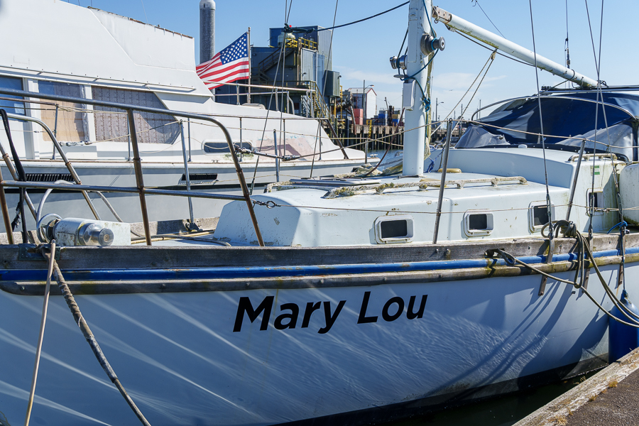
Our next stop on our way home was Tillamook Bay City RV Park on July 18, 2024. On WA-105 and US-101, we drove through a canyon of trees so thick I caught only a glimpse here and there of what looked like homes or commercial buildings amid the dense forest. Near the ocean, sloughs snaked their way through the wetlands. And folks tried their luck clamming in the muddy low-tide beach areas.
We pulled off the highway and found a long stretch to parallel park the rig in Seaside, Oregon. After a mile and a half walk, Dooger’s Seafood and Grill satisfied our hunger for lunch. It was too bad we had reservations farther south because I wanted to explore the town and area more.
We don’t know whether Apple Maps rerouted us inland onto Miami Foley Road for a reason, or if we made a wrong turn. It didn’t matter. Instead of sitting in traffic on US-101, we enjoyed driving through the narrow valley. Purple, yellow, white, and red wildflowers decorated the side of the road, and the green expanse of farmland acres created an idyllic landscape. The view sure beat looking at car bumpers on the highway.
We reserved the next day for exploring. On our list were the Tillamook Creamery and the Meares Cove Lighthouse.
Tillamook Creamery
In 2014, during a previous trip to the Pacific Northwest, if it hadn’t been pouring rain, we would have stopped to visit the creamery. Then, it seemed the visitor center sat farther back from US-101. We weren’t wrong. The new visitor center opened in June 2018.
For the convenience of visitors, the center is open daily from 10 am to 7 pm. Inside, visitors can take a self-guided tour or opt for a premium experience (reservations recommended). We took the self-guided tour, which took us on a journey through the cheese-making process.
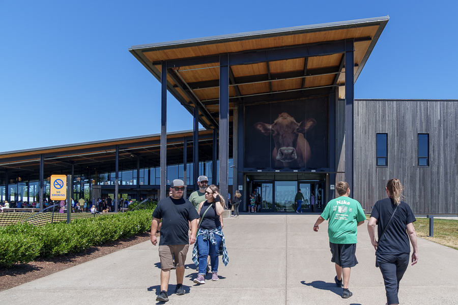
Upstairs in the Farm exhibit, we learned about the care and feeding of the cows throughout their lives. A factory viewing deck allowed us to watch the cheese production in process from a catwalk level. Diagrams and descriptions on posters gave explanations of what we saw. On the other side of the deck, we watched cheese move on conveyor belts and racks from one step to another. Human factory workers performed a quality check to verify the loaves were the correct size and weight. The workers even shaved off bits of cheese, if needed, before the cheese moved to the wrapping machine.
We would have bought lunch at one of the food counters and an ice cream for dessert had it not been so crowded and taken so long to get through the lines. Instead, we wandered through the gift shop and ended up waiting a few minutes for photos with the Yum Bus, where the crowds had thinned.

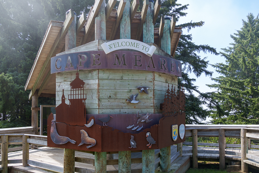
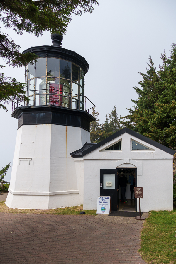
Meares Cove Lighthouse
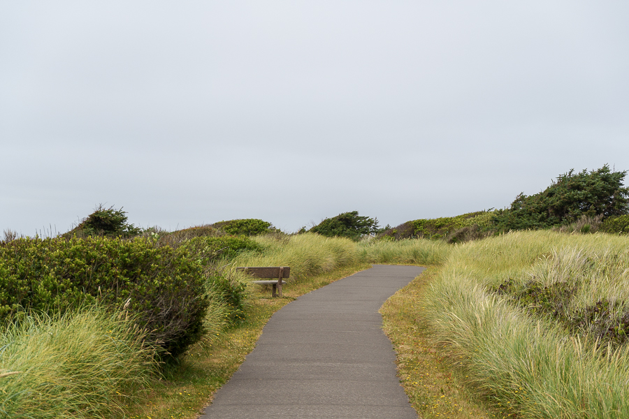
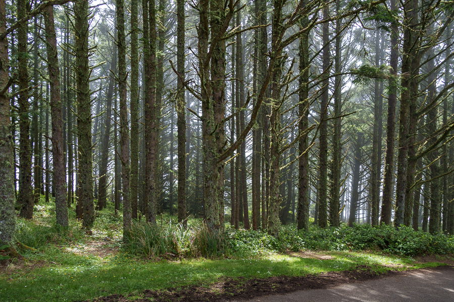
A beautiful drive along a cove and through a forest led us to the Meares Cove Lighthouse parking lot. The forest of trees wept droplets of water on us as we walked toward the lighthouse. The trees were still drying out from the heavy morning fog that hugs the coast most days. It reminded me of walking through the Hoh Rainforest in Olympic National Park.

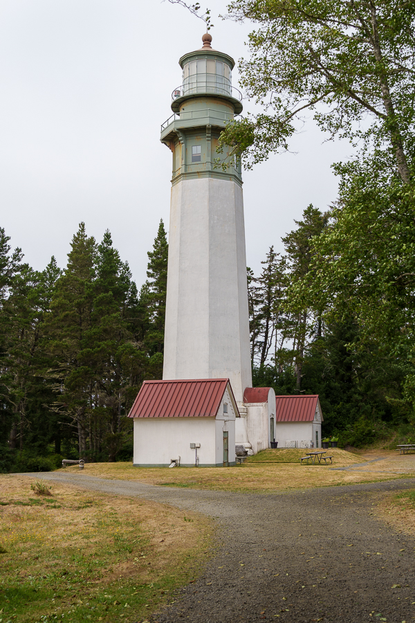
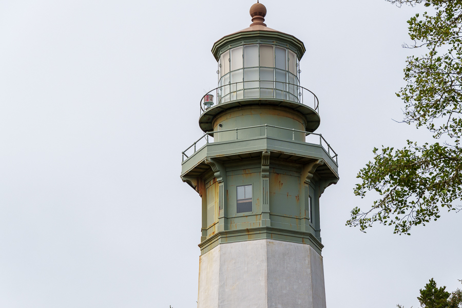
Meares Cove Lighthouse is the shortest lighthouse along the Oregon coast. It stands only 38 feet tall atop a basalt outcropping 200 feet above the Pacific Ocean. Captain John Meares, a northwest explorer who commanded the sloop North West America in the 1780s, named the area Cape Lookout. A mistake made on maritime maps in 1857 identified another location as Cape Lookout. This caused the name change to Cape Meares, since it was easier to change the name than reprint the maps.
During the 1840s and 1850s, prospectors from the goldfields and pioneers who crossed the Coast Range settled in the area for its rich soil. In 1886, the need for a lighthouse became clear, so the Lighthouse Board requested $60,000 for construction. By the end of 1889, the lighthouse, other supporting structures, and living quarters were complete, and on January 1, 1890, the light was lit for the first time.
Two Kohler generators supplied electricity in 1934. On April 1, 1963, a DCB aero beacon, mounted atop a concrete structure, replaced the lighthouse. Concerned citizens pleaded with the Coast Guard not to dismantle the lighthouse a few months later. On April 6, 1964, the Coast Guard agreed to lease the property to Tillamook County.
As often happens with historical buildings, the lighthouse fell victim to neglect and deterioration at the hands of weather and vandalism. Hippies lived in the dwellings and made a mess, and someone, or a group of someones, stole four bull’s-eye lenses from the first-order Fresnel.
Years later, a drug raid recovered one lens. Then, a magazine published an article in 1986 that pleaded for the recovery of the other three. It took 20 years for all four lenses to be reunited.
In 1968, Oregon State Parks Department took over the lease from the county. In 1978, the state built a replacement workroom and had the tower scraped and repainted, and on Memorial Day 1980 the lighthouse opened to visitors.

Inside the lighthouse, a docent took us up the steps to see where the light fixture sits. He told a story of a pair of men in their early twenties who tore up the grassy area around the lighthouse with their vehicle in 2010. They also shot several rounds of ammo into the structure. Their bullets destroyed numerous prisms that made up the antique first-order Fresnel lens. Overall, the damage amounted to $500,000. The Fresnel lenses contain over one thousand prisms and round bull’s-eye lenses that bend the light to produce a powerful beam. They can weigh over two tons.
The judge could have sentenced the young men to seven years in prison for the offence. Instead, he sentenced them to three 16-day stints in jail to be served each year at Christmastime, plus $100,000 restitution. I hope they learned from their mistakes and became more productive citizens as they grew older.
Fifteen years later, their names and details of their crimes still pop up in a Google search. In case guilt and shame fill them with dread, I’ll not repeat their names here. Of course, it’s possible they may still laugh about what they did over a cold glass of beer.
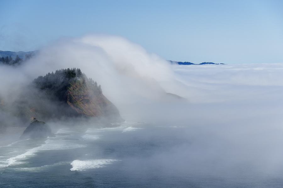
Out on the overlook, I had fun with fog. The formation of the white cottony water droplets suspended in air pushed its way ashore and up the face of hills seemed to mimic the wave action below.


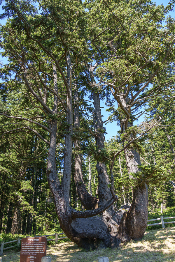
The docents recommended we take the short walk from the lighthouse to the 250- to 300-year-old Octopus Tree. Curious, we headed that way to see the attraction.

The Sitka spruce tree developed a solid base that has grown to 14-15 feet across. The lack of a central trunk and the cluster of trunks around the perimeter create a curiosity to ponder.

Was the tree’s growth natural? Or, was it trained like a bonsai into its formation by Native Americans? Did they bury their dead in canoes built in the tree? No one seems to know for sure, so for now it remains a mystery.
,


The lighthouse is part of the Cape Meares State Scenic Viewpoint and is surrounded by the Cape Meares National Wildlife Refuge and operated by The Friends of Cape Meares Lighthouse and Wildlife Refuge, Inc a 501 © 3 nonprofit organization.
Next Up: Another lighthouse and sand dunes.
Safe Travels.