
Golden-brown russet potatoes, the kind we use for Thanksgiving dinners, came to mind as I switched the map from Nevada to Idaho. But I will forever associate Twin Falls, Idaho with water. Twin Falls is one of eight counties in south-central Idaho known as The Magic Valley. In the early 1900s, an enterprising individual convinced investors to build a canal system to carry water from the Snake River to the surrounding desert populated with sagebrush and grass. Remove the sagebrush, add water, and poof. Out pops fertile farmland.
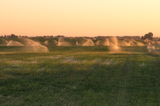
Lush bright-green acres of potatoes, kale, and corn welcomed us as we neared Twin Falls. Golden fields of hay ready for harvest along with cattle and dairy farms rounded out the agricultural offerings. Our jaws dropped when we passed the first of many farms with giant Rainbirds spraying water on the crops and swamping the fields. Coming from California where every drop is precious and conservation is drilled into the residents at every turn, we could only think how wonderful it would be to have access to such an abundance of water. The reddish-orange color in the sunset sky is smoke from fires burning near Boise, 150 miles northwest from Twin Falls.
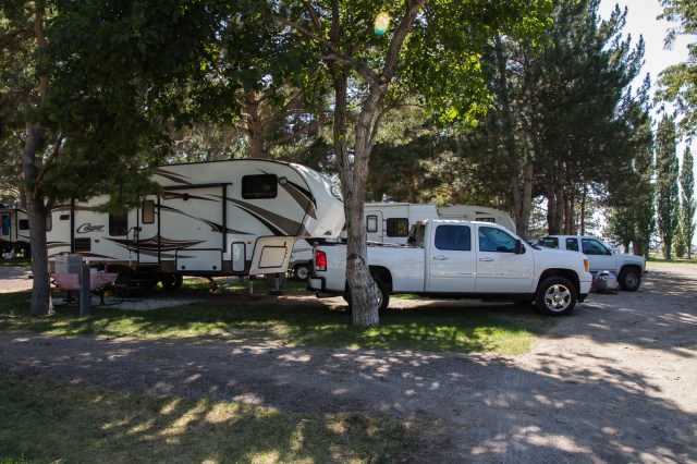
We arrived at Anderson Camp RV Park, our new home for the next three nights, on July 26. The park offered shady, grassy spots with plenty of space between the neighbors. Anderson Camp is a well-maintained older park with a pool and twisty waterslide (for an extra fee). They have cabins to rent and space for tents. If we stop here in the future, we’ll be sure to ask for a site without a walnut tree. The birds and squirrels stripped the nuts of their shells and scattered the debris all over the picnic table, trailer, and truck and in the morning, we woke to little bombs hitting the roof of the trailer.
On the drive down the gorge toward Shoshone Falls, water gushed from the basalt canyon walls. One of the locals told us it was the dry season since the farmers had diverted much of the water to drench their crops. His definition of ‘dry season’ was wildly different from ours after living in a drought state for five years.
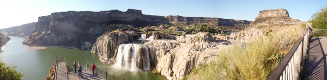
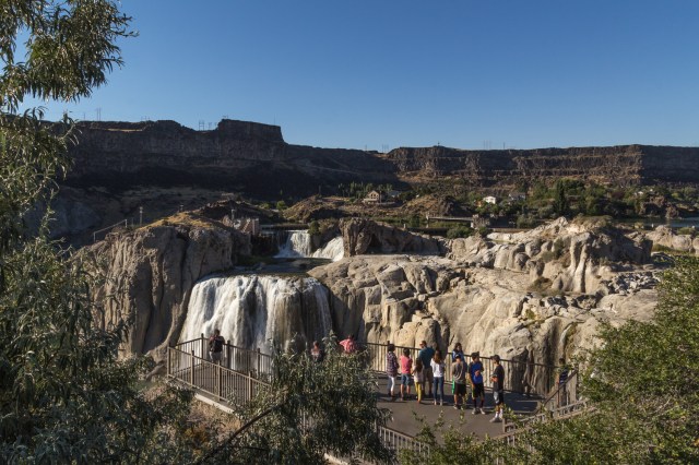
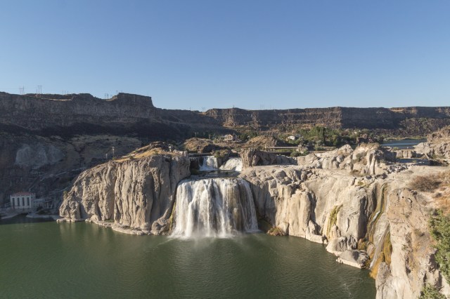
The Shoshone Falls reminded me of a miniature version of the Niagara Falls. I can’t imagine what the water cascading over the boulders would be like at full strength. We saw pictures that showed the falls stretching from one side of the canyon to the next.
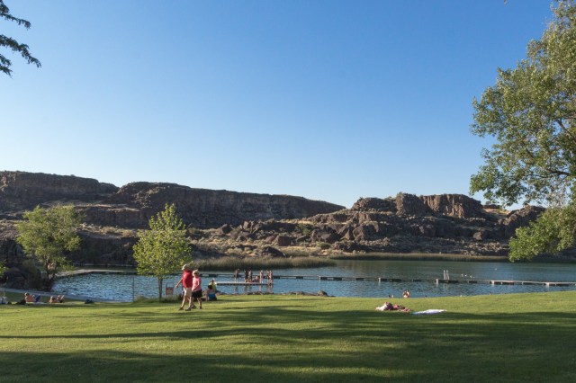
Dierkes Lake and the adjacent park, a favorite for residents and visitors alike, offers swimming, fishing, and picnicking in the cool shade of the large trees.
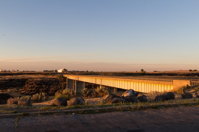
The current Hansen Bridge, built in 1966, spans 258 feet and is 350 feet tall. It replaced a suspension bridge built in 1919. Before the bridge was built, travelers used rowboats to cross the gorge. More smoke is evident on the horizon.
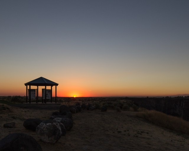
A kiosk on the south side of Hansen Bridge described the impact on the Snake River Plain from the Lake Bonneville Flood, which is believed to have occurred 15,000 years ago. Imagine a late Pleistocene lake covering 19,691 miles in northwest Utah releasing water at a rate of 15 million cubic feet per second into southeastern Idaho and on to the Columbia River in Oregon. The Great Salt Lake in Utah is what remains of Lake Bonneville. Also noted was how the emigrants followed the river on their way to Oregon stopping for a respite in Twin Falls. Another board told of entrepreneurs who developed the canal system promising a Magic Valley, and of other people who provided the goods and services to the new inhabitants of the territory or transport across the divide.
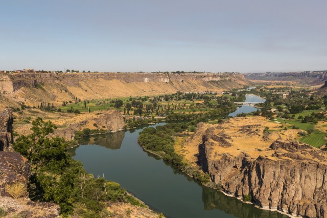
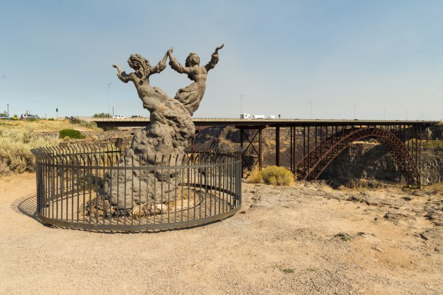
Twin Falls Visitor Center offers maps and pamphlets of other sites to see in the surrounding areas. A walk under the highway leads to The Twins sculpture crafted by David Clemons and provides one of many perspectives of the Perrine Bridge that rises 486 feet above the Snake River. Its span is 1500 feet from rim to rim.
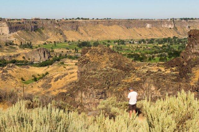
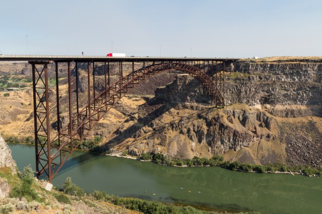
The dirt berm rising from the right side of the canyon is where Evel Knievel attempted his jump across the river.
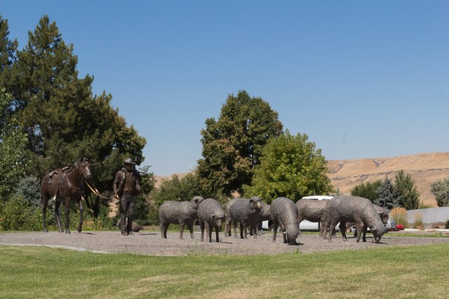
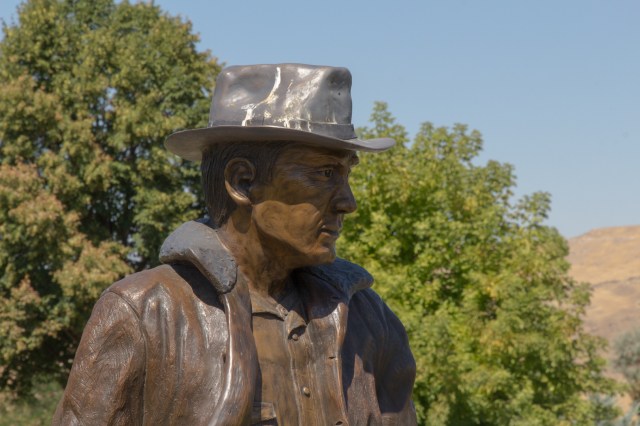
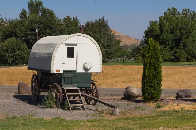
On our way to Hagerman Fossil Beds, we came across the Hagerman Sheep Monument, a tribute to the Basque sheepherders who settled in the area. The monument included statues of sheep, a sheepherder, and a replica wagon equipped with stove, sink, and bed just like a small trailer you might see today.
Access points along the Snake River provide fishing, swimming, and boating. Loaner life vests are also available at some boat launches.
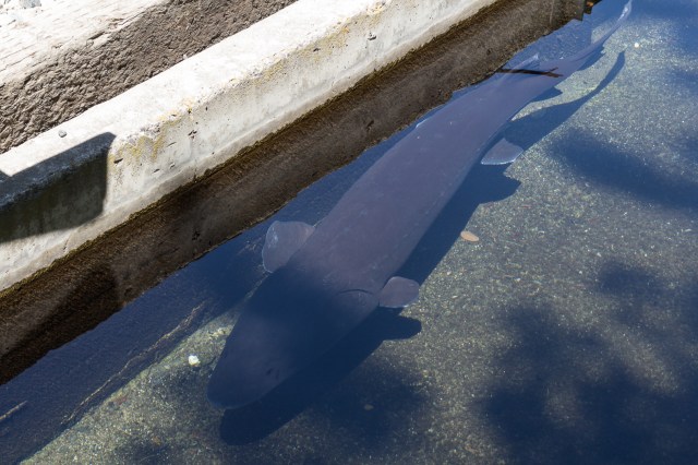
Another side trip was The Hagerman National Fish Hatchery. Outside in a demonstration pond, sturgeon and trout swam in the shadows.
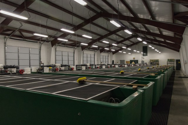
Inside the building, we saw the zillion little fish in the tanks that one day will be planted in the lakes and river.
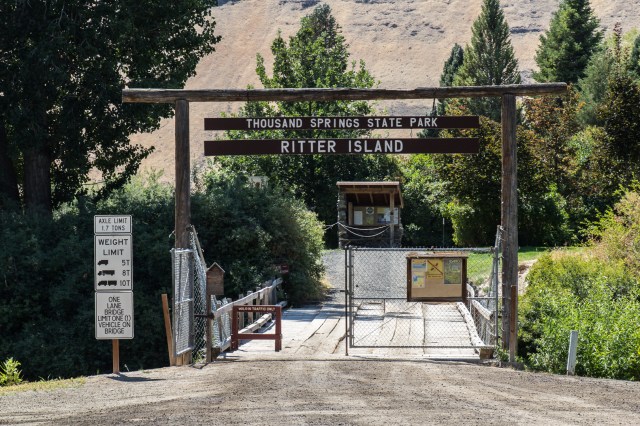
We never did make it to the fossil beds. The ranger at the Forest Service Office recommended Thousand Springs State Park and Ritter Island instead due to the hot weather. More falls, water gushing from the canyon walls, and ankle-deep water provided a break from the heat of the day.
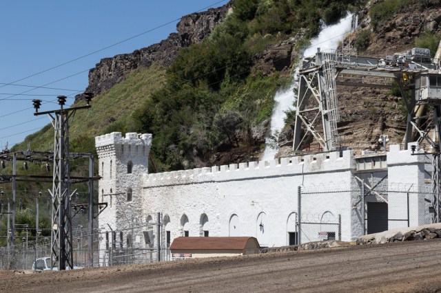
The Thousand Springs Hydroelectric Power Plant acquired in 1916 and updated in 1921 generates 8800 kilowatts. The castle-like architecture creates a sense of whimsy to what would otherwise be another hunk of concrete and steel.
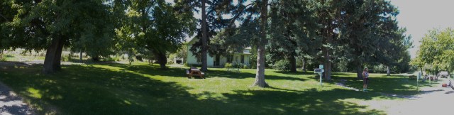
Our last day in Twin Falls, we went to the Rock Creek Station and Stricker Home.
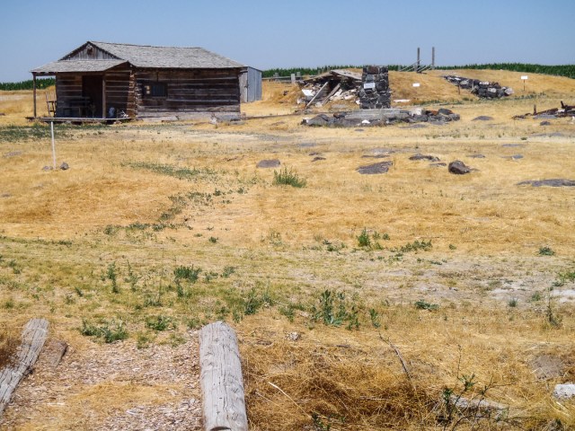
The cabin building in the photo was a store, a post office, and polling place from 1879 – 1897. The mounds behind the building are cellars, one wet, and one dry. I wanted to look inside the dark earthen cave, but thick cobwebs draped the doorways. No way was I going to pass through them into a spider infested space. To the right of the store once stood a station where stagecoaches stopped to change out their horses.
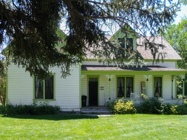
A creek runs behind the white house that was built in 1901. Apparently, there were up to forty buildings during the stagecoach days. This property must have been an oasis after traveling in a stagecoach across miles of dry land and sagebrush. Tours of the fully furnished house are available.
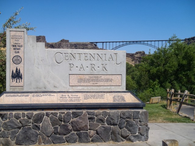
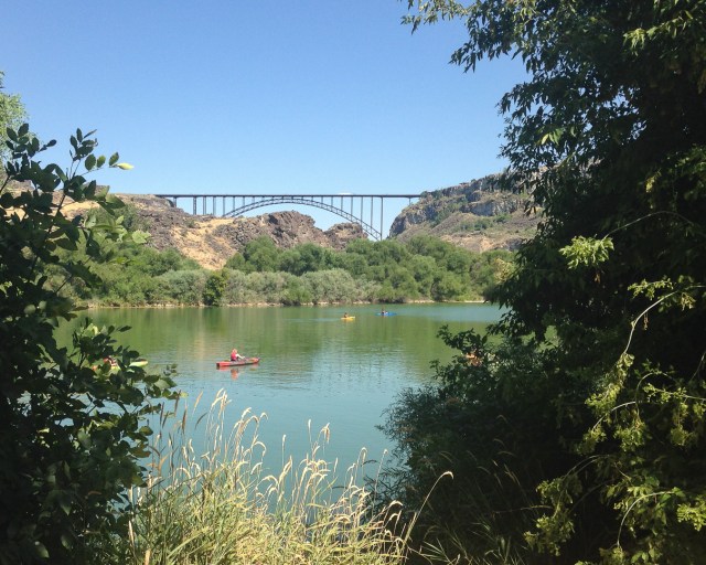
One last stop before we headed off to Idaho Falls. Centennial Waterfront Park is a great place to rent a kayak, eat a picnic, hike the trails, find rocks to climb, or . . .. We walked along a path at the water’s edge under shade trees and watched the kayakers glide across the water.
After three fun-filled days, it was time to move on. “Idaho Falls, here we come.” I expected to see a lot more water coming our way.
