After four nights in Twenty-nine Palms exploring Joshua Tree National Park, we were ready to find new places to explore. We had Boron, California, in our sights, on October 23, 2017. Not to stay overnight, just to check out the Borax Visitor Center, a place we had driven by for the past thirty or forty years going between northern and southern California. It was time to visit the company that once sponsored the Death Valley Days program on television.
The Borax Mine is located on State Route 58 about 12 miles west of Kramer Junction—where US Route 395 and State Route 58 intersect. We weren’t sure we were headed in the right direction. All we could see as we drove down the road were tall towers, steam rising in columns, and hills, nothing that looked like a visitor center.
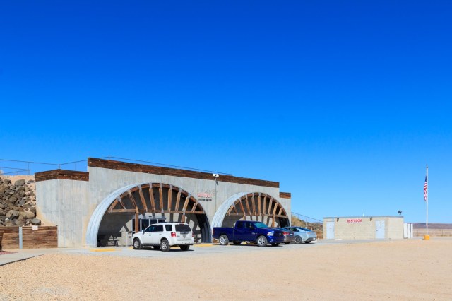
Borax Processing Plant
When we came to the end of the road, signs directed us toward an unmanned booth along a dirt road. We trusted the billboard that advertised plenty of RV parking at the top of a hill and kept on driving. When we reached the top, the road turned left and sure enough, there was plenty of space to accommodate multiple fifth wheels and buses.
Borax Visitor Center
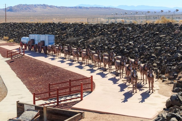
An original 20-Mule Team Wagon set complete with hitched up mule statues welcomed us at the visitor center. The teams carried borax out of Death Valley 165 miles to the nearest railroad junction in Mojave. The round trip took 20 days to deliver 20 tons of borax between 1883 and 1888.
20-Mule Team Wagon with Statues
Today the operation mines colemanite, ulexite, kernite, and borax, from a borate deposit, which has been mined since 1927. These minerals are used in agriculture, ceramics, detergents and personal care products, fiberglass and glass, and as a wood treatment to prevent fungal decay and damage from termites, ants, and roaches.
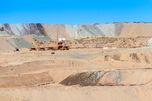
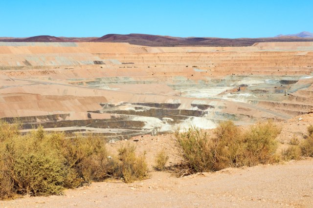
Pit and Tailings
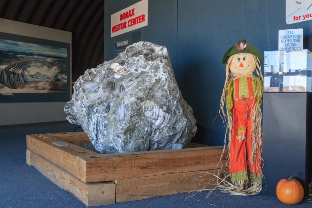
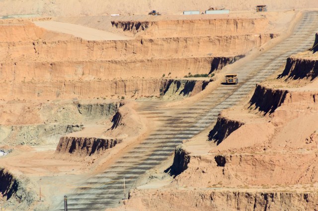
The visitor center is open 7 days a week from 9 a.m. to 5 p.m., except holidays or during bad weather. Admission is free. Inside the building is a theater where a short movie and talks by docents provide information about the Rio Tinto Mining Company and the history of the pit. Displays show how borax is mined and processed, what products the minerals are used in, and the different types of minerals mined. Outside a ramp takes visitors to a platform where they can watch the giant dump trucks, which look like ants where we stood, maneuver atop the tiers.
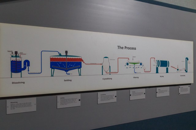
Sample of Borate Ore (Kernite) Taken from Mine in 1997Diagram that Explains the Process
The pit is almost like looking into the Grand Canyon. At 1 mile wide, 1½ miles long, and 650 feet deep, the heavy equipment is dwarfed by the vast landscape. A few pieces of equipment are barely identifiable in the mid-right gray area.
Borax Pit
Even Zoomed in, the Equipment Appears Like a Toy Among the Towering Tiers
Back in Boron is the Twenty Mule Team Museum. Unfortunately, we ran out of time and had to get back on the road so we could arrive before dark in Tehachapi where we planned to spend the night.
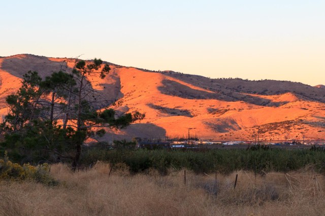
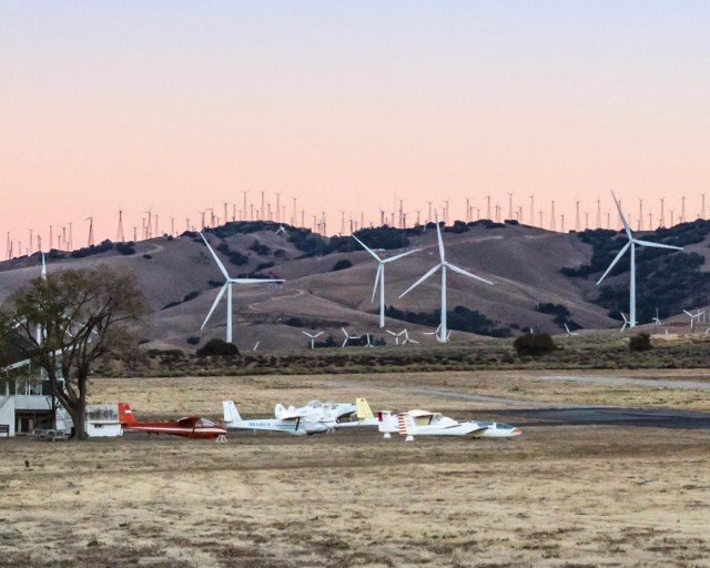
We found a quiet spot away from the trains and freeway at Mountain Valley RV Park where they offer water, electricity, restrooms, showers, and laundry. There is a dump station but no sewer hookups. A short walk away is the Mountain Valley Airport that serves small aircraft and gliders and operates a café.
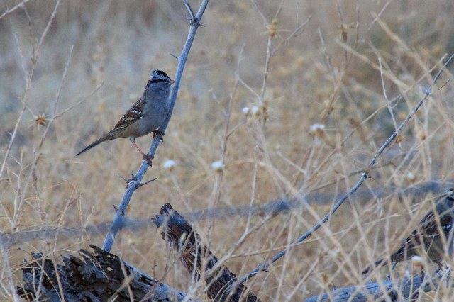
Looking South From Mountain Valley RV Park the Last Bits of Sun Paint the Hills Little Birds Flitted About in the Dry GrassHills and Windmills Create a Backdrop for the Hidden Valley Airport
Coyotes woke us around 4:00 a.m. and as the sun rose, the wind grew stronger. Time to hit the road.
From Prescott we headed toward Twenty-nine Palms, California, to explore Joshua Tree National Park, a place we had wanted to return to for many years. We checked in at Twenty-nine Palms RV Resort on October 19, 2017, for four nights.
Joshua Tree National Park Visitor Center
This desert area became a national park in 1994 after being set aside as a monument in 1936 by President Roosevelt. Jon and I had driven by the park several times going to and from other places and often commented that we needed to go back and spend some time. I was curious about what had changed since I camped at Jumbo Rocks with a group of friends while still in high school. Finally, I’d find out.
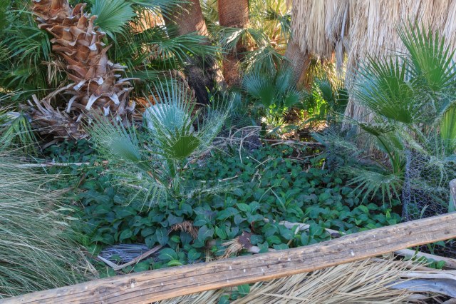
Oasis Visitor Center
We started our exploration at the Oasis Visitor Center where we picked up a pamphlet and a map of the 794,000-acre park. We also walked around the Oasis Trail with a volunteer ranger. She had a grade school teacher’s personality that roused our interest as she pointed out features of the palms, the different plants, and the animals that visited the pond. She explained that they do not trim the dead palm fronds from the trees because they serve as homes and protection for birds, owls, and other critters.
Oasis Trail at Visitor Center
The main highway traffic ebbed into white noise leaving only the sounds of wind whistling through the palm fronds, the trickling spring, birds trilling their songs, and scampering lizards and mice rustling in the brush.
There’s a Spring Under All that Greenery
Along the path is a series of signposts that tell the story of what happens when a seventeen-year-old girl of the Chemehuevi falls in love with a white man. The story gave me a glimpse into the people who visited the oasis in the early 1900s.
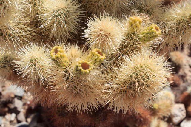
Cholla Cactus Garden
Be sure to wear closed-toe shoes while navigating the quarter-mile loop trail in the Cholla Cactus Garden.
Cholla GardensCholla Garden
Although the branches appear as if they are covered with something soft and fluffy, don’t touch. The prickly barbs will latch onto shoes and clothing and you’ll have a jolly time trying to remove them. The cone shapes tipped with yellow are what is left from the flowers that bloom from March through May.
Cholla Close Up
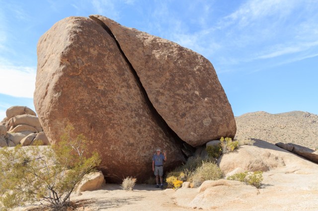
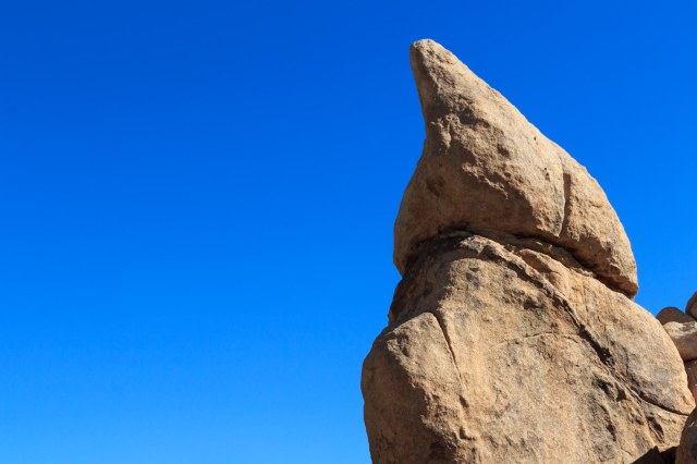
Split Rock Loop Trail
Take the Split Rock short loop trail to see rocks and cactus up close, or extend the hike to a full 2.5 miles by taking the extension to Face Rock.
JT Waving at Split RockMy, What a Big Toe You HaveSleeping Baby Elephant?Yucca Plant Cuddles With a Prickly PearStone Steps Mark the TrailYucca Plants Hanging on to the Last of Their Bloom StalksBalancing Rocks Are A Common SightThe Olympic Flame Just Like in Bryce Canyon
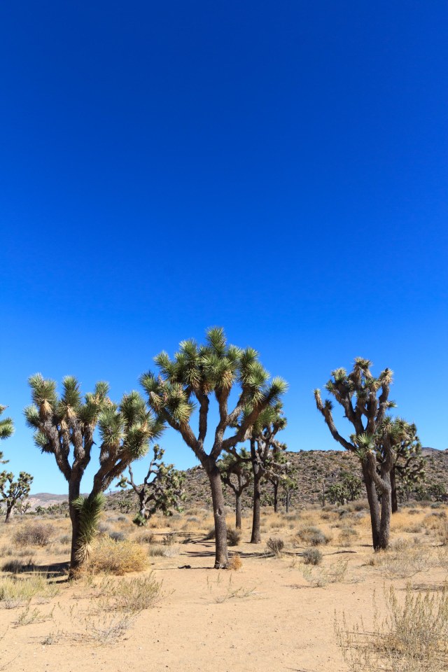
Joshua Trees
Joshua Tree National Park is unique in that it encompasses portions of both the Mojave Desert on the western half of the park and the Colorado Desert on the eastern half. The Joshua Trees, a species of yucca rather than a true tree, are most prevalent on the western side where elevations are greater than 3,000 feet.
Acres and Acres of Joshua TreesJoshua Tree Forest
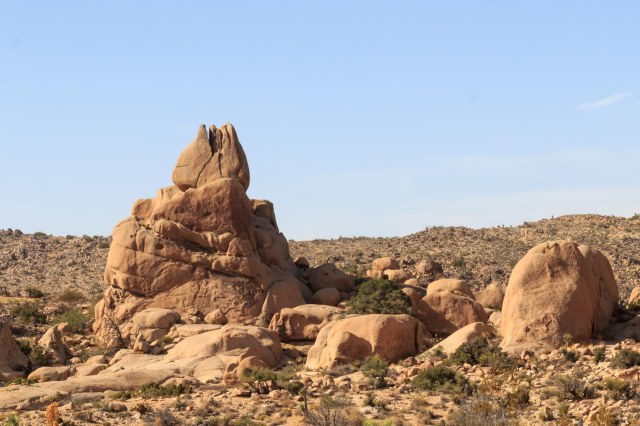
Skull Rock Trail
This is another loop trail and quite popular with cars and trucks parked on both sides of the road for about a quarter mile on either side. Start at Jumbo Rocks Campground, or at Skull Rock. There are trails on both sides of the highway and plenty to see.
View from Atop The Jumbo Rocks
A sampling of plants seen on the trails.
Red Top Buckwheat
Paper Bag Bush
Beaver Tail Cactus
Or, is This a Baby Elephant?Skull Rock Crawling with People
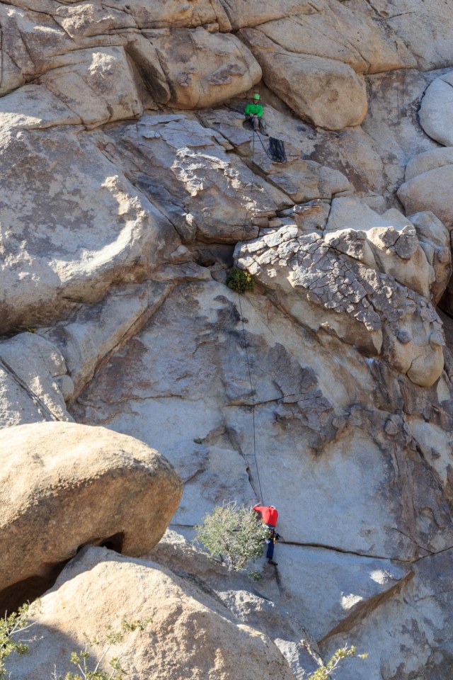
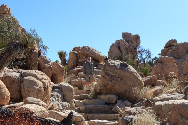
Hidden Valley Trail
I think Hidden Valley Trail was one of my favorites. It’s such a surprise to break through the tight boulder formations and encounter a rock enclosed valley that cattle rustlers may have used to hide out.
Yucca and Other Plants Find Cracks and Crevices to GrowClimbers Have Plenty of Spots to Navigate The Steep Rock Faces in Hidden ValleyLook Ma, I’m King of the HillStairs Make the Trek Easier
Hershey Kiss?
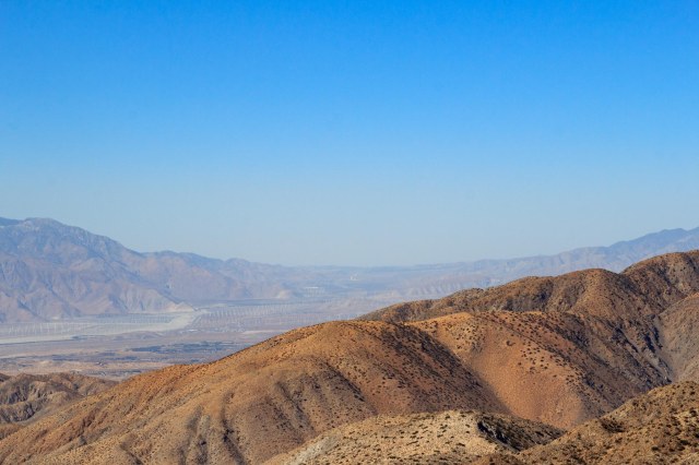
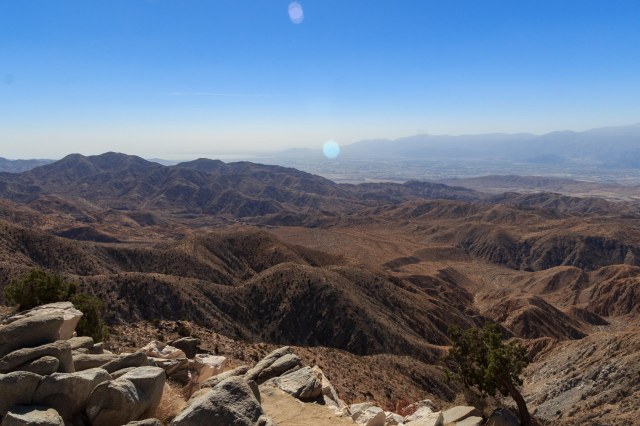
Keys View (5,183 feet)
Keys View overlooks Highway 10 and across the valley stands the Indio Hills.
San Gorgonio PeakSan Gorgonio Pass Looking WestCoachella Valley In the Haze
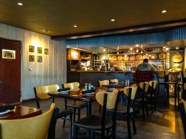
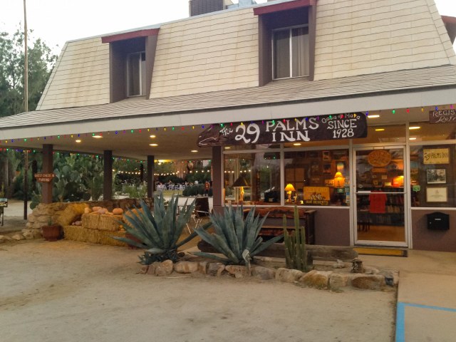
29 Palms Inn and Restaurant
We didn’t expect much in the way of a decent restaurant in town since the main drag was where most of the fast-food chains set up shop. We were surprised, however, when we drove to the end of a road, skirted the pool, and walked into the restaurant at the 29 Palms Inn on the Oasis of Mara. They have been dishing up tasty food since 1928.
29 Palms Inn Restaurant
Dining room at 29 Palms Inn Restaurant
The inn includes several adobe bungalows, suites, wood frame cabins, and other accommodations guests wanting a quirky place to stay. Oh, the stories those bungalows could tell if only given a chance.
29 Palms Inn Lobby
Camping at Joshua Tree National Monument
Camping is available year round. No reservations are needed during the summer when the temperatures rise to 100 degrees or more. October through May is the busiest time and mid-February to mid-May and holidays are the busiest. Two of the campgrounds accept reservations and six are first come, first served. By Friday morning, October 20, 2017, the campgrounds were already full. I’m glad we had arranged for accommodations outside of the park, although it would have been fun to look up at the pitch black sky and watch the Orionid meteor shower without ambient light getting in the way. Oh, about what has changed at Jumbo Rock Campground? Although I noticed a definite upgrade in the amenities, the crowded sites turned me off. Maybe Sunday through Wednesday wouldn’t be so bad.
Another Restaurant Recommendation
On our way from Prescott, Arizona, to Twenty-nine Palms, California, we passed through Wickenburg, Arizona, at lunchtime. The Tastee Freez looked to be the best bet in town, and we weren’t disappointed. Expecting only grilled hamburgers and French fries, this Tastee Freez, along with Sundance Pizza, has a large menu to satisfy any guest, including deli sandwiches and salads. If you are traveling through Wickenburg and it’s time to eat, don’t be shy about giving this Tastee Freez a try.
Tastee Freez in Wickenburg
Tastee Freez in Wickenburg
If the timing is right the next time we roll through Twenty-nine Palms, we’ll have to stop and explore more of Joshua Tree National Park. Plenty of trails still remain for us to take.
Coming up is the Borax Visitor Center in Boron, California, and then on to Sequoia and Kings Canyon National Parks.
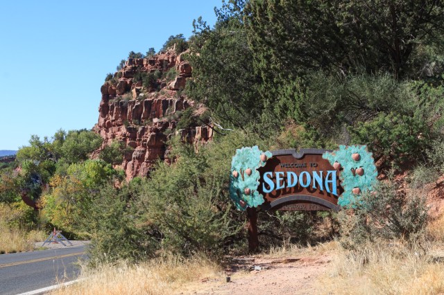
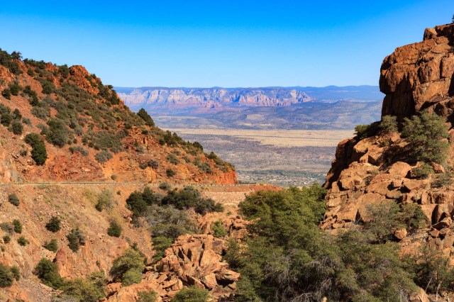
We headed south on Highway 17 on Sunday, October 15, 2017, the 22nd day of our fall tour. We transitioned onto scenic Highway 89A through Sedona and on toward Prescott, Arizona. We wanted to stop in Sedona and see what the town had to offer, but there was too much traffic, vehicles and pedestrians, and no place to park.
Welcome to Sedona if You Can Find a Spot to Park
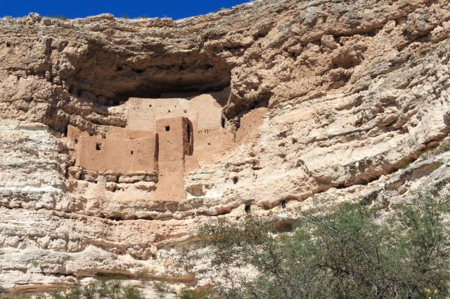
Along the way we saw signs advertising Montezuma Castle National Monument, so we detoured east on Highway 260 to Camp Verde, Arizona, to take a look.
Montezuma Castle National Monument
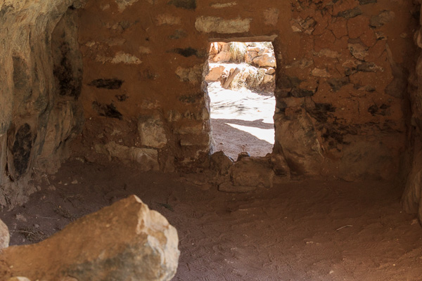
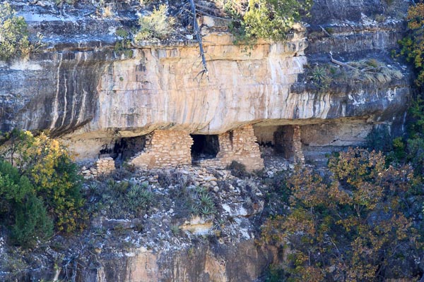
Montezuma Castle is one of three national monuments in the Verde Valley that protect and interpret the legacy of the Sinagua culture. Although it is a small monument, it contains well-preserved cliff-dwellings. A paved trail meanders through a forest of Arizona Sycamore and Walnut trees with an undergrowth of creosote bush, velvet mesquite, catclaw mimosa, and soaptree yucca, to name a few.
Montezuma Castle Cliff Dwelling
Along with Montezuma Castle, Montezuma Well—a natural oasis—and Tuzigoot—an excavated ancestral village—depicts a farming life in the valley some 1,000 years ago. Unfortunately, we were only able to see Montezuma Castle and had to add the well and Tuzigoot to our list of places to visit during a future trip.
Highway 17 would have taken us to Prescott, but we wanted to go through Jerome, Arizona. Jon remembered steep cliffs without safety railings along the road through Jerome, so I braced for a white-knuckle ride. I’ve seen cities built on hills before, but nothing to the degree of how Jerome is situated. Billboards mentioned RV parking, but with so many vehicles around, it was clear there was no spot for our truck and 30’ fifth wheel. We continued on along the narrow street, navigating hairpin turn after hairpin turn until we stopped at a vista point to calm our nerves.
Whew! This View was Our Reward for Making it Safely Through Jerome.
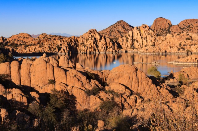
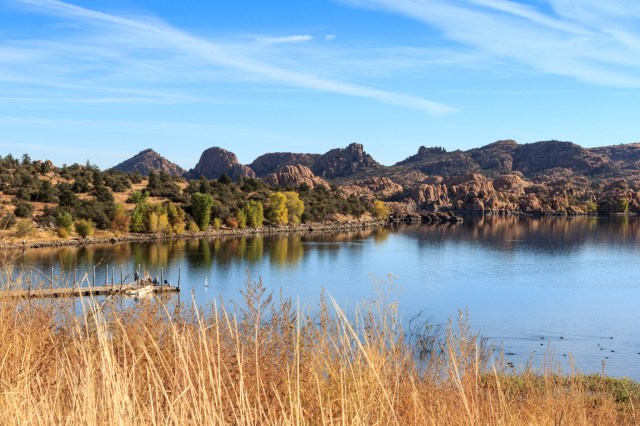
Point of Rocks RV Park and Watson Lake
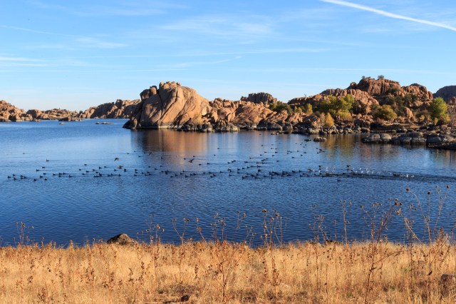
As advertised, Point of Rocks RV Park in Prescott, Arizona, was a short walk to Watson Lake where we had our first views of the Granite Dells.
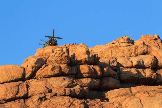
Watson Lake and Granite DellsMemorial to Lost Hiker?
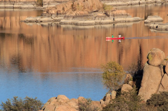
The lake, one of two, was created by the Chino Valley Irrigation District in the early 1900s. Today the City of Prescott owns the lake and has preserved it and the surrounding area for recreational purposes. Visitors enjoy fishing and kayaking at the lake and birding, hiking, and rock climbing along the 4.6-mile trail that surrounds the water.
Watson LakeKayaking on Watson LakeGo Ducks, GoTrail Around Watson Lake
Besides the available outdoor activities around Prescott, we found the preservation of historic buildings and the Sharlot Hall Museum of interest.
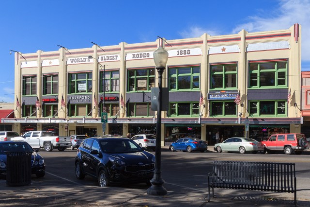
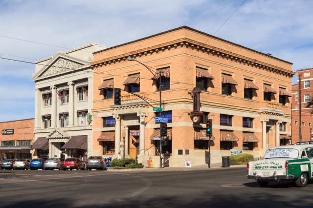
Historic Downtown Prescott and Whiskey Row
We stopped in at the Tourist Center and grabbed a pamphlet that detailed the location of the buildings built over 100 years ago.
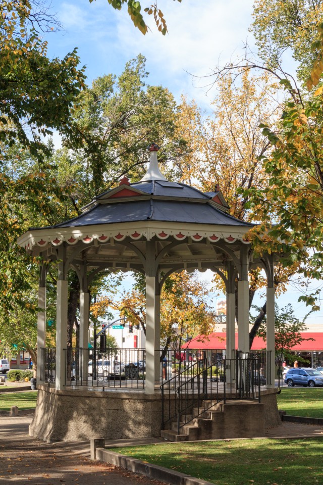
Bandstand Predates the County Courthouse
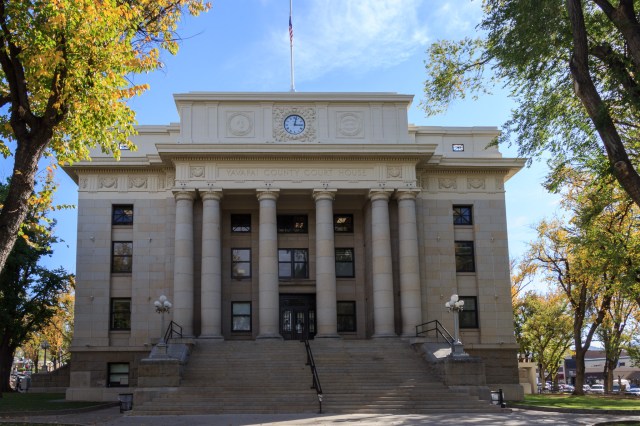
The Yavapai County Courthouse Plaza is at the center of the historic district which encompasses a 17-acre area that includes 26 contributing buildings in its designation on the National Registry of Historic Places.
Yavapai County Courthouse
Whiskey Row, across from the courthouse, is where a total of 40 saloons once occupied the commercial space when the street was rebuilt after the 1900 fire destroyed four blocks of businesses.
Whiskey Row Across the Street From Courthouse Plaza
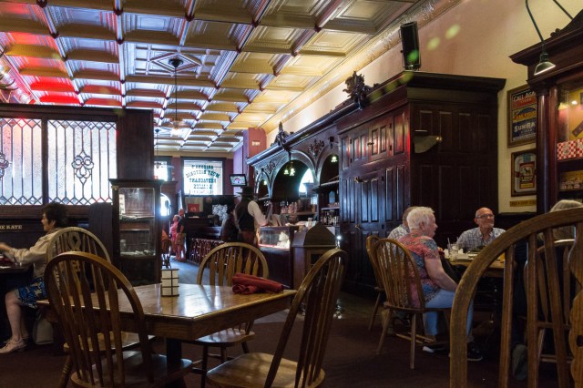
The Palace Restaurant and Saloon, originally established in 1877, is considered the oldest frontier saloon in Arizona. The Palace lists Wyatt Earp, Virgil Earp, and Doc Holliday as patrons in the late 1870s. The 1880s Brunswick Bar is still in use, having been carried to safety across the street by patrons before the 1900 fire destroyed the building.
Palace Restaurant and Saloon
A gentleman costumed in old western attire greets customers as they enter the bar and escorts them to a dining table. After we enjoyed our meal and an Arizona Sunrise Margarita, we took time to walk around the restaurant to check out the memorabilia and photos that line the walls.
Here’s a sample of other buildings around the square.
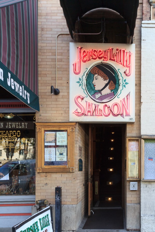
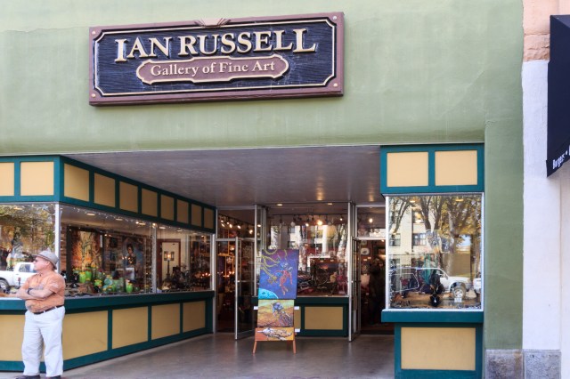
Dedicated to Lilly Langtry, Jersey Lilly Saloon has a Balcony that Overlooks Courthouse Plaza Square for a Birdseye View of All the ActivityOne of the GalleriesSeveral Businesses Occupy this Art Deco BuildingPrescott National Bank Building on the Corner and the Masonic Temple Next Door
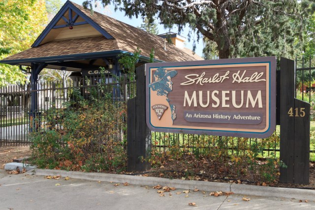
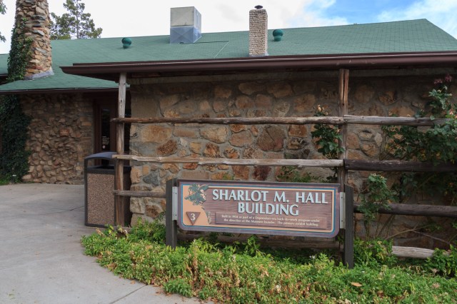
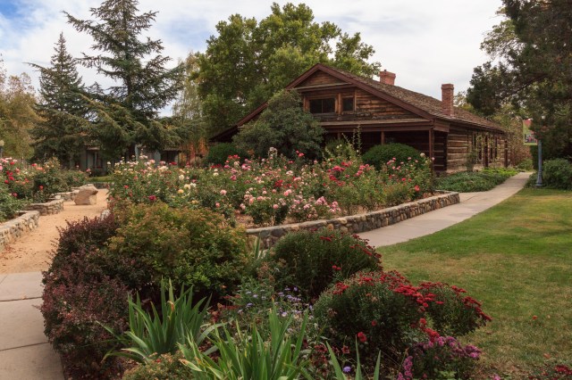
Sharlot Hall Museum
Sharlot Hall Museum Entrance
I never heard of Sharlot Hall before, but I’m glad I met her while visiting the Sharlot Hall Museum. She is truly a woman to admire.
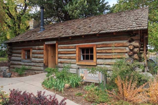
Restored Arizona Territorial Governor’s Mansion Once Housed Sharlot’s Collections
Sharlot moved to the Prescott area with her parents and brother in 1882 at the age of 12. She saw the need to collect and protect Native American and pioneer artifacts early on and planned to develop a museum for her collections.
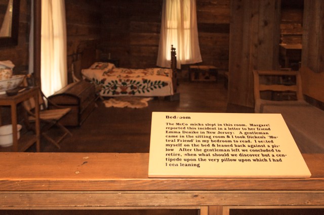
Bedroom in Old Governor’s Mansion
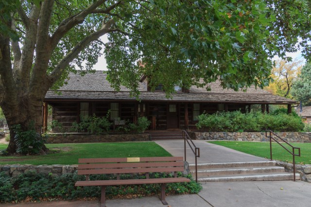
She lived at her father’s Orchard Ranch until 1927 when she moved her collection of artifacts and documents into the Old Governor’s Mansion. She opened the museum one year later. A journalist, poet, and essayist, she served as the territorial historian from September 1909 to February 1912 and lobbied against a bill that would have combined New Mexico and Arizona territories into one state.
1875 Fremont House Shows Period Construction and Furnishings. Used as Residence for 5th Territorial Governor John Charles Fremont
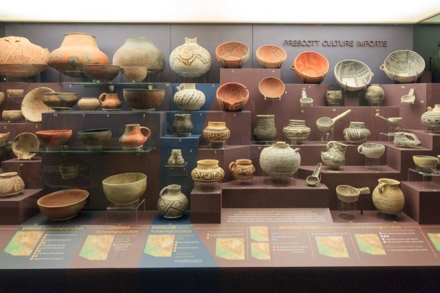
Working with the Civil Works Administration during the 1930s, the Sharlot Hall Museum building was built. After her death in 1943, the entire complex officially became The Sharlot Hall Museum. In 1981 she became one of the first women elected to the Arizona Women’s Hall of Fame. Today the museum consists of ten exhibit buildings, four of which have been historically restored.
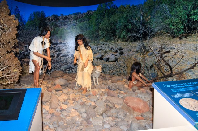
Constructed in 1934 This Building Houses Many of the Items Collected by Sharlot HallPottery DisplayDiorama Exhibit of Native Americans
The museum operates daily from October through May, conducts four annual festivals, and offers living history events. We enjoyed our visit to the museum and highly recommend it for anyone interested in Native American and pioneer history of the old west.
Memorial Rose Garden Honors More Than 200 Territorial WomenRanch House Built in the 1930s to Represent the Ranch Homes in the Area
Of all the places we have visited over the past two years, Prescott has to be one of my favorites. With plenty of outdoor activities, museums, and dedication to historical preservation, it is a place I would like to stay for more than three or four nights. I’m sure we will return soon.
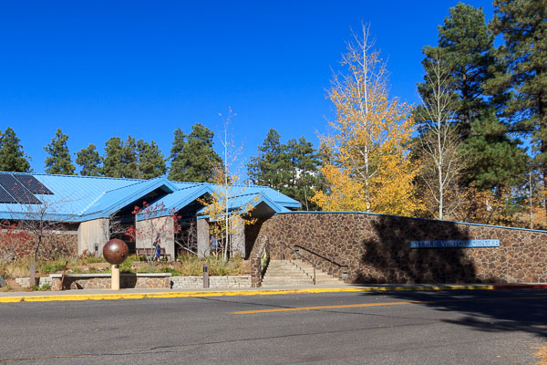
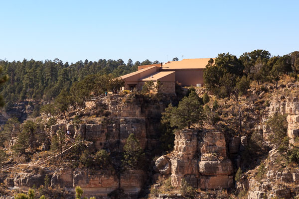
We managed to fit into our schedule a couple more Flagstaff sights while in town: the Lowell Observatory, founded in 1894 by Percival Lowell, and the Walnut Creek National Monument, where a civilization once lived and farmed 1,000 years ago.
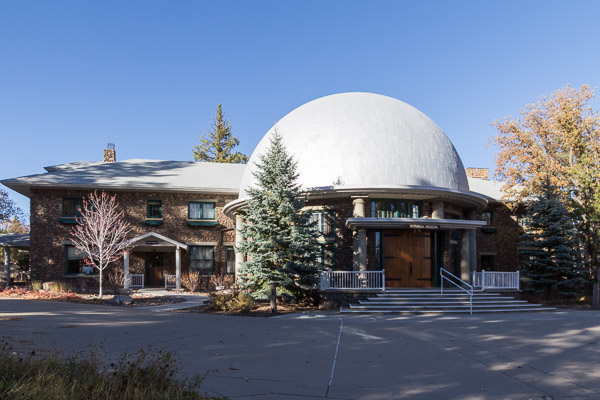
Lowell Observatory
Lowell Observatory Visitor Center
Percival Lowell had a theory about life on Mars, mainly, that water flowed through what he thought were canals. Although controversial, Percival was undeterred. Using a 24-inch Alvan Clark refracting telescope installed in 1896, Lowell spent fifteen years mapping Mars and creating hand-drawn globes of the planet that showed details of the canals.
Clark Refractor
Later, he was devoted to searching for Planet X, a planet located beyond Neptune having a gravitational impact on Uranus and Neptune. The Pluto Discovery Telescope, currently under renovation, was built in 1928-1929. The year before Lowell’s death in 1916, astronomers at the observatory photographed what would later be identified as Pluto, which was reclassified as a dwarf planet in 2006. The scope is an astrograph with three 13 inch diameter lenses and designed to take photos of the night sky for survey purposes and to detect objects, such as meteors. Today, I understand astronomers are searching for Planet Nine which could be ten times the mass of Earth. Mauna Kea Observatory in Hawaii and its Subaru Telescope is one such tool being used to find the elusive planet.
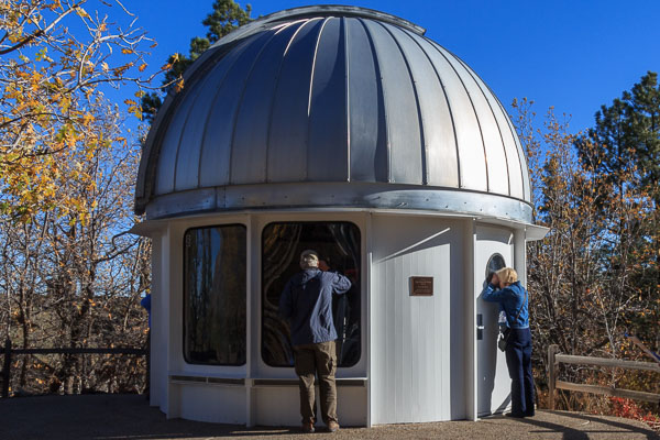
John Vickers McAllister Public Observatory
Other discoveries made at the Lowell Observatory include V. M. Slipher’s observations that lead to the theory of an expanding universe and the measurement of motions and properties of stars, some of which were used in the 1960s to create maps of the moon.
While at the observatory, we had an opportunity to view the sun through a solar telescope. After a lifetime of being told not to look directly at the sun, I had a strange feeling as my eye focused on the orange ball for a minute or so. Although the sun was quiet that day with no solar flares evident, it was still an awesome sight to see.
Other buildings of interest include the Rotunda Museum where the public can view the first telescope Percival Lowell received when he was 15 years old, his hand-drawn Mars globes, instruments built by Lowell scientists, and classic scientific books.
Rotunda Museum
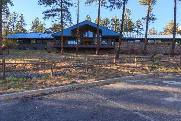
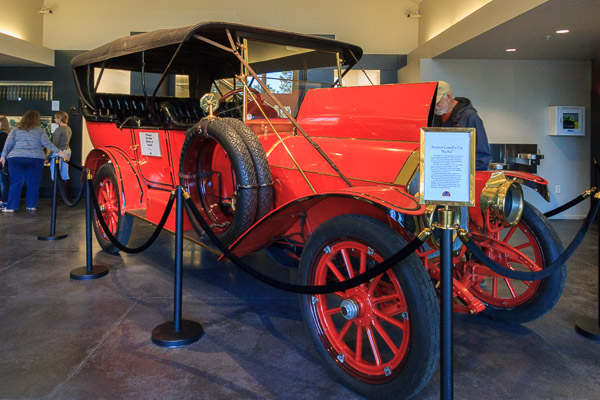
The Putnam Collection includes Percival Lowell’s state-of-the-art horseless carriage, a 1911 Stevens-Duryea still in working order.
Putnam Collection Building1911 Stevens-Duryea
And don’t forget Percival Lowells Mausoleum, a perfect resting place for the astronomer.
Percival Lowell’s Mausoleum
Daytime guided tours, films, and evening programs will please the amateur and professional astronomer alike.
I admire Percival Lowell for embarking on his pursuit of water on Mars and a new planet. His theory of water on Mars may not have panned out, but his persistence led to further searches for objects in the night sky beyond what we can see with our naked eyes.
Walnut Creek National Monument
Walnut Creek National Monument, established in 1915, is accessed a few miles east of Flagstaff off Highway 40.
Walnut Canyon Visitor Center
The Island Trail takes visitors into the canyon 185 vertical feet on 273 stair steps. The reward for this effort is to walk among the 25 cliff dwelling rooms where the Sinagua people made their home among the cliffs 1,000 years ago.
Bottom of Stairs on the Island TrailOn the Island TrailInside one of the Cliff DwellingsDoorways Led Into Adjoining RoomsImagine the Work Required to Build the Stonewalls
Views of other structures etched into the surrounding cliffs are also visible. Were these rooms used only for storage, or did the people make their homes in the small structures? I tried to imagine how the people accessed the caches. Did they use ropes? Or maybe they constructed ladders? Either way, it must have been treacherous.
View from Across the Canyon
The self-guided Rim Trail follows the canyon rim to two overlooks, and loops around to a pit house and pueblos set back from the rim. This is the area where the Sinagua grew their crops. Signposts along the way describe the vegetation and other information about the people who lived there.
Claret Cup Hedgehog CactusBlue Grama Grass
I think I would have felt more comfortable living in a pueblo like the two-room structure below, but I’m sure there were other dangers there as well.
Excavated Pueblo Along the Rim Trail
Across the path stands a pit room where, presumably, the people stored their food and other possessions. Or, perhaps this was someone’s home.
Excavated Pit House
I tried to imagine the sounds and smells of life when the Sinagua lived on this land: the squawk of birds overhead, the echo of children laughing, men joking while they work, meat cooking over an open fire. How would I have managed along the cliffs with a baby swaddled to my body or toddlers underfoot and in constant fear of a child falling into the canyon abyss? Not very well, I guess.
Flagstaff has so much more to offer visitors than what we were able to see during our short stay. When the desert valleys turn hot, head to Flagstaff to beat the heat, go on a hike, or explore the downtown. Or visit in winter to shuush down slopes, cross-country ski, or set out with snowshoes strapped to your feet. Any time of year would be a great time to visit Flagstaff.