Rocky Mountain National Park – Part 1

Rocky Mountain National Park – Part 1

 It’s rare that we take off for a new destination without some idea of where we will stay for the night. Without a reservation or multiple options, it feels like a gymnast is inside my stomach flipping, flopping, twisting, and turning during the whole trip. Thursday, August 23, 2018, found us in such a predicament as we headed for the west entrance of Rocky Mountain National Park.

I could barely enjoy the view as we drove through Rabbit Ears Pass where patches of dead trees broke up the healthy forest covering the mountainsides. There were only 98 sites at the only first-come-first-served campground on the west side of the park.

The sign at the Grand Lake Entrance showed no vacancy for the first four campgrounds listed. Then the last campground, Timber Creek (first-come-first-served), showed vacancy. Yes! Now we only had to worry about finding a campsite for our 30’ fifth wheel. Would the sites be big enough?

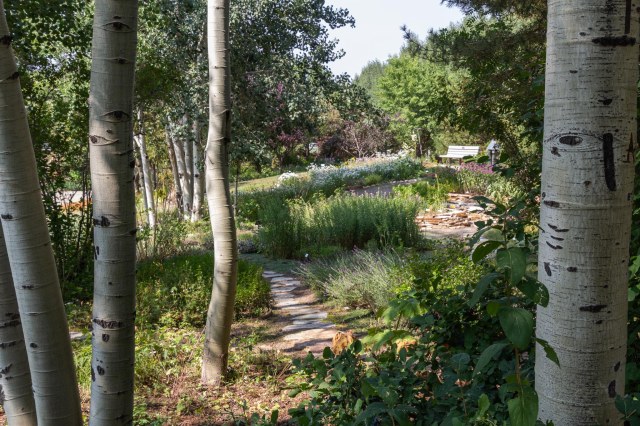
All of that worrying turned out to be for naught, as it usually does. We managed to squeeze into a perfect spot, paid the fee, and settled in for three nights.

Timber Creek campsite

We had plenty of daylight left to commence with exploration. First stop, of course, was the Kawuneeche Visitor Center for maps and information about hikes. We didn’t plan on any strenuous hikes at elevations of 9,000 to 12,000 feet. Even though we had been in high elevations for almost a month, we still suffered from shortness of breath at the slightest exertion, the occasional headache, or dehydration. Sticking with the shorter and flatter trails would keep the more serious symptoms of altitude sickness at bay.

Adams Falls

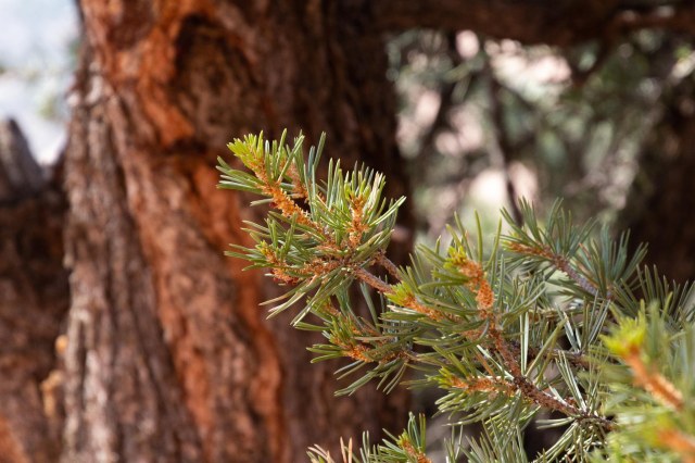
Accessible near Grand Lake a few miles outside of the park, Adams Falls turned out to be our speed at a distance of .6 miles roundtrip and an elevation gain of 79 feet.  Lodgepole pines had fallen like pick up sticks along the trail, cluttering the forest floor. It looked like more than a good raking was needed to prevent a catastrophic forest fire.

Lodgepole pines downed by bark beetle
Adams Falls
Adams Falls empties into Grand Lake

Grand Lake Lodge

Grand Lake Lodge was our next stop. The lodge was either established, built, or began operation in 1920 or 1925. Three different signs listed three different dates. It’s a beautiful old lodge with wood beams and floors. A huge fireplace dominated the middle of the lobby with a bar on one side and a restaurant beyond. Seating on the porch was popular for its view of the lake.

Grand Lake Lodge with historic vehicles
Picturesque location for a wedding
Lobby area with fireplace, seating, and bar
Welcome to Grand Lake Lodge
Flowers on the porch create a homey feel

Tundra Communities

Our destination for the morning was the Alpine Visitor Center. Yeah, right. To get a parking place requires an early rise, something we rarely manage, or a long wait in line until someone leaves. We kept on driving to the Tundra Communities Trailhead. Information signs along the 1.3-mile roundtrip trail with an elevation gain of 260 feet explained the topography, detailed the plants and animals that live in the tundra zone at 12,000 feet and how they adapt to the cold temperatures. We came prepared for the cold donning our base layers, sweaters, jackets, gloves, and knit hats. The difference in temperatures from 9,000 feet to 12,000 is significant, especially when the wind is blowing.

I had heard of marmots before, but never had the pleasure of meeting one in person. This guy must have been a lookout because we heard him screaming from the parking lot which was about a half mile away.

Marmot lookout squeals from atop a rock

The tundra is similar to a desert in that it doesn’t look like much from a distance. Get down close to the ground, though, and it comes alive. All of the plants are miniaturized in the tundra. Some flowers are so tiny they’re hard to see. They stay low to stay warm and their little faces track with the sun.

Some alpine plants contain an antifreeze type chemical that converts sunlight into heat. Hairs also protect the plants from the ultraviolet radiation that in the tundra is twice what it is at sea level.

Yellow tundra flower nestles close to the ground for protection from wind and cold

It looks like someone came in with a skip loader and deposited piles of big rocks and boulders on the hill. The rocks actually were churned up; forming rock streams, strips, garlands, or polygons; when moist soil repeatedly froze and thawed.

Clusters of rocks provide shelter for tundra critters

An icy wind howled across the tundra cooling my left side as I made my way up the hill even though my right side was comfortably warm. On my way down the hill, my right side took the brunt of the wind. It was hard going, but oh, what a view. We envisioned a stressful drive pulling the trailer across the ridge after seeing the road from the top of the mountain.

Trail Ridge Road does not have guardrails
Even at 12,000 feet, smoke filled the air

Strange mushroom-shaped rocks at the top of one hill looked out of place. The darker rock is schist which formed from sand, silt, and clay at the bottom of a long-ago sea. Magma pushed its way up from deep in the earth, cooled into granite forming the white mushroom stem.  Erosion finished the masterpiece and continues to shape and mold the formation.

Erosion shaped the mushroom formation

A little girl wanted to race across the field. Her father pulled her back. The girl cried and tried to wiggle out of her father’s arms. It could take 500 to a thousand years for trampled tundra to repair itself. Everyone must stay on the asphalt trail. Toddlers don’t understand.

Tundra Communities Trail

On our way back to base camp, we drove by the Alpine Visitor Center. There were even more cars lined up to find a spot to park. From the road, I saw a hill where people walked up and down. It looked like we didn’t miss much. We already completed our walk, viewed the tundra up close, and marveled at the views.
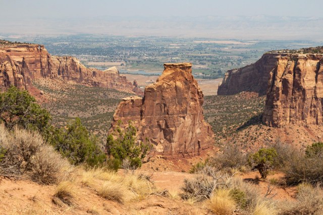
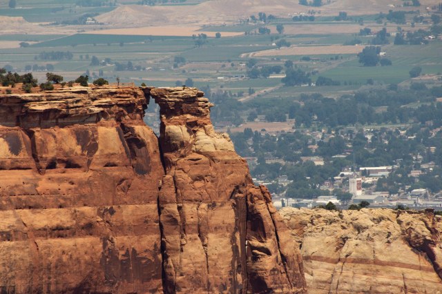
Trail Ridge Road

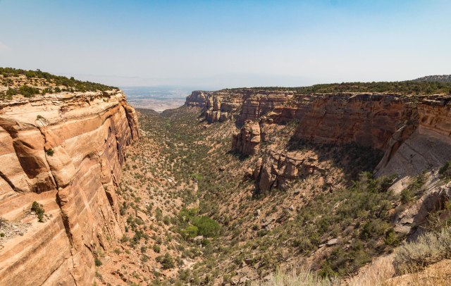
Driving along Trail Ridge Road we stopped at a few pullouts to take in the views. A portion of the Never Summer Mountains is depicted below. They are the only volcanic mountain range within Rocky Mountain National Park. With a length of 10 miles north to south, they form a section of the continental divide near the headwaters of Colorado River.

Mt. Stratus 12,500 feet
Never Summer Mountains
The valley below
The Lava Cliffs were created 28 million years ago by a powerful volcanic explosion


More of our visit to Rocky Mountain National Park coming up next in Part 2.

Safe Travels

Steamboat Springs, Colorado

Our drive on Sunday, August 19, 2018, from Craig, Colorado, to Steamboat Springs only took us about 40 minutes. The scenery along the way that filled the windshield included canyons, green pastures, grazing cows, and rolling hills.

Where’s the Steamboat?

No actual steamboat has ever resided in Steamboat Springs. The story goes that trappers named the spring from where they heard what sounded like a steamboat. The city later adopted the name when it was incorporated in 1900. The economy originally rolled along supported by ranching and mining. In 1913, Carl Howelsen, a Norwegian, introduced ski jumping by building the first jump on Howelsen Hill, now part of the Howelsen Ski Area. A winter carnival soon followed and is the oldest continually operated ski area in the state. Founded by Jim Temple and John Fetcher, the Steamboat Ski Resort opened in 1963 and is now the largest employer in Steamboat for the population of nearly 13,000.

With a 2-bedroom condo offered at just under $500,000 and many single family residences going for over $1 million, this resort town is not an inexpensive place to live. I suspect many of the condos and residences are second homes for people who drive or fly in to enjoy the skiing and other winter activities.

Adventures in Laundry

Laundry day, usually a boring activity, turned out to be a challenge in Steamboat. After setting up and eating lunch, I strolled over to the Steamboat Springs KOA laundry to check out the facilities. They had four washers and six dryers crammed into the corner of a building. Really? Why would they have six dryers if they only had four washers? It seemed like a waste. Two women had the machines filled with their clothes and another woman waited for her turn. It was going to be a while before I could squeeze in and I really needed more than four machines.

A quick search online showed a public laundry not too far away. The pictures online of rows and rows of clean and modern machines promised a better facility. Sadly, most of the machines had “not working” signs on them. Water seeped out from under one machine. Congregated around folding tables and one of the doors, a group of hippy-dippy type young people gathered around a guy playing a ukulele and singing. With the young people sporting dreadlocks, baggy pants, and ill-fitting shirts, and the distinctive odor of ganja hanging in the air, Jon and I were transported back to 1967. I had to silently laugh when I saw one of the guys pulling on a pair of jeans that had not dried yet. Hey, I remember pulling on wet jeans and letting them dry while I wore them. Oh, to be young again. Well, maybe not.

Fish Creek Falls

We sought out the Fish Creek Falls trail to start on our first full day of adventure. The accessible trail to the lower falls is only a 1/4 mile, so easy peasy even at an elevation of 7,440. The trail continued for another 5 miles, but it was a bit treacherous. Another ½ mile was enough for us.

Fish Creek Falls Trail
Fish Creek Falls
Watching the world go by
Accessibility of Fish Creek Falls makes it a popular place

Yampa River Botanic Garden

The Yampa River Botanic Park was next on our list. It took us a few tries to find the place. The instructions said to turn on Emerald Park Lane, but the actual street sign said Emerald Park Way. We finally saw the soccer field and knew we were in the right place. We were flabbergasted that a botanic garden thrived in a place that receives snow 7 to 8 months out of the year.

Yampa River Botanic Park

A butterfly garden inside the gate contained echinacea in full bloom with bees, moths, and butterflies whirling around and landing on the flowers.

Butterflies love echinacea
Bees love echinacea too

Rocks terraced on a small hill create pockets for a variety of plants and flowers to grow and flourish.

Rock garden
Colorful garden plot
Whimsical houses for birds and other creatures

Plenty of benches throughout the park are strategically located for a view of the plant and flower displays. We picked a bench that overlooked a pond where cattails and water lilies bloomed.

Reflecting pond
Water lily and pads

Then we wandered around the pine forest and found a few hideaways to explore.

Alliums
A trail led through an aspen grove

I wonder how many people visit Steamboat Springs every year and never realize there is a botanic garden growing with such bounty. It is truly a wonderful place to visit.

Downtown and The Shack Cafe

After the botanic garden, we ducked in and out of a few of the shops while we searched for a place to eat. I had expected the stores in the downtown area to consist of brand name upscale shops one might see in a ski resort, not so. It was a nice surprise to enter the independent establishments with unique offerings.

JT kicking back with Ben Franklin

The Shack Cafe closes for the day after lunch service, but we managed to make it inside before they flipped the sign over. A French dip and a side of sweet potato fries for me and a bowl of chili and salad for JT satisfied our hunger pains.

Steamboat Lake State Park

After Jon nursed a headache one morning and an hour’s worth of rain passed over, a drive to Steamboat Lake State Park occupied our afternoon. This state park looked like a great place to stay with stunning views of mountains. There are 113 campsites and most can accommodate large RVs and some are pull-through sites. Only electric hookups at some sites, with no water or sewer. One loop had a nice restroom, laundry, and store at the marina. Deer grazed and strolled through the sections of the campground that were less occupied.

Steamboat Lake and campground
Steamboat Lake State Park View
Hahn’s Peak

Vista Nature Trail

The highlight of our time in Steamboat was stumbling upon the naturalist-led hike on Vista Nature Trail followed by a gourmet lunch at the lodge. Our objective for the day was a hike along the Vista Nature Trail, but when trying to find its location we learned we had to take the gondola to the top of the mountain.

When we arrived to purchase our tickets, the offer for the hike and gourmet lunch was too good to pass up. The hike turned out to be led by not only the naturalist, Katy from Yampatika, but also Mark Bass a Steamboat Resort ambassador and a woman from the botanical garden.

Each of them added a unique perspective to the hike. Katy talked about the geology of the area. Mark talked about the history of the town and ski resort, and the woman from the botanical garden pointed out which plants were edible and which were poisonous. We even had a chance to taste huckleberries, which pack a sweet punch in a tiny berry.

Steamboat Springs Gondola
Steamboat Springs Resort
View south of Yampa Valley from the mountain range
Sumac berries
Ski runs
Not all was green

Even though it was mid-August, wildflowers still bloomed at the top of the mountain, much to our surprise.

Fireweed
Puffball
Alpine Yarrow

We managed to pick a good time to visit Steamboat Springs. Prior to our arriving, smoke filled the skies. A little rain cleared out the smoke leaving beautiful blue skies and puffy clouds.

View north from Steamboat mountain range

We would have stayed longer in Steamboat if the KOA hadn’t been booked solid for the weekend coming up. There was much more for us to explore. Perhaps we will make our way there again to spend more time.

Although we were sad to leave, we looked forward to making our way to Rocky Mountain National Park.

Safe Travels

Craig, Colorado

Our next stop in Colorado was a two-night stay in Craig starting August 17. We checked in at the KOA, which was an older RV park with new owners. They had already renovated the restrooms with new tile. The train tracks bordering the south end of the RV park gave us pause. Sounds of a train rumbling by in the middle of the night and disturbing our sleep didn’t seem like fun. As it turned out, the tracks only function as a spur line and no trains traveled the route during our stay.

Our drive from Fruita took us along the Colorado River on Interstate 70 east then we headed north on Colorado state route 13. While wide and shallow in some spots, the river moved swiftly in other places. A local from Grand Junction told us the river’s level was the lowest he’d seen since the mid-eighties. The low level is probably not a good sign for the Zonis and Calis that rely on the river for recreation, farming, and drinking water.

Verdant valleys with orchards, vineyards, shade trees and green grasses fanned out from the river. On the other side of the freeway, the terrain was more desert looking with yellow grasses, short shrubs, or just rock. The mountain cliffs continued to tower above the valley floor with a plateau here and there.

One one side of the freeway a verdant valley
While the other side takes on a desolate look

With a population of approximately 9,000, Craig serves as the Moffat County seat. A drive through town revealed a city in transition. While many of the residential streets contained well-maintained dwellings with tidy yards, other homes had slipped into disrepair. The downtown area was similarly checkerboard with businesses that looked like they had been around for years, others fairly new, and still others abandoned, like the Safeway grocery store. The City Market, however, stocks just about anything a person might want or need.

Craig, Colorado, street scene

Some people consider the City of Craig as the Elk Hunting Capital of the World. Signs and posters on business property welcomed the hunters to town. We saw a group of elk trying to cross the road and plenty of pronghorn grazing in fields around town.

Grazing pronghorn

Other draws to the city include the Museum of Northwest Colorado and the Wyman Museum. June would be a good time to visit Craig. That’s when the city holds a Whittle the Wood Rendezvous chainsaw carving competition & festival. Several examples of past entries and winners occupy space in the downtown area.

Woodcarving made into a bench

The Museum of Northwest Colorado

Open year round, except for holidays and Sundays, with free admission, the Museum of Northwest Colorado is a great place to visit. I liked the wide aisles, display signs, and how neat and orderly the artifacts were displayed.

View of the museum from upstairs

For instance, artifacts included a set of spurs once owned by Ann Basset, the queen of the cattle rustlers. The posters near the displays tell the stories of not only the artifact but also the owner and how the item came to the museum.

Ann Bassett, the queen of the cattle rustlers

A whole room is dedicated to the western cowboy where saddles, spurs, and weapons are arranged.

Saddles, spurs, and firearms

Other displays included an entry from the June 2008 Whittle the Wood Rendezvous, mining equipment, stagecoach model, and information about prominent residents of the area.

The detail of this carving caught my eye. It amazed me to think it was created with a chainsaw.

“We Were Free” by Ron Eye created during Whittle the Wood Rendezvous June 2008
Mining Equipment
Butterfield stagecoach model

Archie Smethurst was a stage driver and proprietor from 1904 – 1906.

Archie Smethurst display

Downstairs are posters of graduating classes dating back to the 1900s along with yearbooks that serve as a great resource for genealogists filling in the gaps of an ancestor’s past.

The Wyman Living History Museum

While the Museum of Northwest Colorado preserves the artifacts and legends of the old west, the Wyman Museum is an eclectic assortment of memorabilia collected by Lou Wyman since 1949.  A military tank takes center stage in front of the museum entrance.

Wyman Living History Museum

Outbuildings consist of an old barn, blacksmith building, schoolhouse complete with a three-stall outhouse, and a general store.

Blacksmith building and barn
General store on the left, schoolhouse on the right, and a three-stall latrine behind and to the left of the schoolhouse

Also, on the property is Sherman Park, which contains a pond for fishing, a large population of leopard frogs, cattails, and other marsh grasses and plants. There is also a section dedicated to archery shooting.

Farm and train equipment scattered about the yard. Sherman Park and pond are behind the orange piece of equipment.
Collection of tractor seats

Inside the museum, visitors find automobiles, a hearse, military memorabilia, farming implements, and equipment, old boat motors, mining display with tools and much, much, more.

Western style kitchen
Plane
Various vehicles
Hearse and camera equipment
Sheepherder’s wagon and a tractor
A 1950 model electrocardiograph (EKG) machine

The guys from American Pickers, the reality television program produced by A&E Television Networks and the History Channel, filmed an episode at the Wyman Living History Museum which aired with the title “One of Everything” on April 23, 2018. Take a look at the episode to see more of Lou Wyman’s collection.

That concludes our time in Craig, Colorado. A great place to stay for a little peace and quiet and a slower pace. Stay tuned for our next stop in Steamboat Springs.

Safe Travels

Fruita, Colorado, and Colorado National Monument

Colorado, here we come. Finally, on Friday, August 10, the 19th day of our Summer 2018 Tour, we made our way into Fruita, Colorado. The drive from Torrey, Utah, was filled with a variety of terrain including aspen groves that dotted the hillsides, juniper forests, and sagebrush. Plumes of smoke rose from behind a set of hills early on the drive reminding us that wildfires still burned. Large boulders and slick rocks, similar to what we saw in Capitol Reef, appeared and then an overlook gave us a wonderful view of a valley as we descended to lower elevations.

Valley view at an overlook along Utah Highway 72

As we made our way to the Utah Colorado border, the landscape turned barren and resembled the sandy area near Hanksville, Utah. When we arrived at Monument RV Resort in Fruita, Colorado, we were glad to see vegetation, especially near the Colorado River. We quickly set up, turned on the air conditioning to beat back the 90-degree temperatures, and drove to the nearest restaurant, Mexican food of course. El Tapatio served up a crisp tostada topped with a generous serving of chicken. The food, margarita, and colorful décor brightened our mood.

Good food and margaritas at El Tapatio in Fruita, Colorado

The smoky skies and high temperatures conspired to limit our activities during our stay, but we still found plenty to keep us busy even though we lost the truck for a day and a half for maintenance and repairs.  Jon knew the truck needed an oil and filter change but also realized that it was time to service the Allison transmission too. Better to get that done there especially because of the extreme grades we would encounter towing the 8000-pound trailer.

Colorado National Monument

We can thank a man named John Otto for the Colorado National Monument. In 1907, Mr. Otto started a campaign to set aside and protect this unique area for the pleasure of future generations. Residents of Grand Junction supported Otto’s vision by writing letters and petitioning politicians in Washington and in 1911, the Colorado National Monument was established. Otto was named the caretaker for $1.00 per month, built miles of trails, and stayed until 1927.

Visitor center at Colorado National Monument

We began our visit to the monument by stopping at the visitor center to pick up maps and trail guides. The center offered not one, but two movies, one on the geology of the area and the other on the park. The Monument includes 7 short trails ranging from a ¼ mile one way to 1.75 miles one way. There are an additional 7 trails with one-way distances of 3.3 miles to 8.5 miles. A developed campground is available with both first-come-first-served and reservable sites. Permits are required for camping in the backcountry.

Depiction of John Otto

Given the heat, smoky skies, and altitude, we opted to stick to the shorter trails. The Canyon Rim Trail is accessed from behind the visitor center, meanders along the canyon rim toward the Window Rock Trail, and contains views of both Monument and Wedding canyons and many of the iconic rock formations.

Independence Monument formation was once a wall that stretched from the right to the left.
Window Rock
Drought and insect infestation have killed many of the pinyon pines
Collared Lizard

We found the Alcove Trail across the street from the visitor center. The guide sheet (available at the visitor center) gave detailed descriptions of the numbered stops along the trail.

A cluster of prickly pear cacti. Don’t walk off the trail, the biological soil crust is alive. The composition of lichens, mosses, microfungi, bacteria, and green algae protects the soil and nutrients that the plants need to grow. It can take up to 50 years for soil crusts to heal once it is damaged.
Acidic rainwater created small cavities on the cliff walls when it seeped through the rock and dissolved the cemented quartz sand grains
Native Americans used the seeds from the pinyon pines as a food source
Watch out for the bumps in the sand. They are antlion traps.
The trail deadends where water has carved out this ancient sand dune
The water erosion is also evident near the slot canyon floor

The 23-Mile Rim Rock Drive is one of the highlights of the monument. Several overlooks along the drive allow visitors a chance to get out of the car, peer into the canyons, and take in the breathtaking views of Grand Junction. Some of the overlooks include short trails to viewpoints.

Coke Ovens formation
View of canyon and rock walls
View of canyon spilling out into Grand Junction
I always expect to hear sirens coming after seeing people in dangerous situations when taking photos. Luckily for this couple, we saw them again later on so they managed to stay safe. At least this time.

The Devil’s Kitchen Picnic Area, a short distance from the Grand Junction entrance, was a great place to stop for lunch where there are a large shelter, plenty of picnic tables, and clean restrooms.

Grand Junction

The downtown area of Grand Junction was a great place to walk around. We joined the several groups of families and friends walking up and down the street. One thing separated us from them, though. They all had their heads bent down focused on their mobile phones. “Boy, the people in Grand Junction sure like their phones,” I said to Jon.

Downtown Grand Junction on a Sunday afternoon

Then a group of three people walked near us and said something about there was supposed to something or other right there. I asked if they were playing a game and the woman said, yes, they were playing Pokemon. Okay, that explained the fascination with the mobile phones.

What’s the obsession with the phones? Pianos are placed along the street for anyone to play

It was a good day to wander around the city on a Sunday and look at all the Art on the Corner. Established in 1989, the year-round event showcases both permanent and temporary sculptures along the downtown streets.

The apple and the ant
Woman bicyclist
James Trumbo working in his bath. Trumbo graduated from Grand Junction High School and learned his writing skills by working for the Grand Junction Daily Sentinel.
Ah, refreshing water from a hose

Although most of the stores were closed for the day, we found Slickrock Brewery open and stopped in for a bite. We split a cob salad and had an order of Calamari to start. The beer was pretty good a blend of 50/50 pale ale and wheat beer. It tasted pretty good, but I think I like 100% wheat beer better.

Museum of the West in Grand Junction

The Museum of the West in Grand Junction is a nice little museum that includes displays that tell the history of Grand Junction and the surrounding area.

Step on up and take a seat to listen to the sounds of riding on a coach
A cowboy’s tools of the trade
A lawman’s tools of the trade
Was the Teddy Bear invented in Glenwood Springs, Colorado, or in Mississippi? The controversy continues.
A plane used for uranium prospecting
Replica of a uranium mine
A local post office set up at the museum
Display of stamps from 1935
Artifacts from the Fremont Indian culture
More artifacts

One of the unique features of this museum is that it has an elevator to the roof where visitors have a 360-degree view of Grand Junction and beyond.

Cable Wake Board

We had seen the cable and the lake from the freeway and had to take a look. We both had skied at the local cable ski where we grew up in Southern California but hadn’t seen a similar business for more than forty years. Opened in April 2018, the Imondi Wake Zone Cable provides equipment and lessons.

Imondi Wake Zone
Cowabunga! That looks like fun.

The Western Slope Vietnam War Memorial

The memorial, located near the Fruita Welcome Center off Interstate 70, is “dedicated to the men and women who served in the United States of America Armed Forces during the Vietnam War 1959-1975.”

Grand Mesa

After picking up our truck from the dealer, we took it on a test run by taking a loop drive through the Grand Mesa. The drive started out not very scenic with mostly bare land and little vegetation and wide open spaces. Then we headed up Highway 65 into aspen forests that would burst into yellow, gold, and red colors during the fall.

Too bad we were too early to see it. Up, up and up we went onto the mesa where the aspen gave way to pines and several reservoirs were located. This was winter activities country where cross-country skiing seemed like the prominent sport. The views from the top were wonderful without the blanket of smoke to hide the view.

Cedarridge Overlook

Coming down the other side and driving through a canyon was like driving atop a divide. On the south side of the road, tall slick rock cliffs rose from the canyon floor while on the north side of the road trees covered the mountains that slowly rose up. The vegetation on the north side was due to a river running along the foot of the mountain.  What a difference a little water makes. I wished there would have been a place to pull over to snap a few photos of the phenomenon.

That’s it for our time in Fruita, Colorado. Next up we stop for a couple days in Craig, Colorado, on our way to Steamboat Springs.

Safe Travels