Week Three – Mesa Verde National Park

Week Three – Mesa Verde National Park

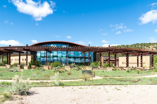
Mesa Verde National Park was the reason for our trip to the southwest corner of Colorado. Finally, after snow, and rain, and wind, we rose from bed with a forecast for good weather. Our first stop in any national park is the visitor center.

Mesa Verde National Park Visitor and Research Center

Don’t pass up the visitor center at Mesa Verde. This is the place to purchase tickets for the ranger-guided tours of Cliff Palace and Balcony House on Chapin Mesa and Long House on Wetherill Mesa. These tours provide visitors with an up-close experience that requires short or long hikes, crawling through tunnels, and climbing up ladders. Tours book up fast and may not be available the day of arrival. The $5.00 tickets are available up to two days in advance and can also be purchased at the Durango Welcome Center.

Having tickets in hand before making the one hour drive to the tours will reduce the likelihood of disappointment. Although the roads to the tours are only 23 – 26 miles from the visitor center, it takes about an hour to drive there, even longer if stopping at the various overlooks.

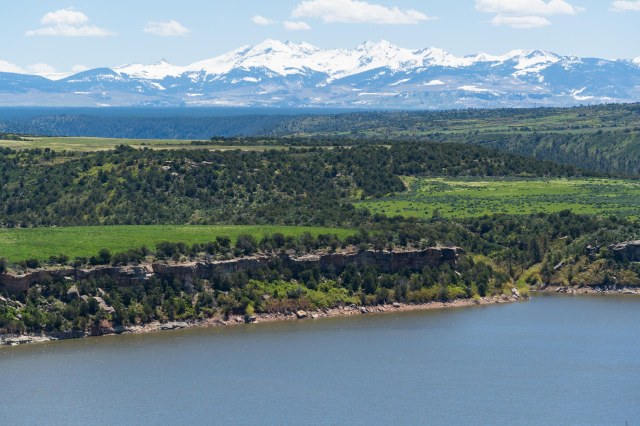
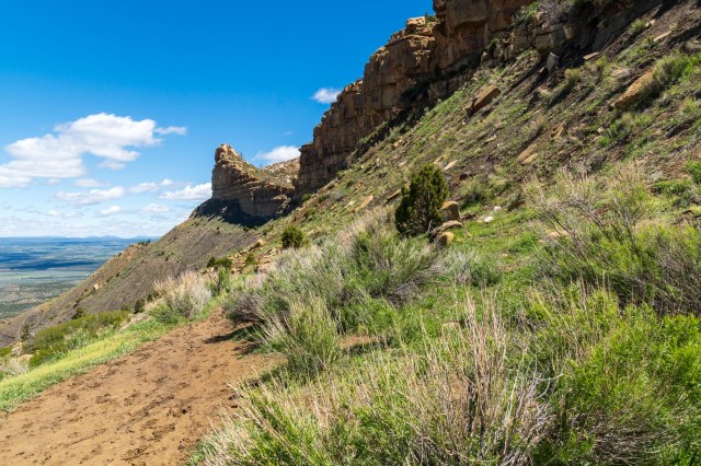
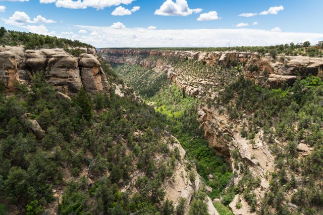
Do not despair, if tickets are sold out. There are plenty of sites to see without the need for tour tickets.  Several overlooks offer views of the landscapes, cliff dwellings, and pit house villages. Here is a sampling of those sights.

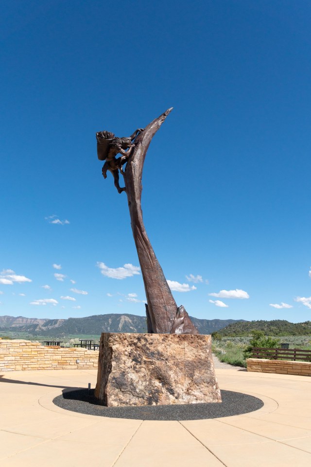
Center stage in front of the visitor center we encountered a sculpture titled “The Ancient Ones” by Edward J. Fraughton. A man, burdened with a basket of what looks to be corn, navigates a cliff side using hand and toe holes. We couldn’t help but be inspired to explore the park after marveling at the man’s struggle.

“The Ancient Ones” by Edward J. Fraughton

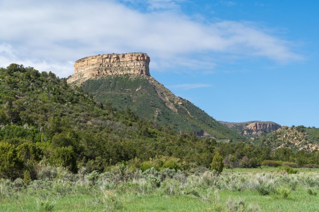
Behind the visitor center is a good place to view Point Lookout. Hikers can catch the trail to the top at the Morefield Campground.

Point Lookout

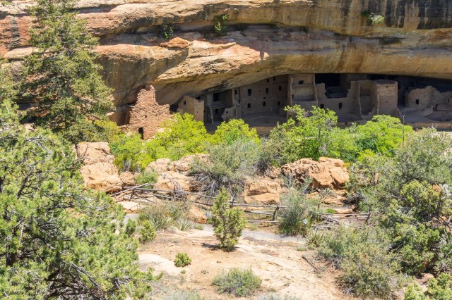
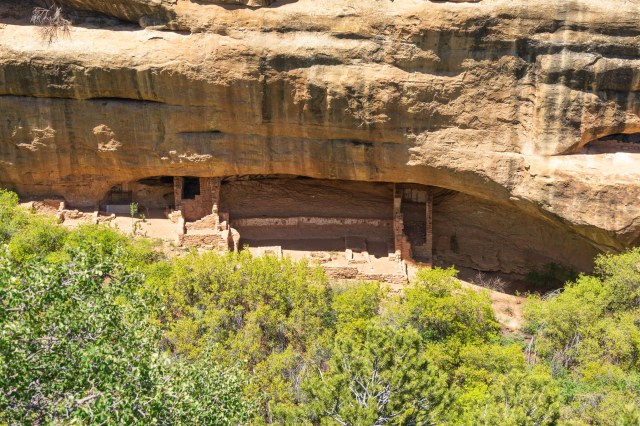
The Spruce Tree House near the Chapin Mesa Archeological Museum is the park’s third largest cliff dwelling and was constructed between 1211 and 1278 AD. The dwelling contains 130 rooms, eight kivas, and may have housed at least 60 – 80 people. The self-guided tour of the house was closed due to the risk of falling rock. I walked down the trail a bit to gain a better view for photos only to find that the terrace at the Chapin Mesa Archeological Museum offered the best perspective of the structure. Oh, well. At least I was able to stretch my legs get my heart pumping a bit.

Spruce Tree House

Knife Edge Road carried travelers to Mesa Verde in the early 1900s. The dirt road was eventually paved with asphalt, but abandoned in 1956 when the Morefield-Prater tunnel was constructed.

Remnant of Knife Edge Road

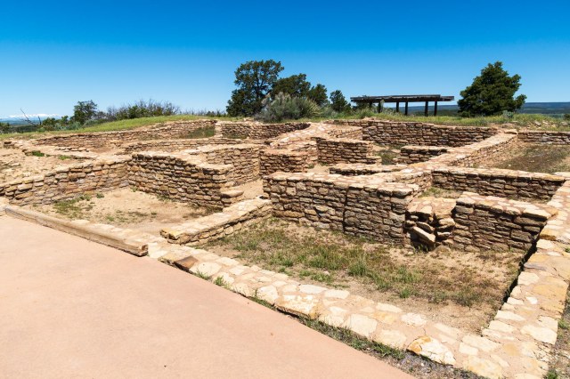
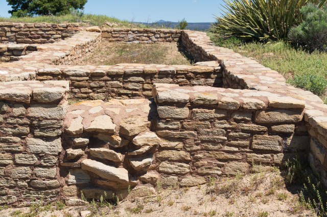
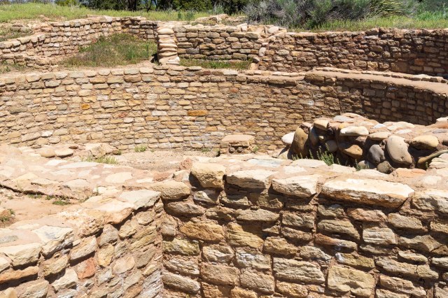
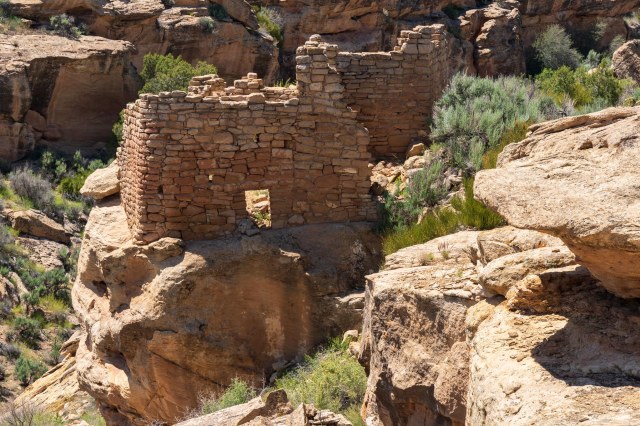
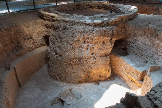
Fire Temple is one of the few sites that contained no evidence of domestic tasks. It was used as more of a public place possibly for ceremonies that included dancing or other types of performances.

Fire Temple

To the right of the public space, is New Fire House, where domestic activity was found in the 22 rooms and 3 kivas. Perhaps the caretakers resided here?

New Fire House

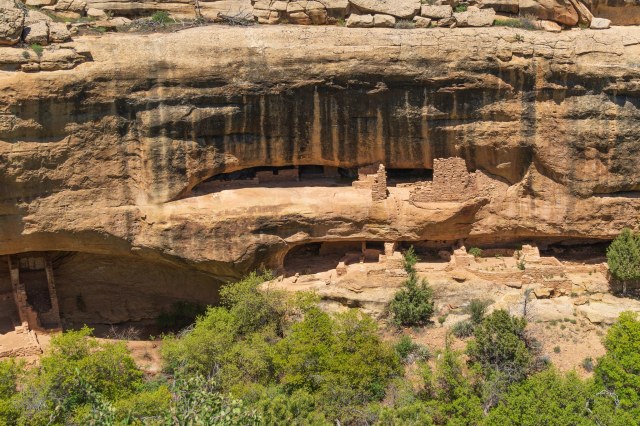
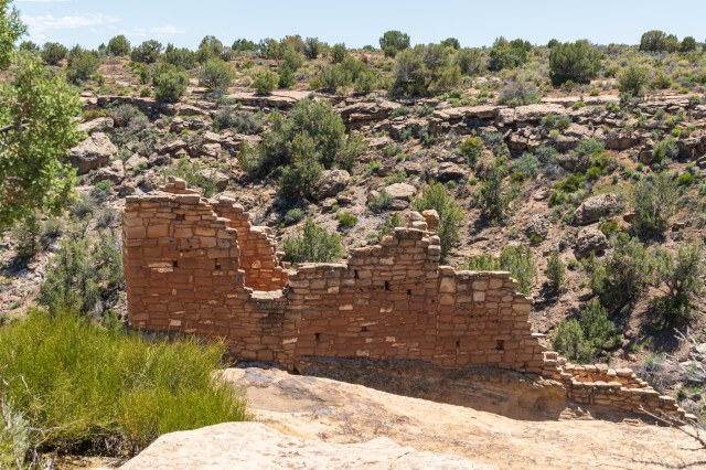
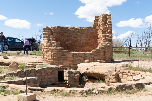
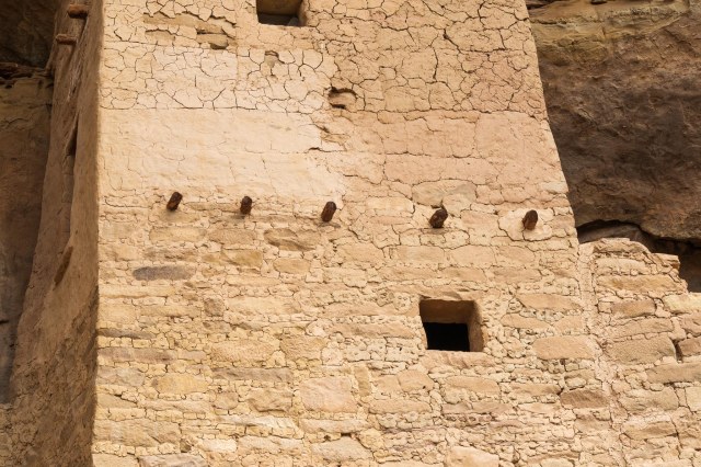
Square Tower House is the tallest structure in the park. The three-story building stands at 28 feet.

Square Tower House

Navajo Canyon View

Navajo Canyon

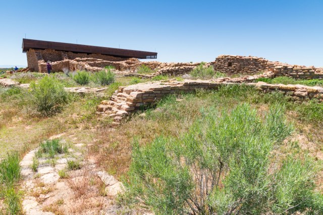
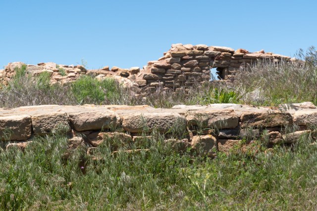
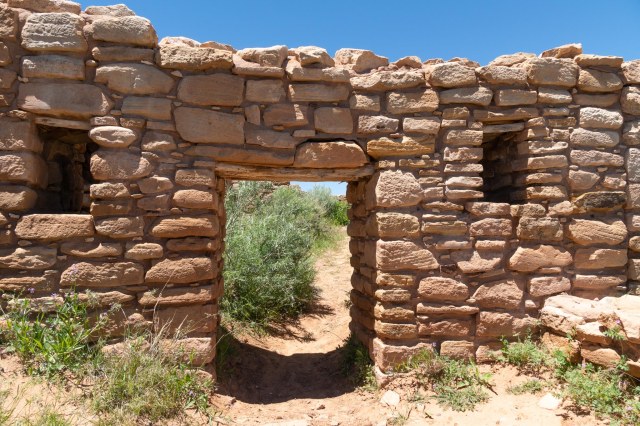
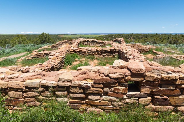
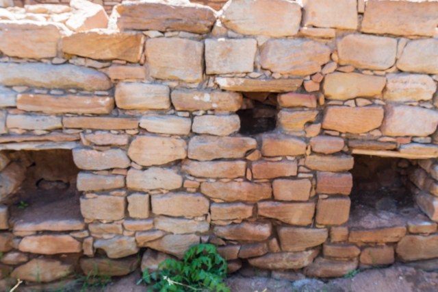
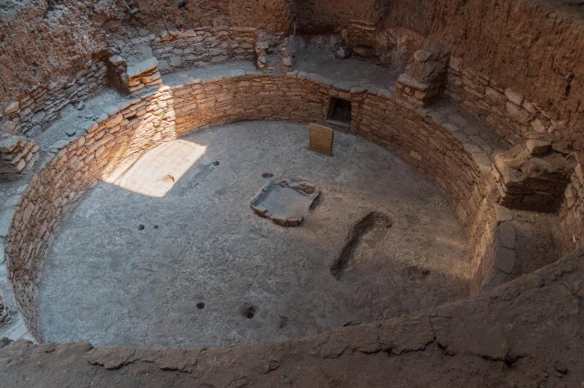
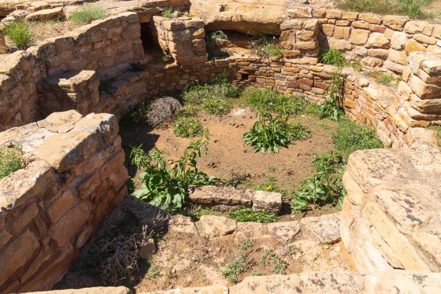
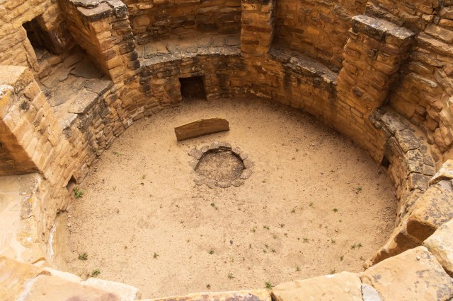
Pit Houses and Villages depict the life of the Ancestral Puebloans who settled in the area around AD 550 and occupied houses built underground. Archeological evidence shows three villages built on top of each other over the course of several hundred years. Around AD 750 people started building houses above ground, using poles and mud to fashion upright walls and utilizing the pit houses as kivas. By AD 1000 stone masonry replaced the poles and mud construction. The thick stone walls rose two to three stories high and consisted of 50 rooms or more. The building of cliff dwellings occurred between the late 1190s to the late 1270s.

Restored Kiva in a Pit House
Excavated pit house

To see the Sun Temple requires only a few steps from the parking lot. Archeologists have yet to determine the purpose of the kiva and the tower. Was it for communication, defense, storage, ceremonial, social gatherings, or a religious purpose? Whatever their use, it is clear the buildings were important to the people since they are found everywhere throughout the park and at the other sites we visited.

Sun Temple
Kiva at Sun Temple

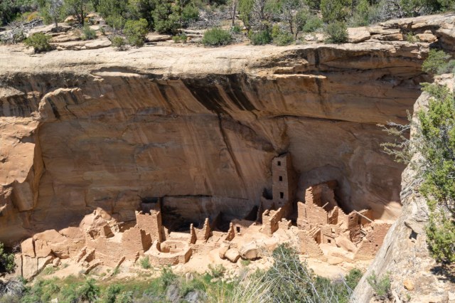
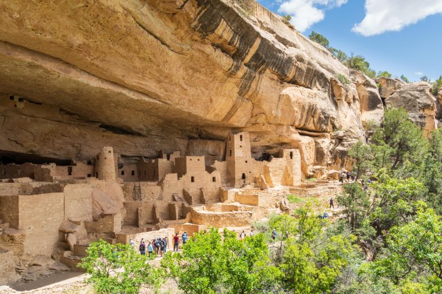
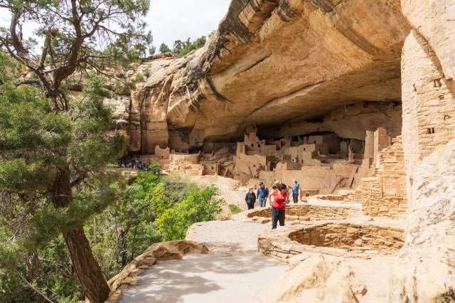
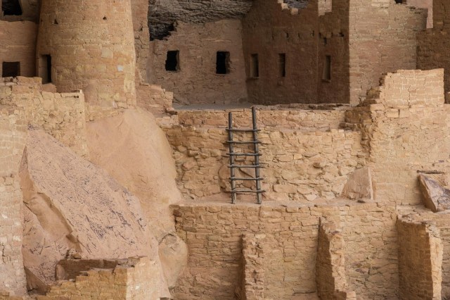
Cliff Palace, the largest dwelling in the park, is viewed from across the canyon. After taking photo after photo at a distance, I had to see it up close, so I booked a tour for another day.

Cliff Palace from across the canyon

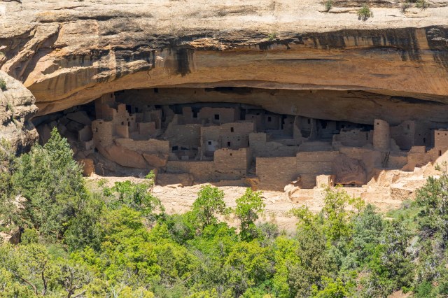
The Cliff Palace overlook provides a good view of the ruin without the ¼-mile walk and climb up four 8- to 10- foot ladders. A ranger-led tour is the only way to view Cliff Palace up close and personal along with 40 other people.

Cliff Palace from the overlook

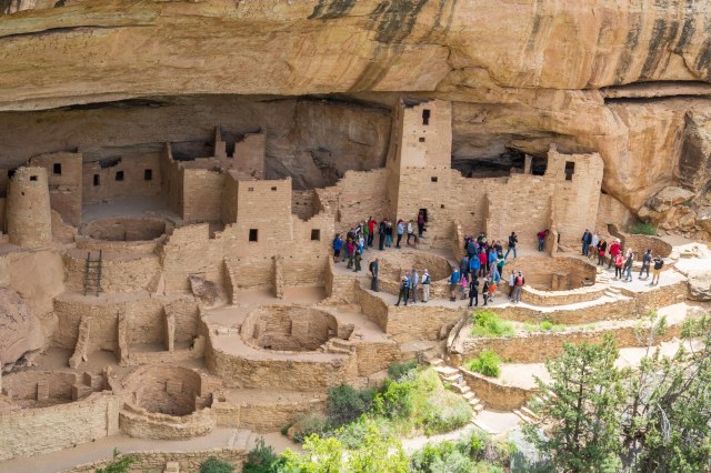
Archeologists have determined Cliff Palace contained at least 150 rooms, 23 kivas, and housed 100 people or more. This compares to the nearly 600 structures within the park, 75% of which only contain 1-5 rooms each. One theory is that the Ancient Puebloans used Cliff Palace for social, administrative, and ceremonial purposes.

Cliff Palace

Starting in AD 550 people from the Four Corners region arrived at Mesa Verde. Over the next 700 years, they progressed in their architecture until they built the elaborate stone structures in the alcoves of the canyon walls that we see today.

Cliff Palace

Farming took place above on the mesa tops. Using hand-and-toe holds carved into the soft sandstone, the Ancient Puebloans navigated between the alcoves and the mesa tops.

Cliff Palace close up of construction

Imagine carrying tools and supplies for farming up the steep cliffs and toting crops back down using only the hand-and-toe holds, much like the sculpture we saw in front of the visitor center. The ladders were hard enough for me to use with my small backpack on my shoulders and camera strapped around my neck.

Cliff Palace Kiva
Cliff Palace close up

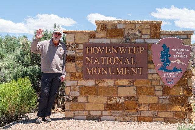
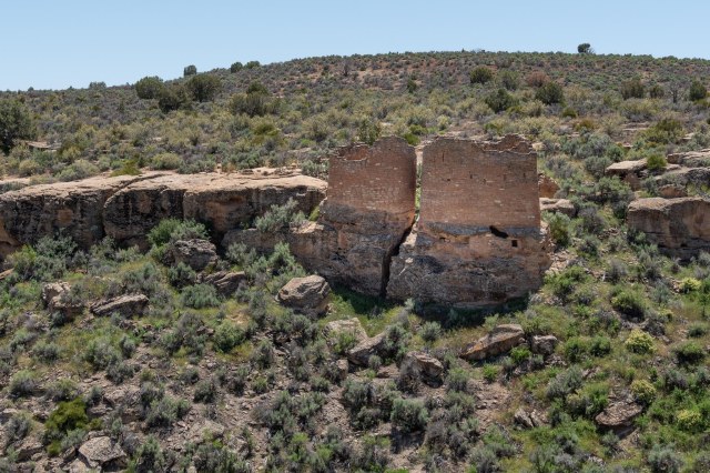
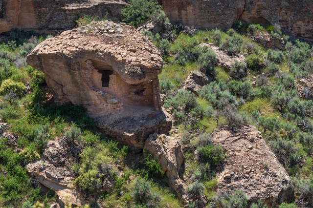
Mesa Verde National Park, along with Hovenweep National Monument and Canyon of the Ancients National Monument are very special places to visit. To think that more people lived in the region surrounding Mesa Verde between AD 550 and AD 1250 than live there today strains my brain. Their skills as master potters, weavers, architects, and builders using only basic primitive tools that they manufactured themselves, says so much about the perseverance of mankind.

As I sit at my desk, surrounded by electronics, cool air blowing in the room from the air conditioner, I can’t help but think how small my life is in comparison with the ancient people. They grew their own food, while I drive to the grocery store and push around a cart gathering products from the shelves. They made their own clothes, shoes, pottery, rugs, and blankets, while I head to the mall or order online. They erected elaborate structures that sheltered hundreds of families to keep them safe and warm using only the products in their immediate surroundings. If I want shelter I call a realtor or the closest RV dealer.

I look at how far we have come as a civilization in the past 1500 years and question whether we are truly better off or have we lost something of our humanity along the way. Just something to ponder. I’m in no way wanting to give up my air conditioning when the temperatures rise above 100 degrees. I only want to know what the ancient peoples had that I might be missing, be it sociological, philosophical, psychological, or spiritual.

Okay, all that pondering is bringing on a headache. Time to wrap up here.

Next, we take a drive to Silverton, Colorado, I take photos around Cortez, and we head for home. Jon’s had enough of sciatica. Time for an MRI.

Safe Travels

Cortez, Colorado

Week Two – Cortez, Colorado

It’s May 31, 2019, and we’re still hanging out in Cortez, Colorado. Several days of rain and snow kept us inside for the first few days, which was okay since Jon was dealing with his sciatica. Since we weren’t on a strict timeline, we could afford to snuggle up in the trailer during the winter weather and wait for sunny warmer days.

Did acupuncture work?

Jon’s excitement for a miracle pain relief dissipated after the first treatment. Discouraged there was no improvement, he wanted to cancel the next appointment. “You can’t expect it to work the first time,” I said. He persevered, though, dragging his feet and skepticism into Dr. Hawes’s office. When he noticed improvement after the second and third visits, he said, “Maybe there is something to this after all?”

By the fourth visit, he hurriedly stripped to his skivvies, climbed onto the table face down, and immediately relaxed, offering up his body as a human pin cushion.

Whether it was the acupuncture, the CBD oil, the natural course of things, or a combination, the moans and groans have subsided. Not yet ready for a ½-mile hike, he can now make it halfway around the grocery store. This is a great improvement over our first days in Cortez when he could barely make it inside the store before having to grab a seat at the Starbucks kiosk.

Although we weren’t able to hit the trails with our new trekking poles, we still had fun exploring the Canyons of the Ancients National Monument, Hovenweep National Monument, and Mesa Verde National Park.

Enough with the medical issues and on to the explorations. Let’s start off with Canyons of the Ancients and Hovenweep National Monuments and leave Mesa Verde National Park for the next post.

Canyons of the Ancients National Monument

Canyons of the Ancients National Monument, designated on June 9, 2000, covers over 176,000 acres of federal land administered by the Bureau of Land Management (BLM). The number of sites contained within the monument is estimated at 30,000, more than 6,355 of which have been recorded.

Canyons of the Ancients Visitor Center and Museum

Humans who have inhabited the area for the past 10,000 years left evidence of homes below ground, above ground and tucked under cliff overhangs, towers of some sort, and sweat lodges, along with reservoirs and dams for irrigation of crops. Some areas contain more than 100 sites within a square mile.

A replica pit house shows how people lived

A stop at the Canyons of the Ancients Visitor Center and Museum is recommended before venturing out to the public sites. The cost is $3.00 for adults March to October and free in November through February. Federal Interagency passes are accepted. At the center, visitors gain an appreciation of the people who once occupied the land through the movies and exhibits that depict native cultures of the Four Corners region. Key archeologists and their work are also on display.

Artifacts contained in display cases and timeline depictions on the walls

What I found amazing is the condition of the structures and their contents at the time they were located. Architects found intact pottery and baskets, tools and cooking implements, and shoes made from the yucca plant. To think these items survived untouched for thousands of years is mind-boggling.

Seasonal calendar

Computers are set up that detail the timelines and different cultures. The information covers the different types of dwellings each culture built as well as the enterprises they engaged in such as weaving or pottery.

Gardens and art in front of the visitor center

Follow the concrete paved trail around the side of the building to the Escalante Pueblo for a bird’s eye view of the surrounding landscape, mountains, and McPhee reservoir. Time for a picnic? Find tables with protective covers at the start of the paved trail. While the wind blew hard in front of the visitor center, the path side of the hill had very little wind until I reached the top.

San Juan Mountain Range
Escalante Pueblo at Canyons of the Ancients Visitor Center and Museum
Escalante Pueblo
Kiva at Escalante Pueblo

Lowry Pueblo

Twenty-five miles from the visitor center is the Lowry Pueblo. Constructed around 1060 AD, it housed at least 40 – 100 people at a time for approximately 165 years. The entire structure consisted of 40 rooms and multiple kivas. Archeologists found evidence of hunting, farming, pottery, and cotton weaving up until the early 13th century.

Lowry Pueblo
Is that hole in the wall a window?
The doorway was so short I had to squat my way through.
View of the ruins after crawling through the doorway

As I stood inside the walls, I couldn’t help but wonder what the niches were used for. Were they places to stash belongings, decorations, supplies, pots filled with water, baskets holding herbs and seeds and nuts, or maybe tools used in farming.

What was the purpose of the niches?

Hovenweep National Monument

President Warren G. Harding proclaimed Hovenweep a part of the National Park Service in March 1923.

As many as 2,500 people lived in the six prehistoric villages built between 1200 and 1300 A.D. Hovenweep is known for its multistory towers lining the canyon rims and balanced atop boulders. Photos are from the Square Tower group. The only group of ruins accessible from a paved path.

The Twin Towers

The function of the towers, many shaped like the letter D, remains a mystery. Some theorize they were used as celestial observatories, defensive structures, storage facilities, civil buildings, homes, or a combination of all these.

Eroded Boulder House

Occupation ended around the later part of the 13th century due to a prolonged drought and depletion of resources, or factionalism, or warfare. The actual reason is still unclear. However, it is believed the ancestral Puebloans migrated south to the Rio Grande Valley in New Mexico and the Little Colorado River Basin in Arizona. The Pueblo, Zuni, and Hopi people of today trace their heritage to culture from the Four Corners region.

Unit Type House
Stronghold House

To wrap up this post, I present a delicate flower I found along the pathway to the ruins. With its soft white petals and yellow stamen, I couldn’t pass up the photo opportunity to contrast with the masonry work of the ancients.

Stansbury Cliffrose

It would seem as though once you see one stone building lasting over a thousand years, you’d seen them all. That wasn’t the case for me. All of the structures were unique in their craftsmanship and given the tools they had available to them, the architecture and construction impressive.

Next up: We visit Mesa Verde National Park in the next post.

Safe Travels

Late Spring 2019 Tour

Week One – Kickoff

Aah! It feels good to be back on the road exploring these great United States. Between heart surgery and recovery for me, and sciatic nerve pain for Jon, we were ready to roll.

We pointed at the landscape that zoomed by as we left the Bay Area. “Look over there,” I said. “The hills were still green in the Tri-Valley. At the Altamont Pass they turned the color of a teddy bear.” Further on, the fruit and nut trees along Interstate 5 had already leafed out, and newly planted crops painted the San Joaquin Valley floor in patchwork fashion.

We stopped for the night at our favorite way station in Bakersfield, the Orange Grove RV Park. Dove calls, the chip-chip-chip of quail, and the trilling and singing of other birds welcomed us to the grove. Sure, we have birds in the Bay Area, but the abundance of birds nestled in the orange trees was like a chorus.

Orange Grove RV Park in Bakersfield, California

Guests are allowed to pick the fruit when in season so long as they don’t use ladders or climb in the trees.

It seems like we are seeing more and more solar panels in use where ever we go.

Solar Panels at Orange Grove RV Park

The next day, we continued oohing and aahing over the landscape. The sage, bristlebush, creosote, Joshua trees, and grasses colored the desert terrain green. Even yellow mustard still bloomed in the higher elevations.

A train of black tankers with double engines at the head, mid-train, and rear worked its way through Tehachapi pass. We wanted to know what the tankers held, where they were going, and where they began their journey. Our curiosity and taste for adventure returned quickly after the nine-month absence.

Lake Havasu City (LHC) came next so we could say hey to my sister Merri. Unfortunately, she had to work so we didn’t get to spend much time together during our three nights there. A breakfast meet-up at The Red Onion downtown and a quick goodbye at her place of business would have to suffice. We’ll have to make sure our next visit coincides with her days off.

A mural in downtown Lake Havasu City

One day while in LHC, Jon and I walked along the channel south of the London Bridge.

Lake Havasu City is home to replica famous lighthouses from across the United States. This one is of Currituck Beach Lighthouse constructed along the channel walkway.
The channel is a great place to boat and people watch
These little blackbirds are a common sight
JT taking a rest with the London Bridge in the background

We stopped in at Kokomo. A refreshing Mai Tai and a slice or two of pizza was the perfect snack.

Kokomo is not only a place to get drinks. You can play corn hole, drop a basketball in a trash barrel or jump in the pool for a game of volleyball.

Then we wandered about before making our way back to Rotary Park. It was a good thing the walkway included plenty of benches to sit and take a break in the shade. After almost a week of very little sciatica, Jon had trouble walking without pain for more than a few yards. We discussed turning back home, but he would not hear of it so we pressed on.

Love locks at the top of London Bridge
Trees are a welcome sight in 100-degree weather in Lake Havasu City
Closer view of the London Bridge

The weather forecast for May 19 predicted a high wind advisory for the state of Arizona and rain the next day in Cortez, Colorado, where we had reservations. We decided to skedaddle and called Cortez/Mesa Verde KOA for early arrival.

But before we left LHC, we stopped in to say goodbye to my Merri.

Bye, Merri. It was great to see you. Miss you already.

We made an overnight stay in Tuba City, Arizona, at the Quality Inn and RV park, and a quick stop at Four Corners Monument the next day.

Four Corners Monument
Photo op at Four Corners Monument

Then we arrived safe and sound at the KOA.

Site 46 at Cortez/Mesa Verde KOA
A bit of yard art at the KOA
View from the Cortez high school parking lot

Our decision to arrive early turned out perfect. Snuggled in our fifth wheel on Monday, May 20, we gazed out at RVers arriving, not in the rain as forecast, but in the snow. The freak storm surprised the park operators as much as it did us. Accuweather.com sure got it wrong. It wasn’t until late in the day the app actually acknowledged that snow had fallen.

Three little cabins sitting in the snow
A bit of green among all the white

The snow stopped after about four hours. I zipped up my jacket, pulled on my knit cap, and slung my new Sony A6500 around my neck. I needed some quality time with my new camera. The smaller form factor and weight was my goal for purchasing new gear. A bonus was the 5-axis in camera stabilization. I wasn’t sure I’d like going mirrorless. But so far I’m quite pleased with the lighter weight and stabilization. I rarely use a tripod and have noticed an improvement in the sharpness of my photos. Editing the raw images also seems easier and quicker.

Canon Rebel T3i with Tamron 16 to 300 zoom lens versus the Sony A6500 with 18 to 135 lens. Which would you rather carry around?
Ice on a branch
The snow melted fast once it quit falling
Little yellow wagon in the snow
Playground at Denny Park
Denny Lake with campsites in background
From 90 degrees in Lake Havasu to 30 degrees in Cortez, Colorado

For the past few days, we’ve stayed close to camp because of the weather, but also because of the return of Jon’s sciatica. The week before we left on this trip, Jon’s pain had eased considerably with physical therapy and exercises. After being on the road for a few days, the beast struck again. His walks of a 1/2 mile to a mile have reduced to a few steps. Will acupuncture give him some relief? “I’m ready to try anything at this point,” Jon answered.

Stay tuned for the results and a little bit about Mesa Verde National Park, if we’re lucky.

Safe Travels

Montrose, Colorado, and Black Canyon at the Gunnison National Park

Decision time had arrived. Our original plans were to hang around Mesa Verde for a few days or a week and then drop down into New Mexico, staying on the road until the first part of November. Except one of those life-happens-as-your-making-plans moments popped up on the day before we began our Summer 2018 Tour.

When my cardiologist broke the news that it was time to repair my weakened mitral heart valve, I thought I could push it off until April or May. After spending a month and a half on the road, I realized it was best to get the surgery over with as soon as possible. The worry hung over me like an anvil and I needed to get out from under it. We cut our trip short and turned the truck for home on September 9, 2018. But that didn’t mean we weren’t going to stop to see a few more sights along the way.

Preferring the back roads, we took the scenic route heading west on U.S. 24, making a left at U.S. 285 and continuing to U.S. 50 toward Montrose, Colorado, passing through Monarch Pass. The colorful hills and forests kept us alert during our 4-1/2 hour drive.

The hills begin their fall displays
San Isabel National Forest
Dillon Pinnacles and Gunnison River in Curecanti National Recreation Area

We checked in at Black Canyon KOA, a nice campground with large spots and plenty of shade trees. Our focus for staying in Montrose was to visit the Black Canyon at the Gunnison National Park. Established as a national monument in 1933, Black Canyon became a national park on October 21, 1999.

South Rim

The park features a 7-mile road along the south rim with 12 overlooks where we found differing views of the canyon and the river 2,000 feet below. Some of the overlooks were more popular than others, especially with the tour buses. If we missed an overlook going one way, we caught it on the return trip.

Tomichi Point View toward the east
View from visitor center

While at the visitor center we noticed what looked like a natural bridge. When we asked one of the rangers about it, he said, no. Not a bridge. He had never seen it before and guessed the rock recently fell and wedged itself between the pillars. It was cool to think we were one of the first people to have seen this phenomenon.

I dub thee Fallen Rock Bridge

The Painted Wall was definitely a do-not-miss overlook. The cliff stands 2,250 feet above the river. The stripes on the wall consist of pegmatite, a type of granite containing quartz, feldspar, and mica.

Painted Wall with photographer
Painted Wall with Gunnison River
Spires in Black Canyon of the Gunnison

When we arrived at the High Point overlook, we were ready to stretch our legs on the 1-1/2 mile Warner Point Nature Trail. The pamphlet led us through pinyon pines, juniper, Douglas fir, and Gambel oak trees.

We kept our eye on the storm brewing across the valley. Luckily, it stayed east of us during our entire walk.

Keep eyes on any storm
View of Uncompahgre Valley from Warner Trail
View of Adobe Hills and Uncompahgre Valley from Warner Nature Trail
Warner Nature Trail – Fall is rushing in
Warner Nature Trail and greener pastures thanks to the Gunnison Tunnel

East Portal

The East Portal road is the access route to the Gunnison River, Gunnison Tunnel, Gunnison Diversion Dam, Crystal Dam, a campground, and picnic area. It sounds like a lot to see after reading that list, but everything is contained within about a mile, so not really. And a chainlink fence with concertina wire on top prevents anyone from getting near the Crystal Dam. Take note that the road includes a 16% grade and numerous switchbacks. Vehicles over 22 feet long are prohibited.

East Portal Road switchbacks

Water diverted from the Gunnison River flows through the Gunnison Tunnel, built between 1905 and 1909. I marvel at the engineering it must have taken to blast through rock to create the 11-foot by 12-foot tunnel 5.8 miles long through the granite cliffs of Black Canyon. Starting at opposite ends of the mountain the workers met in the middle using a heading and bench system. First, a heading was cut out of the rock at the top of the bore then cut down six to eight feet, leaving a bench of seven to five feet. Then they cut deeper into the rock and eventually removed the bench portion. President William Taft dedicated the tunnel on September 23, 1909.

Gunnison River from 1/2 way up the East Portal Road

The tunnel is not visible, however, a pump house containing a 5-hp pump and a flat surface under the water is.

Gunnison River Diversion Dam
The dam at end of East Portal Road
Gunnison Tunnel and Diversion Dam Parking and Picnic Cabana

All of our sightseeing must have been too much for us (I mean Jon) to cook dinner while in Montrose because we ate out twice in the short time we were there. First up was the Horsefly Brewing Company. We both opted for the fried shrimp basket. I had sweet potatoes fries with mine, and Jon chose onion rings. A crisp cold Hefeweizen washed it all down.

Horsefly Brewing Company

Check out the barstools at the end of the bar on the right.

Horsefly Brewing Company

Mi Mexico served bargain margaritas for $3.00 when we stopped in for an early dinner. While a bargain price wise, the restaurant did not skimp on the volume or taste. The taco/enchilada lunch special filled our bellies and did not disappoint our taste buds.

Next up we leave Colorado behind and head for Richfield, Utah.

Safe Travels