Willcox, Arizona

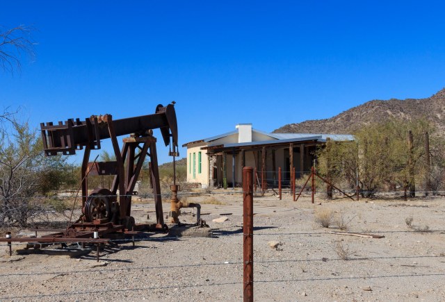
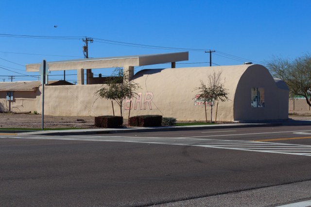
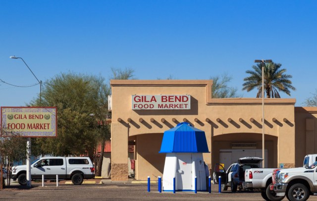
Day 15 of our 2018 Winter Tour took us to Willcox, Arizona. Our goal was to see Fort Bowie National Historic Site, another place we had seen while passing through the area on our way to somewhere else. It smelled like rain when we left Gila Bend, gusty winds and thick sandstorms pelted our rig through Casa Grande. The clouds finally cleared by the time we hit Tucson, but the wind stayed with us all the way to Willcox, finally dying down around 7:00 p.m.

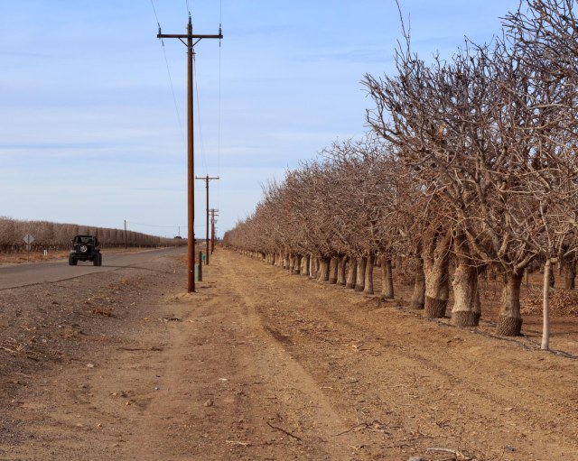
The groves of pecan and pistachio trees in this part of Arizona always surprise me. After traveling miles with only the desert landscape to gaze at, acres of trees pop up like a mirage. We drove through Pistachio Alley on our way to and from Fort Bowie National Historic Site Trailhead. The trees with their bare limbs don’t look like much this time of year, but I bet they are majestic covered in leaves.

IMG_6138
Pistachio Alley

Fort Bowie was named in honor of Colonel George Washington Bowie commander of the 5th Regiment, California Volunteer Infantry, who first established the fort. The trailhead can be reached through either the town of Willcox or the town of Bowie. We selected the Bowie route to avoid what I gathered was a 10-mile drive on a graded dirt road over the Apache Pass. Going through Bowie, there is only about 1 mile of the dirt road.

IMG_6136
Fort Bowie Trailhead

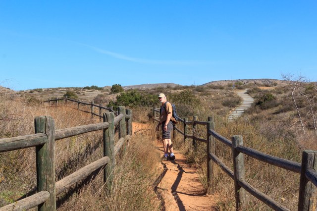
Don’t expect to drive a car up to a visitor center at Fort Bowie. (Accessible travel can be arranged). A 1.5-mile hike to the ruins meanders up and down hills, through a valley, alongside a spring, and past a cemetery. Information signs reveal the historic significance of the ruins along the way.

IMG_6070
Creek Crossing at Start of Trail

We took our time stopping at the ruins, reading the information signs, taking pictures, and wondering how it must have been riding a stagecoach through the rugged land.

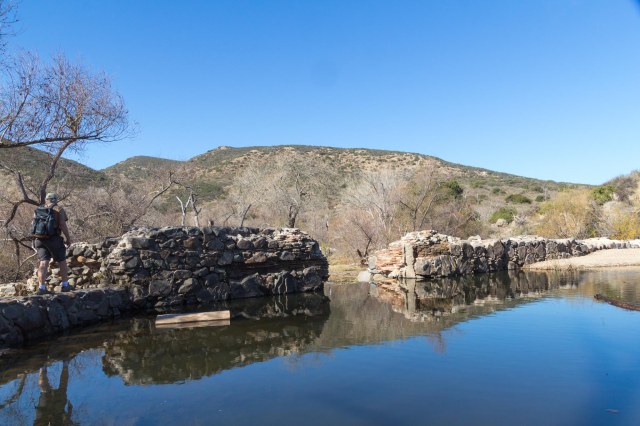
The rocks in the photo below outline the spot where a cabin once stood. A local prospector and well digger, Jesse L. Millsap, lived in the cabin, according to his nephew who visited his uncle in a Model-T Ford with his father.

IMG_6072
Millsap Cabin Ruin

It was a pleasure walking along with only the sounds of nature surrounding us. Without the noise of a freeway, trains, and airplanes, it was like experiencing what someone during the 1880s might have experienced. Standing near the ruins of the Stage Station brought the scene to life.

IMG_6079
Stage Station Ruin Where The Butterfield Overland Mail Stopped to Exchange Mules and Rest

Imagine 6 – 8 foot-high walls surrounding a kitchen-dining room where stagehands and passengers ate a meal of bread, coffee, meat, and beans for fifty cents and rooms where guests might rest while waiting for the stagecoach to continue its route. Also enclosed within the walls was a storage room for feed and weapons and a corral for mules.

IMG_6082
Stage Station Ruin

One of the biggest events that occurred in the area was the Bascom Affair. On February 4, 1861, Lt. George Bascom gathered with 54 of his men on a mission to find Cochise, the principal chief of the Chokonen band of the Chiricahua Apache. Bascom believed Cochise and his band kidnapped a boy and stole livestock and he was intent to recover both the boy and the livestock. The problem was Cochise and his band did not take the boy or the livestock and was insulted over the accusation.

The conflict lasted for sixteen days with both Indians and soldiers capturing hostages and executing them in retaliation. For twelve years tensions between the two groups continued until President U.S. Grant sent General Oliver O. Howard to join army scout Thomas Jeffords to make peace with Cochise.

IMG_6080
Location Where Bascom Unsuccessfully Pressed Cochise to Return a Kidnapped Boy and Livestock

The Post Cemetery predates Fort Bowie when soldiers of the California Column were interred there in 1862. Other graves include military dependents, civilian employees, emigrants, mail carriers, and three Apache children including one of Geronimo’s sons.

IMG_6085
Little Robe Possibly Died from Dysentery While in Custody of Soldiers Along with Other Geronimo Family Members

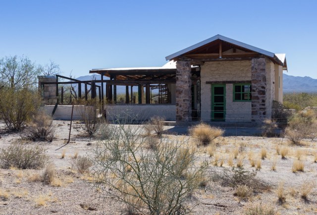
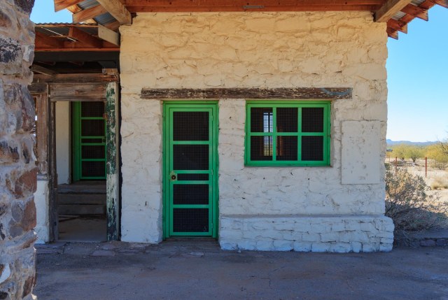
The ruin in the photo below is of a late 19th-century adobe building, which housed the Chiricahua Apache Indian Agency in 1873-77. Based on an archeology study conducted in 1984,  the building contained fireplaces, three rooms, and a wooden floor. A porch may have occupied the front of the building along with corrals at the back of the building for holding agency livestock. Adobe plaster covers and stabilizes the walls exposed by the archeologists.

IMG_6088

When Cochise died in 1874, he left a band divided in leadership and conduct. Some Apaches lingered on the reservation while others left to plunder Mexican Settlements.  U.S. Indian Agent Thomas Jeffords governed the remaining 900 Chiricahua Apaches at the Chiricahua Apache Indian Agency in 1875-76.

In June 1876, the government removed Jeffords and moved 325 Apaches northward to the San Carlos Reservation. Many escaped and fled to distant sanctuaries to renew hostilities for another decade.

Imagine a camp of several thatched wickiups like the one in the photo below. Clustered together but hidden for safety, camp life continued as it had for hundreds of years.  Men rode off to hunt for game while women harvested crops, prepared food, and cared for the children. The freshwater spring and other resources in the surrounding area supported hundreds of Chiricahua during the winter and spring seasons.

IMG_6096
Wikiup Hut and Ramada

A unique feature located in Apache Pass, and a cause of many conflicts, is a freshwater spring that flows from a geological fault. Native Americans relied on the water long before the emigrants and soldiers arrived on the scene. Eventually, the Chiricahua were driven away from their home.

IMG_6099
Apache Spring

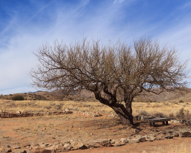
The walk to the ruins was not strenuous, but we were glad to have plenty of water and a snack with us. It is also a good idea to take along a sweater or light jacket, depending on the time of year, in case the weather conditions shift.

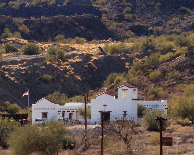
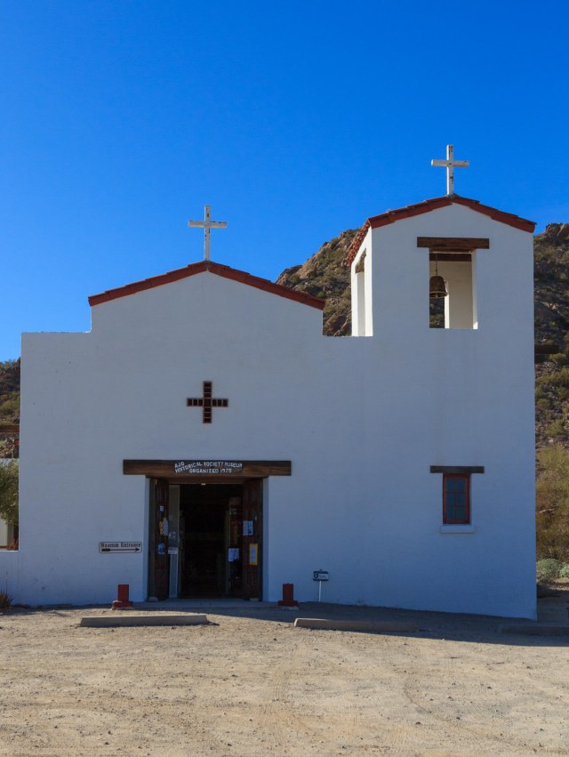
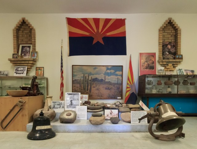
The steps up to the big porch at the visitor center and a comfortable bench where I could rest for a few minutes was a welcome sight. Inside the building, are a small museum and the typical national park T-shirts, hats, books, and junior ranger paraphernalia offered for sale.

IMG_6112
Long View of Fort Bowie Ruins
IMG_6105
Fort Bowie Ruins
IMG_6101
Non-commissioned Staff Officer’s Quarters

We followed the docent advice and took the return trail back to the parking lot. Although the steep incline up a hill behind the visitor center was intimidating, switchbacks and flat stretches made the descent easier.

IMG_6120
Return Trail to Parking Lot

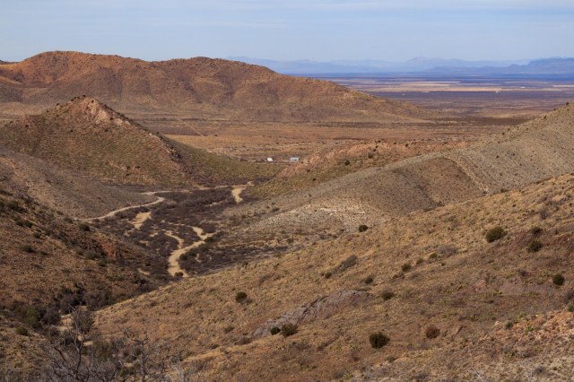
The best part was the spectacular views of not only the fort ruins but also the agricultural zones, valleys, and cities off in the distance.

IMG_6121
Views from Atop the Hill

We enjoyed our hike to the Fort Bowie ruins and wouldn’t mind returning some day during a prettier time of year. I’d like to see the pistachio and pecan trees dressed in their leaves and the ocotillo in bloom. Next time we’ll carry a full lunch in our backpack instead of the measly snacks we had packed.

Keeping with our 250 – 400 miles a day, Van Horn seemed like the next logical place to stop as we headed into Texas.

Gila Bend and Ajo, Arizona

We left Monday, February 5, 2018, with San Diego in the rearview mirrors and the GPS pointed toward Arizona’s Gila Bend KOA. Along Interstate 8, we drove through hills populated with huge boulders, similar to what we saw at Jumbo Rocks in Joshua Tree National Park. The hills gave way to agricultural areas in the valleys. One field contained sheep clustered together in small groups as if they were in breakout sessions at a conference.

We made a pit stop at the multi-directional Sand Hills Rest Area located in the median and accessed from the fast lane. A group of ATVs on the sand hills caught my attention.

IMG_5942
Imperial Sand Dunes

We lucked out getting reservations for a week during this trip at Gila Bend KOA when someone had to delay his arrival. The owners recently completed a two-year renovation project that has enticed other winter visitors to this location, filling the park on most nights.  We ended our day sitting out under the awning, sipping beers, munching chips and salsa, and enjoying the amazing sunset and calm winds.

IMG_6059
Gila Bend Sunset

With the park so full, I expected a noisy morning. However, the loudest noises came from the cooing doves and the clicking hummingbirds that serenaded us throughout the day. An occasional boom and shake of the earth from air-to-ground bombing practice at the Barry M. Goldwater Air Force Range and a far-off freight train had little effect on the sounds of nature.

After two days relaxing and catching up on the wash and house cleaning duties, it was time to venture out. Here are a few places in and around Gila Bend that we managed to see.

Big Horn Station

Big Horn Station sits twenty miles east of Gila Bend on Interstate 8. We found a closed gate across the road with a chain in place, but no lock prevented our access to the property.

IMG_5962
Big Horn Station
IMG_5949
Big Horn Station

The Bender family established the station in the mid-1920s and became a stopping point for weary travelers between Casa Grande and Gila Bend on what once was Highway 84.

IMG_5953
Big Horn Station and Oil Rig

A. O. Bender and his son A. L. Bender made their living in the ranching industry, diversifying interests by selling gas, food, and other items to visitors.

IMG_5955
Cattle Ramp

The property is now in the hands of BLM who has partially restored the station and plans to add interpretive signs that will tell the history of the property and the people who called the station their home.

IMG_5961
Saguaro Skeleton

Sofia’s

The bright colors on the building that houses Sofia’s enticed us to give it a try.

IMG_5964
Sofia’s Mexican Food

The 6-pack with three tacos and three enchiladas was the perfect sized lunch-for-two. The enchilada sauce infused with a mild spicy flavor was one of the best I ever tasted. Cleanliness is a priority at Sofia’s. Not a speck of dust coated the windowsills and even the ceiling air vents sparkled.

Gila Bend Visitor Center and Museum

The visitor center and museum found a clever way to draw travelers to visit. Geocaches point to various pieces of information or artifacts to attract searchers to the location. For the hour we were there, four groups of people came in on the hunt to find their next cache. The lady onsite even helped some of the visitors find the few obscure items. The museum contains several display cases of artifacts and small dioramas that depict the town’s early history. It’s worth a stop to visit for an hour or so.

9/11 Memorial Park

The 9/11 Memorial Park is the location of a 4,000-pound steel beam salvaged from the New York Twin Towers Ground Zero site. A concrete marquee nearby is engraved with names of men and women who gave their lives and service in the military.

IMG_5968
Gila Bend 9/11 Memorial Park
IMG_5970
Twin Tower Steel Beam
IMG_5971
Close Up of Steel Beam

The Rest of the Town

Once a thriving community, Gila Bend has experienced economic difficulties. There are plenty for-lease buildings available for enterprising individuals who are considering starting or bringing a business to town.

IMG_5976
Stout’s Hotel “The Jewel of the Desert” Architect: Henry C. Trost Built: 1927 – 1929
IMG_5980
This Building Looks Perfect for a Craft Beer Pub 

For grocery shopping, there is a Carniceria, Family Dollar, and Dollar General. The one food market that was in town remains closed, although, the Watermill Express kiosk does a brisk business.

IMG_5978
Food Market is Closed. Drive Up to Fill Water Jugs.

A Circle K was close to completion with five or six pump lanes and a large building that looks like it will hold more than snack items and drinks. Perhaps this is a sign the town will soon experience an uptick in its economy.

Ajo, Arizona

The Ajo visitor center had a historic map with descriptions of various sites along a walking tour.

IMG_5981
Ajo Visitor Center
IMG_5983
Ajo Plaza View From Visitor Center

On the tour, we saw the Ajo Copper News building,

IMG_5988
Ajo Copper News Building. Bookstore and Printing Also Inside.

Then the Immaculate Conception Catholic Church built in 1925 in the Spanish Colonial Revival style came next. Many houses built in a similar fashion surrounded the church.

IMG_6013
Immaculate Conception Catholic Church

Also referred to as territorial houses, the most notable feature of this style is the clean horizontal lines.

IMG_5999
One of Many Territorial Houses

Artist Alley was an interesting place with its bright colorful paintings.

Our server at Estrella Restaurant & Bar christened me Miss Picky Pants for asking so many questions about the menu.

IMG_6019
Estrella Restaurant & Bar

I only wanted to know about the ingredients in the paninis in case I needed to break out the Zantac. My veggie sandwich turned out yummy (and easy on the tummy) and Jon’s ½-lb. cheeseburger was enough food for two people to eat. We washed our meals down with Arnold Palmers that were not overly sweet.

IMG_6018
Estrella Bar

The Ajo Museum and Historical Society is housed in an old Catholic church and consists of period household items, military pieces, numerous documents including school yearbooks, various historical newspaper articles, and much more.

IMG_6045
Ajo Museum and Historical Society

The docent, Louie Walters introduced himself as a retired mathematics teacher who has lived in Ajo since the 1960s.

IMG_6038
Entrance to Ajo Museum and Historical Society

He told us that Native Americans, Spaniards, and Americans all extracted minerals from Ajo’s rich ore deposits, and how the copper mining company, New Cornelia Branch of Phelps Dodge, and the town of Ajo was established and developed in the early 1900s.

IMG_6034
The Wonder of Copper Poster

He also used visual aids to show where Mexican Town and Indian Town had been located before the copper mining pit expansion encroached on the communities.

IMG_6028
Display in Ajo Museum

The company did compensate the people to leave their homes.

IMG_6039
Open 24 Hours. How Convenient.

The copper mine pit overlook was a bit disappointing. The visitor center was closed by the time we left the museum, but I don’t think it would have made much difference. The view would still have been through a fence.

IMG_6044
Copper Mine Pit and Spring Fed Ajo Lake

Our week was up and time to move on. Willcox, Arizona was our next stop so we could take a look at Fort Bowie National Historic Site, a place we had driven past two years in a row on our way to and from other places.

Safe Travels

Kicking it in San Diego, California – Part 2

Top on our list for choosing San Diego was, of course, our favorite resident. Our son Kevin moved there shortly after graduating from high school and has adopted it as his hometown.

IMG_5935
Kevin Catches Me Taking a Candid Photo While Jon Shows Bailey Something on His New Phone.

We understand his choice given all the beaches, hiking trails, and nightlife that is available. And don’t forget the San Diego Zoo, Sea World, and Balboa Park. Who wouldn’t want to live in this subtropical zone with high temperatures that range between 66 and 77 degrees and lows that dip between 49 and 67?

Sunset Beach

After a day of hanging out at the trailer, we met up with Kevin and his girlfriend Bailey Bishop for a walk along the cliffs at Sunset Beach. The popular spot draws people out of their homes and apartments to enjoy the last hour or two of the day before the sun sinks into the Pacific Ocean. With clear skies and temperatures in the high 70s, we joined the fun.

IMG_5932
Swimmers Check Out Conditions
IMG_5930
Catching Dinner

When I stepped out of the car, moist ocean air reminded me of another reason I come to San Diego. The whiff of the ocean breeze and the moisture that settles on my skin provokes a sense of calm I rarely experience anywhere else.

IMG_5937
Boulders Piled Up On Beach Prevent Cliff Erosion

I hadn’t realized I missed the beach so much. We would have stayed at Campland on the Bay Resort as usual if they had not raised their rates to $96.00 a night. La Mesa RV will have to do for future stays as long as I remember to visit the beach more often.

IMG_5938
Beautiful Day at the Beach
IMG_5934
Nice of This Pair to Pose for a Photo

Ocean Beach Brewery

Ocean Beach Brewery’s rooftop restaurant was another great place to watch the sunset from our bistro chairs and table we were fortunate to snag. The place was hopping when we arrived with barely any standing room near the bar.

IMG_5940
Ocean Beach Brewery Rooftop. How Many Cell Phones do You Count?

Jon said the El Diablo double burger with a red onion spicy aioli on a brioche bun was the best he had ever eaten. I enjoyed the Mona Lisa, a marinated grilled chicken breast, roasted red pepper, fontina cheese, with a spread of spring mix basil pesto on a ciabatta roll. Crispy French fries and a glass of Hidden Gem Dunkelweizen on tap accompanied our dinner selections.

The Gulls

Kevin surprised us with tickets to the Gulls, an American Hockey League team affiliated with the National Hockey League’s Anaheim Ducks. None of us knew anything about hockey, but with tickets around $20, it seemed like an inexpensive way to spend a few hours.

APC_0123
The San Diego Gulls on Ice

We watched with excitement as The Gulls managed a goal on the Tucson Roadrunners, then the Roadrunners scored, and back and forth, the players skated from one side of the rink to the other. With mere minutes left on the clock, the Gulls took advantage when the Roadrunners replaced their goalie with another player leaving their net vulnerable to attack. The Gulls pulled ahead and won the game when they easily shot the puck over the undefended Roadrunners goal line, not once, but twice. After this game, I might adopt hockey as a sport to follow in the future.

The Big Game

The Super Bowl is the one and only football game I watch each year, often hosting a party for friends and family. Our fifth wheel with it’s 32” television hardly has space for a party. Fortunately, Bailey’s parents invited us to join them for the big game.

APC_0143
Jon Watches the Game with Ray and Cherrie Bishop
APC_0140
Oops! Bailey Catches Me in the Act.

We were treated to a spread that included chips and queso, guacamole, and salsa; pulled pork sliders with a tangy slightly hot barbecue sauce and coleslaw to cool it down; and a variety of hot wings. These cute little football deviled eggs were delicious.

APC_E0131
Cutest Little Deviled Eggs

Even after all that food, none of us could resist the Knock-You-Naked Brownies. They were gone before I had time to take a picture.

The Super Bowl for me isn’t at all about the game. It’s about the food, great company, halftime, and the commercials. The food and company was a hit, the halftime show entertaining, and a few commercials made me smile while I shook my head at others.

Although I’m not into football, I did find the game entertaining this year and managed to cheer along with everyone else when the Philadelphia Eagles won. Who could not wish a close game win for the underdogs? Maybe the gamblers who bet on the Patriots were peeved, but we were ecstatic.

Our San Diego stop had come to a close and it was time to say good-bye. The next day we hit the road headed east for who knows how long.

Safe Travels

Kicking Off 2018 Winter Tour in San Diego, Part 1

San Diego is a favorite destination for us so selecting the location for the kick-off of our 2018 Winter Tour on January 30, 2018, wasn’t difficult. During our stopover in San Diego, we searched for places we had never stumbled upon before.

Mission Trails Regional Park

Mission Trails Regional Park was our first pick. I’m glad past city leaders realized the benefit of setting aside a swath natural habitat for future generations to enjoy.  Although the town encroaches near the edges of the park, urbanites and visitors alike can spend a few hours in the wilderness and learn about the history of San Diego in the early 1800s.

We started at the Visitor Center located off Mission Gorge Road. After grabbing a map and discussing trails with the volunteer, we escaped the busload of school kids that had arrived shortly before we did.

IMG_5900
Mission Trails Regional Park Visitor Center
IMG_5901
Hello Up There

We drove directly to the Old Mission Dam, which is registered as both a National Historic Site and a California State Historic Landmark. Kumeyaay Indian laborers, under the supervision of engineers trained in Mexico, constructed the 250-foot dam to provide a year-round water supply for Spanish settlements.

IMG_5903
Old Mission Dam

Construction consisted of cementing rocks and boulders together using mortar made of lime and crushed seashells. The dam created a reservoir that spanned the length of three football fields. A flume lined with hand-made tiles delivered water from the reservoir to the Mission San Diego De Alcala crops about three miles away and another 2.5 miles to the Mission. Today the reservoir is now a pond and the flume is no longer present.

IMG_5905
Old Mission Dam

We followed the Oak Canyon trail along the San Diego River, through sagebrush, chaparral, oak trees, and grassland. Critters rustled through the underbrush as we approached and birds flew from grass to tree tops.

IMG_5924
Bridge Across the River
IMG_5912
Are You Coming?

Every once in a while, I forgot we were so close to an urban setting. Then a plane would fly overhead, the roar of the highway traffic would seep into my ears, or a semi would rattle its exhaust brakes as it slowed.

IMG_5913
Stop Awhile and Rest in My Shade
IMG_5915
Edible or Toxic?
IMG_5920
Just a Puddle

At one point I heard rushing water. I picked up my pace at the prospect of seeing a waterfall or rapids in the desert environment. I knew it was just around the corner only to find more grass-covered hills. Around the next hill, still no water, nothing around the next hill either. Then I finally looked up.

IMG_5922
High Tension Wires

What I heard was not the rush of water flowing but the rush of electricity through the high tension lines. Silly me.

There are 24 trails to explore in Mission Trails Regional Park with plenty of choices whether hikers prefer easy, moderate, or difficult levels. I envision future trips to San Diego so we can experience more of what the park has to offer.

Trolley Ride to Historic Downtown

The Trolley has existed since 1981, yet we had never jumped aboard.  I suspect the reason is due to the ease of getting around town in a vehicle. Since our RV site was adjacent to the 70th Street stop, we hopped on for a ride to the Gaslamp Quarter in downtown.

CYQA3991
The Trolley

A day pass was $5.00 plus $2.00 for a reusable Compass Card. We saved the Compass Card to use during our next trip to San Diego.

Craving tapas, we stopped in at Cafe Sevilla for a flight of sangria, bacon wrapped dates and empanadas. It turned out to be a great choice.

KZYS8458
Cafe Sevilla’s Place Settings

The rich bacon wrapped dates melted in our mouths and the trio of empanadas contained generous helpings of meat wrapped inside. Next time I think we will stick to the traditional red sangria, although the apple and citrus glasses did have a crisp taste.

LNGO4545
Yummy Bacon Wrapped Dates
kynd7352.jpg
A Flight of Sangria

Cafe Sevilla also offers Spanish music and dance lessons, making it a great place to have a birthday or anniversary party with family and friends.

BEMZ1175
Stage
JLEA6400
Not Your Ordinary Bar Stool

Harbor Drive led the way toward the Midway Aircraft Museum where ships are often docked in port along the Embarcadero. First we came across The Headquarters.

HKKP2509
The Headquarters

Once the San Diego Police Headquarters, the courtyard is now home to restaurants, shops, and art galleries. The hallway to the restrooms contains a height chart to use as a background for taking selfies and a jail room with mug shots of prisoners.

Along the embarcadero is a memorial to the USS San Diego (CL-53).

WVMD8116
USS San Diego (CL-53) Memorial

The memorial was sponsored by the USS San Diego (CL-53) Memorial Association, Inc. to honor the “valiant and remarkable service of the cruiser USS San Diego and the men who served aboard it during World War II.”

Take a look at this stealth-like ship. They offered tours of the USS Independence (LCS-2) but did not allow bags, a no go for us since we both had backpacks. Instead, we gawked at the ship from the pier. The trimaran build allows flexibility for the military crew to employ different types of operations.

XQAF0207
USS Independence (LCS-2)

As we walked back to catch the trolley we admired a unique characteristic of San Diego’s skyline. One America Plaza, the tallest building in San Diego, sports a Phillips screwdriver roofline,

DMXC0333
One America Plaza

while the Hyatt’s roofline resembles a standard screwdriver.

SKSH9792
The Hyatt

Other buildings also have unique designs that makeup San Diego’s skyline.

Next week we finish up with Part 2 of our visit to San Diego.

Safe Travels