Mammoth Lakes Fishing, Fishing, and More Fishing

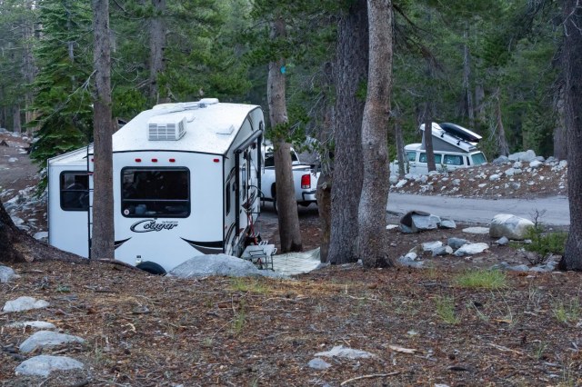
Coldwater Creek Campground in Mammoth Lakes was our next destination on our 2018 Summer Tour. We met our daughter Laura and her family at the campground on Monday, July 23. Laura had procured reservations for two sites across the street from each other, which made it convenient for visiting and sharing meals.

IMG_8491
Coldwater Creek Campground Campsites for the Cougar and Westfalia

There are plenty of things to do in Mammoth Lakes: ride the gondola, hike, horseback ride, bicycle around the lakes, visit Devil’s Postpile National Monument, wander around town, shop, and much more, all of which we have done at one time or another during our many vacations at Mammoth. This trip turned out to be all about fishing.

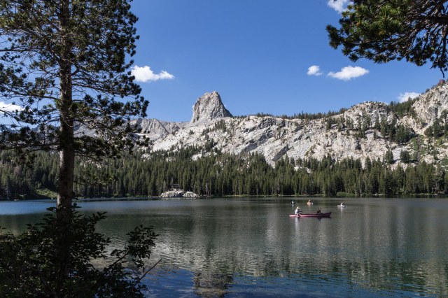
It was time for the grandkids to catch their first fish so off to Lake George with poles, tackle boxes, and a stringer to secure all of the caught fish.

IMG_8495
Lake George

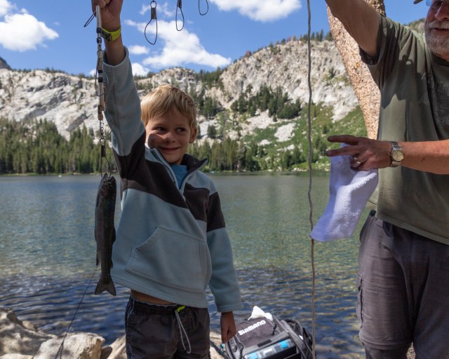
Our grandson Jackson caught the first fish of the day, which was his first fish ever caught. Way to go Jackson!

IMG_8518
Jackson Silvey not only catches his first fish, he catches the most fish for the day

Papa Jon demonstrates the perfect cast while Maya considers his technique.

IMG_8502
Hmmm, was that the right spot?

The hatchery truck showed up, not too far from where the gang was fishing, and dumped out a load of fish to add to the lake.

IMG_8529
More fish to catch

All in all the day was successful. Well, at least for the grandkids. Jackson caught three fish, Maya caught one, and they skunked Jon. That’s okay, though. He had fun showing the kids how to put on the bait, cast the line out, and reel the fish in. Even our daughter Laura and son-in-law Chris helped with the tasks.

IMG_8555
Maya Silvey catches her first fish while Mom and Dad look on

My job was taking photos to document the event and when the action slowed, I sought out other things to photograph.

IMG_8565
Mountain Whitethorn

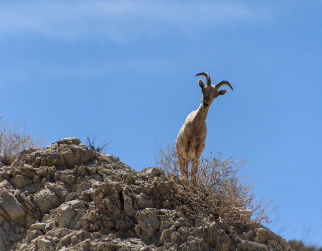
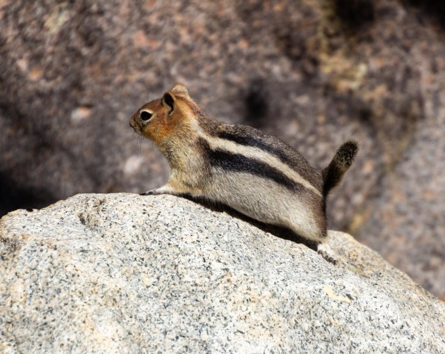
Squirrels and chipmunks can usually be counted on to pose for a photo.

IMG_8508
Chipmunk

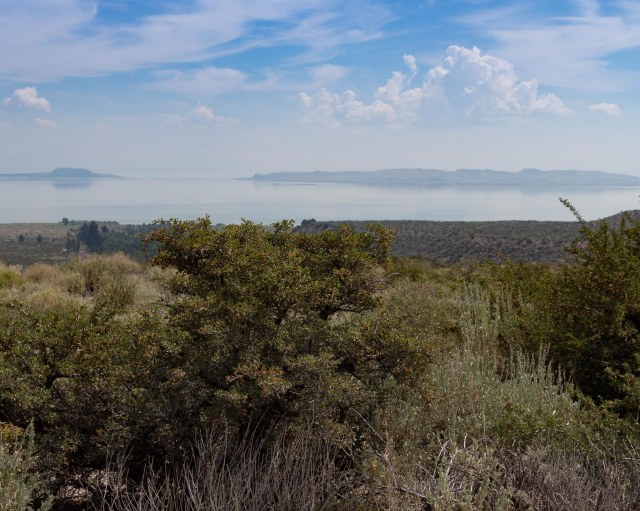
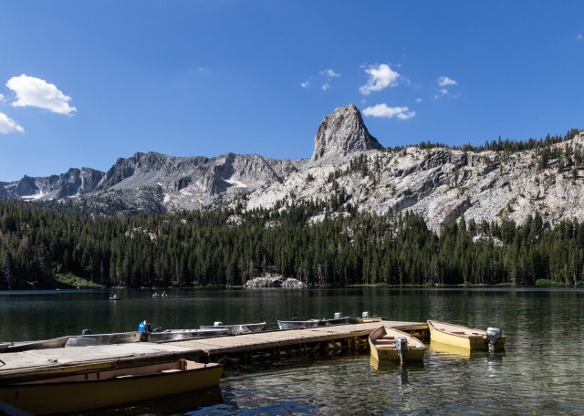
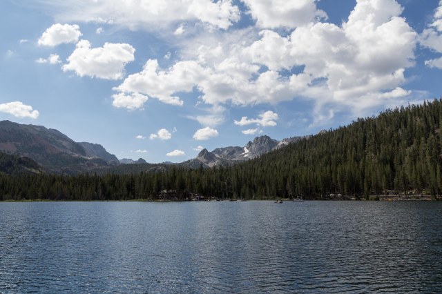
The surroundings and the view are also good subjects.

IMG_8498
Lake George

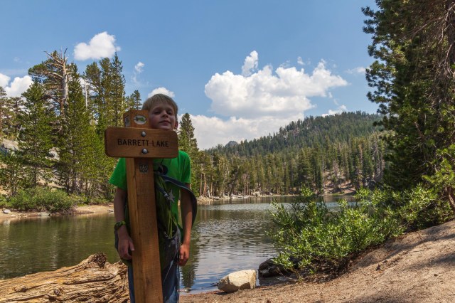
The next day, my daughter Laura, Jackson, and I took a hike up to Lake Barret while we waited for our son Kevin, his girlfriend Bailey, and Bailey’s nephew Patrick to arrive. No fishing included on this day, just a walk through nature. When we returned from our hike, Kevin, Bailey, and Patrick had their tents set up.

IMG_8569
Barrett Lake
IMG_8570
We arrived!

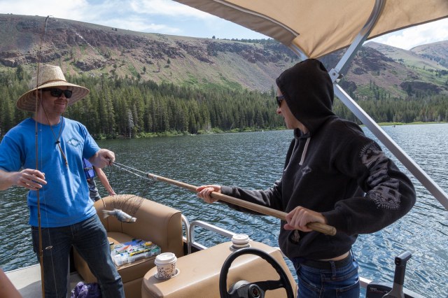
The next morning, we all chipped in on a pontoon boat for a half-day of fishing. It was well worth the investment. Everyone fishing caught at least one fish and Jackson and Kevin competed for the most caught.

IMG_8617
A great day for fishing

A Croman helicopter flew overhead at one point. It must have been on its way to or from one of the fires on the other side of the Sierras.

IMG_8623
Croman Helicopter

One of Kevin’s many fish caught for the day.

IMG_8583
Come to Papa

Brother and sister work together for our dinner.

IMG_8624
Is it too small? Should we put it back in?

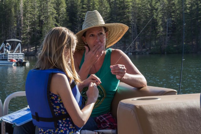
Maya and Bailey work together.

IMG_8577
Maya, I’ve got a secret
IMG_8590
Jackson catches another fish

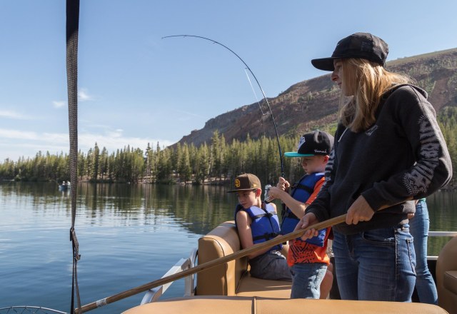
The gang waits patiently for a bite.

IMG_8654
Here, fishy, fishy, fish

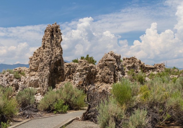
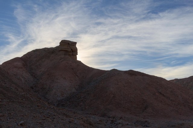
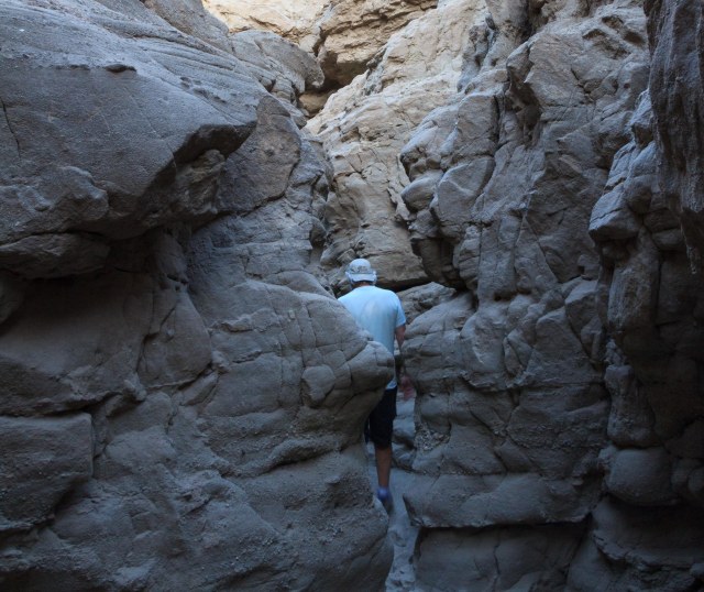
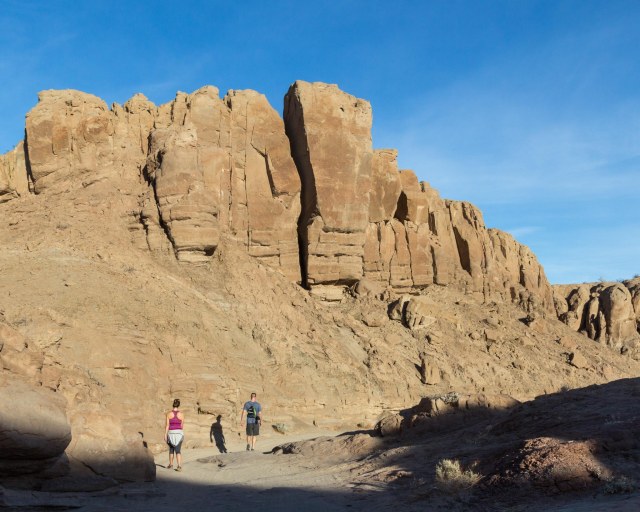
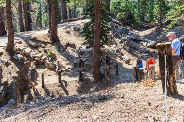
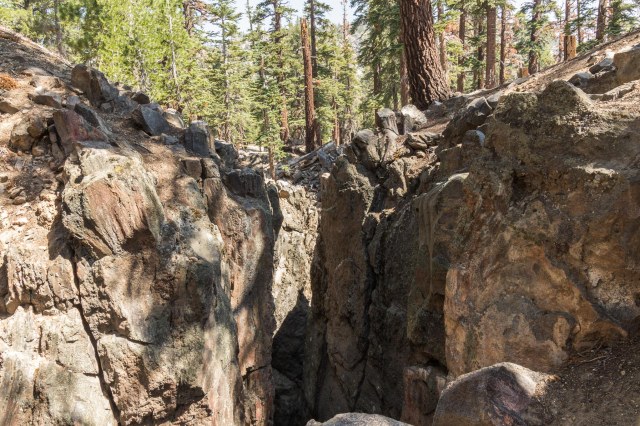
On our last day together as a family, we chose an activity other than fishing, or so we thought. Devils Postpile National Monument won out over a drive to Bodie Ghost Town, no one wanted to sit in a car for an hour drive. We loaded into two vehicles and took off only to find out that we had to ride a shuttle to the monument and no one wanted to wait for the shuttle. Instead, we stopped off at the Earthquake Fault before going to back to our campsites.

IMG_8659
The trail to the fissure

The Earthquake Fault, which is not a fault at all. It is actually a fissure that opened around 550 to 650 years ago when magma pushed its way to the surface.  Although the sides are 6′ to 10′ apart, in places you can see that the sides would fit together like a puzzle. Other areas have experienced erosion and the sides don’t quite match up anymore.

IMG_8660
Fissure

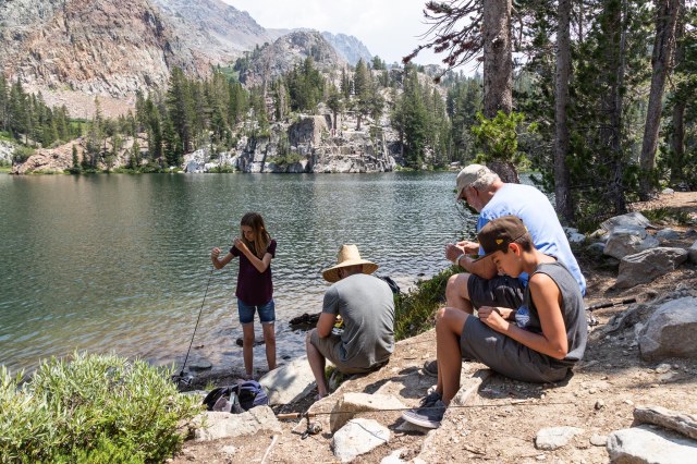
When we got back to camp, everyone agreed that a hike up to Arrowhead Lake for more fishing would be a great way to spend the rest of the day. Jon left his fishing gear back at the trailer and helped out the others when needed.

IMG_8670
Baily works with a lure while Patrick raids her tackle box
IMG_8673
Mom and Dad kick back while Jackson enjoys a snack
IMG_8675
The tedious part of fishing, tying leaders

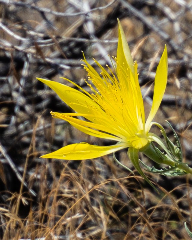
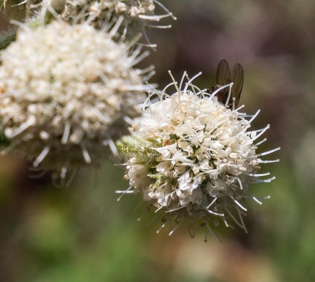
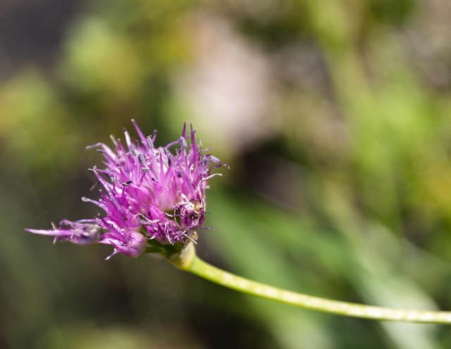
While the gang fished, I wandered around the lake catching the cliff jumpers in action and finding remnants of wildflowers.

IMG_8682
Cliff jumpers
IMG_8677
Spent purple wildflower

Camping with our kids again brought back so many memories of the vacations we spent in the Eastern Sierras and we had plenty of fun camping with them again. Seeing the smiles of the grandkid’s faces when they caught a fish was priceless and watching Maya cast a line as if she’s been doing it for years made me so proud of her. I’m hoping we can all find the time to have more camping adventures in our future.

On Saturday, July 28, we said our goodbyes and went our separate ways. While our kids headed to their respective homes, Jon and I turned north to Carson City, Nevada, for a few days to clean the trailer, wash clothes, and relaxation, then a stop in Ely, Nevada, as we worked our way to Colorado.

Safe Travels

Summer 2018 Tour – Mono Lake

We headed out on the road again a month after our Alaskan Cruise. With the truck and trailer in tiptop shape after regular maintenance, we had the State of Colorado in our sights. Before leaving California, though, we headed up to June Lake, California, on July 21 for altitude acclimation before meeting our family at Mammoth Lakes for a week.

It was sad to see that smoke from the Ferguson Fire, which had started on July 13, had filled Yosemite and surrounding areas. Smoke followed us through Yosemite on CA-120 until we transitioned onto US-395 toward June Lake where blue skies and cottony clouds prevailed.

IMG_2190
View from Vista Rim of the World Overlook on CA-120

Although we took it easy while in June Lake, we did manage a trip to Mono Lake Tufa State Natural Reserve. A few years ago, we had visited the south side of Mono Lake taking the trail to the tufas. This trip we stopped in at the visitor’s center, too.

IMG_8437
Mono Basin Visitor Center

Outdoors is a display of huge boulders of the types of rocks that are found in the area ranging from obsidian to granite and a trail around the center with information signs pointing out the views and discussing the types of birds that visit each year during their migration.

IMG_8438
JT takes a look at the obsidian boulder

Inside, we watched a movie on Mono Basin, which summarized the history of Mono Lake from the Paiutes to Los Angeles stealing water in 1941 and ruining the ecological environment.

Mono Lake, one of the oldest lakes in North America, is estimated to be at least 760,000 years old. With no outlet, minerals carried into the lake by streams and evaporation of fresh water has created a lake that is 2.5 times saltier than the ocean with an alkaline content of 100 times more. No fish can survive in the lake but brine shrimp and alkali flies thrive in the sodium chloride and baking soda enriched water, providing food for migratory birds.

IMG_8480
California Gull

The efficient food chain in Mono Lake is the key to keeping the migratory birds healthy for their long trek. Bacteria break down decaying matter providing nutrients for algae. Trillions of brine shrimp, along with the alkali flies, eat the algae. Then the millions of birds that stop at Mono Lake during their migration, eat the shrimp and flies.

Designated as an International Reserve in the Western Hemisphere Shorebird Reserve Network, thirty-five species of shorebirds, totaling nearly 2 million water birds, stop along their migration route. Each year, 44,000 to 65,000 California Gulls fly into Mono Lake to breed on the islands. Unfortunately, after a couple of days, smoke had pushed its way over the Sierra Nevada Mountain Range, shrouding the islands in a haze.

IMG_8441
Negrit and Paoha Islands

The larger island, Paoha, formed about 300 years ago when magma rose underneath the lake and pushed sediments above the water level. Volcanic eruptions occurring between 300 and 1,700 years ago, formed Negit, the smaller island on the left.

On the south side of the lake, a trail leads to the tufas. Along the way are signs that indicate the level of the lake at certain points in time and one sign shows where the water’s edge will be once the level of the lake reaches its mandated 6,392 feet, the elevation in 1963. Some of the tufas may no longer be visible when the lake achieves its goal.

IMG_8448
Trail to tufas

A few wildflowers lined the sides of the trail in addition to the tall grasses.

IMG_8449
Blazing Star

Up close the tufas look pretty gnarly. I wouldn’t want to get scraped by one.

IMG_8453
Tufa formations

Those black spots in the photo below are the alkaline underwater flies. The flies were a delicacy for Native Americans who also traded the food with other tribes. The many birds that fly in during their migration also feed on the flies. When I heard there might be flies I wasn’t sure I wanted to go to the water’s edge. I had nothing to worry about. As people walked by the pools, the flies would hover above the water for a few seconds before settling back underwater. They had no intention of bothering us humans.

IMG_8458
Alkaline underwater flies

The tufas come in all shapes and sizes. Freshwater springs bubbled up through the carbonate-rich lake water to form the tufa shapes under water. They are composed of calcium carbonate, a whitish limestone deposit that forms the basis of the tufa formations. In 1941 Los Angeles diverted the streams that entered Mono Lake causing the lake to decrease in size revealing the tufas.

IMG_8460
Strange tufa formations

The hazy cloudy skies made conditions perfect for picking up mirror images on the smooth-as-glass water surface. I could have sat for hours watching how the light changed across the surface of the water and played with the tufas. I couldn’t pick just one, so here are four.

IMG_8457
Reflections 1
IMG_8461
Reflections 2
IMG_8462
Reflections 3
IMG_8468
Reflections 4 – Can you find the peregrine falcon’s nest at the top of one of the columns?

While traveling along US-395 each year on vacation during the 1980s, we watched Mono Lake decrease in size and wondered about the white formations that stood like sentries at the south end of the lake. In 1982, the lake was only 69 percent of its 1941 surface area, and by 1990 it had lost 50 percent of its volume. While the tufas are interesting to look at and photograph, I’m glad to see the lake recover and continue as a stopover for migratory birds and a breeding ground for the California gulls.

What would have happened had universities not performed studies to sound the alarm that LA’s diversion of the streams had caused significant ecological damage? Where would all of the migratory birds have gone? It took over a decade of litigation for the California State Water Resources Control Board to issue an order to protect Mono Lake and its tributary streams on September 28, 1994. A lake level of 6,392 feet above sea level is the goal for restoring the lake. On August 1, 2018, the lake’s level was 6,382.1 feet according to Monolake.org.

Safe Travels

San Diego, California—the perfect place to escape a heat wave

The weather forecast predicted a week of heat-wave temperatures for California and Arizona on April 9, 2018. Since the best places to hang out when it’s scorching hot are a forest at high altitudes or along the coast, we headed for the San Diego Resort-Sunland in La Mesa, California. Although in the 80s, it was better than panting in temperatures that approached 100 degrees.

IMG_7466
Urban wildlife

The goal of our recent San Diego visits is to explore places we have never been before. We checked off Mt. Helix, Cabrillo National Park, and Lake Murray on this trip.

Mt. Helix

The children of Mary Carpenter Yawkey built the 12-acre Mt. Helix private, non-profit park as a tribute to their mother in 1925. Open year-round, the park attracts residents and visitors to explore the trail that circles the crown of the mountain; engage in a fitness work out by using the amphitheater steps, seats, and retaining walls; and to marvel at the 360° views. After tackling the steps five or six times, I surprised myself and managed the seats as well.

IMG_7504
Mt. Helix Amphitheatre
IMG_7497
Smile for the photo op
IMG_7493
Contemplating life
IMG_7476
Cross at the top of Mt. Helix
IMG_7472
One of the 360° views from Mt. Helix
IMG_7469
Not a clear day in San Diego

Cabrillo National Monument

We visited Cabrillo National Monument a few years back, but that was before I had my National Park Passport. So off to Point Loma to add another stamp in my book.

IMG_7587
Gettin’ a bit shaggy there JT

Lucky for us low tide coincided with our arrival. We wandered around the rocky intertidal zone for about an hour, peering into the pools to watch the sea anemones and snails going about their business. Witnessing sea life under the water takes a little patience A quick glance won’t do if the aim is to watch the animals move around. Other creatures clung to the cliffs for a bit of sunbathing while waiting for the onslaught of waves at high tide.

IMG_7517
Tide pools at Cabrillo National Monument
IMG_7522
Gooseneck barnacles
IMG_7534
Sea anemone and snails in a small pool
IMG_7539
Staghorn kelp, perhaps?
IMG_7545
Couples share a moment as the waves roll in
IMG_7554
Oh, how I adore your limpet eyes
IMG_7550
Pink barnacle clinging to a rock
IMG_7556
A ranger leads students and chaperones through the tide pools
IMG_7570
Pelican Air Force on duty

We stopped off at the Old Point Loma Lighthouse, cooled off while watching the movie at the visitor center, and gazed out at the views of San Diego’s skyline and watercraft in the bay.

IMG_7610
Old Point Loma Lighthouse
IMG_7609
Exhibits inside depict life as a lighthouse keeper

The monument recognizes the arrival of Juan Rodriguez Cabrillo in September of 1542. Cabrillo was the first European to explore the west coast of the United States. He described the bay as “a closed and very good port,” and named it San Miguel. Another explorer, Sebastian Vizcaino, changed the name to San Diego 60 years later.

IMG_7619
Juan Rodriguez Cabrillo monument statue
IMG_7615
Black Phoebe flycatcher, perhaps?

Military uses of the point include a military reserve beginning in 1852, the installation of gun batteries in 1899, and a harbor defense system during World War I and II between 1918 and 1943. Visitors can see remnants of the batteries and an old radio station where an exhibit of “They Stood the Watch,” depicts the military history of Point Loma.

IMG_7605
Battlement near the lighthouse

From the ocean to the San Diego skyline, the views are spectacular from the monument.

IMG_7601
Ocean views
IMG_7510
San Diego skyline
IMG_7513
Rosecrans National Cemetery

Lake Murray Reservoir

Less than two miles from our base camp, Lake Murray Reservoir is a convenient park to visit, enjoy a lakeside walk and a bit of nature, or grab a picnic table and eat lunch. A 3.2-mile paved service road outlining the lake’s perimeter and ending at the dam is popular with walkers, joggers, and bicyclists. Fishing is also available. Or, rent a paddleboat or a kayak on a first-come-first-served basis from the concessionaire. We chose a 6-mile walk around the lake, turning around just short of the dam.

IMG_7623
Lake Murray Reservoir
IMG_7624
Here fishy, fishy, fish
IMG_7625
Paved trail around Lake Murray
IMG_7652
Rent a paddle boat or kayak
IMG_7647
Osprey nest

It’s a Wrap

That pretty much concludes our 2018 Winter Tour. We left San Diego on April 15, 2018, took a detour through Lake Havasu to take care of some business and arrived home on April 20.  This was our longest tour yet, a total of 81 days, almost 12 weeks.

More stats:

  • 8,200 miles on the truck
  • 5,153 miles on the 5th wheel
  • 23 RV parks
  • 6 5th wheel repairs (entry steps, sewer connection, room slider, front jacks bolt, spare tire carrier, propane door)
  • 3 presidential library and museums
  • 8 national parks, monuments, or trails
  • 1 amusement park
  • and a whole lot of other sites

As much as we love being on the road, we were both glad to make it home safe and sound. Time to dust ourselves off and catch up with family and friends.  Oh yeah, Jon has a long list of RV preventative maintenance projects to complete before our next tour.

Before we packed up the rig and hit the pavement again, we needed a little vacation. A roundtrip Alaskan cruise from San Francisco seemed the ideal adventure for these two road-weary travelers.

Safe Travels

Kicking back in Borrego Springs, California

Onward we traveled to trade in the Orange County crowds for peace and quiet in Borrego Springs on April 4, 2018, the 68th day of our 2018 Winter Tour. We arrived at Palm Canyon Hotel and RV with time to check out the Anza-Borrego Desert State Park visitor center.

IMG_7314

We watched the introduction movie and picked up a few pamphlets and maps to plan our days.

Anza-Borrego is known for its fabulous display of spring wildflowers when winter rains provide ideal conditions for the show. The winter of 2017-18 did not bring enough rain.

Wait, stop! A lone ocotillo in bloom. We wondered if someone drove by each day and gave it a drink.

IMG_7258

The Hikes

Borrego Palm Canyon Trail

Borrego Palm Canyon Trail is a popular hike that skirts a creek through a canyon. Doves cooed and bees buzzed, and sand-colored lizards dashed about as we walked by, and a few wayward cactus blooms poked out their heads

A white dot appeared on a ridge. Was it a bighorn sheep? I zoomed in to see and wished we were closer.

IMG_7271

The 2004 flood uprooted a bunch of palms in the canyon and scattered them along the trail and in the creek bed.

IMG_7274

After scrambling over creek boulders, we entered an oasis. The canyon must have been a beautiful site before the flood.


IMG_7279
JT navigates the creek crossing

We joined a group of people in the shade and enjoyed our snack before making our way back down.

IMG_7280
Resting in the shade
IMG_7281
California Fan Palms


The streaky clouds hardly subdued the heat.


IMG_7298
Fallen palms


The Slot

We woke early to hike The Slot, hoping to beat the heat. Although the sun had already risen over the horizon, the valley floor was still in shadow when we started out.

IMG_7344

It was a good thing we woke early to hike The Slot. The tight squeeze through the canyon would have been challenging if we encountered people coming toward us.


IMG_7338
How’d he fit through there?

Although the walls lacked the variated red of other canyons we’ve explored, the formations were still impressive.

IMG_7352

Only a few cliffs showed off iron oxide layers.

IMG_7343IMG_7347

IMG_7349
Onward

These man-made formations enhanced the interest of the landscape.

IMG_7351
The rocks point the way, but which ones?


Yaqui Well

Yaqui Well is located near the Tamarisk campground. Parking along the road is available, some with shade. Sunscreen and plenty of water are recommended during hot weather. This trail is a desert botanical garden featuring several varieties of cactus.


IMG_7356
Hedgehog cactus in bloom
IMG_7357
California barrel cactus
IMG_7358
Ocotillo blooms but no leaves


IMG_7359
Backlit Teddy-Bear Cholla


We didn’t find a well, only a spring. The greenery was a clue water existed, but it was not visible.


IMG_7360
Where’s the water?


Narrow Earth Trail

We missed the turnoff for the Narrows Earth Trail and had to turn around. Although tire tracks were plentiful at our turn around spot, they disguised the deep sand. The back tires of the truck stuck hard. Our son, Kevin, and his girlfriend, Bailey, dug out sand from in front of the rear tires, then the three of us pushed the tailgate while Jon drove out, spewing sand all over us. We learned our lesson and now carry a shovel in the toolbox.

Bighorn sheep were our reward once we found the trailhead and started walking. We watched as a bighorn scrambled through the brush and climbed the hill. Then another one came and grazed while keeping an eye on us.


IMG_7368
“I’m keeping my eye on you.”


IMG_7390
“I see walking people.”
IMG_7394
“What you lookin’ at?”

They watched as we slowly made our way up the trail and whispered to each other, “Look, look, over there, kids and juveniles.”

IMG_7401
“Look, Ma, there’s people down there.”
IMG_7404
“Come on Joey, watch your step.”

Although it was a pain in the behind to get stuck, our timing was perfect to see the Bighorn sheep up close.


The Town and Surrounding Area

Christmas Circle Community Park

If something is happening in Borrego Springs, it is likely occurring at Christmas Circle Community Park. On Thursday, vendors set up shop at the farmers market. We chowed down on a couple of tamales from a woman who kept busy serving her patrons. The pico de gallo was the perfect complement for the chicken tamales.


IMG_7304
Christmas Circle Farmers Market
IMG_7305
“Hot tamales, come get your hot tamales.”
IMG_7311
Nice selection of vegetables


Borrego Springs is completely surrounded by the Anza-Borrego Desert State Park and boasts a population of over 3,500 seasonal and year-round residents. It holds the distinction as California’s first International Dark Sky Community due to its distance of 55 miles from the highly populated California coastline.

With tourism as the primary industry, the town includes a variety of resorts and inns for all price ranges as well as restaurants. Borrego Outfitters offer clothing, footwear, outdoor gear, and gifts. Spas, fitness centers, medical services, a grocery store, and a library are other amenities available.

A chock-full calendar of events from October through May provides plenty of events for the tourists and residents.


Galleta Meadows Estate

Visitors to Borrego Springs have fun with the sky art throughout the area. Dennis Avery turned his private estate into an art museum when he commissioned Ricardo Breceda to create a series of sculptures inspired by the history and nature of the Anza-Borrego Desert.

IMG_7330
Permission is granted!

Dirt roads weave in and around the sculptures, which began arriving in April 2008, allowing visitors to get up close for photo opportunities.

IMG_7321
“Settle down now, Colt. I’m bigger than you are.”

The detail of the metal structures speaks to the craftsmanship that went into their creation.

IMG_7322
Detail of the horse

From prehistoric creatures to this miner and his mule, Breceda depicts life in the desert throughout the years.

IMG_7445
“Just one more pan full and we’ll go, Betsy.”

Not only does he depict a mule burdened with the miner’s supplies, he sets it in motion as if the jenny is spooked and pulling away from something that has frightened it.

IMG_7444
“What am I? A beast of burden?”

Breceda pays tribute to modern times with the jeep navigating boulders in the backcountry. In Anza-Borrego State Park and surrounding area offroaders have a dilemma figuring out which of the many primitive roads they want to explore.

IMG_7440
Whoa, Nelly!

Visitors crowd around the serpent that crosses the road, taking one photo, two photos, and more. We waited several minutes in order to take our selfies.  The tail of the serpent continues on the east side of the road.


IMG_7436
Serpent’s head on the west side of the road and tail on the east side


IMG_7438
Serpent detail

And here are a scorpion and a grasshopper poised for battle.

IMG_7450
“I’ll give you 5 to 1 the scorpion clobbers the grasshopper.”

I can’t wait to get back to Borrego Springs and Anza-Borrego State Park to explore all the places we weren’t able to visit. In the meantime, I’m praying for lots of rain during the 2018-19 winter. Come on, rain, bring on the wildflowers.


Safe Travels