Ravenswood Historic Site in Livermore, California

One November Sunday, the house filled with the aroma of nachos and a blaring television. The crowd roared, announcers babbled, and Jon yelled, “Catch the ball,” for the umpteenth time. It was time for this NFL widow to get out of the house.

Ravenswood Historic Site in Livermore, California, called me to visit the restored Victorian country estate built by Christopher Augustine Buckley, Sr.

Ravenswood Historic Site

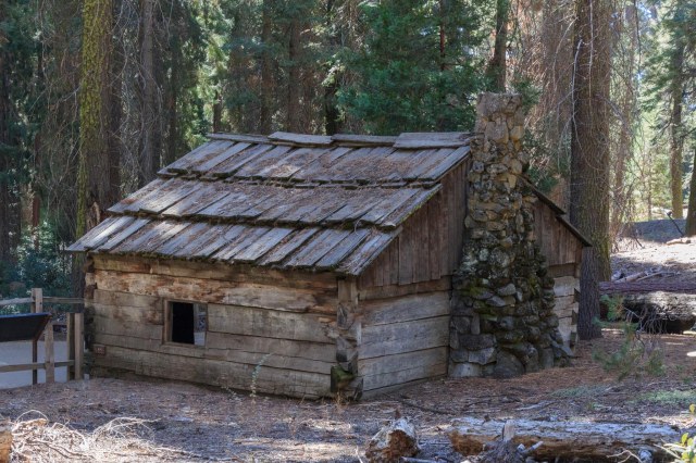
Known as the “Blind Boss” of San Francisco politics in the 1870s and 1880s, Mr. Buckley, a saloonkeeper and Democratic Party political boss, built the cottage on the left side of the photo in 1885 for his family. He later planted a 100-acre vineyard and finished the main house in 1891.

Historic Ravenswood Site

The Buckley family spent summers at Ravenswood from 1885 to 1920. They did not ignore the once rural area that served as their part-time home. Generously donating to local charities, and appearing regularly on the society page of the Livermore Press earned Mr. Buckley the nickname “Lord of Livermore.”

Main House

The Ravenswood Progress League docents conduct guided tours of the 1885 cottage, the 1891 main house, and the grounds on the second and fourth Sunday from January through November and the second Sunday in December. Tours start at noon and run from 20 minutes to one hour. Special events during the year include an ice cream social the second Sunday in August and a Victorian yuletide the second Sunday in December. The tours are free but don’t be shy about leaving a donation. The docents use the funds to help maintain the property and purchase period antiques to fill the home.

The day I visited, preparation for the Victorian Yuletide celebration was well underway in the cottage.

Cottage Entry Halltree
Decorated Christmas Tree
Mantel Decorations
Chairs for Mr. and Mrs. Santa Claus

The city rents out the main house for weddings and other events, so the rooms do not contain furniture. My footsteps echoed on the hardwood floor while wandering inside admiring the artisanship in the doorknobs and hinges and in the stain glass windows.

Main House
Stain Glass Window
Architectural Detail of Main House

Had I lived in this house, my favorite place would have been the benches next to the fireplace. Pillows, a worn quilt, and a good book would have provided hours of pleasure during a cold spell.

A Cozy Place to Read a Book

An outbuilding holds a collection of period pieces that the Buckleys could have used on the property when they spent their summers in the valley.

Outbuilding
Typical Farm House Supplies

Outside a baby carriage sat on the porch of the cottage, a statue of a boy is given prominence as the centerpiece in a garden, and a sundial tells time nearby.

Baby Carriage
Boy Statue
Sundial

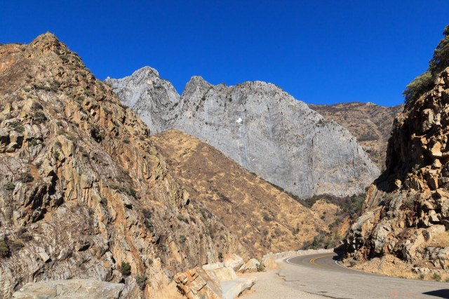
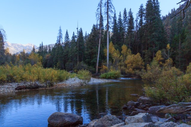
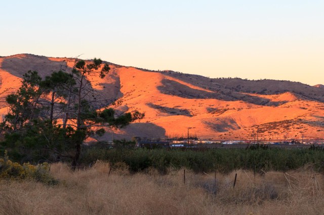
From the parking lot, vineyards spread out in the valley, and the Livermore hills rise in the south.

The historic site, located at 2647 Arroyo Road in Livermore, California, is part of the Livermore Area Recreation Park District. Livermore, known for the Livermore and Sandia National Labs, is also home to award-winning wineries, breweries, and a lively downtown.

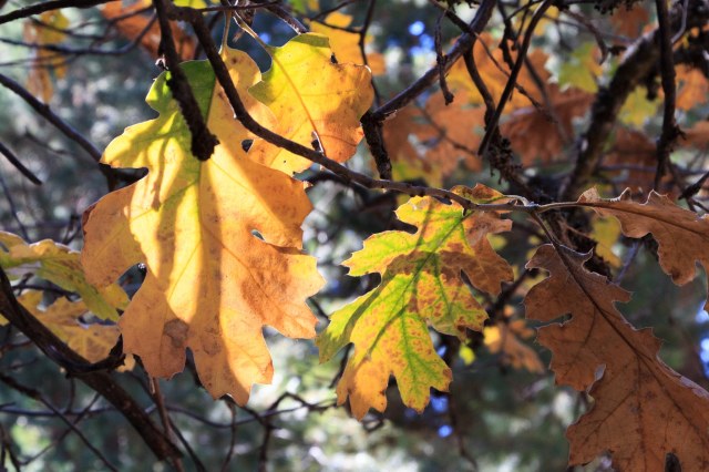
I felt restored after my trip back in time at Historic Ravenswood with its vineyards decked out in their fall colors and views of the golden hills. The trip made for a perfect place to escape the cacophony of the football games blaring at home.

Safe Travels

Sequoia National Park and Lemon Cove, California

The next day we managed to get through the 10:00 a.m. traffic flow through the construction zone with no delays. The Giant Forest Museum in Sequoia National Park was our first stop where we listened to a ranger talk about the sequoias. Inside the museum, he had planted a couple of seeds, which had sprouted into tiny seedlings. It was difficult to imagine how those seedlings could grow to the size of The Sentinel that stood outside of the museum.

IMG_5346
The Sentinel

Capturing the Sentinel from base to crown was a challenge even though it ranked #42 in the Wikipedia list of the largest sequoia trees.

Our next stop was Moro Rock where we climbed up 350 steps to an overlook. I could have stayed there half a day gawking at the views of the High Sierras, the valley below, and the road leading to and from the Lemon Cove.

IMG_5357
Stairs, Stairs, and More Stairs
IMG_5363
High Sierra Peaks
IMG_5366
Moro Rock Trail


IMG_5354
Generals Highway Twists and Turns. Line of Cars Waiting for Construction Pause.


IMG_5359
Valley Leading to Lemon Cove


Tunnel Tree was our next stop.


IMG_5382
Tunnel Tree


A short drive from Tunnel Tree was Crescent Meadow where there were plenty of picnic tables. Unfortunately, the insects were so fierce we ate in the cab of the truck. I braved the onslaught of flying pests long enough to fast walk to the meadow and grab a few shots.


IMG_5383
A Little Buggy Wanted to Share our Lunch


IMG_5390
Crescent Meadow
IMG_5386
Dried Out Ferns on Crescent Meadow Trail


Back on Generals Highway, we continued to the Sherman Tree trail. Parking close to the tree is only available for wheelchair accessible parking. Everyone else needs to follow the signs up the hill and then take the ½-mile downhill trail consisting of steps, ramps, and places to stop and rest.

General Sherman, considered the largest tree in the world, tops out at a height of 274.9 feet, has a circumference of 102.6 feet, a diameter of 32.7 feet, and bole (trunk) volume of 52.508 cubic feet.

Taking a selfie with the tree required a long wait while a group of six guys and gals took photo after photo of each other. They took close-ups, far away shots, this person, then that person, one couple and then another couple, turn to the left, turn to the right, and oh, don’t forget to stretch out your arms. Eventually, we had a chance to stand near the tree.


IMG_5407
Finally, Our Selfie with General Sherman.
IMG_5408
This Would be a Nice Shelter


Sherman’s healing fire scar.


IMG_5412
General Sherman Fire Scar


Don’t forget to look up once in a while. It’s a way to see the forest in a whole new light.


IMG_5409
Sequoia Tree Crowns


Walking up the trail back to our truck did us both in at the end of the day. We skipped the Big Tree Trail on our way out of the park and headed toward Lemon Cove for our last night of our 2017 Fall Tour.

As we waited in line for the construction crew to finish up for the day and release the traffic, we reminisced about all the places we had traveled and all that we had seen. Utah gave us the hoodoos in Bryce Canyon National Park, colorful cliffs in Kodachrome State Park, a rushing river, and steep cliffs in Zion National Park.

We walked where dinosaurs once roamed and gazed at Coral Pink Sand Dunes. The drive into Arizona to the North Rim of the Grand Canyon took us through meadows and gave us a glimpse of the Kachina Peaks Wilderness, including Humphreys’ Peak, from the North Rim of the Grand Canyon and close up in Flagstaff from the observatory.

Prescott, Arizona, offered us trails to hike, rocks to climb, and introduced us to Sharlot Hall. California gave us trails among the Cholla, Joshua trees, and jumbo rocks in Joshua Tree National Monument and the Giant Sequoias in Sequoia and Kings Canyon National Park.

Moro Rock from the road


IMG_5415
Moro Rock From Road


Here’s a Mystery Tree. Can anyone identify?


IMG_5417
What Kind of Tree am I?
IMG_5418
Mystery Tree Silhouette


After our white-knuckle ride back to Lemon Grove, we stopped for gas and took photos of some of the old buildings in this tiny town.


IMG_5419
Old Timey Richfield Station
IMG_5420
Quaint Green House


These buildings could use some tender care to restore them to their previous beauty. The name Victor Allred is barely visible on the one building expressing pride to be the owner of the enterprise that once occupied the space. When did businesses cease to use the owner’s name? It seems now most businesses make up words or some kind of catchy acronym to name their businesses.


IMG_5421
A Little TLC is Needed Here


After 33 days, we were ready to head home on October 27, 2017. It was time to enjoy the holidays and recharge for our 2018 Winter Tour.

Our main destination for our next tour is Galveston, Texas, for our niece’s wedding. We haven’t quite worked out which route to take or what we will see along the way. Where will we go after the wedding? Who knows which direction the wind will blow us.

Safe Travels


Lemon Cove, California, and Kings Canyon National Park

We selected Lemon Cove RV Park in Lemon Cove, California, on October 25, 2017, for our three-night stay 25 miles outside Sequoia National Park. Although close to the road, the campsites sit below street grade dampening the vehicle noise. After getting settled, we drove to the Sequoia National Park visitors’ center to pick up a map and newsletter and inquire about the signs we had seen about the construction delays.

IMG_5337
Mountains Tower Above Kings Canyon Floor

I’ve heard stories about drivers ending up in precarious situations if they rely too much on their GPS. I have to admit our trusty GPS backup, a map, got the better of us. Having missed the traffic release window on Generals Highway through Sequoia, our map showed a straight shot north to the Kings Canyon entrance. Thinking it would be faster than waiting to get through the construction zone, we took the Highway 245 detour. It was a lovely drive through citrus, nut, and olive orchards, a few vineyards, and small farm towns. Then the road turned dicey when it became narrow and curvy and increased elevation with each hairpin turn. What happened to the straight line I saw on the map? Once committed, it made no sense to retrace our route. Onward we continued through forested areas and remote property until the road intersected with Highway 180, which took us to the Big Stump Entrance of Kings Canyon.

General Grant Tree Grove

Our first stop inside the park was at the General Grant Tree Grove, which contains a 1/3 mile paved loop trail to General Grant Tree, the Fallen Monarch, the Centennial Stump, and Gamlin Cabin.

IMG_5274
General Grant through the Trees Doesn’t Look so Big Here

General Grant, believed to be 1,650 years old, was named in 1867 after Ulysses S. Grant, a Union Army General and the 18th president of the United States. The tree stands 267.4 feet tall, has a girth of 107.6 feet, and estimates peg it at 46,608 cubic feet of wood and bark. What I find impressive is that the tree continues to add board feet and bark, increasing in not only height but also girth.

IMG_5278
General Grant Crown

All about Sequoias

Although Sequoias are the largest living individual thing on the planet, they are not the tallest, widest, or even the oldest. Their trunks, however, occupy more space than any other single organism.

IMG_5271
Fallen Monarch Measures 124 Feet from Roots to Top. No One Knows When it Fell

The trees occur naturally in groves on the western slopes of the California Sierra Nevada Mountains within a 260-mile long by 15-mile wide strip between 5,000 and 7,500 feet above sea level.

IMG_5290
Centennial Stump is Partially Seen Behind and to the Right of the Sign

The trees’ bark, containing very little pitch and an abundance of tannins, provides built-in protection from burrowing insects, fungi, and fire. In fact, fire is one of the ways the tree reproduces. It clears the undergrowth and low branches and allows the tiny (.16 – .20 inches long by .04 inches wide by .04 inches broad) seeds to open up and flourish. Squirrels and insects also can cause the seeds to release from the cones and sprinkle the forest floor. A cone holds on average 230 seeds, but a tree may only produce one offspring during its entire lifetime of thousands of years.

IMG_5297
Hey, What Are You Doing Here?

A sequoia can even heal itself, after it has been burned, by generating new bark around its blackened trunk. The sequoias are also self-pruning, shedding lower branches as it grows taller and reduces sunlight escaping through the leaves.

IMG_5284
Example of Burned Trunk

It is a good thing that the wood of the Sequoia is fibrous and brittle and not ideal for construction. Otherwise, the Gamlin Brothers may have destroyed all of them. They held a logging permit in the area. At one point, loggers did fell the ancient trees for shingles, fence posts, and even toothpicks. Imagine how many toothpicks one of the beautiful giants could produce.

IMG_5288
Gamlin Cabin Built 1872 To House the Gamlin Brothers who Grazed Cattle Until 1878

Kings Canyon

A drive through Kings Canyon gives visitors a snapshot of some of the attractions that make California a favorite place to visit. Towering granite cliffs, a rushing river, golden grass, and yuccas captured our attention as we drove beside the Kings River. Most of the campgrounds had already been closed for the winter, and even gates prevented driving down some of the roads. We stopped at Canyon View expecting a spectacular landscape only to find the view blocked by overgrown trees. I think someone needs to rename the overlook.

IMG_5324
Contrasting Rock
IMG_5317
Kings River
IMG_5312
View Through the Forest

Montecito-Sequoia Lodge

On our way toward Sequoia National Park, we stopped in at the Montecito-Sequoia Lodge, an all-inclusive rustic resort. The property reminded me of the setting in the Dirty Dancing movie. Open year round, room rates include lodging, meals, and activities. I wouldn’t mind staying there a night or two. It sure would be more convenient than driving in and out of the park each day.

IMG_5282
October Colors

As the sun fell lower in the sky, we continued out of the park, with no delays through the construction zone where the crews had finished up for the day. Low gear was required to avoid burning up the brakes while descending into the valley. With growling stomachs, we watched for the first restaurant to grab a bite to eat before we continued back to Lemon Cove.

IMG_5292
Forest Mushrooms

 Gateway Restaurant & Lodge in Three Rivers looked like a good bet, and we were not disappointed. We sat at a table overlooking the Kaweah River illuminated by outdoor lighting. The snapper, the best I had ever eaten, was accompanied by a fluffy baked potato, plenty of butter and chives scooped on top, and perfectly cooked squash. The memory of the meal makes my mouth water.

Join us next time for a peek at Sequoia National Park.

Safe Travels

Boron and Tehachapi, California

After four nights in Twenty-nine Palms exploring Joshua Tree National Park, we were ready to find new places to explore. We had Boron, California, in our sights, on October 23, 2017. Not to stay overnight, just to check out the Borax Visitor Center, a place we had driven by for the past thirty or forty years going between northern and southern California. It was time to visit the company that once sponsored the Death Valley Days program on television.

The Borax Mine is located on State Route 58 about 12 miles west of Kramer Junction—where US Route 395 and State Route 58 intersect. We weren’t sure we were headed in the right direction. All we could see as we drove down the road were tall towers, steam rising in columns, and hills, nothing that looked like a visitor center.


IMG_5238
Borax Processing Plant


When we came to the end of the road, signs directed us toward an unmanned booth along a dirt road. We trusted the billboard that advertised plenty of RV parking at the top of a hill and kept on driving. When we reached the top, the road turned left and sure enough, there was plenty of space to accommodate multiple fifth wheels and buses.

IMG_5232
Borax Visitor Center

An original 20-Mule Team Wagon set complete with hitched up mule statues welcomed us at the visitor center. The teams carried borax out of Death Valley 165 miles to the nearest railroad junction in Mojave. The round trip took 20 days to deliver 20 tons of borax between 1883 and 1888.


IMG_5251
20-Mule Team Wagon with Statues


Today the operation mines colemanite, ulexite, kernite, and borax, from a borate deposit, which has been mined since 1927. These minerals are used in agriculture, ceramics, detergents and personal care products, fiberglass and glass, and as a wood treatment to prevent fungal decay and damage from termites, ants, and roaches.


IMG_5252
Pit and Tailings


The visitor center is open 7 days a week from 9 a.m. to 5 p.m., except holidays or during bad weather. Admission is free. Inside the building is a theater where a short movie and talks by docents provide information about the Rio Tinto Mining Company and the history of the pit. Displays show how borax is mined and processed, what products the minerals are used in, and the different types of minerals mined. Outside a ramp takes visitors to a platform where they can watch the giant dump trucks, which look like ants where we stood, maneuver atop the tiers.


IMG_5239
Sample of Borate Ore (Kernite) Taken from Mine in 1997
IMG_5236
Diagram that Explains the Process


The pit is almost like looking into the Grand Canyon. At 1 mile wide, 1½ miles long, and 650 feet deep, the heavy equipment is dwarfed by the vast landscape. A few pieces of equipment are barely identifiable in the mid-right gray area.


IMG_5244
Borax Pit


IMG_5255
Even Zoomed in, the Equipment Appears Like a Toy Among the Towering Tiers


Back in Boron is the Twenty Mule Team Museum. Unfortunately, we ran out of time and had to get back on the road so we could arrive before dark in Tehachapi where we planned to spend the night.

We found a quiet spot away from the trains and freeway at Mountain Valley RV Park where they offer water, electricity, restrooms, showers, and laundry. There is a dump station but no sewer hookups. A short walk away is the Mountain Valley Airport that serves small aircraft and gliders and operates a café.


IMG_5256
Looking South From Mountain Valley RV Park the Last Bits of Sun Paint the Hills 
IMG_5259
Little Birds Flitted About in the Dry Grass
IMG_5265
Hills and Windmills Create a Backdrop for the Hidden Valley Airport 


Coyotes woke us around 4:00 a.m. and as the sun rose, the wind grew stronger. Time to hit the road.

Safe Travels