Valencia and Pismo Beach, California

At the end of last week’s post, I said Pismo, California, was next up and our last stop. That was not entirely true. I forgot about having to stay in Valencia for the three-day President’s weekend. There had been no problem procuring sites since we left on January 24, 2020, and the holiday weekend slipped my mind. At the last minute, the only spot I could find was at Valencia Travel Village RV Resort, and they required payment for three nights.

To make the best of the situation, we drove to Fort Tejon State Historic Park. I guess my slippery mind was still fully engaged because I left my camera behind. That’s okay, I used the best camera I had, the one in my pocket.

On our many trips up and down Interstate 5 through the Grapevine, I would see the signs to Fort Tejon and wonder what was there. We took this opportunity to find out.

Fort Tejon State Historic Park

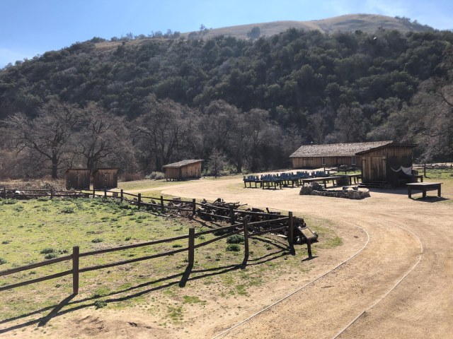
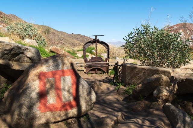
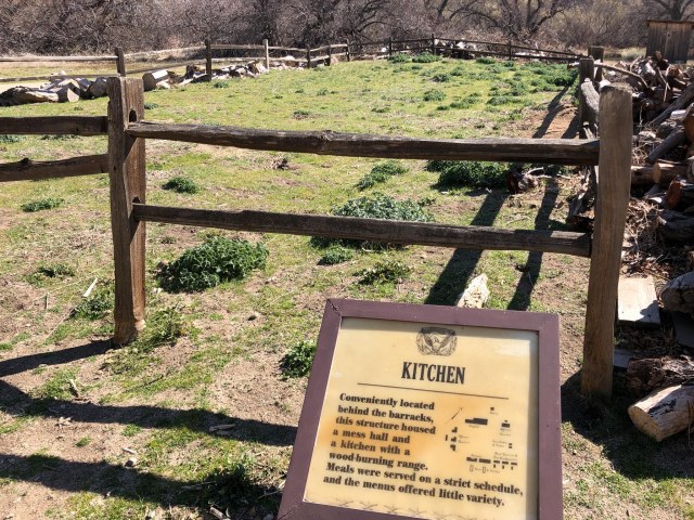
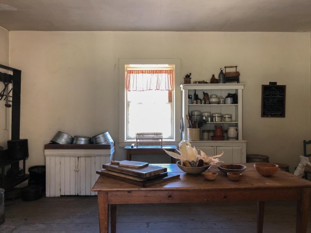
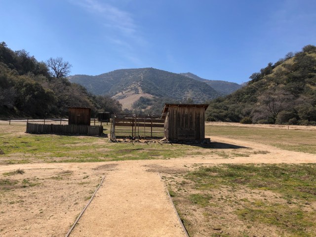
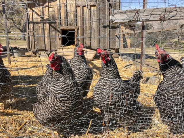
Fort Tejon became a state park in 1947, designated as a California Historical Landmark in 1954, and added to the U.S. National Register of Historic Places in 1971. We stopped in at the visitor center where informational panels tell the historical story of the park and displays contain artifacts and recreations.

Displays at visitor center

Edward Fitzgerald Beale, Superintendent of Indian Affairs in California, was instrumental in the establishment of the fort in August 1854. It’s mission being to “protect and control the Sebastian Indian Reservation,” and to protect white settlers from raids by other Indian groups. Ten years later, it was abandoned.

Edward Fitzgerald Beale

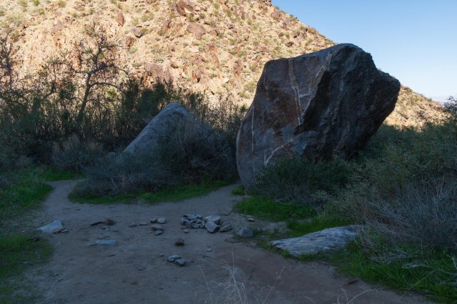
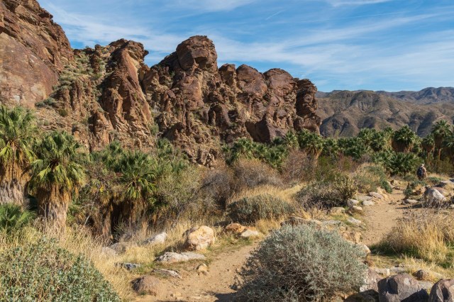
Then we took the self-guided tour around the grounds where foundations outline the footprints of buildings. Some of the buildings have been restored, and apparently, there are plans to restore others.

Picnic area
Rocks, cut tree trunks, and a split-rail fence outline the footprint of the kitchen
Kitchen inside the commander’s house

The website lists the Frontier Army Days event scheduled for May 2, 2020. It would be wonderful if the State of California was back in business at that time. More than likely the event will need to be canceled due to the dreaded virus.

Chicken coop path
“Got food?”
400-year-old Valley Oak Trees dot the landscape

Not ready to head back to the trailer, we drove up to Mt. Pinos in the Los Padres Forest and found a place to park and eat our lunch.

Campground closed

Then we stopped at Pyramid Lake, which is part of the West Branch California Aqueduct of the California State Water Project. The lake is fed with water from the San Joaquin Valley, which is pumped through the Tehachapi Mountains. The water then flows downstream to Castaic Lake. Both lakes supply water for the Castaic Power Plant, a 1,405-megawatt pumped-storage hydroelectric plant.

Pyramid Lake

There are 90 tent and RV camping sites at the Los Alamos Campground. Tucked far away from the freeway in lower Hungry Valley, it’s quiet and rustic. It includes drinking water, toilets, a dump station, and a camp store. This is a place we might consider staying overnight in the future if we need to.

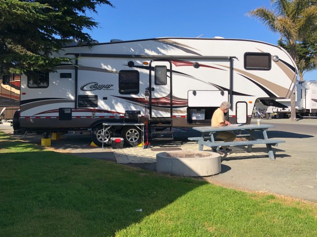
On Monday, February 17, 2020, we left Valencia Travel Village for Pismo Coast Village RV Resort in Pismo Beach. We liked the wide spaces, access to the dunes, and other amenities. The grassy area and large shade trees were a bonus. It was a perfect place to spend the last three nights of our trip.

Plenty of room, grassy areas, and shade trees

Monarch Grove Park was a short walk from the resort on the other side of Pismo State Beach North Beach Campground. We encountered a few butterflies while there and a few that had wandered over into the resort, but most of the population had already flown to the next stop on their migration.

End of the monarch season

In a list of things to do, I found Price Historical Park and Anniversary House. We like touring old homes, so off we went. Too bad the house was all closed up, and we could only walk around the property.

Price Anniversary House

A need for lunch led us to Avila Beach and the Custom House for plates of fish and chips. My mouth waters as I remember biting into the crispy crust to reach the tender moist cod inside. It had to be the best I ever tasted.

Custom House Restaurant serves the best fish and chips

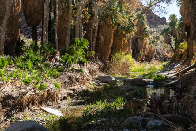
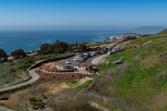
Pismo Preserve is a popular place for hiking, biking, and horseback riding. Owned by The Land Conservancy, the 880-acre preserve is a private, not-for-profit organization that recently opened for recreation. There are 11 miles of trails and roads on the property that traverse through coastal-hill terrain ranging from grasslands to a wooded oak canyon and streambed.

Wild mustard in bloom
View of the parking lot, picnic area, water, restrooms, and the ocean from a hill
Amenities at Pismo Preserve
Along the trail
Oaks dripping with lichen

When near the beach, tide pools are fun to explore and Margo Dodd Park seemed to be the best place for the activity. I checked the tide chart, but somehow got the time wrong, so we arrived when the tide was already coming back in. No worries, though, we scrambled over rocks, then watched the sun sink into the horizon.

A peek through the rocks
Snails in tidepool
Pebbles and Rock
Searching for an occupied pool
Arching bridge
Eroding shoreline
Goodnight sun

For our last meal in Pismo Beach, we stopped in at Ada’s Fish House for a dynamite shrimp dish in a wine and butter sauce served with au gratin potatoes and asparagus. Jon ordered the fish and chips again and said it was as good as what we had at the Custom House. My mouth is watering just thinking of our meal at Ada’s and wish we could drive there for another visit.

Patiently waiting for food
For the best seat in the house, arrive early at Ada’s Fish House

That concludes our Winter 2020 adventure. We are patiently waiting at home until the dreaded virus releases the world from its grip, allowing all of us to travel once again. May you all be well during this crisis and keep busy with planning your next trip.

Stay safe

Riverside, California, Mt. Rubidoux, and Tio’s Tacos

Gale force winds woke us early on February 10, 2020. Driving during a wind warning is not our idea of fun, but it was moving day. We had reservations at Rancho Jurupa Regional Park and Campground for four nights, so we packed up and headed out.

Spot 213

We were glad we tried this park. The spaces were wide, surrounded by green grass, and quiet. Instead of a noisy freeway like we had in San Diego, we heard birds singing in the trees and small aircraft flying overhead. I think this park is going to become our place to stay when visiting the Inland Empire in the future.

Crane scouting for food

The park includes two fishing lakes, cabins, and unobstructed views of the sunset and Mt. Rubidoux each evening. And the gnarly tree limbs were perfect subjects to photograph.

“Walk away, then. I’ll wait here.”
Perfect place for a barbecue and picnic near the lake
Mud hens having fun
Playground for the little ones
A trail to where
Horse and rider
Line of trees leads to Mt. Rubidoux
Goodbye sun

Our friends Suzie and Dan Bloomer came to visit one day, so we drove over to Mt. Rubidoux to get a good view of the valley from the top of the mountain. There is an easy trail and a steeper trail. We chose the easy trail up and came down the steeper trail.

Prickly pear garden

The Peace Tower and Friendship Bridge is a popular landmark built in 1925 to honor Frank A. Miller for his vision of the mountain and his ideals of International Friendship and World Peace.

Peace Tower and Friendship Bridge—the guy in the red shirt under the bridge is Dan

The cross and tablet at the summit was erected in 1907 to honor Father Junipero Serra who is thought to have traveled through the valley and rested at Rubidoux Rancho. Americans United for Separation of Church and State objected to the cross on city property and threatened a lawsuit to have it removed. To avoid the legal tussle, a group formed to raise money to purchase the top of the mountain and the .43 acres beneath it. They raised enough money to purchase the land and provide an endowment, the interest from which is used to manage and maintain the property.

Cross at the top of the mountain

Sunrise services have been held on Easter at the top of the mountain since 1909. However, due to the California and local COVID-19 restrictions in place, the service has been canceled for April 12, 2020. The top of the mountain is also used for July 4 fireworks. Let’s hope and pray for lifted restrictions by then.

View northwest from Mt. Rubidoux
View south from Mt. Rubidoux
View mostly east from Mt. Rubidoux with what I believe is the San Jacinto Mountains in the background

The trek up and down Mt. Rubidoux triggered hunger in our bellies so off to Tio’s Tacos for lunch. Opened in 1990, Tio’s has become another landmark in Riverside.

Tio’s Taco entrance

The owner, Martin Sanchez, is the creator of the funky art pieces that populate the half-acre of unique gardens. All of the pieces were created from recycled objects once relegated to the fate of landfills.

Dressed in plastic dolls
Roof acrobats
Suzie sprouted angel wings
Craft project: Shape a roll of chicken wire, fill it with plastic bottles, and presto change-o, a work of art
Mission bell, flags, and lights

We definitely want to come back and explore Riverside in more depth. We hear the Mission Inn went through a recent renovation, and I’d like to check out the mission-style architecture in the area.

Next up is Pismo Beach which was the last stop on our Winter 2020 tour.

Wishing everyone health and well being in these trying times as we hunker down the best we can and avoid traveling too far afield.

Stay safe

San Diego, California, and the San Diego Zoo Safari Park

Today is Saturday, March 21, 2020, as I write this. We here in the San Francisco Bay Area have been sheltering in place since Monday, and so far we are safe from the COVID-19 virus. I worry about the homeless, the migrant workers, and the 60 some odd million people that live paycheck to paycheck. I hope congress considers them when passing bail-out legislation. Jon and I wish everyone good health and hope you are safe wherever you have selected to shelter in place.

If boredom has set in from staring at the same walls for days, enjoy this tour of the San Diego Zoo Safari Park. Who can resist looking at a few photos of animals? We visited on February 8, 2020, way before the world closed for business.

Bailey, Kevin, and Jon at the San Diego Zoo Safari Park Entrance

Our memories of the Wild Animal Park, as the Safari Park was once called, included wide open spaces, few trees or vegetation, no shade, and a monorail that circled the African plains where the animals lived. Later they added a walk to the elephants and a bird show. Our last visit was sometime in the 1980s.

The 1,800-acre park now includes many miles of trails through various lands, some of which allow getting up-close with the animals, but no touching or harassing, please. Rangers are on hand to eject anyone intent on harming the animals.

We started our tour in the Wings of the World, an aviary housing a host of beautiful birds, the names of which I have no idea.

Nice tree pose
Bird of feathers
Perfect posture

At the Animal Ambassador Stage, we were introduced to a Pygmy Falcon. These falcons are found in eastern and southern Africa. They are the smallest raptor on the continent at only 19 to 20 cm (7.5 to 8 inches) long.

Pygmy Falcon

Next, we took the Kangaroo Walk where we followed a path through their enclosure.

“Hey Martha, where are you?”
“Over here, Kanga, chillin’ in the shade.”

The Bonsai Pavilion includes around 60 trees some of which are at least 400 years old. The members of the San Diego Bonsai Club volunteer to maintain the trees.

I think this was a juniper.

Take a walk through the World Gardens to see several species of cacti and other plants.

World Gardens

Then off to the Tiger Trail and the Sambutan Longhouse to watch the tigers eat their lunch.

There is a glass partition between the tigers and the guests.
Such a beautiful animal.

The African Tram has taken the place of the monorail that once ran. There is plenty of shade for visitors waiting their turn to hop on as the line zig-zags between rails. The following photos are views from the tram overlooking the African Plains and Asian Savanna.

The tram is in the background upper right corner behind the tree. Zookeepers in the pickup truck are putting hay in the giraffe feeder.
Ruppell’s Vulture
A tower of giraffes
“Hey, Mildred. Do you think the grass is greener over there?”
Look, a unicorn. Nah. It’s an Arabian Oryx. The Oryx only get one set of horns. If they break off, they will not grow back.
Man feeding giraffe
Sable antelope
Somali Wild Ass
Cape Buffalo
Ankole Cattle
The view west
A crash of rhinos

Once our tram tour concluded, we continued our exploration along the pathways. The lemurs were fun to watch. They played on logs for a bit and then walked around, delighting those of us walking through the enclosure.

King of the logs
Here a lemur, there a lemur, everywhere a lemur

The Gorilla Trail was a great place to stop. Do we watch them, or do they watch us?

Big Bubba watches over the clan
I guess I’ll play by myself.
Momma and her baby
Do you like my umbrella?

The slow-moving elephants reminded us that we should slow down too. What was our hurry?

Tree limbs are tasty
Hey, where did the rest go?
Majestic
There are six species of flamingo at the Safari Park

And here is one last photo to entice readers to visit the San Diego Safari Park after it reopens once the virus danger subsides.

Open wide

We didn’t do much else while in San Diego other than watch the Super Bowl Game, go out to eat a couple of times, walk around Lake Murray, worked out at the gym, and relaxed at the trailer. It was nice to take it easy. We needed a breather after the whirlwind of activity during the past two weeks.

We turned the truck toward home on Monday, February 10, 2020, but we aren’t done yet. Next stop was Rancho Jurupa Park in Rubidoux for four nights.

Safe Travels and Stay Healthy

Palm Desert, California – Part Two

We continue our adventure in Palm Desert by exploring a few of the many trails located on the Agua Caliente Band of Cahuilla Indians’ land, then end with a stroll through the College of the Desert Street Fair.

Tahquitz Canyon

Tahquitz (pronounced taw—kwish) Canyon is a culturally sensitive area preserved and opened to visitors. Along the trail hikers can see ancient irrigation systems, rock art, plants, and a 60-foot waterfall. Artifacts are on display in the visitor center.

Tahquitz Canyon

We stepped up to pay our money, and the ranger said, “You should watch the Legend of Tahquitz first. You might not want to take the trail once you do.” We heeded her advice even though we didn’t believe we’d be scared. The legend says the great shaman Tahquitz used his power for selfish reasons and turned on his people. So the Agua Caliente banished him to the canyon. Some people believe his evil spirit lives there still.

Remnants of the Lebacho-Tahquitz Creek Ditch built in 1830. The symbol is not graffiti. It marks the spot for this point of interest.

As we thought, the legend was not scary. Who knows, maybe the ranger was just monitoring the number of people.

A promotional card gives visitors a $2.50 discount off the regular adult fee of $12.50 for up to 10 people. Children under thirteen years of age and U.S. Military with an ID are free. We picked up the card from our RV park. I’m sure they have them at the visitor information center in town or in hotel lobbies.

Spillway
Tahquitz Falls

This canyon was not always so beautiful or accessible. In 1969 tribal leaders were forced to close the culturally sensitive area after a Canned Heat rock concert drew more than 1,000 people. Many of the people stayed for days and trashed the mountains. Spring break revelers showed up each year bringing guns and drugs. Squatters lugged in bags of cement to make “home” improvements. Trespassers trampled wild grapevines and polluted the freshwater pools. Hikers became stranded, were injured, or died.

Boulders along trail

The tribe was in a Catch 22 situation. People would continue to destroy the beautiful, magical place and use it as a dumping ground if the tribe did nothing. They didn’t want to open the canyon to the public, but had to find a way to save the canyon and still respect the culture.

View of the city below and Desert Hot Springs across the valley

In January 1998 the tribe began a cleanup effort costing more than $100,000. They removed trash, erased graffiti, and rousted homeless who had set up camp just a few blocks from Palm Canyon Drive. They installed fencing, hired security guards, improved trails, and built a museum annex.

Tahquitz Creek

We enjoyed the peaceful surroundings and the walk along the stream while we searched for the points of interest designated by geometric signs. It was an honor to follow the paths where ancient Agua Caliente Indians once lived, and I’m thankful the tribe restored the canyon for visitors like us to enjoy.

Indian Canyons

Indian Canyons, the ancestral home of the Agua Caliente Band of Cahuilla Indians, preserves rock art, house pits, foundations, irrigation ditches, dams, reservoirs, trails, and food preparation areas for current and future generations. There are three canyons available to explore: Palm Canyon, Andreas Canyon, and Murray Canyon.

Palm Canyon Trading Post Overlook

We headed for the 15-mile long Palm Canyon, the world’s largest California Fan Palm Oasis, arriving just in time for a ranger talk. The ranger took us down into the canyon, where he shared the philosophy of the Cahuilla Indians and how they dealt with hunger.  He pointed out a kish replica made of reeds and brush, and a rock that was used as a mortar. He showed us how to pick out the ripest palm fruit berries that had fallen from the trees, then let us continue on the trail.

Kish
Mortar Rock

There are several trails from easy to strenuous from which to choose. We walked along the stream for a mile or so, then turned around and went back to the trading post.

This picnic table would not be a good choice. It’s too close to the palm skirt where snakes live.

Other options are to take the Victor Trail back to the parking lot or continue along the palm canyon trail. More strenuous hikes also shoot off from the trading post.

Palm canyon creek
Fire scarred palm trees

On our way out, we stopped to find out more about the mysterious gas station dating from the early to mid-1900s. Stories indicate there were gas pumps, except no one remembers gas ever being sold. The station did sell drinks and snacks to visitors. It looked like a place I might have stopped on a trip with my grandparents when I was a little girl, and I imagined Indians might have had tables set up out front to sell their jewelry, baskets, and pottery.

Mystery gas station with an outhouse in the distance

Andreas Canyon was our next stop. The trail was an easy one-mile loop beside a year-round flowing stream. The scenery attracts painters as well as hikers.

En Plein Air class
Jon walks among the towering palms
Andreas Creek

Tahquitz and the three Indian Canyons are listed on the National Register of Historic Places.

Leaves under clear water
Cabins on a hill

These craggy cliffs reminded me of something one might see in Hawaii.

Craggy Cliffs

Living Desert Zoo and Gardens

The Living Desert Zoo and Gardens in Palm Desert was celebrating its 50th anniversary and their mission encompasses more than their name implies.

Living Desert Zoo and Gardens

They preserve a portion of the Colorado Desert in a natural state, foster an awareness and appreciation for the variety of plants and animals in worldwide ecosystems, build up populations of various species of desert animals and plants that face extinction in the wild, and foster studies to protect desert species in the wild.

Aren’t I pretty?
Oh, what long lashes you have
Giraffe ossicones (ossified cartilage).
Giraffes can run up to 35 mph (55 km/h)

The nature preserve protects 1,200 acres of Sonoran desert. Trails, which are closed in the summer, consist of easy half-mile walks and more difficult 5-mile treks. There are two main sections: North America and Africa. Australia Adventures was under construction during our visit with a planned opening in spring 2020.

The following are samples of the different types of animals that live in an environment typical of what they would experience in the wild.

Warthog heads look almost as big as their body
Porcupine
Grevy’s Zebra
Great Egret
African Wild Dog
White Herron

Even the Big Horn Sheep have a mountain and cliffs to climb on.

Big Horn Sheep blends into the hillside

Several garden areas provide shade and a peaceful environment to enjoy. The 1.5-mile walkway meanders through the zoo and garden, or hop on the tram if walking is difficult.

Wander the shady gardens to cool off
Or sit back in the shade and rock away.

Make time to stop by the G-scale model train that sits on 3/4 of an acre. Some of the scenes include the Grand Canyon, Rocky Mountains, and Old Indio.


G-scale model train

The College of the Desert Street Fair

Last on our places to explore was the College of the Desert Street Fair, which has operated year-round every weekend for over 36 years. Seasonal fresh fruits and vegetables are available along with a wide variety of vendors selling apparel, footwear, hats, handbags, and home goods, to name a few.

Vendors line the long aisles

There is also a food court in case patrons work up an appetite from all the shopping. Parking is free, and there is plenty of shade under the solar panel shelters.

Step right up. Get your fresh produce and dates here.

After our whirlwind in Palm Desert, we were ready for a bit of relaxation. Our next stop was San Diego and a visit to the San Diego Zoo Safari Park. Stay tuned.

Safe Travels