Bryce Canyon National Park was our destination on September 24, 2017. The California hills along Interstate 5 south of Tracy sported their summer golden highlights. Bands of scorched earth, patches in places and acres in others, signaled that the California fire season had arrived. We made an overnight stop in Barstow at Shady Lane RV Camp. Its location away from the freeway was a better pick than the KOA at Calico Ghost Town where we had previously stayed.
We selected Ruby’s Inn RV Park & Campground as our home for six nights. Ruby’s accommodates all types of travelers whether they need a motel experience, full hookups for an RV, a cabin, tipi, or tent site. The restaurant serves up delicious western grub and the store contains food items, camping equipment, clothing, and gifts. The convenient shuttle stops for the national park, one near the motel and the other near the RV park, were a bonus.
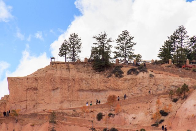
Our first venture into the park was on the Rainbow Point Shuttle Tour, included with admission to the park by reservation. Our driver, Jay Evans, regaled us with the history and geology of the park, information about the flora and fauna, stories about the people, and a few jokes during the 3.5-hour tour. The tour allowed us to acclimate to the change in elevation from sea level to 8,000 feet and to figure out the areas of the park we wanted to explore in more depth. What we didn’t acclimate to was the cold wind that cut through our thin pant legs. Why did I not pack my long johns?
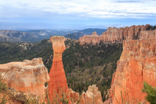
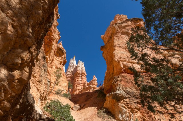
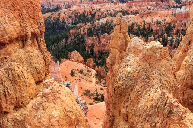
Our Tour Group Overlooking One of the Fourteen Amphitheaters of HoodoosBryce Canyon became a national park in 1928 and is named after Ebenezer Bryce who was a Mormon pioneer. The canyon is best known for its long and narrow 56 square miles which contain unique geological formations of hoodoos, fins, windows, arches, domes, and pinnacles.
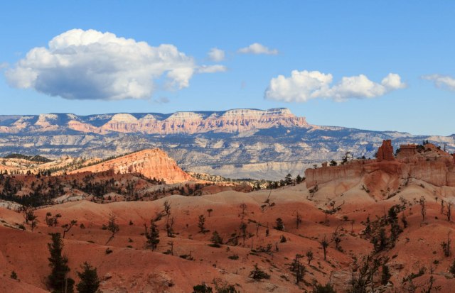
View From Rainbow PointWhile on the tour, Jay pointed out the names of some of the hoodoos we looked down on from the rim of the cliffs.
The Hunter is Known for His Ear Muffs The Rabbit Or Bart Simpson? Natural Bridge Olympic Flame Kneeling MonkLayers of silt, sand, and lime in beds that run up to 2,000 feet thick provided the base of sedimentary rock for Bryce Canyon. Erosion from wind, rain, and the freeze-thaw action, which causes fracturing, created the formations and continue their impact on the landscape. In addition, plant roots, and burrowing animals loosen the rocks and accelerate the erosion.
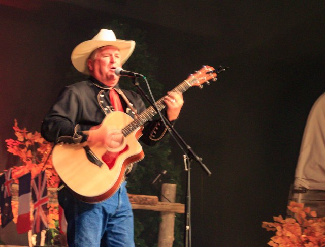
Fairyland Overlook Fin HoodoosWe topped off our day at Ebenezer’s Barn & Grill for some old fashioned western fun, music, and cowboy chow. Members of the Bar G Wranglers, the evening’s entertainment, greeted the guests, escorted them to their seats, and made sure the diners followed the proper route through the chow line. Surprisingly, the food was delicious, the music great, and we enjoyed meeting the other couples at our table.
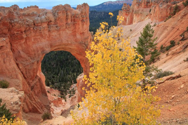
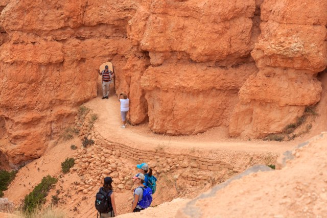
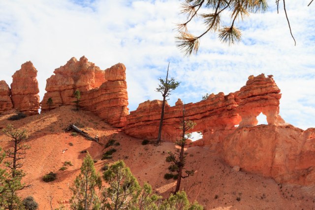
Ebenezer’s Barn & Grill Jay Evans: Best Shuttle Bus Driver and Fastest Strumming Guitar PlayerOne day, we rode the shuttle to Sunset Point where we hiked the Navaho Loop Trail, connected with Queen’s Garden and came up out of the canyon at Sunrise Point.
View from Sunset Point Navaho Trail Slot Canyon Looking Up at the Hoodoos Squirrel? Prairie Dog? Sorry Squirrel. No Feeding the Animals. Queen Victoria Standing on the Back of a Camel The Fortress Olympic Flame Queen’s Garden Trail Sunrise Point Queen’s Garden Trail Shipwreck Rock
People on the Trail Below are Barely Visible
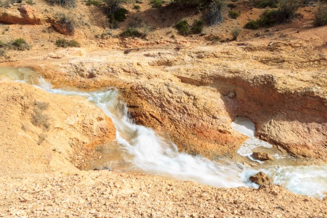
Photographers Abound on the Trail The SentinelsNot interested in a long steep hike? Take the Mossy Cave trail from Highway 12. The short walk follows the Tropic Ditch to a mossy cave and a waterfall. In 1890 and 1892, Mormon farmers, using picks and shovels, dug the ditch to bring water to the settlements around Tropic, Utah. Except for 2002 during the drought, the ditch has continued to carry irrigation water to the towns of Tropic and Cannonville.
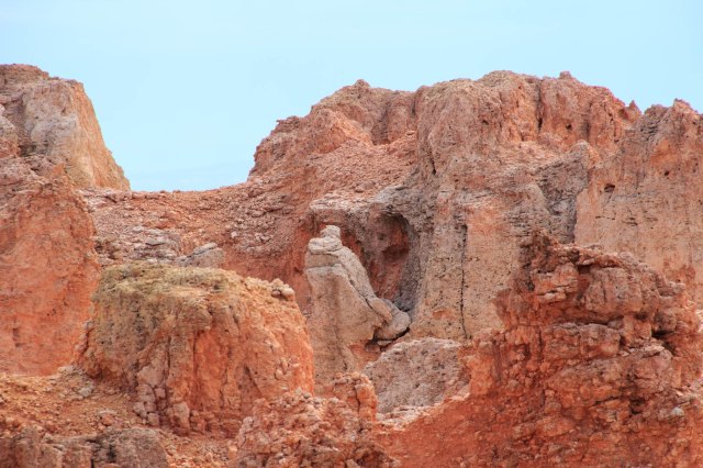
Mossy Cave Tropic Ditch Waterfall Tropic Ditch Hoodoos and Windows Along Mossy Cave TrailWords and photos are not sufficient to portray the feelings that well up while walking among the hoodoos and gazing across the vistas. Bryce Canyon is a place to slow down, feel the sun on your back, breath in the fresh pine scent, hear the wind rustle through the pine needles and aspen leaves, and watch squirrels and lizards scurry around and raptors fly overhead. Oh, and don’t forget to look for queens, hunters, rabbits, Chinese terracotta soldiers, Scotty dogs, and whatever else you can make of the gazillion formations.
Thanks, Judy. How long ago were you there? They have made it pretty accessible along the rim. But of course the trails down to the amphitheater floor are steep and gravelly.
Darn. We missed the hummingbirds. Maybe it was too late in the season. At night the temperatures often dipped into freezing. I hope you’re able to visit for longer than a day next time.


Wonderful!!
LikeLiked by 1 person
Thanks, Ester.
LikeLiked by 1 person
Absolutely beautiful, Linda! Diana and I have yet to get there. Bryce was one of my mom’s favorites!
LikeLiked by 1 person
You must go. It’s truly magical.
LikeLiked by 1 person
Beautiful photos. I love Bryce Canyon. Glad I was there when I could still walk.
LikeLiked by 1 person
Thanks, Judy. How long ago were you there? They have made it pretty accessible along the rim. But of course the trails down to the amphitheater floor are steep and gravelly.
LikeLike
Oh I love Bryce Canyon. 🙂 It’s been years since we’ve been there and your pictures have me thinking we need to go back soon. 🙂
LikeLiked by 1 person
We had been there about twenty five years ago and only a few things looked as I remembered. This time I’ll have lots of photos to remind me.
LikeLiked by 1 person
The pictures you shared are gorgeous.
LikeLiked by 1 person
Thank you! 🌞
LikeLiked by 1 person
I love Bryce. Thanks for the reminders why.
LikeLiked by 1 person
I’m glad you enjoyed them.
LikeLike
We remember the hummingbirds from Bryce. Spent a wonderful day there. Thanks for the excellent overview and entertainment recommendation.
LikeLiked by 1 person
Darn. We missed the hummingbirds. Maybe it was too late in the season. At night the temperatures often dipped into freezing. I hope you’re able to visit for longer than a day next time.
LikeLiked by 1 person